Post-Nor'Ida Coastal Oblique Aerial Photographs Collected from Ocean City, Maryland, to Hatteras, North Carolina, December 4, 2009
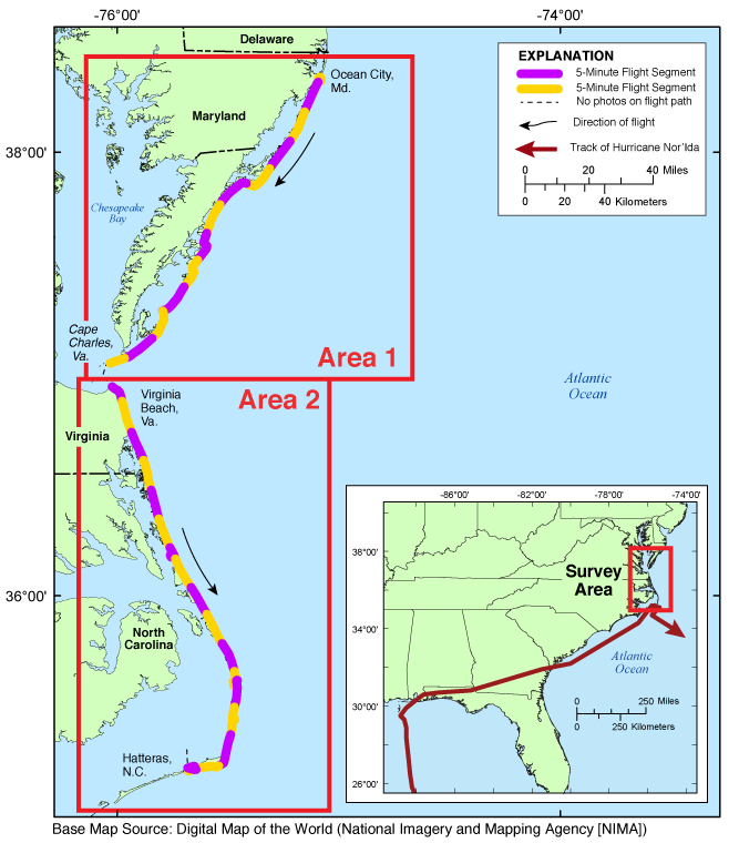
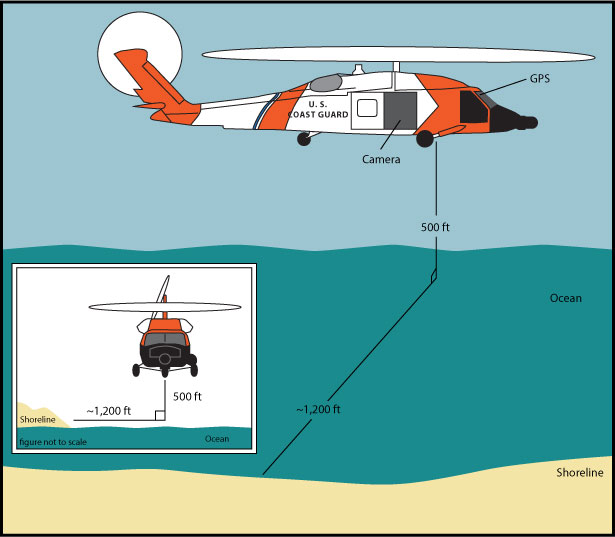
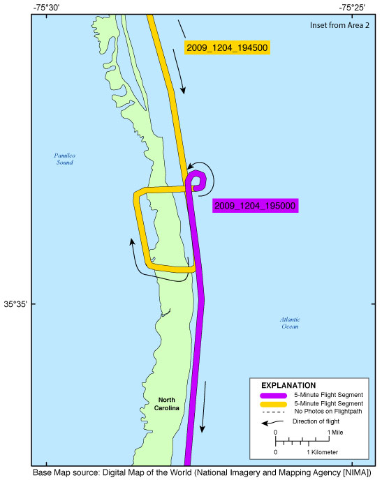
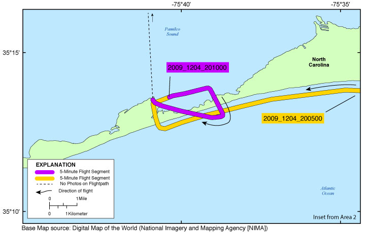
The U.S. Geological Survey (USGS) conducts baseline and storm response photography missions to document and understand the changes in vulnerability of the Nation's coasts to extreme storms. On December 4, 2009, the USGS conducted an oblique aerial photographic survey from Ocean City, Maryland, to Hatteras, North Carolina, aboard a U.s. Coast Guard H60 Helicopter at an altitude of 500 feet (ft) and approximately 1,200 ft offshore (Figure 2,
http://pubs.usgs.gov/ds/0930/html/ds930_fig2.html). This mission was flown to collect data for assessing incremental changes since the last surveys, flown in May 2009 (
http://compass.er.usgs.gov/activity_popup.php?id=154) and May 2008 (
http://compass.er.usgs.gov/activity_popup.php?id=114), and can be used for assessing future coastal change. The photographs provided here are Joint Photographic Experts Group (JPEG) images. The photograph locations are an estimate of the position of the and aircraft do not indicate the location of the feature in the images (See the Navigation Data page,
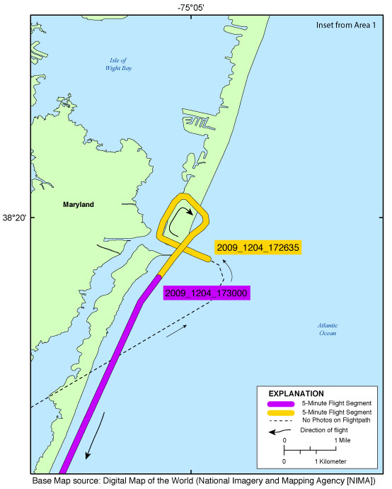
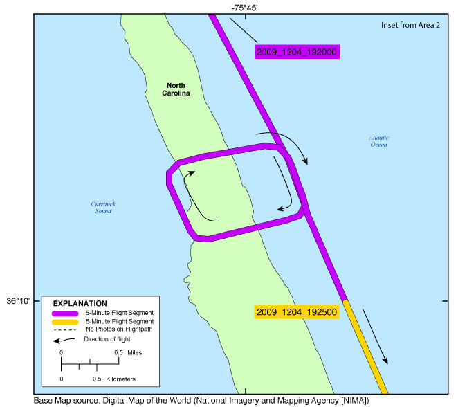
http://pubs.usgs.gov/ds/0930/html/ds930_nav.html). These photographs document the configuration of the barrier islands and other coastal features at the time of the survey. ExifTool was used to add the following to the header of each photo: time of collection, Global Positioning System (GPS) latitude, GPS longitude, keywords, credit, artist (photographer), caption, copyright, and contact information (see process step below). Photographs can be opened directly with any JPEG-compatible image viewer by clicking on a thumbnail on the contact sheet. All image times are recorded in UTC. Table 1 (
http://pubs.usgs.gov/ds/0930/html/ds930_table.html) provides detailed information about the assigned location, name, date, and time the photograph was taken along with links to the photograph. In addition to the photographs, a Google Earth Keyhole Markup Language (KML) file is provided and can be used to view the images by clicking on the marker and then clicking on either the thumbnail or the link above the thumbnail. The KML files were created using the photographic navigation files. Note: A KML number was assigned to each photograph to aid navigation of the Google Earth file. These numbers correspond to the site labels in Google Earth.
NOTE: No photographs were taken during the following 5-minute segments: ds930_2009_1204_183000 through ds930_2009_1204_184500. No surveying was conducted during that time. For a summary of field activity 09ACH03 please see .