Location and analysis of sediment samples collected during field activity 2012-035-FA by the U.S. Geological Survey and Massachusetts Office of Coastal Zone Management in Ipswich Bay and Massachusetts Bay, Massachusetts, in August 2012 (point shapefile and CSV file)

Metadata also available as - [Questions & Answers] - [Parseable text] - [XML]

Metadata:

Identification_Information:
Citation:
Citation_Information:
Originator: U.S. Geological Survey
Publication_Date: 2018
Title:
Location and analysis of sediment samples collected during field activity 2012-035-FA by the U.S. Geological Survey and Massachusetts Office of Coastal Zone Management in Ipswich Bay and Massachusetts Bay, Massachusetts, in August 2012 (point shapefile and CSV file)
Edition: 1.0
Geospatial_Data_Presentation_Form: vector and tabular digital data
Series_Information:
Series_Name: data release
Issue_Identification: DOI:10.5066/P924M8R1
Publication_Information:
Publication_Place:
Woods Hole Coastal and Marine Science Center, Woods Hole, Massachusetts
Publisher: U.S. Geological Survey, Coastal and Marine Geology Program
Online_Linkage: https://doi.org/10.5066/P924M8R1
Online_Linkage: Larger_Work_Citation:
Citation_Information:
Originator: Emily C. Huntley
Originator: Seth D. Ackerman
Originator: Robert L. Boeri
Originator: Todd P. Callaghan
Originator: Daniel W. Sampson
Originator: Dann S. Blackwood
Publication_Date: 2018
Title:
Sampling data collected in Ipswich Bay and Massachusetts Bay, Massachusetts, in 2012, U.S. Geological Survey Field Activity 2012-035-FA
Edition: 1.0
Series_Information:
Series_Name: data release
Issue_Identification: DOI:10.5066/P924M8R1
Publication_Information:
Publication_Place: Reston, VA
Publisher: U.S. Geological Survey
Other_Citation_Details:
Suggested citation: Huntley, E.C., Ackerman, S.D., Boeri, R.L., Callaghan, T.P., Sampson, D.W., and Blackwood, D.S., 2018, Sampling data collected in Ipswich Bay and Massachusetts Bay, Massachusetts, in 2012, U.S. Geological Survey Field Activity 2012-035-FA: U.S. Geological Survey data release, https://doi.org/10.5066/P924M8R1.
Online_Linkage: https://doi.org/10.5066/P924M8R1
Online_Linkage:
Description:
Abstract:
Accurate data and maps of sea-floor geology are important first steps toward protecting habitat, delineating marine resources, and assessing environmental changes due to natural or human effects. Initiated in 2003, the primary objective of the Geologic Mapping of the Massachusetts Sea Floor program is to develop regional geologic framework information for the management of coastal and marine resources. The program is focused on the inshore waters (primarily 5-30 meters deep, although the region surveyed in this field activity includes waters up to 90 meters deep) of Massachusetts. This dataset, collected aboard the Ocean Survey Vessel (OSV) Bold as part of the Geologic Mapping of the Massachusetts Sea Floor Program, is from U.S. Geological Survey (USGS) sampling survey 2012-035-FA (August 21-27, 2012) by the USGS Woods Hole Coastal and Marine Science Center and the Massachusetts Office of Coastal Zone Management with partners from the Massachusetts Bays Program, the Massachusetts Department of Environmental Protection, the Massachusetts Division of Marine Fisheries, and the U.S. Environmental Protection Agency. During the survey, surficial sediment samples and bottom still and video imagery were collected in Ipswich Bay and Massachusetts Bay, Massachusetts.
Purpose:
This dataset includes the locations and grain-size analysis or textural description of surficial sediments collected with a modified Van Veen grab on the SEABed Observation and Sampling System (SEABOSS) during USGS survey 2012-035-FA.
Supplemental_Information:
Physical sediment samples were additionally analyzed for benthic infauna by AECOM (see report by the Massachusetts Office of Coastal Zone Management [2013] available from the cross-reference citation). Bottom still and video imagery was also taken at each station (see shapefiles 2012-035-FA_photos.shp and 2012-035-FA_videos.shp available from the larger work citation; see the Coastal and Marine Geology Program Video and Photograph Portal to view the bottom videos [Golden and others, 2015; link available from the cross-reference citation]). For more information about this field activity, see https://cmgds.marine.usgs.gov/fan_info.php?fan=2012-035-FA. For more information about the Geologic Mapping of the Massachusetts Sea Floor program, see https://woodshole.er.usgs.gov/project-pages/coastal_mass/.
Time_Period_of_Content:
Time_Period_Information:
Range_of_Dates/Times:
Beginning_Date: 20120821
Ending_Date: 20120827
Currentness_Reference: ground condition
Status:
Progress: Complete
Maintenance_and_Update_Frequency: None planned
Spatial_Domain:
Bounding_Coordinates:
West_Bounding_Coordinate: -70.907127
East_Bounding_Coordinate: -70.498603
North_Bounding_Coordinate: 42.873395
South_Bounding_Coordinate: 42.296985
Keywords:
Theme:
Theme_Keyword_Thesaurus: USGS Metadata Identifier
Theme_Keyword: USGS:b66085fe-2dc4-4686-86d8-dcf8c29d95a8
Theme:
Theme_Keyword_Thesaurus: None
Theme_Keyword: U.S. Geological Survey
Theme_Keyword: USGS
Theme_Keyword: Coastal and Marine Geology Program
Theme_Keyword: CMGP
Theme_Keyword: Woods Hole Coastal and Marine Science Center
Theme_Keyword: WHCMSC
Theme_Keyword: Massachusetts Office of Coastal Zone Management
Theme_Keyword: MassCZM
Theme_Keyword: MA CZM
Theme_Keyword: CZM
Theme_Keyword: ground-truth
Theme_Keyword: seafloor samples
Theme_Keyword: sediment samples
Theme_Keyword: sediment data
Theme_Keyword: surficial sediment classification
Theme_Keyword: stations
Theme_Keyword: seafloor
Theme_Keyword: sea floor
Theme_Keyword: marine geology
Theme_Keyword: sediments
Theme_Keyword: SEABOSS
Theme_Keyword: SEABed Observation and Sampling System
Theme_Keyword: Van Veen grab sampler
Theme_Keyword: gravel
Theme_Keyword: sand
Theme_Keyword: silt
Theme_Keyword: clay
Theme_Keyword: shapefile
Theme_Keyword: field activity 2012-035-FA
Theme_Keyword: field activity number 12035
Theme_Keyword: OSV Bold
Theme:
Theme_Keyword_Thesaurus: USGS Thesaurus
Theme_Keyword: grab sampling
Theme_Keyword: grain-size analysis
Theme_Keyword: marine geology
Theme_Keyword: sea-floor characteristics
Theme:
Theme_Keyword_Thesaurus: ISO 19115 Topic Category
Theme_Keyword: oceans
Theme_Keyword: geoscientificInformation
Theme_Keyword: location
Theme:
Theme_Keyword_Thesaurus: Marine Realms Information Bank (MRIB) keywords
Theme_Keyword: marine geology
Theme_Keyword: sediment analysis
Theme_Keyword: bay
Theme_Keyword: continental shelf
Place:
Place_Keyword_Thesaurus: None
Place_Keyword: North America
Place_Keyword: United States
Place_Keyword: Atlantic Ocean
Place_Keyword: Gulf of Maine
Place_Keyword: Bigelow Bight
Place_Keyword: Massachusetts
Place_Keyword: Ipswich Bay
Place_Keyword: Massachusetts Bay
Place_Keyword: Cape Ann
Place_Keyword: Plum Island
Stratum:
Stratum_Keyword_Thesaurus: None
Stratum_Keyword: sea floor
Stratum_Keyword: seafloor
Stratum_Keyword: seabed
Temporal:
Temporal_Keyword_Thesaurus: None
Temporal_Keyword: 2012
Access_Constraints: None
Use_Constraints:
Public domain data from the U.S. Government are freely redistributable with proper metadata and source attribution. Please recognize the U.S. Geological Survey as the originator of the dataset.
Point_of_Contact:
Contact_Information:
Contact_Person_Primary:
Contact_Person: Seth Ackerman
Contact_Organization: U.S. Geological Survey
Contact_Position: Geologist
Contact_Address:
Address_Type: mailing and physical address
Address: 384 Woods Hole Rd.
City: Woods Hole
State_or_Province: MA
Postal_Code: 02543-1598
Country: USA
Contact_Voice_Telephone: 508-548-8700 x2315
Contact_Facsimile_Telephone: 508-457-2310
Contact_Electronic_Mail_Address: sackerman@usgs.gov
Browse_Graphic:
Browse_Graphic_File_Name: Browse_Graphic_File_Description:
Thumbnail image of sample locations in Ipswich Bay and Massachusetts Bay, Massachusetts.
Browse_Graphic_File_Type: JPEG
Native_Data_Set_Environment:
Microsoft Windows 7 Version 6.1 (Build 7601) Service Pack 1; Esri ArcGIS 10.3.1.4959
Cross_Reference:
Citation_Information:
Originator: Massachusetts Office of Coastal Zone Management
Publication_Date: 2013
Title: ENV13 CZM 01 Benthic Infaunal Analysis Report
Publication_Information:
Publication_Place: Boston, MA
Publisher: Massachusetts Office of Coastal Zone Management
Online_Linkage:
Cross_Reference:
Citation_Information:
Originator: Nadine E. Golden
Originator: Seth D. Ackerman
Originator: Evan T. Dailey
Publication_Date: 2015
Title: Coastal and Marine Geology Program video and photograph portal
Publication_Information:
Publication_Place: Santa Cruz, CA
Publisher: U.S. Geological Survey
Online_Linkage: https://dx.doi.org/10.5066/F7JH3J7N
Cross_Reference:
Citation_Information:
Originator:
National Oceanic and Atmospheric Administration (NOAA) National Centers for Environmental Information (formerly NOAA National Geophysical Data Center)
Publication_Date: 201110
Title: U.S. Coastal Relief Model
Publication_Information:
Publication_Place: Boulder, CO
Publisher: NOAA National Centers for Environmental Information
Online_Linkage: https://www.ngdc.noaa.gov/mgg/coastal/crm.html
Cross_Reference:
Citation_Information:
Originator: D. Blackwood
Originator: K. Parolski
Publication_Date: 2001
Title: Seabed observation and sampling system
Edition: 1.0
Series_Information:
Series_Name: Sea Technology
Issue_Identification: v. 42, no. 2, p. 39-43
Publication_Information:
Publication_Place: Arlington, VA
Publisher: Compass Publications, Inc.
Cross_Reference:
Citation_Information:
Originator: L.J. Poppe
Originator: K.Y. McMullen
Originator: S.J. Williams
Originator: V.F. Paskevich
Publication_Date: 2014
Title:
USGS east-coast sediment analysis: Procedures, database, and GIS data
Edition: 3.0
Series_Information:
Series_Name: Open-File Report
Issue_Identification: 2005-1001
Publication_Information:
Publication_Place: Reston, VA
Publisher: U.S. Geological Survey
Online_Linkage: https://pubs.usgs.gov/of/2005/1001/
Cross_Reference:
Citation_Information:
Originator: F.P. Shepard
Publication_Date: 1954
Title: Nomenclature based on sand-silt-clay ratios
Series_Information:
Series_Name: Journal of Sedimentary Petrology
Issue_Identification: v. 24, no. 3., p. 151-158
Publication_Information:
Publication_Place: Tulsa, OK
Publisher: Society of Economic Paleontologists and Mineralogists
Online_Linkage: https://doi.org/10.1306/D4269774-2B26-11D7-8648000102C1865D
Cross_Reference:
Citation_Information:
Originator: J.S. Schlee
Publication_Date: 1973
Title:
Atlantic continental shelf and slope of the United States - sediment texture of the northeastern part
Series_Information:
Series_Name: Professional Paper
Issue_Identification: 529-L
Publication_Information:
Publication_Place: Reston, VA
Publisher: U.S. Geological Survey
Online_Linkage: https://pubs.er.usgs.gov/publication/pp529L
Data_Quality_Information:
Attribute_Accuracy:
Attribute_Accuracy_Report:
All attributes were evaluated during data processing as standard quality control to ensure attributes contain accurate and relevant information and values.
Logical_Consistency_Report:
The physical sediment samples were all collected with the same modified Van Veen grab sampler mounted on the InterOcean SEABOSS. The station numbers (FIELD_NO) were determined before the survey and are not necessarily in sequential order of when they were occupied. Gaps in sequential station numbers exist as not all planned stations were occupied during the survey. No additional checks for topological consistency were performed on these data.
Completeness_Report:
All 350 stations that were occupied during USGS survey 2012-035-FA are included in this dataset; however, physical sediment samples were only collected at 219 of the 350 stations. Sediment samples were only attempted in areas where collecting a sample would not damage the SEABOSS; therefore, no samples were collected in areas with a cobble, boulder, or rocky seabed, as identified in real time using the top-side live video feed. At one site (station 115), a sample was attempted in what appeared in the real-time video as mud, but the sampler got caught in a net and no sample was successfully collected. The 131 stations with no physical sediment sample were classified by USGS geologists based on the visual observation of the bottom still and video imagery taken during the sampler deployment, which is noted in the comments field for these stations. Note that the term "sediment samples" used herein may be used to describe physical samples as well as stations where the bottom type was determined by visual observation and no physical sediment sample was collected.
Positional_Accuracy:
Horizontal_Positional_Accuracy:
Horizontal_Positional_Accuracy_Report:
Navigation for survey 2012-035-FA used Differential Global Positioning System (DGPS). The DGPS was set to receive fixes at a two-second interval in geographic coordinates (World Geodetic System of 1984 [WGS 84]). The recorded position of each sediment sample is the position of the DGPS antenna on the survey vessel, not the SEABOSS sampler. The antenna was mounted at the top of the vessel's A-frame from which the sampler was deployed, within a few meters of the sampler (+/- 3 meters). No layback or offset was applied to the recorded position. In addition to the +/- 3-meter offset, the sampler may drift away from the survey vessel when deployed to the sea floor. Based on the various sources of horizontal offsets, a conservative estimate of the horizontal accuracy of the sediment sample locations is 10 meters. The visual observation sediment samples are generally located along the bottom video trackline at the start of the sampler retrieval; the sampler retrieval position was chosen as the sample location because the video clip is considered the sample in the absence of a physical sample. Twenty-nine of the 131 visual observation stations did not intersect a bottom video trackline and were moved to the last navigation fix along the station's bottom video trackline (stations 6, 8, 9, 13, 14, 23, 26, 33, 34, 45, 67, 76, 77, 97, 151, 214, 219, 224, 258, 260, 264, 265, 266, 271, 272, 278, 308, and 310) or to the last bottom image if the recorded video was cut short (station 125).
Vertical_Positional_Accuracy:
Vertical_Positional_Accuracy_Report:
The depths recorded for each sample were derived from the National Oceanic and Atmospheric Administration (NOAA) U.S. Coastal Relief Model. See the original data to determine the vertical accuracy of these depth values (link available from the cross-reference citation).
Lineage:
Source_Information:
Source_Citation:
Citation_Information:
Originator: U.S. Geological Survey
Publication_Date: Unpublished Material
Title:
Sediment sample locations with sediment grain-size analysis and navigation data
Geospatial_Data_Presentation_Form: tabular digital data
Type_of_Source_Media: disc
Source_Time_Period_of_Content:
Time_Period_Information:
Range_of_Dates/Times:
Beginning_Date: 20120821
Ending_Date: 20120827
Source_Currentness_Reference: ground condition
Source_Citation_Abbreviation:
Sediment sample locations with sediment grain-size analysis and raw navigation files
Source_Contribution:
Sediment samples were acquired using the InterOcean SEABOSS. The sediment data and the observations from video and still cameras are used to explore the nature of the sea floor and, in conjunction with high-resolution geophysical data, to make interpretive maps of sedimentary environments and validate acoustic remote sensing data. The InterOcean SEABOSS incorporates a downward-looking video camera, a still camera, and a modified Van Veen sediment sampler. The elements of this particular SEABOSS system are held within a stainless-steel frame that measures 1.15 x 1.15 meters. The frame has a stabilizer fin that orients the system as it drifts over the seabed. The OSV Bold occupied one of the target stations and the SEABOSS was deployed off the vessel's A-frame on the stern of the ship. The vessel and sampler drifted with wind and current for up to a few minutes to ensure a decent image with a clear view of the sea floor and then at most stations the sea floor was sampled with the SEABOSS's integrated Van Veen grab. Sediment samples were only attempted in areas where collecting a sample would not damage the SEABOSS; therefore, no samples were collected in areas with a cobble, boulder, or rocky seabed, as identified in real time using the top-side live video feed. The system was then raised and recovered to the deck of the survey vessel. DGPS navigation from a Garmin GPSMAP 76CSx receiver was logged through a Microsoft HyperTerminal (version 5.1) session on a Dell Latitude D820 laptop computer running Windows XP SP2 via serial cable and was also recorded to the audio channel of the video files. The DGPS was set to receive fixes at a two-second interval in geographic coordinates (WGS 84). Log files were saved approximately for each Julian day in ASCII text format.
Process_Step:
Process_Description:
Three hundred fifty stations were occupied aboard the OSV Bold during USGS survey 2012-035-FA with the InterOcean SEABOSS (Blackwood and Parolski, 2001). The SEABOSS was equipped with a Van Veen grab sampler, a still camera, and a downward-looking video camera. Physical sediment samples were collected at 219 of the 350 stations. Times for the sampler retrieval, which would later be used to derive the sample locations, were manually recorded in the logbook from the DGPS receiver when the sampler was lifted from the seabed (the Van Veen sampler closed and collected a sample as it was lifted off the sea floor). Once the sampler was recovered, the sample was divided in the Van Veen grab using an acrylic sheet. One side was used for grain-size analysis, while the other side was processed for benthic infaunal analysis by AECOM (see report by the Massachusetts Office of Coastal Zone Management [2013] available from the cross-reference citation).
Process_Date: 201208
Source_Produced_Citation_Abbreviation: Physical sediment samples
Source_Produced_Citation_Abbreviation: Logbook
Process_Contact:
Contact_Information:
Contact_Person_Primary:
Contact_Person: Seth Ackerman
Contact_Organization: U.S. Geological Survey
Contact_Position: Geologist
Contact_Address:
Address_Type: mailing and physical address
Address: 384 Woods Hole Rd.
City: Woods Hole
State_or_Province: MA
Postal_Code: 02543-1598
Country: USA
Contact_Voice_Telephone: 508-548-8700 x2315
Contact_Facsimile_Telephone: 508-457-2310
Contact_Electronic_Mail_Address: sackerman@usgs.gov
Process_Step:
Process_Description:
DGPS navigation from a Garmin GPSMAP 76CSx receiver was logged through a Microsoft HyperTerminal (version 5.1) session on a Dell Latitude D820 laptop computer running Windows XP SP2 via serial cable. The DGPS was set to receive fixes at a two-second interval in geographic coordinates (WGS 84). Log files were saved approximately for each Julian day in ASCII text format. Dates and times were recorded in UTC. The original log files were reformatted into log files by full Julian day based on UTC time. An AWK script (awkseth.gprmc.12035.awk) was run on the log files to parse for the GPRMC navigation string and create ASCII Comma Separated Value (CSV) text files. The output files were merged and then reformatted using an AWK script (nav_time_reformat.awk), creating a final processed navigation file for the entire sampling survey.
Source_Used_Citation_Abbreviation: Raw navigation files
Process_Date: 201209
Source_Produced_Citation_Abbreviation: Processed two-second navigation file
Process_Contact:
Contact_Information:
Contact_Person_Primary:
Contact_Person: Seth Ackerman
Contact_Organization: U.S. Geological Survey
Contact_Position: Geologist
Contact_Address:
Address_Type: mailing and physical address
Address: 384 Woods Hole Rd.
City: Woods Hole
State_or_Province: MA
Postal_Code: 02543-1598
Country: USA
Contact_Voice_Telephone: 508-548-8700 x2315
Contact_Facsimile_Telephone: 508-457-2310
Contact_Electronic_Mail_Address: sackerman@usgs.gov
Process_Step:
Process_Description:
The sediment samples were geolocated by linking the sampler retrieval time, which was recorded in the logbook as the VOFFB (vehicle off bottom) time, to the corresponding time in the navigation file.
Source_Used_Citation_Abbreviation: Logbook
Source_Used_Citation_Abbreviation: Processed two-second navigation file
Process_Date: 201210
Source_Produced_Citation_Abbreviation: Sediment sample locations CSV file
Process_Contact:
Contact_Information:
Contact_Person_Primary:
Contact_Person: Seth Ackerman
Contact_Organization: U.S. Geological Survey
Contact_Position: Geologist
Contact_Address:
Address_Type: mailing and physical address
Address: 384 Woods Hole Rd.
City: Woods Hole
State_or_Province: MA
Postal_Code: 02543-1598
Country: USA
Contact_Voice_Telephone: 508-548-8700 x2315
Contact_Facsimile_Telephone: 508-457-2310
Contact_Electronic_Mail_Address: sackerman@usgs.gov
Process_Step:
Process_Description:
Samples were analyzed in the sediment laboratory at the USGS Woods Hole Coastal and Marine Science Center. The coarse fraction was determined by sieve; the fine fraction was determined using a Coulter Counter. See Poppe and others (2014) for analytical specifics for grain-size measurement processes. Sediment statistics and sample locations were recorded in Microsoft Excel and saved as a CSV file.
Source_Used_Citation_Abbreviation: Physical sediment samples
Source_Used_Citation_Abbreviation: Sediment sample locations CSV file
Process_Date: 201211
Source_Produced_Citation_Abbreviation: Sediment grain-size analysis CSV file
Process_Contact:
Contact_Information:
Contact_Person_Primary:
Contact_Person: Kate McMullen
Contact_Organization: U.S. Geological Survey
Contact_Position: Geologist
Contact_Address:
Address_Type: mailing and physical address
Address: 384 Woods Hole Rd.
City: Woods Hole
State_or_Province: MA
Postal_Code: 02543-1598
Country: USA
Contact_Voice_Telephone: 508-548-8700
Contact_Facsimile_Telephone: 508-457-2310
Process_Step:
Process_Description:
A shapefile was created using the sediment grain-size analysis CSV file in Esri ArcGIS (version 10.2). Stations with no physical sediment sample were included in the shapefile and classified by USGS geologists based on the visual observation of the bottom still and video imagery taken during the sampler deployment.
Source_Used_Citation_Abbreviation: Sediment grain-size analysis CSV file
Process_Date: 201402
Source_Produced_Citation_Abbreviation: Sediment grain-size analysis shapefile
Process_Contact:
Contact_Information:
Contact_Person_Primary:
Contact_Person: Seth Ackerman
Contact_Organization: U.S. Geological Survey
Contact_Position: Geologist
Contact_Address:
Address_Type: mailing and physical address
Address: 384 Woods Hole Rd.
City: Woods Hole
State_or_Province: MA
Postal_Code: 02543-1598
Country: USA
Contact_Voice_Telephone: 508-548-8700 x2315
Contact_Facsimile_Telephone: 508-457-2310
Contact_Electronic_Mail_Address: sackerman@usgs.gov
Process_Step:
Process_Description:
The visual observation sediment samples are generally located along the bottom video trackline at the start of the sampler retrieval; the sampler retrieval position was chosen as the sample location because the video clip is considered the sample in the absence of a physical sample. When creating the bottom video tracklines shapefile, the manually recorded sampler retrieval times for some stations were replaced with more precise video end times obtained from the audio channel of the video files. As a result, 29 of the 131 visual observation stations did not intersect a bottom video trackline and were moved in Esri ArcGIS (version 10.3.1); these stations were moved to the last navigation fix along the bottom video trackline (stations 6, 8, 9, 13, 14, 23, 26, 33, 34, 45, 67, 76, 77, 97, 151, 214, 219, 224, 258, 260, 264, 265, 266, 271, 272, 27, 308, and 310) or to the last bottom photo if the recorded video was cut short (station 125). The latitude and longitude of the edited points were calculated using the Calculate Geometry tool (Property=Y Coordinate of Point and X Coordinate of Point, respectively; Use coordinate system of the data source=WGS 1984; Unit=Decimal Degrees). XTools Pro (version 12.0) for Esri ArcGIS was used to edit field types in the point shapefile (Table Operations - Table Restructure). The field calculator in Esri ArcGIS was used to add a no data value (-9999) to empty numeric attributes in the attribute table as needed. The shapefile's attribute table was exported and saved as a CSV file. The FID field was deleted in the CSV file.
Source_Used_Citation_Abbreviation: Sediment grain-size analysis shapefile
Source_Used_Citation_Abbreviation: Bottom video tracklines shapefile (2012-035-FA_videos.shp)
Source_Used_Citation_Abbreviation: Bottom still imagery shapefile (2012-035-FA_photos.shp)
Source_Used_Citation_Abbreviation: Processed two-second navigation file
Process_Date: 201711
Source_Produced_Citation_Abbreviation: Final sediment grain-size analysis shapefile
Source_Produced_Citation_Abbreviation: Final sediment grain-size analysis CSV file
Process_Contact:
Contact_Information:
Contact_Person_Primary:
Contact_Person: Emily Huntley
Contact_Organization: U.S. Geological Survey
Contact_Position: Geographer/Database Specialist
Contact_Address:
Address_Type: mailing and physical address
Address: 384 Woods Hole Rd.
City: Woods Hole
State_or_Province: MA
Postal_Code: 02543-1598
Country: USA
Contact_Voice_Telephone: 508-548-8700
Contact_Facsimile_Telephone: 508-457-2310
Contact_Electronic_Mail_Address: ehuntley@usgs.gov
Process_Step:
Process_Description:
Added keywords section with USGS persistent identifier as theme keyword.
Process_Date: 20200908
Process_Contact:
Contact_Information:
Contact_Organization_Primary:
Contact_Organization: U.S. Geological Survey
Contact_Person: VeeAnn A. Cross
Contact_Position: Marine Geologist
Contact_Address:
Address_Type: Mailing and Physical
Address: 384 Woods Hole Road
City: Woods Hole
State_or_Province: MA
Postal_Code: 02543-1598
Contact_Voice_Telephone: 508-548-8700 x2251
Contact_Facsimile_Telephone: 508-457-2310
Contact_Electronic_Mail_Address: vatnipp@usgs.gov
Spatial_Data_Organization_Information:
Direct_Spatial_Reference_Method: Vector
Point_and_Vector_Object_Information:
SDTS_Terms_Description:
SDTS_Point_and_Vector_Object_Type: Entity point
Point_and_Vector_Object_Count: 350
Spatial_Reference_Information:
Horizontal_Coordinate_System_Definition:
Geographic:
Latitude_Resolution: 0.00000001
Longitude_Resolution: 0.00000001
Geographic_Coordinate_Units: Decimal degrees
Geodetic_Model:
Horizontal_Datum_Name: D_WGS_1984
Ellipsoid_Name: WGS_1984
Semi-major_Axis: 6378137.000000
Denominator_of_Flattening_Ratio: 298.257224
Entity_and_Attribute_Information:
Detailed_Description:
Entity_Type:
Entity_Type_Label: 2012-035-FA_samples
Entity_Type_Definition:
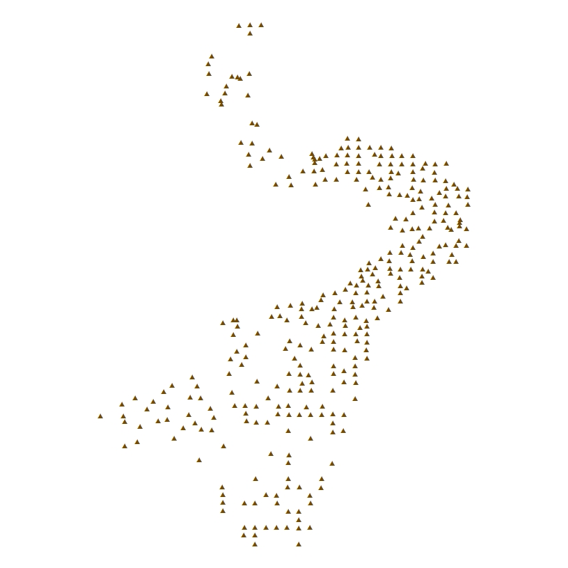
Sample locations and textural analysis for samples collected during USGS survey 2012-035-FA in Ipswich Bay and Massachusetts Bay, Massachusetts, in 2012.
Entity_Type_Definition_Source: U.S. Geological Survey
Attribute:
Attribute_Label: FID
Attribute_Definition: Internal feature number.
Attribute_Definition_Source: Esri
Attribute_Domain_Values:
Unrepresentable_Domain:
Sequential unique whole numbers that are automatically generated.
Attribute:
Attribute_Label: Shape
Attribute_Definition: Feature geometry.
Attribute_Definition_Source: Esri
Attribute_Domain_Values:
Unrepresentable_Domain: Coordinates defining the features.
Attribute:
Attribute_Label: GROUP
Attribute_Definition:
Sample group number assigned to data by USGS sediment laboratory based on source.
Attribute_Definition_Source:
Modified from USGS East-Coast Sediment Texture Database data dictionary
Attribute_Domain_Values:
Enumerated_Domain:
Enumerated_Domain_Value: 3
Enumerated_Domain_Value_Definition:
Sediment entirely or partially analyzed, processed, or visually described by USGS Woods Hole scientists; most samples analyzed in the USGS Woods Hole Sediment Laboratory.
Enumerated_Domain_Value_Definition_Source: USGS East-Coast Sediment Texture Database data dictionary
Attribute:
Attribute_Label: DB_ID
Attribute_Definition: Database identifier assigned by sediment laboratory.
Attribute_Definition_Source:
Modified from USGS East-Coast Sediment Texture Database data dictionary
Attribute_Domain_Values:
Unrepresentable_Domain: Character string.
Attribute:
Attribute_Label: FIELD_NO
Attribute_Definition:
Sample name or number as assigned in the field by the Chief Scientist.
Attribute_Definition_Source: USGS East-Coast Sediment Texture Database data dictionary
Attribute_Domain_Values:
Unrepresentable_Domain: Character string.
Attribute:
Attribute_Label: PROJECT
Attribute_Definition: Survey area of the research project.
Attribute_Definition_Source:
Modified from USGS East-Coast Sediment Texture Database data dictionary.
Attribute_Domain_Values:
Unrepresentable_Domain: Character sting.
Attribute:
Attribute_Label: CRUISE_ID
Attribute_Definition:
Name or number of cruise on which sample collected. Historically cruise identifiers were a combination of ship name, year of cruise, and cruise leg. In more recent years, cruise identifier is a sequential serial number assigned to field activities within a specific year (in the format YYYY-XXX-FA where YYYY is the survey year, XXX is the cruise number within that year, and FA is Field Activity).
Attribute_Definition_Source:
Modified from USGS East-Coast Sediment Texture Database data dictionary
Attribute_Domain_Values:
Unrepresentable_Domain: Character string.
Attribute:
Attribute_Label: CONTACT
Attribute_Definition:
Name of Principal Investigator or Chief Scientist responsible for data collection (usually first initial and last name).
Attribute_Definition_Source: USGS East-Coast Sediment Texture Database data dictionary
Attribute_Domain_Values:
Unrepresentable_Domain: Character string.
Attribute:
Attribute_Label: AREA
Attribute_Definition: Regional research focus for USGS survey 2012-035-FA.
Attribute_Definition_Source:
Modified from USGS East-Coast Sediment Texture Database data dictionary
Attribute_Domain_Values:
Unrepresentable_Domain: Character string.
Attribute:
Attribute_Label: LATITUDE
Attribute_Definition:
Latitude coordinate, in decimal degrees (WGS 84), of sample location. South latitude is recorded as negative values.
Attribute_Definition_Source:
Modified from USGS East-Coast Sediment Texture Database data dictionary
Attribute_Domain_Values:
Range_Domain:
Range_Domain_Minimum: 42.29698500
Range_Domain_Maximum: 42.87339500
Attribute_Units_of_Measure: decimal degrees
Attribute_Measurement_Resolution: 0.00000001
Attribute:
Attribute_Label: LONGITUDE
Attribute_Definition:
Longitude coordinate, in decimal degrees (WGS 84), of sample location. West longitude is recorded as negative values.
Attribute_Definition_Source:
Modified from USGS East-Coast Sediment Texture Database data dictionary
Attribute_Domain_Values:
Range_Domain:
Range_Domain_Minimum: -70.90712670
Range_Domain_Maximum: -70.49860330
Attribute_Units_of_Measure: decimal degrees
Attribute_Measurement_Resolution: 0.00000001
Attribute:
Attribute_Label: DEPTH_M
Attribute_Definition:
Depth in meters extracted from the NOAA U.S. Coastal Relief Model data.
Attribute_Definition_Source:
Modified from USGS East-Coast Sediment Texture Database data dictionary
Attribute_Domain_Values:
Range_Domain:
Range_Domain_Minimum: 11.0
Range_Domain_Maximum: 87.3
Attribute_Units_of_Measure: meters
Attribute_Measurement_Resolution: 0.1
Attribute:
Attribute_Label: T_DEPTH
Attribute_Definition:
Top depth of the sub-sample collected from the whole grab sample below the sediment-water interface in centimeters. No data value is -9999.
Attribute_Definition_Source:
Modified from USGS East-Coast Sediment Texture Database data dictionary
Attribute_Domain_Values:
Range_Domain:
Range_Domain_Minimum: 0
Range_Domain_Maximum: 0
Attribute_Units_of_Measure: centimeters
Attribute:
Attribute_Label: B_DEPTH
Attribute_Definition:
Bottom depth of the sub-sample collected from the whole grab sample below the sediment-water interface in centimeters. No data value is -9999.
Attribute_Definition_Source:
Modified from USGS East-Coast Sediment Texture Database data dictionary
Attribute_Domain_Values:
Range_Domain:
Range_Domain_Minimum: 2
Range_Domain_Maximum: 2
Attribute_Units_of_Measure: centimeters
Attribute:
Attribute_Label: DEVICE
Attribute_Definition: Device used to collect the sample.
Attribute_Definition_Source:
Modified from USGS East-Coast Sediment Texture Database data dictionary
Attribute_Domain_Values:
Unrepresentable_Domain: Character string.
Attribute:
Attribute_Label: MONTH_COLL
Attribute_Definition: Calendar month sample collected based on time in UTC.
Attribute_Definition_Source:
Modified from USGS East-Coast Sediment Texture Database data dictionary
Attribute_Domain_Values:
Range_Domain:
Range_Domain_Minimum: 8
Range_Domain_Maximum: 8
Attribute_Units_of_Measure: months
Attribute_Measurement_Resolution: 1
Attribute:
Attribute_Label: DAY_COLL
Attribute_Definition: Calendar day sample collected based on time in UTC.
Attribute_Definition_Source:
Modified from USGS East-Coast Sediment Texture Database data dictionary
Attribute_Domain_Values:
Range_Domain:
Range_Domain_Minimum: 21
Range_Domain_Maximum: 27
Attribute_Units_of_Measure: days
Attribute_Measurement_Resolution: 1
Attribute:
Attribute_Label: YEAR_COLL
Attribute_Definition: Calendar year sample collected based on time in UTC.
Attribute_Definition_Source:
Modified from USGS East-Coast Sediment Texture Database data dictionary
Attribute_Domain_Values:
Range_Domain:
Range_Domain_Minimum: 2012
Range_Domain_Maximum: 2012
Attribute_Units_of_Measure: years
Attribute_Measurement_Resolution: 1
Attribute:
Attribute_Label: MONTH_ANAL
Attribute_Definition: Calendar month sample analyzed. No data value is -9999.
Attribute_Definition_Source:
Modified from USGS East-Coast Sediment Texture Database data dictionary
Attribute_Domain_Values:
Range_Domain:
Range_Domain_Minimum: 11
Range_Domain_Maximum: 11
Attribute_Units_of_Measure: months
Attribute_Measurement_Resolution: 1
Attribute:
Attribute_Label: DAY_ANAL
Attribute_Definition: Calendar day sample analyzed. No data value is -9999.
Attribute_Definition_Source:
Modified from USGS East-Coast Sediment Texture Database data dictionary
Attribute_Domain_Values:
Range_Domain:
Range_Domain_Minimum: 28
Range_Domain_Maximum: 28
Attribute_Units_of_Measure: days
Attribute_Measurement_Resolution: 1
Attribute:
Attribute_Label: YEAR_ANAL
Attribute_Definition: Calendar year sample analyzed. No data value is -9999.
Attribute_Definition_Source:
Modified from USGS East-Coast Sediment Texture Database data dictionary
Attribute_Domain_Values:
Range_Domain:
Range_Domain_Minimum: 2012
Range_Domain_Maximum: 2012
Attribute_Units_of_Measure: years
Attribute_Measurement_Resolution: 1
Attribute:
Attribute_Label: WEIGHT
Attribute_Definition: Weight of dry sample in grams. No data value is -9999.
Attribute_Definition_Source:
Modified from USGS East-Coast Sediment Texture Database data dictionary
Attribute_Domain_Values:
Range_Domain:
Range_Domain_Minimum: 16.7942
Range_Domain_Maximum: 246.6600
Attribute_Units_of_Measure: grams
Attribute_Measurement_Resolution: 0.0001
Attribute:
Attribute_Label: GRAVEL_PCT
Attribute_Definition:
Gravel content in percent dry weight of the sample (particles with nominal diameters greater than 2 mm; -1 phi and larger). No data value is -9999.
Attribute_Definition_Source:
Modified from USGS East-Coast Sediment Texture Database data dictionary
Attribute_Domain_Values:
Range_Domain:
Range_Domain_Minimum: 0
Range_Domain_Maximum: 74.51
Attribute_Units_of_Measure: percent
Attribute_Measurement_Resolution: 0.01
Attribute:
Attribute_Label: SAND_PCT
Attribute_Definition:
Sand content in percent dry weight of the sample (particles with nominal diameters less than 2 mm, but greater than or equal to 0.0625 mm; 0 phi through 4 phi, inclusive). No data value is -9999.
Attribute_Definition_Source:
Modified from USGS East-Coast Sediment Texture Database data dictionary
Attribute_Domain_Values:
Range_Domain:
Range_Domain_Minimum: 5.39
Range_Domain_Maximum: 99.69
Attribute_Units_of_Measure: percent
Attribute_Measurement_Resolution: 0.01
Attribute:
Attribute_Label: SILT_PCT
Attribute_Definition:
Silt content in percent dry weight of the sample (particles with nominal diameters less than 0.0625 mm, but greater than or equal to 0.004 mm; 5 phi through 8 phi, inclusive). No data value is -9999.
Attribute_Definition_Source:
Modified from USGS East-Coast Sediment Texture Database data dictionary
Attribute_Domain_Values:
Range_Domain:
Range_Domain_Minimum: 0.18
Range_Domain_Maximum: 70.51
Attribute_Units_of_Measure: percent
Attribute_Measurement_Resolution: 0.01
Attribute:
Attribute_Label: CLAY_PCT
Attribute_Definition:
Clay content in percent dry weight of the sample (particles with nominal diameters less than 0.004 mm; 9 phi and smaller). No data value is -9999.
Attribute_Definition_Source:
Modified from USGS East-Coast Sediment Texture Database data dictionary
Attribute_Domain_Values:
Range_Domain:
Range_Domain_Minimum: 0.08
Range_Domain_Maximum: 34.49
Attribute_Units_of_Measure: percent
Attribute_Measurement_Resolution: 0.01
Attribute:
Attribute_Label: CLASSIFICA
Attribute_Definition:
Sediment classification based on a rigorous definition (Shepard [1954] as modified by Schlee [1973] and Poppe and others [2014]). For stations where a physical sample was not collected, the classification was based on visual analysis by USGS geologists of the bottom still and video imagery taken during the sampler deployment. In the definitions below, gravel is defined as particles with nominal diameters greater than 2 mm; sand consists of particles with nominal diameters less than 2 mm, but greater than or equal to 0.0625 mm; silt consists of particles with nominal diameters less than 0.0625 mm, but greater than or equal to 0.004 mm; and clay consists of particles with nominal diameters less than 0.004 mm.
Attribute_Definition_Source:
Modified from USGS East-Coast Sediment Texture Database data dictionary
Attribute_Domain_Values:
Enumerated_Domain:
Enumerated_Domain_Value: CLAYEY SILT
Enumerated_Domain_Value_Definition:
Silt less than 75 percent and equal to or greater than 50 percent, clay greater than sand, and sand less than 20 percent.
Enumerated_Domain_Value_Definition_Source: USGS East-Coast Sediment Texture Database data dictionary
Attribute_Domain_Values:
Enumerated_Domain:
Enumerated_Domain_Value: GRAVEL
Enumerated_Domain_Value_Definition: Gravel equal to or greater than 50 percent.
Enumerated_Domain_Value_Definition_Source: USGS East-Coast Sediment Texture Database data dictionary
Attribute_Domain_Values:
Enumerated_Domain:
Enumerated_Domain_Value: GRAVELLY SEDIMENT
Enumerated_Domain_Value_Definition:
Gravel equal to or greater than 10 percent, but less than 50 percent.
Enumerated_Domain_Value_Definition_Source: USGS East-Coast Sediment Texture Database data dictionary
Attribute_Domain_Values:
Enumerated_Domain:
Enumerated_Domain_Value: MUD
Enumerated_Domain_Value_Definition:
Mud (silt plus clay) equal to or greater than 50 percent based on visual observation.
Enumerated_Domain_Value_Definition_Source: U.S. Geological Survey
Attribute_Domain_Values:
Enumerated_Domain:
Enumerated_Domain_Value: SAND
Enumerated_Domain_Value_Definition: Sand equal to or greater than 75 percent.
Enumerated_Domain_Value_Definition_Source: USGS East-Coast Sediment Texture Database data dictionary
Attribute_Domain_Values:
Enumerated_Domain:
Enumerated_Domain_Value: SAND SILT CLAY
Enumerated_Domain_Value_Definition: Clay, sand, and silt greater than 20 percent each.
Enumerated_Domain_Value_Definition_Source: USGS East-Coast Sediment Texture Database data dictionary
Attribute_Domain_Values:
Enumerated_Domain:
Enumerated_Domain_Value: SANDY SILT
Enumerated_Domain_Value_Definition:
Silt less than 75 percent and equal to or greater than 50 percent, sand greater than clay, and clay less than 20 percent.
Enumerated_Domain_Value_Definition_Source: USGS East-Coast Sediment Texture Database data dictionary
Attribute_Domain_Values:
Enumerated_Domain:
Enumerated_Domain_Value: SILTY SAND
Enumerated_Domain_Value_Definition:
Sand less than 75 percent and equal to or greater than 50 percent, silt greater than clay, and clay less than 20 percent.
Enumerated_Domain_Value_Definition_Source: USGS East-Coast Sediment Texture Database data dictionary
Attribute:
Attribute_Label: MEDIAN
Attribute_Definition:
Middle point in the grain-size distribution in phi units. No data value is -9999.
Attribute_Definition_Source:
Modified from USGS East-Coast Sediment Texture Database data dictionary
Attribute_Domain_Values:
Range_Domain:
Range_Domain_Minimum: -4.20
Range_Domain_Maximum: 7.34
Attribute_Units_of_Measure: phi
Attribute_Measurement_Resolution: 0.01
Attribute:
Attribute_Label: MEAN
Attribute_Definition:
Average value in the grain-size distribution in phi units. No data value is -9999.
Attribute_Definition_Source:
Modified from USGS East-Coast Sediment Texture Database data dictionary
Attribute_Domain_Values:
Range_Domain:
Range_Domain_Minimum: -2.37
Range_Domain_Maximum: 7.06
Attribute_Units_of_Measure: phi
Attribute_Measurement_Resolution: 0.01
Attribute:
Attribute_Label: STDEV
Attribute_Definition:
Standard deviation (root mean square of the deviations) of the grain-size distribution in phi units (sorting). No data value is -9999.
Attribute_Definition_Source:
Modified from USGS East-Coast Sediment Texture Database data dictionary
Attribute_Domain_Values:
Range_Domain:
Range_Domain_Minimum: 0.44
Range_Domain_Maximum: 4.65
Attribute_Units_of_Measure: phi
Attribute_Measurement_Resolution: 0.01
Attribute:
Attribute_Label: SKEWNESS
Attribute_Definition:
Skewness (deviation from symmetrical form) of the grain-size distribution where positive values show an excess of fine-grained sediments and negative values show an excess of coarse-grained sediments. No data value is -9999.
Attribute_Definition_Source:
Modified from USGS East-Coast Sediment Texture Database data dictionary
Attribute_Domain_Values:
Range_Domain:
Range_Domain_Minimum: -0.45
Range_Domain_Maximum: 5.30
Attribute_Units_of_Measure: unitless
Attribute_Measurement_Resolution: 0.01
Attribute:
Attribute_Label: KURTOSIS
Attribute_Definition:
Kurtosis (degree of curvature near the mode) of the grain-size distribution. No data value is -9999.
Attribute_Definition_Source:
Modified from USGS East-Coast Sediment Texture Database data dictionary
Attribute_Domain_Values:
Range_Domain:
Range_Domain_Minimum: -1.44
Range_Domain_Maximum: 144.45
Attribute_Units_of_Measure: unitless
Attribute_Measurement_Resolution: 0.01
Attribute:
Attribute_Label: MODE1CLASS
Attribute_Definition:
First mode (particle size that occurs the most number of times) in phi units.
Attribute_Definition_Source: USGS East-Coast Sediment Texture Database data dictionary
Attribute_Domain_Values:
Unrepresentable_Domain: -9999 (representing no data for this field).
Attribute:
Attribute_Label: MODE1FREQ
Attribute_Definition: Modal strength of the first mode in percent.
Attribute_Definition_Source: USGS East-Coast Sediment Texture Database data dictionary
Attribute_Domain_Values:
Unrepresentable_Domain: -9999 (representing no data for this field).
Attribute:
Attribute_Label: MODE2CLASS
Attribute_Definition: Second mode in phi units.
Attribute_Definition_Source: USGS East-Coast Sediment Texture Database data dictionary
Attribute_Domain_Values:
Unrepresentable_Domain: -9999 (representing no data for this field).
Attribute:
Attribute_Label: MODE2FREQ
Attribute_Definition: Modal strength of the second mode in percent.
Attribute_Definition_Source: USGS East-Coast Sediment Texture Database data dictionary
Attribute_Domain_Values:
Unrepresentable_Domain: -9999 (representing no data for this field).
Attribute:
Attribute_Label: MODE3CLASS
Attribute_Definition: Third mode in phi units.
Attribute_Definition_Source: USGS East-Coast Sediment Texture Database data dictionary
Attribute_Domain_Values:
Unrepresentable_Domain: -9999 (representing no data for this field).
Attribute:
Attribute_Label: MODE3FREQ
Attribute_Definition: Modal strength of the third mode in percent.
Attribute_Definition_Source: USGS East-Coast Sediment Texture Database data dictionary
Attribute_Domain_Values:
Unrepresentable_Domain: -9999 (representing no data for this field).
Attribute:
Attribute_Label: NMODES
Attribute_Definition: Number of modes.
Attribute_Definition_Source: USGS East-Coast Sediment Texture Database data dictionary
Attribute_Domain_Values:
Unrepresentable_Domain: -9999 (representing no data for this field).
Attribute:
Attribute_Label: PHIm5
Attribute_Definition:
Weight percent of the sample in the -5-phi fraction and larger (nominal diameter of particles greater than or equal to 32 mm); very coarse pebbles, cobbles, and boulders. No data value is -9999.
Attribute_Definition_Source:
Modified from USGS East-Coast Sediment Texture Database data dictionary
Attribute_Domain_Values:
Range_Domain:
Range_Domain_Minimum: 0
Range_Domain_Maximum: 0
Attribute_Units_of_Measure: percent
Attribute_Measurement_Resolution: 0.01
Attribute:
Attribute_Label: PHIm4
Attribute_Definition:
Weight percent of the sample in the -4-phi fraction (nominal diameter of particles greater than or equal to 16 mm, but less than 32 mm); coarse pebbles. No data value is -9999.
Attribute_Definition_Source:
Modified from USGS East-Coast Sediment Texture Database data dictionary
Attribute_Domain_Values:
Range_Domain:
Range_Domain_Minimum: 0
Range_Domain_Maximum: 62.49
Attribute_Units_of_Measure: percent
Attribute_Measurement_Resolution: 0.01
Attribute:
Attribute_Label: PHIm3
Attribute_Definition:
Weight percent of the sample in the -3-phi fraction (nominal diameter of particles greater than or equal to 8 mm, but less than 16 mm); medium pebbles. No data value is -9999.
Attribute_Definition_Source:
Modified from USGS East-Coast Sediment Texture Database data dictionary
Attribute_Domain_Values:
Range_Domain:
Range_Domain_Minimum: 0
Range_Domain_Maximum: 26.13
Attribute_Units_of_Measure: percent
Attribute_Measurement_Resolution: 0.01
Attribute:
Attribute_Label: PHIm2
Attribute_Definition:
Weight percent of the sample in the -2-phi fraction (nominal diameter of particles greater than or equal to 4 mm, but less than 8 mm); fine pebbles. No data value is -9999.
Attribute_Definition_Source:
Modified from USGS East-Coast Sediment Texture Database data dictionary
Attribute_Domain_Values:
Range_Domain:
Range_Domain_Minimum: 0
Range_Domain_Maximum: 29.58
Attribute_Units_of_Measure: percent
Attribute_Measurement_Resolution: 0.01
Attribute:
Attribute_Label: PHIm1
Attribute_Definition:
Weight percent of the sample in the -1-phi fraction (nominal diameter of particles greater than or equal to 2 mm, but less than 4 mm); very fine pebbles (granules). No data value is -9999.
Attribute_Definition_Source:
Modified from USGS East-Coast Sediment Texture Database data dictionary
Attribute_Domain_Values:
Range_Domain:
Range_Domain_Minimum: 0
Range_Domain_Maximum: 40.11
Attribute_Units_of_Measure: percent
Attribute_Measurement_Resolution: 0.01
Attribute:
Attribute_Label: PHI_0
Attribute_Definition:
Weight percent of the sample in the 0-phi fraction (nominal diameters of particles greater than or equal to 1 mm, but less than 2 mm); very coarse sand. No data value is -9999.
Attribute_Definition_Source:
Modified from USGS East-Coast Sediment Texture Database data dictionary
Attribute_Domain_Values:
Range_Domain:
Range_Domain_Minimum: 0.01
Range_Domain_Maximum: 41.54
Attribute_Units_of_Measure: percent
Attribute_Measurement_Resolution: 0.01
Attribute:
Attribute_Label: PHI_1
Attribute_Definition:
Weight percent of the sample in the 1-phi fraction (nominal diameter of particles greater than or equal to 0.5 mm, but less than 1 mm); coarse sand. No data value is -9999.
Attribute_Definition_Source:
Modified from USGS East-Coast Sediment Texture Database data dictionary
Attribute_Domain_Values:
Range_Domain:
Range_Domain_Minimum: 0.02
Range_Domain_Maximum: 81.40
Attribute_Units_of_Measure: percent
Attribute_Measurement_Resolution: 0.01
Attribute:
Attribute_Label: PHI_2
Attribute_Definition:
Weight percent of the sample in the 2-phi fraction (nominal diameter of particles greater than or equal to 0.25 mm, but less than 0.5 mm); medium sand. No data value is -9999.
Attribute_Definition_Source:
Modified from USGS East-Coast Sediment Texture Database data dictionary
Attribute_Domain_Values:
Range_Domain:
Range_Domain_Minimum: 0.10
Range_Domain_Maximum: 61.82
Attribute_Units_of_Measure: percent
Attribute_Measurement_Resolution: 0.01
Attribute:
Attribute_Label: PHI_3
Attribute_Definition:
Weight percent of the sample in the 3-phi fraction (nominal diameter of particles greater than or equal to 0.125 mm, but less than 0.25 mm); fine sand. No data value is -9999.
Attribute_Definition_Source:
Modified from USGS East-Coast Sediment Texture Database data dictionary
Attribute_Domain_Values:
Range_Domain:
Range_Domain_Minimum: 0.12
Range_Domain_Maximum: 74.09
Attribute_Units_of_Measure: percent
Attribute_Measurement_Resolution: 0.01
Attribute:
Attribute_Label: PHI_4
Attribute_Definition:
Weight percent of the sample in the 4-phi fraction (nominal diameters of particles greater than or equal to 0.0625 mm, but less than 0.125 mm); very fine sand. No data value is -9999.
Attribute_Definition_Source:
Modified from USGS East-Coast Sediment Texture Database data dictionary
Attribute_Domain_Values:
Range_Domain:
Range_Domain_Minimum: 0.02
Range_Domain_Maximum: 92.53
Attribute_Units_of_Measure: percent
Attribute_Measurement_Resolution: 0.01
Attribute:
Attribute_Label: PHI_5
Attribute_Definition:
Weight percent of the sample in the 5-phi fraction (nominal diameter of particles greater than or equal to 0.031 mm, but less than 0.0625 mm); coarse silt. No data value is -9999.
Attribute_Definition_Source:
Modified from USGS East-Coast Sediment Texture Database data dictionary
Attribute_Domain_Values:
Range_Domain:
Range_Domain_Minimum: 0.04
Range_Domain_Maximum: 18.99
Attribute_Units_of_Measure: percent
Attribute_Measurement_Resolution: 0.01
Attribute:
Attribute_Label: PHI_6
Attribute_Definition:
Weight percent of the sample in the 6-phi fraction (nominal diameter of particles greater than or equal to 0.016 mm, but less than 0.031 mm); medium silt. No data value is -9999.
Attribute_Definition_Source:
Modified from USGS East-Coast Sediment Texture Database data dictionary
Attribute_Domain_Values:
Range_Domain:
Range_Domain_Minimum: 0.03
Range_Domain_Maximum: 18.06
Attribute_Units_of_Measure: percent
Attribute_Measurement_Resolution: 0.01
Attribute:
Attribute_Label: PHI_7
Attribute_Definition:
Weight percent of the sample in the 7-phi fraction (nominal diameter of particles greater than or equal to 0.008 mm, but less than 0.016 mm); fine silt. No data value is -9999.
Attribute_Definition_Source:
Modified from USGS East-Coast Sediment Texture Database data dictionary
Attribute_Domain_Values:
Range_Domain:
Range_Domain_Minimum: 0.05
Range_Domain_Maximum: 29.21
Attribute_Units_of_Measure: percent
Attribute_Measurement_Resolution: 0.01
Attribute:
Attribute_Label: PHI_8
Attribute_Definition:
Weight percent of the sample in the 8-phi fraction (nominal diameter of particles greater than or equal to 0.004 mm, but less than 0.008 mm); very fine silt. No data value is -9999.
Attribute_Definition_Source:
Modified from USGS East-Coast Sediment Texture Database data dictionary
Attribute_Domain_Values:
Range_Domain:
Range_Domain_Minimum: 0.05
Range_Domain_Maximum: 27.05
Attribute_Units_of_Measure: percent
Attribute_Measurement_Resolution: 0.01
Attribute:
Attribute_Label: PHI_9
Attribute_Definition:
Weight percent of the sample in the 9-phi fraction (nominal diameter of particles greater than or equal to 0.002 mm, but less than 0.004 mm); coarse clay. No data value is -9999.
Attribute_Definition_Source:
Modified from USGS East-Coast Sediment Texture Database data dictionary
Attribute_Domain_Values:
Range_Domain:
Range_Domain_Minimum: 0.04
Range_Domain_Maximum: 18.67
Attribute_Units_of_Measure: percent
Attribute_Measurement_Resolution: 0.01
Attribute:
Attribute_Label: PHI_10
Attribute_Definition:
Weight percent of the sample in the 10-phi fraction (nominal diameter of particles greater than or equal to 0.001 mm, but less than 0.002 mm); medium clay. No data value is -9999.
Attribute_Definition_Source:
Modified from USGS East-Coast Sediment Texture Database data dictionary
Attribute_Domain_Values:
Range_Domain:
Range_Domain_Minimum: 0.02
Range_Domain_Maximum: 10.59
Attribute_Units_of_Measure: percent
Attribute_Measurement_Resolution: 0.01
Attribute:
Attribute_Label: PHI_11
Attribute_Definition:
Weight percent of the sample in the 11-phi fraction and smaller (nominal diameter of particles less than 0.001 mm); fine clay. No data value is -9999.
Attribute_Definition_Source:
Modified from USGS East-Coast Sediment Texture Database data dictionary
Attribute_Domain_Values:
Range_Domain:
Range_Domain_Minimum: 0.02
Range_Domain_Maximum: 5.23
Attribute_Units_of_Measure: percent
Attribute_Measurement_Resolution: 0.01
Attribute:
Attribute_Label: ANALYST
Attribute_Definition:
Name (usually first initial and last name) of person who analyzed the sediment samples in the sediment lab.
Attribute_Definition_Source:
Modified from USGS East-Coast Sediment Texture Database data dictionary
Attribute_Domain_Values:
Unrepresentable_Domain: Character string.
Attribute:
Attribute_Label: ANAL_COMM
Attribute_Definition:
Any further information about sediment analysis for all or specific parameters in this table.
Attribute_Definition_Source: USGS East-Coast Sediment Texture Database data dictionary
Attribute_Domain_Values:
Unrepresentable_Domain: Character string.
Attribute:
Attribute_Label: LITHOLOGY
Attribute_Definition:
Description of physical characteristics of the sample, if appropriate.
Attribute_Definition_Source:
Modified from USGS East-Coast Sediment Texture Database data dictionary.
Attribute_Domain_Values:
Unrepresentable_Domain: Character string.
Attribute:
Attribute_Label: COMMENTS
Attribute_Definition:
Comments on sample collection or lithology. Visual observation of bottom type was made from bottom still and video imagery for this survey.
Attribute_Definition_Source: USGS East-Coast Sediment Texture Database data dictionary
Attribute_Domain_Values:
Unrepresentable_Domain: Character string.
Overview_Description:
Entity_and_Attribute_Overview:
The CSV file has the same attributes, except for FID (which is not included), with the same definitions.
Entity_and_Attribute_Detail_Citation: U.S. Geological Survey
Distribution_Information:
Distributor:
Contact_Information:
Contact_Person_Primary:
Contact_Person: Seth Ackerman
Contact_Organization: U.S. Geological Survey
Contact_Position: Geologist
Contact_Address:
Address_Type: mailing and physical address
Address: 384 Woods Hole Rd.
City: Woods Hole
State_or_Province: MA
Postal_Code: 02543-1598
Country: USA
Contact_Voice_Telephone: 508-548-8700 x2315
Contact_Facsimile_Telephone: 508-457-2310
Contact_Electronic_Mail_Address: sackerman@usgs.gov
Resource_Description:
USGS data release 2012-035-FA contains sediment sample locations and grain-size analysis collected offshore of Massachusetts in Ipswich Bay and Massachusetts Bay (2012-035-FA_samples.zip). The zip file contains the following files: a shapefile of the sediment sample locations and analysis (2012-035-FA_samples.shp); a CSV file of the sediment sample locations and analysis (2012-035-FA_samples.csv); a browse graphic of sediment sample locations (2012-035-FA_samples_browse.jpg); and Federal Geographic Data Committee (FGDC) Content Standard for Digital Geospatial Metadata (CSDGM) metadata files in three standard formats (2012-035-FA_samples_meta.html, 2012-035-FA_samples_meta.txt, and 2012-035-FA_samples_meta.xml).
Distribution_Liability:
Neither the U.S. Government, the Department of the Interior, nor the USGS, nor any of their employees, contractors, or subcontractors, make any warranty, express or implied, nor assume any legal liability or responsibility for the accuracy, completeness, or usefulness of any information, apparatus, product, or process disclosed, nor represent that its use would not infringe on privately owned rights. The act of distribution shall not constitute any such warranty, and no responsibility is assumed by the USGS in the use of these data or related materials. Any use of trade, product, or firm names is for descriptive purposes only and does not imply endorsement by the U.S. Government.
Standard_Order_Process:
Digital_Form:
Digital_Transfer_Information:
Format_Name: Shapefile
Format_Version_Number: Esri ArcGIS 10.3.1
Format_Specification: Shapefile
Format_Information_Content:
The zip file contains a shapefile and CSV file of sediment sample locations and grain-size analysis collected by the U.S. Geological Survey Woods Hole Coastal and Marine Science Center and Massachusetts Office of Coastal Zone Management in Ipswich Bay and Massachusetts Bay, Massachusetts, in 2012 and the associated metadata.
File_Decompression_Technique:
Use WinZip, 7-Zip, PeaZip, PKUNZIP, or other uncompressing software
Transfer_Size: 0.2
Digital_Transfer_Option:
Online_Option:
Computer_Contact_Information: Access_Instructions:
The first link is a direct link to download the zip file of the data and metadata. The second and third links are for the field activity data page where additional datasets from this survey are available.
Digital_Form:
Digital_Transfer_Information:
Format_Name: CSV
Format_Version_Number: Microsoft Excel 2016 for Mac
Format_Specification: Comma Separated Value (CSV) text file
Format_Information_Content:
The zip file contains a shapefile and CSV file of the sediment sample locations and grain-size analysis collected by the U.S. Geological Survey Woods Hole Coastal and Marine Science Center and Massachusetts Office of Coastal Zone Management in Ipswich Bay and Massachusetts Bay, Massachusetts, in 2012 and the associated metadata.
File_Decompression_Technique:
Use WinZip, 7-Zip, PeaZip, PKUNZIP, or other uncompressing software
Transfer_Size: 0.2
Digital_Transfer_Option:
Online_Option:
Computer_Contact_Information: Access_Instructions:
The first link is a direct link to download the zip file of the data and metadata. The second and third links are for the field activity data page where additional datasets from this survey are available.
Fees: none
Technical_Prerequisites:
This zip file contains data available as a point shapefile and CSV file. The user must have software capable of reading shapefile format to use the point shapefile. The CSV file can be read with a text editor.
Metadata_Reference_Information:
Metadata_Date: 20200908
Metadata_Contact:
Contact_Information:
Contact_Person_Primary:
Contact_Person: Emily Huntley
Contact_Organization: U.S. Geological Survey
Contact_Position: Geographer/Database Specialist
Contact_Address:
Address_Type: mailing and physical address
Address: 384 Woods Hole Rd.
City: Woods Hole
State_or_Province: MA
Postal_Code: 02543-1598
Country: USA
Contact_Voice_Telephone: 508-548-8700
Contact_Facsimile_Telephone: 508-457-2310
Contact_Electronic_Mail_Address: ehuntley@usgs.gov
Metadata_Standard_Name: FGDC Content Standard for Digital Geospatial Metadata
Metadata_Standard_Version: FGDC-STD-001-1998
Metadata_Time_Convention: local time

This page is <https://cmgds.marine.usgs.gov/catalog/whcmsc/field_activities/2012_035_fa/2012-035-FA_samples_meta.html>
Generated by mp version 2.9.50 on Tue Sep 21 18:20:14 2021