Shot point navigation at even 500 shot intervals for EdgeTech SB-512i chirp seismic-reflection data collected in 2015 by the U.S. Geological Survey along the Delmarva Peninsula, MD and VA (Esri point shapefile, GCS WGS 84)

Metadata also available as - [Questions & Answers] - [Parseable text] - [XML]

Metadata:

Identification_Information:
Citation:
Citation_Information:
Originator: U.S. Geological Survey
Publication_Date: 2016
Title:
Shot point navigation at even 500 shot intervals for EdgeTech SB-512i chirp seismic-reflection data collected in 2015 by the U.S. Geological Survey along the Delmarva Peninsula, MD and VA (Esri point shapefile, GCS WGS 84)
Edition: 1.0
Geospatial_Data_Presentation_Form: vector digital data
Series_Information:
Series_Name: data release
Issue_Identification: DOI:10.5066/F7P55KK3
Publication_Information:
Publication_Place:
Woods Hole Coastal and Marine Science Center, Woods Hole, Massachusetts
Publisher: U.S. Geological Survey, Coastal and Marine Geology Program
Online_Linkage: https://doi.org/10.5066/F7P55KK3
Online_Linkage: Larger_Work_Citation:
Citation_Information:
Originator: Edward M. Sweeney
Originator: Elizabeth A. Pendleton
Originator: Seth D. Ackerman
Originator: Brian D. Andrews
Originator: Wayne E. Baldwin
Originator: William W. Danforth
Originator: David S. Foster
Originator: E. Robert Thieler
Originator: Laura L. Brothers
Publication_Date: 2016
Title:
High-resolution geophysical data collected along the Delmarva Peninsula 2015, U.S. Geological Survey Field Activity 2015-001-FA
Edition: 2.0
Series_Information:
Series_Name: data release
Issue_Identification: DOI:10.5066/F7P55KK3
Publication_Information:
Publication_Place: Reston, VA
Publisher: U.S. Geological Survey
Online_Linkage: https://doi.org/10.5066/F7P55KK3
Description:
Abstract:
The Delmarva Peninsula is a 220-kilometer-long headland, spit, and barrier island complex that was significantly affected by Hurricane Sandy in the fall of 2012. The U.S. Geological Survey conducted cruises during the summers of 2014 and 2015 to map the inner continental shelf of the Delmarva Peninsula using geophysical and sampling techniques to define the geologic framework that governs coastal system evolution at storm-event and longer timescales. Geophysical data collected during the cruises include swath bathymetric, sidescan sonar, chirp and boomer seismic reflection profiles, grab sample and bottom photograph data. More information about the USGS survey conducted as part of the Hurricane Sandy Response-- Geologic Framework and Coastal Vulnerability Study can be found at the project website or on the WHCMSC Field Activity Web pages: https://woodshole.er.usgs.gov/project-pages/delmarva/, https://cmgds.marine.usgs.gov/fan_info.php?fan=2014-002-FA and https://cmgds.marine.usgs.gov/fan_info.php?fan=2015-001-FA. Data collected during the 2014 survey can be obtained here: https://doi.org/10.5066/F7MW2F60
Purpose:
This dataset contains 500 shot point navigation and unique shot point navigation for approximately 5,500 km of chirp seismic-reflection data collected by the U.S. Geological Survey during cruise 2015-001-FA along the Delmarva Peninsula, MD and VA. This information can help spatially correlate the subbottom data with other data in the GIS.
Time_Period_of_Content:
Time_Period_Information:
Range_of_Dates/Times:
Beginning_Date: 20150610
Ending_Date: 20150714
Currentness_Reference:
ground condition; data were not collected on 20150628 (transition between Legs 1 and 2 of the survey)
Status:
Progress: Complete
Maintenance_and_Update_Frequency: None planned.
Spatial_Domain:
Bounding_Coordinates:
West_Bounding_Coordinate: -75.891075
East_Bounding_Coordinate: -75.156914
North_Bounding_Coordinate: 37.839169
South_Bounding_Coordinate: 36.999886
Keywords:
Theme:
Theme_Keyword_Thesaurus: USGS Metadata Identifier
Theme_Keyword: USGS:52755492-5fdc-46df-a6a0-a8415a2016b0
Theme:
Theme_Keyword_Thesaurus: None
Theme_Keyword: U.S. Geological Survey
Theme_Keyword: USGS
Theme_Keyword: Woods Hole Coastal and Marine Science Center
Theme_Keyword: WHCMSC
Theme_Keyword: Coastal and Marine Geology Program
Theme_Keyword: CMGP
Theme_Keyword: seismic profile
Theme_Keyword: shot point navigation
Theme_Keyword: seismic navigation
Theme_Keyword: seismic reflection
Theme_Keyword: field activity number 2015-001-FA
Theme_Keyword: chirp
Theme_Keyword: 512i
Theme_Keyword: shot point
Theme_Keyword: Marine Geology
Theme:
Theme_Keyword_Thesaurus: ISO 19115 Topic Category
Theme_Keyword: oceans
Theme_Keyword: location
Theme:
Theme_Keyword_Thesaurus: USGS Thesaurus
Theme_Keyword: navigational data
Theme_Keyword: marine geophysics
Theme_Keyword: geospatial datasets
Place:
Place_Keyword_Thesaurus: None
Place_Keyword: Atlantic Ocean
Place_Keyword: Delmarva Peninsula
Place_Keyword: Delaware
Place_Keyword: Maryland
Place_Keyword: Virginia
Place_Keyword: Assateague Island
Place_Keyword: Assateague Island National Seashore
Place_Keyword: Chincoteague Island
Place_Keyword: Chincoteague National Wildlife Refuge
Place_Keyword: Chincoteague Inlet
Place_Keyword: Chincoteague Bay
Place_Keyword: Wallops Island
Place_Keyword: Parramore Island
Place_Keyword: Cobb Island
Place_Keyword: Wreck Island
Place_Keyword: Ship Shoal Island
Place_Keyword: Myrtle Island
Place_Keyword: Smith Island
Place_Keyword: Fisherman Island
Place_Keyword: Hog Island
Access_Constraints: none
Use_Constraints:
Public domain data from the U.S. Government are freely redistributable with proper metadata and source attribution. Please recognize the U.S. Geological Survey as the originator of the dataset.
Point_of_Contact:
Contact_Information:
Contact_Person_Primary:
Contact_Person: Edward M. Sweeney
Contact_Organization: U.S. Geological Survey
Contact_Position: Physical Scientist
Contact_Address:
Address_Type: mailing and physical address
Address: 384 Woods Hole Road
City: Woods Hole
State_or_Province: Massachusetts
Postal_Code: 02543-1598
Country: USA
Contact_Voice_Telephone: 508-548-8700 x2256
Contact_Facsimile_Telephone: 508-457-2310
Contact_Electronic_Mail_Address: emsweeney@usgs.gov
Browse_Graphic:
Browse_Graphic_File_Name: Browse_Graphic_File_Description:
Thumbnail image of chirp seismic-reflection shot points at 500-interval spacing for Delmarva Peninsula.
Browse_Graphic_File_Type: JPEG
Cross_Reference:
Citation_Information:
Originator: Elizabeth A. Pendleton
Originator: Seth D. Ackerman
Originator: Wayne E. Baldwin
Originator: William W. Danforth
Originator: David S. Foster
Originator: E. Robert Thieler
Originator: Laura L. Brothers
Publication_Date: 2015
Title:
High-resolution geophysical data collected along the Delmarva Peninsula 2014, U.S. Geological Survey Field Activity 2014-002-FA
Edition: 3.0
Geospatial_Data_Presentation_Form: webpage
Series_Information:
Series_Name: data release
Issue_Identification: DOI:10.5066/F7MW2F60
Publication_Information:
Publication_Place: Reston, VA
Publisher: U.S. Geological Survey
Online_Linkage: https://doi.org/10.5066/F7MW2F60
Data_Quality_Information:
Logical_Consistency_Report:
These seismic reflection profile data were collected at roughly 3.2 kilometer line spacing during the multi-channel seismic reflection profile survey (Julian day 161-168) and at 200 meter line spacing during the sidescan sonar mapping survey (JD 168-195). The M/V Scarlet Isabella can only survey in water depths greater than 8 meters, so there are some gaps in the survey lines where the vessel had to avoid crossing shallow shoals. Most of the gaps were planned with breaks in tracklines or maneuvers around the shoals. Most of the data were acquired roughly parallel to the orientation of Assateague Island at an average speed of 5 knots. Crosslines lines were collected roughly perpendicular to the coast. Line numbering begins at line 1 and ends at line 178. Any spurious data points were removed during processing. There is a starting shot point (1) and ending shot point (x) with even 500-shot intervals in the shapefile for each seismic trackline. The CSV file contains unique shot point navigation. No duplicate navigation fixes exist for multiple shots.
Completeness_Report:
Sections of tracklines where navigation was recorded but no seismic data were logged are not included such as some turns and transits. There is no line l155f1.
Positional_Accuracy:
Horizontal_Positional_Accuracy:
Horizontal_Positional_Accuracy_Report:
The EdgeTech SB-0512i subbottom profiler was mounted on a catamaran sled and towed at the sea surface approximately 43 m astern of the M/V Scarlett Isabella. The transducer depth below water line was 0.5 meters below catamaran floats. Navigation data for the 512i were collected using a Differential GPS (DGPS) and Wide Area Augmentation System (WAAS) GPS enabled Garmin receiver, which was located on the catamaran sled and connected to the acquisition computer via a serial cable. Positioning data were recorded in SonarWiz (versions 5.00.015 and 5.06.0058) acquisition software, which logged positioning coordinates to individual trace headers SEG-Y and JSF format. WAAS enabled GPS horizontal positional accuracy is assumed to be within 2 m.
Lineage:
Source_Information:
Source_Citation:
Citation_Information:
Originator: U.S. Geological Survey
Publication_Date: Unpublished Material
Title: 512i shot point trackline data
Geospatial_Data_Presentation_Form: vector digital data
Type_of_Source_Media: disc
Source_Time_Period_of_Content:
Time_Period_Information:
Range_of_Dates/Times:
Beginning_Date: 20150610
Ending_Date: 20150714
Source_Currentness_Reference:
ground condition; data were not collected on 20150628 (transition between Legs 1 and 2 of the survey).
Source_Citation_Abbreviation: SEG-Y and JSF 512i data
Source_Contribution:
Chirp seismic data were collected using an EdgeTech Geo-Star FSSB sub-bottom profiling system and an SB-0512i towfish (0.5-12 kHz), which was mounted on a catamaran and towed astern of the M/V Scarlett Isabella of Cape May, NJ. Chesapeake Technology's SonarWiz (versions 5.00.0015 and 5.06.0058) seismic acquisition software was used to control the Geo-Star topside unit, digitally log trace data in the SEG-Y Rev. 1 format (IEEE floating point) and JSF format, and record GPS navigation coordinates to the SEG-Y trace headers (in arc seconds of Latitude and Longitude, multiplied by a scalar of 100). Data were acquired using a 250 ms shot rate, a 5-ms pulse length, and a 0.5 to 8 kHz frequency sweep. Recorded trace lengths were approximately 180 ms.
Process_Step:
Process_Description:
Scripts within SIOSEIS (version 2013.1.1) and Seismic Unix (version 4.2) were used to process SEG-Y data, create navigation files, and plot images. The processing flow and scripts used to produce navigation files including trackline shapefiles and shot points are summarized below and in the following processing steps.
1. SIOSEIS (version 2013.1.1) was used to read SEG-Y files, renumber shots starting from one, extract the envelope-detected trace, and write out new SEG-Y files. The original shot numbers, which were assigned by SonarWiz sequentially over the duration of an acquisition session despite SEG-Y file changes, are preserved in the raw SEG-Y data.
2. The SIOSEIS script Sio_medianstk was used to minimize S-boom cross talk (when multi-channel streamer lines were recorded simultaneously: Julian day 161-168) with a two-trace median stack (trim 50 percent of the values furthest from the median amplitude) and improve water bottom picking. This script was used for all lines even after multi-channel streamer was turned off, due to the improvements made to water bottom picks.
3. The script Read512i_mstk was used to read median filtered stacked and renumbered SEG-Y files, write a Seismic Unix file, and extract SEG-Y trace header information, including shot number, longitude, latitude, year, Julian day, and time of day (UTC). Header information from each SEG-Y file was saved to text files after an AWK (no version) filter was used to maintain the first and last shots, shots at multiples of 100, 500, and shots with unique navigation coordinates. Geographic coordinates (WGS 84) were converted to UTM zone 18 N coordinates (WGS 84) using Proj (version 4.6.0). End shots and shots at multiples of 100 may not have unique navigation coordinates. Separate text files containing the first and last shots and even 500 shot intervals were also saved. A 500 shot interval was chosen because it corresponds to the annotation interval provided along the top of the seismic-reflection profile images. Read512i_mstk called a Python script 512itoSQL15001.py, written by Wayne Baldwin, which imported the CSV files to the SpatialLite (version 3.0.1) enabled SQLite (version 3.7.9) database. Esri shape polyline and shot point files were exported directly from the SQLite database.
Process_Date: 2015
Process_Contact:
Contact_Information:
Contact_Person_Primary:
Contact_Person: Dave Foster
Contact_Organization: U.S. Geological Survey
Contact_Position: Geologist
Contact_Address:
Address_Type: mailing and physical address
Address: 384 Woods Hole Rd.
City: Woods Hole
State_or_Province: MA
Postal_Code: 02543-1598
Contact_Voice_Telephone: (508) 548-8700 x2271
Contact_Facsimile_Telephone: (508) 457-2310
Contact_Electronic_Mail_Address: dfoster@usgs.gov
Process_Step:
Process_Description:
The online links to the data were updated to reflect the new server hosting the data. Additionally, other small edits could be made to the metadata, such as modifying http to https where appropriate. The metadata date (but not the metadata creator) was edited to reflect the date of these changes.
Process_Date: 20170419
Process_Contact:
Contact_Information:
Contact_Organization_Primary:
Contact_Organization: U.S. Geological Survey
Contact_Person: VeeAnn A. Cross
Contact_Position: Marine Geologist
Contact_Address:
Address_Type: Mailing and Physical
Address: 384 Woods Hole Road
City: Woods Hole
State_or_Province: MA
Postal_Code: 02543-1598
Contact_Voice_Telephone: 508-548-8700 x2251
Contact_Facsimile_Telephone: 508-457-2310
Contact_Electronic_Mail_Address: vatnipp@usgs.gov
Process_Step:
Process_Description: USGS Thesaurus keywords added to the keyword section.
Process_Date: 20180720
Process_Contact:
Contact_Information:
Contact_Organization_Primary:
Contact_Organization: U.S. Geological Survey
Contact_Person: VeeAnn A. Cross
Contact_Position: Marine Geologist
Contact_Address:
Address_Type: Mailing and Physical
Address: 384 Woods Hole Road
City: Woods Hole
State_or_Province: MA
Postal_Code: 02543-1598
Contact_Voice_Telephone: 508-548-8700 x2251
Contact_Facsimile_Telephone: 508-457-2310
Contact_Electronic_Mail_Address: vatnipp@usgs.gov
Process_Step:
Process_Description:
Added keywords section with USGS persistent identifier as theme keyword.
Process_Date: 20200908
Process_Contact:
Contact_Information:
Contact_Organization_Primary:
Contact_Organization: U.S. Geological Survey
Contact_Person: VeeAnn A. Cross
Contact_Position: Marine Geologist
Contact_Address:
Address_Type: Mailing and Physical
Address: 384 Woods Hole Road
City: Woods Hole
State_or_Province: MA
Postal_Code: 02543-1598
Contact_Voice_Telephone: 508-548-8700 x2251
Contact_Facsimile_Telephone: 508-457-2310
Contact_Electronic_Mail_Address: vatnipp@usgs.gov
Spatial_Data_Organization_Information:
Direct_Spatial_Reference_Method: Vector
Point_and_Vector_Object_Information:
SDTS_Terms_Description:
SDTS_Point_and_Vector_Object_Type: Entity point
Point_and_Vector_Object_Count: 10057
Spatial_Reference_Information:
Horizontal_Coordinate_System_Definition:
Geographic:
Latitude_Resolution: 0.000001
Longitude_Resolution: 0.000001
Geographic_Coordinate_Units: Decimal degrees
Geodetic_Model:
Horizontal_Datum_Name: D_WGS_1984
Ellipsoid_Name: WGS_1984
Semi-major_Axis: 6378137.000000
Denominator_of_Flattening_Ratio: 298.257224
Entity_and_Attribute_Information:
Detailed_Description:
Entity_Type:
Entity_Type_Label: 2015-001-FA_512i_500sht
Entity_Type_Definition:
512i 500-interval shot points for survey 2015-001-FA along the Delmarva Peninsula.
Entity_Type_Definition_Source: U.S. Geological Survey
Attribute:
Attribute_Label: FID
Attribute_Definition: Internal feature number.
Attribute_Definition_Source: Esri
Attribute_Domain_Values:
Unrepresentable_Domain:
Sequential unique whole numbers that are automatically generated.
Attribute:
Attribute_Label: Shape
Attribute_Definition: Feature geometry.
Attribute_Definition_Source: Esri
Attribute_Domain_Values:
Unrepresentable_Domain: Coordinates defining the features.
Attribute:
Attribute_Label: East
Attribute_Definition: Easting coordinate in UTM Zone 18 N meters, WGS 84
Attribute_Definition_Source: U.S. Geological Survey
Attribute_Domain_Values:
Range_Domain:
Range_Domain_Minimum: 420749.82
Range_Domain_Maximum: 486145.96
Attribute_Units_of_Measure: meters
Attribute_Measurement_Resolution: 1
Attribute:
Attribute_Label: North
Attribute_Definition: Northing coordinate in UTM Zone 18 N meters, WGS 84
Attribute_Definition_Source: U.S. Geological Survey
Attribute_Domain_Values:
Range_Domain:
Range_Domain_Minimum: 4095036.83
Range_Domain_Maximum: 4188017.75
Attribute_Units_of_Measure: meters
Attribute_Measurement_Resolution: 1
Attribute:
Attribute_Label: Lon
Attribute_Definition: Longitude coordinate in decimal degrees, WGS 84
Attribute_Definition_Source: U.S. Geological Survey
Attribute_Domain_Values:
Range_Domain:
Range_Domain_Minimum: -75.891075
Range_Domain_Maximum: -75.156914
Attribute_Units_of_Measure: degrees
Attribute_Measurement_Resolution: .00001
Attribute:
Attribute_Label: Lat
Attribute_Definition: Latitude coordinate in decimal degrees, WGS 84
Attribute_Definition_Source: U.S. Geological Survey
Attribute_Domain_Values:
Range_Domain:
Range_Domain_Minimum: 36.999885
Range_Domain_Maximum: 37.839168
Attribute_Units_of_Measure: degrees
Attribute_Measurement_Resolution: .00001
Attribute:
Attribute_Label: LineName
Attribute_Definition:
Name of the trackline along which seismic-reflection data were collected in the format: line number (i.e. 'l1') + file number (i.e. 'f1').
Attribute_Definition_Source: U.S. Geological Survey
Attribute_Domain_Values:
Unrepresentable_Domain: Character set
Attribute:
Attribute_Label: Image
Attribute_Definition:
PNG image name of seismic-reflection profile corresponding to survey line. The '_s' refers to the image file for data that has been through swell filter processing.
Attribute_Definition_Source: U.S. Geological Survey
Attribute_Domain_Values:
Unrepresentable_Domain: Character set
Attribute:
Attribute_Label: Shot
Attribute_Definition: Shot number (first, last, and every 500 shot between).
Attribute_Definition_Source: U.S. Geological Survey
Attribute_Domain_Values:
Range_Domain:
Range_Domain_Minimum: 1
Range_Domain_Maximum: 41889
Attribute_Units_of_Measure: shot
Attribute_Measurement_Resolution: 1
Attribute:
Attribute_Label: Year
Attribute_Definition: Year the data were collected YYYY.
Attribute_Definition_Source: U.S. Geological Survey
Attribute_Domain_Values:
Unrepresentable_Domain: Character set
Attribute:
Attribute_Label: JD_UTC
Attribute_Definition:
Julian day and UTC time for first, last, and every 500 shot point between of the survey line in the format: JD:HH:MM:SS; Julian day is the integer number (although recorded here in text string format) representing the interval of time in days since January 1 of the year of collection.
Attribute_Definition_Source: U.S. Geological Survey
Attribute_Domain_Values:
Unrepresentable_Domain: Character set
Attribute:
Attribute_Label: SurveyID
Attribute_Definition:
WHCMSC field activity identifier (e.g. "2015-001-FA" where 2015 is the survey year, 001 is survey number of that year, and FA is Field Activity).
Attribute_Definition_Source: U.S. Geological Survey
Attribute_Domain_Values:
Unrepresentable_Domain: Character set
Attribute:
Attribute_Label: VehicleID
Attribute_Definition: Survey vessel name.
Attribute_Definition_Source: U.S. Geological Survey
Attribute_Domain_Values:
Unrepresentable_Domain: Character set
Attribute:
Attribute_Label: DeviceID
Attribute_Definition: Sonar device used to collect seismic-reflection data.
Attribute_Definition_Source: U.S. Geological Survey
Attribute_Domain_Values:
Unrepresentable_Domain: Character set
Overview_Description:
Entity_and_Attribute_Overview:
The PNG seismic reflection images can be hyperlinked to their trackline location in ArcGIS. The 500 shot point intervals correspond to the x-axis ticks on the PNG images. The unique shot CSV file has the following column headings: Easting, Northing, Longitude, Latitude, LineName, Image, Shot, Year, JulianDay_Time. The first 9 columns correspond to the first 9 attributes of the shapefile.
Entity_and_Attribute_Detail_Citation: U.S. Geological Survey
Distribution_Information:
Distributor:
Contact_Information:
Contact_Person_Primary:
Contact_Person: Edward M. Sweeney
Contact_Organization: U.S. Geological Survey
Contact_Position: Physical Scientist
Contact_Address:
Address_Type: mailing and physical address
Address: 384 Woods Hole Road
City: Woods Hole
State_or_Province: Massachusetts
Postal_Code: 02543
Country: USA
Contact_Voice_Telephone: 508-548-8700 x2256
Contact_Facsimile_Telephone: 508-457-2310
Contact_Electronic_Mail_Address: emsweeney@usgs.gov
Resource_Description:
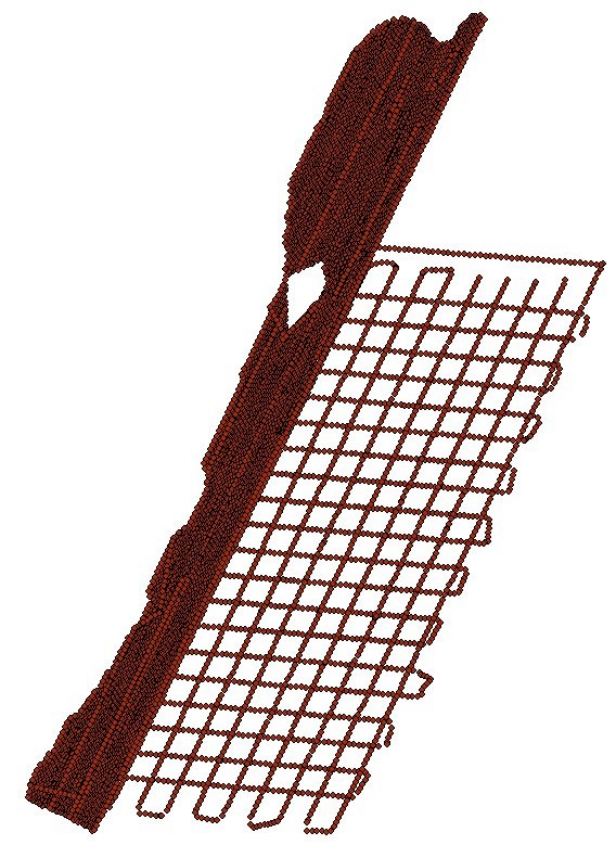
USGS data release 2015-001-FA 512i shot point data from the Delmarva Peninsula area (2015-001-FA_512i_500sht.zip). The zip file contains a folder with the following shapefile: 2015-001-FA_512i_500sht.shp, a browse graphic (2015-001-FA_512i_500sht_browse.jpg), a CSV file of unique shot point locations (2015-001-FA_512i_shot-nav.csv) and Federal Geographic Data Committee (FGDC) Content Standards for Digital Geospatial Metadata (CSDGM) metadata files (2015-001-FA_512i_500sht.xml) in four standard formats are also included in the zip file.
Distribution_Liability:
Neither the U.S. Government, the Department of the Interior, nor the USGS, nor any of their employees, contractors, or subcontractors, make any warranty, express or implied, nor assume any legal liability or responsibility for the accuracy, completeness, or usefulness of any information, apparatus, product, or process disclosed, nor represent that its use would not infringe on privately owned rights. The act of distribution shall not constitute any such warranty, and no responsibility is assumed by the USGS in the use of these data or related materials. Any use of trade, product, or firm names is for descriptive purposes only and does not imply endorsement by the U.S. Government.
Standard_Order_Process:
Digital_Form:
Digital_Transfer_Information:
Format_Name: Shapefile
Format_Version_Number: Spatialite 3.0.1
Format_Specification: Shapefile
Format_Information_Content:
The WinZip (version 14.0) file contains a shapefile of 512i shot point locations collected by the U.S. Geological Survey - Woods Hole Coastal and Marine Science Center along the Delmarva Peninsula, MD and VA and the associated metadata.
File_Decompression_Technique: Use WinZip, 7zip, Peazip or pkUnzip
Transfer_Size: 45
Digital_Transfer_Option:
Online_Option:
Computer_Contact_Information: Access_Instructions: Data can be downloaded via the Internet
Digital_Form:
Digital_Transfer_Information:
Format_Name: CSV
Format_Version_Number: Microsoft Excel Version 2010
Format_Specification: Comma-Separated Values (CSV)
Format_Information_Content:
The WinZip (version 14.0) file contains a CSV file of 512i shot point locations collected by the U.S. Geological Survey - Woods Hole Coastal and Marine Science Center along the Delmarva Peninsula, MD and VA and the associated metadata.
File_Decompression_Technique: Use WinZip, 7zip, Peazip or pkUnzip
Transfer_Size: 45
Digital_Transfer_Option:
Online_Option:
Computer_Contact_Information: Access_Instructions: Data can be downloaded via the Internet
Fees: none
Technical_Prerequisites:
This zip file contains data available in shapefile format. The user must have software capable of reading shapefile format to use these data. The CSV file can be read with a text editor.
Metadata_Reference_Information:
Metadata_Date: 20211119
Metadata_Contact:
Contact_Information:
Contact_Person_Primary:
Contact_Person: Edward M. Sweeney
Contact_Organization: U.S. Geological Survey
Contact_Position: Physical Scientist
Contact_Address:
Address_Type: mailing and physical address
Address: 384 Woods Hole Road
City: Woods Hole
State_or_Province: Massachusetts
Postal_Code: 02543
Country: USA
Contact_Voice_Telephone: 508-548-8700 x2256
Contact_Facsimile_Telephone: 508-457-2310
Contact_Electronic_Mail_Address: whsc_data_contact@usgs.gov
Contact_Instructions:
The metadata contact email address is a generic address in the event the metadata contact is no longer with the USGS or the email is otherwise invalid.
Metadata_Standard_Name: FGDC Content Standards for Digital Geospatial Metadata
Metadata_Standard_Version: FGDC-STD-001-1998
Metadata_Time_Convention: local time

This page is <https://cmgds.marine.usgs.gov/catalog/whcmsc/field_activities/2015_001_fa/2015-001-FA_512i_500sht.html>
Generated by mp version 2.9.50 on Fri Nov 19 13:02:55 2021