Online Links:
Online Links:
| Value | Definition |
|---|---|
| Point | Coordinates defining the features. |
| Value | Definition |
|---|---|
| CERC | US Army Corps of Engineers Coastal Engineering Research Center (CERC) |
| Range of values | |
|---|---|
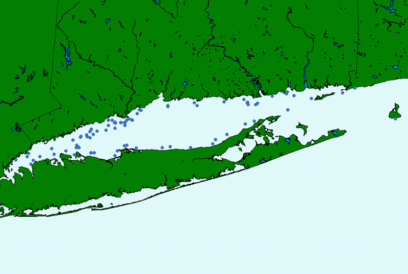
| Minimum: | -71.575302 |
| Maximum: | -73.747002 |
| Units: | Decimal degrees |
| Resolution: | 0.000001 |
| Range of values | |
|---|---|
| Minimum: | 40.880329 |
| Maximum: | 41.316750 |
| Units: | decimal degrees |
| Resolution: | 0.000001 |
| Range of values | |
|---|---|
| Minimum: | 382 |
| Maximum: | 1298 |
| Units: | integers |
| Resolution: | 1 |
| Range of values | |
|---|---|
| Minimum: | 1 |
| Maximum: | 78 |
| Units: | integers and letters |
| Value | Definition |
|---|---|
| 1967 | calendar year |
| Access_Constraints | None |
|---|---|
| Use_Constraints |
The U.S. Geological Survey and the U.S. Army Corps of Engineers must be referenced as the originator of the dataset in any future products or research derived from these data.
Although this derived data set and its lineage dataset have been used by the USGS and Connecticut DEP, no warranty, expressed or implied, is made by the USGS or CT DEP as to the accuracy of the data and/or related materials. The act of distribution shall not constitute any such warranty, and no responsibility is assumed by the USGS or CT DEP in the use of these data or related materials. |
| Data format: | The seven ArcView shapefiles (cercnav.dbf, cercnav.shp, cercnav.shx, cercnav.sbn, cercnav.sbx, cercnav.avl and cercnav.prj) comprising the navigation data for the USACOE vibracores collected in Long Island Sound and an ASCII text version of the metadata file. in format ArcView shapefile Size: 1 |
|---|---|
| Network links: |
https://doi.org/10.3133/ofr022 https://pubs.usgs.gov/of/2002/0002/data/cores/cerc/ https://pubs.usgs.gov/of/2002/0002/data/cores/cerc/cercnav.zip https://pubs.usgs.gov/of/2002/0002/data/cores/cerc/cercnavx.txt |
| Media you can order: |
DVD
(Density 4.7
Gbytes)
(format UDF)
Note: The user must have a system with a DVD drive capable of reading an UDF standard DVD-R disk. To browse the information contained on this disk, the user must also have a current version of WWW browser available. The user must also have the software installed on their computer system capable to unzip the archived file. |