Citation:
Citation_Information:
Originator: Eric Schmuck
Publication_Date: Unknown
Title: 5 m Bathymetric Contours for Long Island Sound (LIS1992)
Geospatial_Data_Presentation_Form: vector digital data
Online_Linkage: https://doi.org/10.3133/ofr022
Online_Linkage: https://pubs.usgs.gov/of/2002/0002/data/bathy/
Larger_Work_Citation:
Citation_Information:
Originator: Larry Poppe
Originator: Valerie Paskevich
Publication_Date: 2002
Title:
Geologic Framework Data from Long Island Sound, 1981-1990: A Digital Data Release
Geospatial_Data_Presentation_Form: atlas
Series_Information:
Series_Name: U.S. Geological Survey Open-File Report
Issue_Identification: 2002-002
Publication_Information:
Publication_Place: Woods Hole, MA
Publisher: U.S. Geological Survey, Coastal and Marine Geology Program
Online_Linkage: https://doi.org/10.3133/ofr022
Description:
Abstract:
This bathymetric contour data set was derived from a gridded data set obtained from URI (B.Tyce, G. Hatcher). They used the "Gridder" program to obtain the grid. This gridded data set was generated from the original NOS soundings from 9 track tape that was cleaned up and edited at URI. This work was done with the intention of producing the color poster called "Long Island Sound Estuary" (Connecticut Dept. of Environmental Protection"), 1993. The accuracy is questionable.
Purpose:
These data can be used with geographic information systems (GIS) software to display geologic and oceanographic information for the U. S. Atlantic northeast. The data are to be used for illustrations and illustrative maps on scientific topics. They are intended for science researchers, students, policy makers, and the general public. There is NO ASSURANCE of their accuracy, completeness, or precision.
Time_Period_of_Content:
Time_Period_Information:
Single_Date/Time:
Calendar_Date: unknown
Currentness_Reference: ground condition
Status:
Progress: Complete
Maintenance_and_Update_Frequency: None planned
Spatial_Domain:
Bounding_Coordinates:
West_Bounding_Coordinate: -74.998530
East_Bounding_Coordinate: -71.000107
North_Bounding_Coordinate: 41.995619
South_Bounding_Coordinate: 40.000462
Keywords:
Theme:
Theme_Keyword_Thesaurus: USGS Metadata Identifier
Theme_Keyword: USGS:cf6b6f96-211d-41dd-980b-7d2c471ca975
Theme:
Theme_Keyword_Thesaurus: None
Theme_Keyword: U. S. Geological Survey
Theme_Keyword: USGS
Theme_Keyword: Coastal and Marine Geology Program
Theme_Keyword: CMGP
Theme_Keyword: bathymetry contours
Theme_Keyword: ArcView shapefile
Theme:
Theme_Keyword_Thesaurus: ISO 19115 Topic Category
Theme_Keyword: oceans
Theme_Keyword: elevation
Theme:
Theme_Keyword_Thesaurus: USGS Thesaurus
Theme_Keyword: bathymetry
Theme_Keyword: geospatial datasets
Theme_Keyword: marine geology
Theme_Keyword: contouring
Place:
Place_Keyword_Thesaurus: None
Place_Keyword: Long Island Sound
Place_Keyword: Connecticut
Place_Keyword: New York
Place_Keyword: New Jersey
Place_Keyword: Rhode Island
Place_Keyword: Block Island Sound
Access_Constraints: None
Use_Constraints:
Although these data have been used by the U.S. Geological Survey, U.S. Department of the Interior, no warranty expressed or implied is made by the agency as to the accuracy of the data.
The act of distribution shall not constitute any such warranty, and no responsibility is assumed by the U.S. Geological Survey in the use of this data.
This information is NOT intended for navigational or legal purposes.
Any use of trade, firm or product names is for descriptive purposes only and does not imply endorsement by the U.S. Government.
Point_of_Contact:
Contact_Information:
Contact_Organization_Primary:
Contact_Organization: U. S. Geological Survey, Coastal and Marine Geology Program
Contact_Person: Valerie Paskevich
Contact_Position: Computer Specialist, GIS Coordinator
Contact_Address:
Address_Type: mailing and physical address
Address: 384 Woods Hole Road
City: Woods Hole
State_or_Province: MA
Postal_Code: 02543-1598
Country: USA
Contact_Voice_Telephone: 508-548-8700 x2281
Contact_Facsimile_Telephone: 508-457-2310
Contact_Electronic_Mail_Address: [email protected]
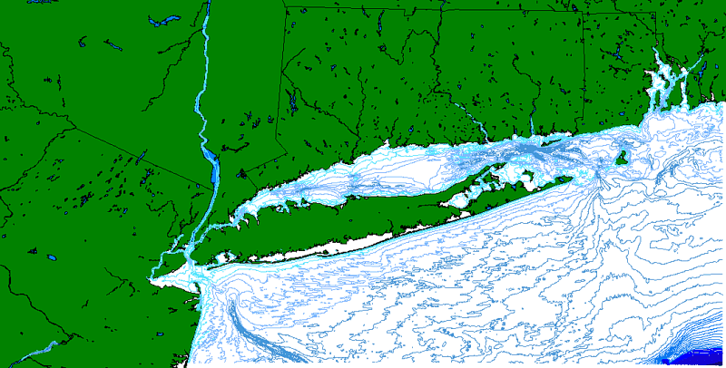
Browse_Graphic:
Browse_Graphic_File_Name:
Browse_Graphic_File_Description:
Image showing extent of coverage for Long Island Sound 5 meter bathymetry contour data layer lis1992.
Browse_Graphic_File_Type: GIF
Native_Data_Set_Environment:
Microsoft Windows 2000 Version 5.1 (Build 2600) ; ESRI ArcCatalog 8.1.0.642