Online Links:
Online Links:
| Access_Constraints | None. |
|---|---|
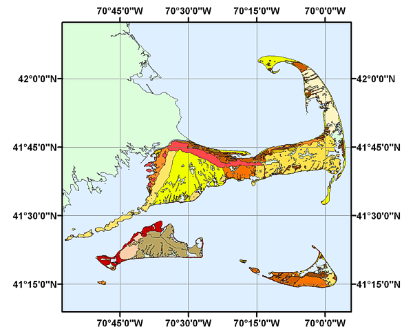
| Use_Constraints | Public domain data from the U.S. Government are freely redistributable with proper metadata and source attribution. Please recognize the U.S. Geological Survey (USGS) as the source of this information. Please cite the source map as: Geologic Map of Cape Cod and the Islands, Massachusetts, 1986, Robert N. Oldale, Roger A. Barlow: Miscellaneous Investigations Series, Map I-1763. |
| Data format: | The individual components that comprise the shapefile, metadata and browse graphic. in format Shapefile (version ArcView 3.2) ESRI Shapefile Format Size: 1.288 |
|---|---|
| Network links: |
http://pubs.usgs.gov/of/2003/of03-221/data/basemaps/cape_cod_geology/cape_cod_geology.zip |