1 m digital bathymetric contours from NOAA charts as organized for the Long Island Sound Study Geographic Information System (LISSGIS) library (LISBATHY.SHP)

Metadata also available as - [Questions & Answers] - [Parseable text] - [XML]

Metadata:

Identification_Information:
Citation:
Citation_Information:
Originator: Mary L. DiGiacomo-Cohen
Originator: Mark Tedesco
Publication_Date: 20020630
Title:
1 m digital bathymetric contours from NOAA charts as organized for the Long Island Sound Study Geographic Information System (LISSGIS) library (LISBATHY.SHP)
Edition: 1.0
Geospatial_Data_Presentation_Form: vector digital data
Series_Information:
Series_Name: Open-File Report
Issue_Identification: 2004-1003
Publication_Information:
Publication_Place: Woods Hole Coastal and Marine Science Center, Woods Hole, MA
Publisher: U.S. Geological Survey, Coastal and Marine Geology Program
Online_Linkage: https://doi.org/10.3133/ofr20041003
Online_Linkage: http://pubs.usgs.gov/of/2004/1003/data/bathy/lisbathy.zip
Larger_Work_Citation:
Citation_Information:
Originator: L.J. Poppe
Originator: V.F. Paskevich
Originator: M.S. Moser
Originator: M.L. DiGiacomo-Cohen
Originator: E.B. Christman
Publication_Date: 2004
Title:
Sidescan Sonar Imagery and Surficial Geologic Interpretation of the Sea Floor off Branford, Connecticut
Edition: 1.0
Series_Information:
Series_Name: Open-File Report
Issue_Identification: 2004-1003
Publication_Information:
Publication_Place: Reston, VA
Publisher: U.S. Geological Survey
Online_Linkage: http://pubs.usgs.gov/of/2004/1003/
Description:
Abstract:
The Long Island Sound Study (LISS) compiled data from a number of different sources, integrated new data, and assembled a comprehensive spatial database for areas of the States of Connecticut, New York, and portions of Rhode Island which border Long Island Sound.
Purpose:
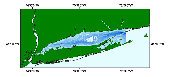
Selected by the Long Island Sound Study to serve as a general bathymetric data layer in its GIS data base. Best for sound-wide applications or general information. These data can be used with geographic information systems (GIS) software to display geologic and oceanographic information for the Long Island Sound. The data are to be used for illustrations and illustrative maps on scientific topics. They are intended for science researchers, students, policy makers, and the general public. There is NO ASSURANCE of their accuracy, completeness, or precision. The contour line data were manually digitized from a published map.
Time_Period_of_Content:
Time_Period_Information:
Multiple_Dates/Times:
Single_Date/Time:
Calendar_Date: 1998
Single_Date/Time:
Calendar_Date: 1986
Single_Date/Time:
Calendar_Date: 1989
Currentness_Reference: publication date
Status:
Progress: Complete
Maintenance_and_Update_Frequency: None planned
Spatial_Domain:
Bounding_Coordinates:
West_Bounding_Coordinate: -73.936708
East_Bounding_Coordinate: -71.999687
North_Bounding_Coordinate: 41.499656
South_Bounding_Coordinate: 40.769513
Keywords:
Theme:
Theme_Keyword_Thesaurus: USGS Metadata Identifier
Theme_Keyword: USGS:38522dd8-fa38-47f4-87bf-a5987ec4e66e
Theme:
Theme_Keyword_Thesaurus: None
Theme_Keyword: U.S. Geological Survey
Theme_Keyword: USGS
Theme_Keyword: Coastal and Marine Geology Program
Theme_Keyword: CMGP
Theme_Keyword: Connecticut Department of Environmental Protection
Theme_Keyword: Connecticut Geological and Natural History Survey
Theme_Keyword: Long Island Sound Resource Center
Theme_Keyword: LISRC
Theme_Keyword: Woods Hole Science Center
Theme_Keyword: WHSC
Theme_Keyword: bathymetry contours
Theme_Keyword: digital vector contours
Theme_Keyword: ArcView shapefile
Theme_Keyword: Open-File Report 98-502
Theme_Keyword: OFR 98-502
Theme_Keyword: Open-File Report 02-002
Theme_Keyword: OFR 02-002
Theme_Keyword: Open-File Report 2004-1003
Theme_Keyword: OFR 2004-1003
Theme_Keyword: 1 meter contours
Theme:
Theme_Keyword_Thesaurus: ISO 19115 Topic Category
Theme_Keyword: oceans
Theme_Keyword: elevation
Theme_Keyword: boundaries
Theme:
Theme_Keyword_Thesaurus: USGS Thesaurus
Theme_Keyword: bathymetry
Theme_Keyword: contouring
Theme_Keyword: sea-floor characteristics
Theme_Keyword: geospatial datasets
Place:
Place_Keyword_Thesaurus: None
Place_Keyword: Long Island Sound
Place_Keyword: Connecticut
Place_Keyword: New York
Place_Keyword: Rhode Island
Place_Keyword: CT
Place_Keyword: NY
Place_Keyword: RI
Place_Keyword: New England
Place_Keyword: U.S northeast
Place_Keyword: U.S. Atlantic East Coast
Place_Keyword: United States
Place_Keyword: North America
Access_Constraints: none
Use_Constraints:
This information is NOT intended for navigational or legal purposes. Public domain data are freely redistributable with proper metadata and source attribution. Please recognize the Connecticut Department of Environmental Protection, Long Island Sound Resource Center and the U.S. Geological Survey as the originator of this dataset.
Point_of_Contact:
Contact_Information:
Contact_Organization_Primary:
Contact_Organization: U.S. Geological Survey
Contact_Person: Larry Poppe
Contact_Position: Geologist
Contact_Address:
Address_Type: mailing and physical address
Address: 384 Woods Hole Road
City: Woods Hole
State_or_Province: MA
Postal_Code: 02543-1598
Country: USA
Contact_Voice_Telephone: (508) 548-8700 x2314
Contact_Facsimile_Telephone: (508) 457-2310
Contact_Electronic_Mail_Address: lpoppe@usgs.gov
Browse_Graphic:
Browse_Graphic_File_Name: http://pubs.usgs.gov/of/2004/1003/data/bathy/lisbathy.gif
Browse_Graphic_File_Description:
Image showing extent of 1 m bathymetry contours for Long Island Sound GIS project area.
Browse_Graphic_File_Type: GIF
Data_Set_Credit:
Connecticut Department of Environmental Protection, Long Island Sound Resource Center for creating the source dataset.
Native_Data_Set_Environment:
Microsoft Windows XP Version 5.1 (Build 2600) Service Pack 2; ESRI ArcCatalog 9.1.0.722
Cross_Reference:
Citation_Information:
Originator: Lawrence J. Poppe
Originator: Christopher F. Polloni
Publication_Date: 1998
Title: Long Island Sound Environmental Studies
Edition: 1.0
Series_Information:
Series_Name: Open-File Report
Issue_Identification: 98-502
Publication_Information:
Publication_Place: Reston, VA
Publisher: U.S. Geological Survey
Online_Linkage: http://pubs.usgs.gov/of/of98-502/
Cross_Reference:
Citation_Information:
Originator: Larry Poppe
Originator: Valerie Paskevich
Publication_Date: 2002
Title:
Geological Framework Data from Long Island Sound, 1981-1990: A Digital Data Release
Edition: 1.0
Series_Information:
Series_Name: Open-File Report
Issue_Identification: 02-002
Publication_Information:
Publication_Place: Reston, VA
Publisher: U.S. Geological Survey
Online_Linkage: http://woodshole.er.usgs.gov/openfile/of02-002/
Data_Quality_Information:
Logical_Consistency_Report:
No additional checks for topological consistency were performed on this data.
Completeness_Report:
This is the complete data layer as originally released in: Long Island Sound Environmental Studies, U.S. Geological Survey Open-File Report 98-502
Lineage:
Source_Information:
Source_Citation:
Citation_Information:
Originator:
National Oceanic and Atmospheric Administration, National Ocean Service
Publication_Date: 1989
Title: NOS Bathymetry - Fishing Map, New Haven
Geospatial_Data_Presentation_Form: map
Publication_Information:
Publication_Place: Rockville, Maryland
Publisher: National Ocean Service
Source_Scale_Denominator: 100000
Type_of_Source_Media: paper
Source_Time_Period_of_Content:
Time_Period_Information:
Single_Date/Time:
Calendar_Date: 1989
Source_Currentness_Reference: publication date
Source_Citation_Abbreviation: Information unavailable from original metadata.
Source_Contribution:
These maps were selected as the most accurate data available preference over National Ocean Service (NOS) bathy point and contains numerous mistakes, and over other interpretations of most of which differ from each other.
Source_Information:
Source_Citation:
Citation_Information:
Originator:
National Oceanic and Atmospheric Administration, National Ocean Service
Publication_Date: 1984
Title: NOS Topo-Bathy Map, Long Island East
Geospatial_Data_Presentation_Form: map
Publication_Information:
Publication_Place: Rockville, Maryland
Publisher: National Ocean Service
Source_Scale_Denominator: 100000
Type_of_Source_Media: stable-base material
Source_Time_Period_of_Content:
Time_Period_Information:
Single_Date/Time:
Calendar_Date: 1984
Source_Currentness_Reference: publication date
Source_Citation_Abbreviation: Information unavailable from original metadata.
Source_Contribution:
These maps were selected as the most accurate data available preference over National Ocean Service (NOS) bathy point and contains numerous mistakes, and over other interpretations of most of which differ from each other.
Source_Information:
Source_Citation:
Citation_Information:
Originator: National Oceanic and Atmospheric Administration
Originator: U.S. Geological Survey
Publication_Date: 1986
Title: USGS Topo-Bathy Map, Bridgeport
Geospatial_Data_Presentation_Form: map
Publication_Information:
Publication_Place: Rockville, Maryland
Publisher: NOAA/USGS
Source_Scale_Denominator: 100000
Type_of_Source_Media: paper
Source_Time_Period_of_Content:
Time_Period_Information:
Single_Date/Time:
Calendar_Date: 1986
Source_Currentness_Reference: publication date
Source_Citation_Abbreviation: Information unavailable from original metadata.
Source_Contribution:
These maps were selected as the most accurate data available preference over National Ocean Service (NOS) bathy point and contains numerous mistakes, and over other interpretations of most of which differ from each other.
Source_Information:
Source_Citation:
Citation_Information:
Originator: National Oceanic and Atmospheric Administration
Originator: U.S. Geological Survey
Publication_Date: 1984
Title: USGS Topo-Bathy Map, Long Island West
Geospatial_Data_Presentation_Form: map
Publication_Information:
Publication_Place: Rockville, Maryland
Publisher: NOAA/USGS
Source_Scale_Denominator: 100000
Type_of_Source_Media: paper
Source_Time_Period_of_Content:
Time_Period_Information:
Single_Date/Time:
Calendar_Date: 1984
Source_Currentness_Reference: publication date
Source_Citation_Abbreviation: Information unavailable from original metadata.
Source_Contribution:
These maps were selected as the most accurate data available preference over National Ocean Service (NOS) bathy point and contains numerous mistakes, and over other interpretations of most of which differ from each other.
Process_Step:
Process_Description:
The two bathy-topo sheets and two bathy-fishing maps were digitized by partially table digitizing and partially through scanning/vectorization.
Process_Date: 19961215
Process_Contact:
Contact_Information:
Contact_Organization_Primary:
Contact_Organization: Applied Geographics, Inc
Contact_Person: Linda Bischoff
Contact_Position: GIS Analyst
Contact_Address:
Address_Type: mailing and physical address
Address: 100 Franklin St.
Address: 7th Floor
City: Boston
State_or_Province: MA
Postal_Code: 02110
Country: USA
Contact_Voice_Telephone: (617) 292-7125
Contact_Facsimile_Telephone: (617) 292-7911
Contact_Electronic_Mail_Address: info@appgeo.com
Process_Step:
Process_Description:
The digitized vector data set was added to the Long Island Sound Study GIS database. An ESRI 'e00' format of the data layer was created and released on U.S. Geological Survey Open-File Report 98-502.
Process_Date: Unknown
Source_Produced_Citation_Abbreviation: lisbathy.e00
Process_Contact:
Contact_Information:
Contact_Person_Primary:
Contact_Person: Mary L. DiGiacomo-Cohen
Contact_Organization: Long Island Sound Resource Center
Contact_Position: GIS Specialist
Contact_Address:
Address_Type: mailing and physical address
Address: University of Connecticut
Address: Avery Point
Address: 1084 Shennecossett Road
City: Groton
State_or_Province: CT
Postal_Code: 06340
Country: USA
Contact_Voice_Telephone: 860-405-9015
Contact_Electronic_Mail_Address: lisrc@uconnvm.uconn.edu
Process_Step:
Process_Description:
The ESRI export file, lisbathy.e00, was imported and converted to an ArcView shapefile. The data layer was converted from UTM projection to geographic.
Source_Used_Citation_Abbreviation: lisbathy.e00
Process_Date: 20011127
Source_Produced_Citation_Abbreviation: lisbathy.dbf
Source_Produced_Citation_Abbreviation: lisbathy.shp
Source_Produced_Citation_Abbreviation: lisbathy.shx
Process_Contact:
Contact_Information:
Contact_Person_Primary:
Contact_Person: Valerie Paskevich
Contact_Organization: U.S. Geological Survey
Contact_Position: Information Specialist, GIS Cordinator
Contact_Address:
Address_Type: mailing and physical address
Address: 384 Woods Hole Road
City: Woods Hole
State_or_Province: MA
Postal_Code: 02543-1598
Country: USA
Contact_Voice_Telephone: (508) 548-8700 x2281
Contact_Facsimile_Telephone: (508) 457-2310
Contact_Electronic_Mail_Address: vpaskevich@usgs.gov
Process_Step:
Process_Description:
Recoded the depth values from positive to negative and deleted the ArcInfo specific attribute fields.
Source_Used_Citation_Abbreviation: lisbathy.dbf
Process_Date: 20011205
Source_Produced_Citation_Abbreviation: lisbathy.dbf
Process_Contact:
Contact_Information:
Contact_Person_Primary:
Contact_Person: Valerie Paskevich
Contact_Organization: U.S. Geological Survey
Contact_Position: Computer Specialist, GIS Coordinator
Contact_Address:
Address_Type: mailing and physical address
Address: 384 Woods Hole Road
City: Woods Hole
State_or_Province: MA
Postal_Code: 02543-1598
Country: USA
Contact_Voice_Telephone: (508) 548-8700 x2281
Contact_Facsimile_Telephone: (508) 457-2310
Contact_Electronic_Mail_Address: vpaskevich@usgs.gov
Process_Step:
Process_Description:
Edits to the metadata were made to fix any errors that MP v 2.9.32 flagged. This is necessary to enable the metadata to be successfully harvested for various data catalogs. In some cases, this meant adding text "Information unavailable" or "Information unavailable from original metadata" for those required fields that were left blank. Other minor edits were probably performed (title, publisher, publication place, etc.). The source information was incomplete and had to be modified to meet the standard. One online linkage in the Identification section was wrong and was deleted. The metadata date (but not the metadata creator) was edited to reflect the date of these changes. The metadata available from a harvester may supersede metadata bundled within a download file. Compare the metadata dates to determine which metadata file is most recent.
Process_Date: 20160412
Process_Contact:
Contact_Information:
Contact_Organization_Primary:
Contact_Organization: U.S. Geological Survey
Contact_Person: VeeAnn A. Cross
Contact_Position: Marine Geologist
Contact_Address:
Address_Type: mailing and physical address
Address: 384 Woods Hole Rd.
City: Woods Hole
State_or_Province: MA
Postal_Code: 02543
Contact_Voice_Telephone: 508-548-8700 x2251
Contact_Facsimile_Telephone: 508-457-2310
Contact_Electronic_Mail_Address: vatnipp@usgs.gov
Process_Step:
Process_Description: USGS Thesaurus keywords added to the keyword section.
Process_Date: 20180720
Process_Contact:
Contact_Information:
Contact_Organization_Primary:
Contact_Organization: U.S. Geological Survey
Contact_Person: VeeAnn A. Cross
Contact_Position: Marine Geologist
Contact_Address:
Address_Type: Mailing and Physical
Address: 384 Woods Hole Road
City: Woods Hole
State_or_Province: MA
Postal_Code: 02543-1598
Contact_Voice_Telephone: 508-548-8700 x2251
Contact_Facsimile_Telephone: 508-457-2310
Contact_Electronic_Mail_Address: vatnipp@usgs.gov
Process_Step:
Process_Description: Crossref DOI link was added as the first link in the metadata.
Process_Date: 20191118
Process_Contact:
Contact_Information:
Contact_Organization_Primary:
Contact_Organization: U.S. Geological Survey
Contact_Person: VeeAnn A. Cross
Contact_Position: Marine Geologist
Contact_Address:
Address_Type: Mailing and Physical
Address: 384 Woods Hole Road
City: Woods Hole
State_or_Province: MA
Postal_Code: 02543-1598
Contact_Voice_Telephone: 508-548-8700 x2251
Contact_Facsimile_Telephone: 508-457-2310
Contact_Electronic_Mail_Address: vatnipp@usgs.gov
Process_Step:
Process_Description:
Added keywords section with USGS persistent identifier as theme keyword.
Process_Date: 20200908
Process_Contact:
Contact_Information:
Contact_Organization_Primary:
Contact_Organization: U.S. Geological Survey
Contact_Person: VeeAnn A. Cross
Contact_Position: Marine Geologist
Contact_Address:
Address_Type: Mailing and Physical
Address: 384 Woods Hole Road
City: Woods Hole
State_or_Province: MA
Postal_Code: 02543-1598
Contact_Voice_Telephone: 508-548-8700 x2251
Contact_Facsimile_Telephone: 508-457-2310
Contact_Electronic_Mail_Address: vatnipp@usgs.gov
Spatial_Data_Organization_Information:
Direct_Spatial_Reference_Method: Vector
Point_and_Vector_Object_Information:
SDTS_Terms_Description:
SDTS_Point_and_Vector_Object_Type: String
Point_and_Vector_Object_Count: 23032
Spatial_Reference_Information:
Horizontal_Coordinate_System_Definition:
Geographic:
Latitude_Resolution: 0.000001
Longitude_Resolution: 0.000001
Geographic_Coordinate_Units: Decimal degrees
Geodetic_Model:
Horizontal_Datum_Name: North American Datum of 1927
Ellipsoid_Name: Clarke 1866
Semi-major_Axis: 6378206.400000
Denominator_of_Flattening_Ratio: 294.978698
Entity_and_Attribute_Information:
Detailed_Description:
Entity_Type:
Entity_Type_Label: lisbathy
Entity_Type_Definition: shapefile attribute file
Entity_Type_Definition_Source: ESRI
Attribute:
Attribute_Label: FID
Attribute_Definition: Internal feature number.
Attribute_Definition_Source: ESRI
Attribute_Domain_Values:
Unrepresentable_Domain:
Sequential unique whole numbers that are automatically generated.
Attribute:
Attribute_Label: Shape
Attribute_Definition: Feature geometry.
Attribute_Definition_Source: ESRI
Attribute_Domain_Values:
Unrepresentable_Domain: Coordinates defining the features.
Attribute:
Attribute_Label: LENGTH
Attribute_Definition: Length of vector segment in native units.
Attribute_Definition_Source: Information unavailable from original metadata.
Attribute_Domain_Values:
Range_Domain:
Range_Domain_Minimum: 0.95402
Range_Domain_Maximum: 41569.30859
Attribute:
Attribute_Label: DEPTH
Attribute_Definition:
Depth value, in meters, of vector contour. Value recorded as negative.
Attribute_Definition_Source: User Defined
Attribute_Domain_Values:
Range_Domain:
Range_Domain_Minimum: -98
Range_Domain_Maximum: -1
Attribute_Units_of_Measure: meters
Attribute_Measurement_Resolution: 1
Attribute_Measurement_Frequency: None planned
Attribute:
Attribute_Label: DEP
Attribute_Definition: Indicates bathymetric line is a depression.
Attribute_Definition_Source: Open-File 98-502 chap6\bathydoc.txt
Attribute_Domain_Values:
Enumerated_Domain:
Enumerated_Domain_Value: Y
Enumerated_Domain_Value_Definition: Indicates bathymetric line is a depression.
Enumerated_Domain_Value_Definition_Source: Information unavailable from original metadata.
Overview_Description:
Entity_and_Attribute_Overview:
Depth value of vector contour and field (DEP) used as flag to identify line as a depression
Entity_and_Attribute_Detail_Citation:
Information unavailable from original metadata. Assumed to be U.S. Geological Survey.
Distribution_Information:
Distributor:
Contact_Information:
Contact_Person_Primary:
Contact_Person: Larry Poppe
Contact_Organization: U.S. Geological Survey
Contact_Position: Geologist
Contact_Address:
Address_Type: mailing and physical address
Address: 348 Woods Hole Road
City: Woods Hole
State_or_Province: MA
Postal_Code: 02543-1598
Country: USA
Contact_Voice_Telephone: (508) 548-8700 x2314
Contact_Facsimile_Telephone: (508) 457-2310
Contact_Electronic_Mail_Address: lpoppe@usgs.gov
Resource_Description: Downloadable Data
Distribution_Liability:
Although this data have been used by the USGS, no warranty, expressed or implied, is made by the USGS as to the accuracy of the data. The act of distribution shall not constitute any such warranty, and no responsibility is assumed by the USGS in the use of these data. The user must assume resposibility for the proper use of this data. This data should not be used at resolutions for which it is not intended. Any use of trade, product, or firm names is for descriptive purposes only and does not imply endorsement by the U.S. Government.
Standard_Order_Process:
Digital_Form:
Digital_Transfer_Information:
Format_Name: SHP
Format_Version_Number: ArcView 3.2
Format_Specification: ESRI Shapefile
Format_Information_Content:
The SHP file contains the geospatial data. The SHX file contains the index of the geospatial data. The DBF file contains the attribute data in dBase format. The PRJ file contains the coordinate system information (optional). The AVL file contains the legend information (optional). The SBN and SBX files contain the spatial index of the geospatial data (optional). The XML file contains the metadata describing the data set <data set name>.shp.xml. An ASCII version of the metadata file. A browse graphic showing the data layer coverage and extent (optional).
File_Decompression_Technique: zip
Transfer_Size: 9.21
Digital_Transfer_Option:
Online_Option:
Computer_Contact_Information: Access_Instructions: Data may be retrieved via any WWW browser.
Offline_Option:
Offline_Media: CD-ROM
Recording_Capacity:
Recording_Density: 650
Recording_Density_Units: Mbytes
Recording_Format: ISO
Compatibility_Information:
The user must have a system with a DVD drive capable of reading an UDF standard DVD-R disk. To browse the information contained on this disk, the user must also have a current version of WWW browser available. The user must also have the software installed on their computer system capable to unzip the archived file.
Fees: None
Technical_Prerequisites:
These data are available in Environmental Systems Research Institute (ESRI) shapefile format. The user must have ArcGIS or ArcView 3.0 or greater software to read and process the data file. In lieu of ArcView or ArcGIS, the user may utilize another GIS application package capable of the importing data. A free data viewer, arcexplorer, capable of displaying the data is available from ESRI at www.esri.com.
Metadata_Reference_Information:
Metadata_Date: 20211116
Metadata_Contact:
Contact_Information:
Contact_Organization_Primary:
Contact_Organization: U.S. Geological Survey
Contact_Person: Valerie Paskevich
Contact_Position: Information Specialist, GIS Coordinator
Contact_Address:
Address_Type: mailing and physical address
Address: 384 Woods Hole Road
City: Woods Hole
State_or_Province: MA
Postal_Code: 02543-1598
Country: USA
Contact_Voice_Telephone: (508) 548-8700 x2281
Contact_Facsimile_Telephone: (508) 457-2310
Contact_Electronic_Mail_Address: whsc_data_contact@usgs.gov
Contact_Instructions:
The metadata contact email address is a generic address in the event the metadata contact is no longer with the USGS or the email is otherwise invalid.
Metadata_Standard_Name: FGDC Content Standards for Digital Geospatial Metadata
Metadata_Standard_Version: FGDC-STD-001-1998
Metadata_Time_Convention: local time
Metadata_Access_Constraints: None
Metadata_Use_Constraints: None

This page is <https://cmgds.marine.usgs.gov/catalog/whcmsc/open_file_report/ofr2004-1003/lisbathy.shp.html>
Generated by mp version 2.9.50 on Tue Nov 16 10:06:30 2021