Grey Toned Surface Model Image from the 150 meter grid of the Puerto Rico Trench (gtsurfmod.tif)

Metadata also available as - [Outline] - [Parseable text] - [XML]

Frequently anticipated questions:


What does this data set describe?

Title:
Grey Toned Surface Model Image from the 150 meter grid of the Puerto Rico Trench (gtsurfmod.tif)
Abstract:
The Puerto Rico Trench is a tectonic plate boundary where the North American Plate slides by and descends under the Caribbean Plate. Although much of the trench lies within the United States of America's Exclusive Economic Zone (EEZ), surprisingly few surveys have been conducted there during the past 25 years. This data set is a grey toned surface model mosaic derived from the 150 meter grid made from the multibeam bathymetric data collected during the U.S. Geological Survey (USGS) science cruise 03008 in collaboration with National Oceanic and Atmospheric Administration (NOAA) Research Cruise RB0303 from 18 February to 7 March 2003, Leg II of III. (Leg I and III: 20020924 to 20020930 and 20030828 to 20030904, respectively).
  1. How might this data set be cited?
    U.S. Geological Survey (USGS), and National Oceanic and Atmospheric Administration (NOAA), 2004, Grey Toned Surface Model Image from the 150 meter grid of the Puerto Rico Trench (gtsurfmod.tif): Open-File Report 2004-1400, U.S. Geological Survey, Coastal and Marine Geology Program, Woods Hole Coastal and Marine Science Center, Woods Hole, MA.

    Online Links:

    This is part of the following larger work.

    Brink, Uri ten, Parker, Castle Eugene, Danforth, William, Polloni, Chris, Uozumi, Toshi, and Williams, Glynn, 2004, Project PROBE Leg II - Final Report and Archive of Swath Bathymetric Sonar, CTD/XBT and GPS Navigation Data Collected During USGS Cruise 03008 (NOAA Cruise RB0303) Puerto Rico Trench 18 February - 7 March, 2003: Open-File Report 2004-1400, U.S. Geological Survey, Reston, VA.

    Online Links:

    Other_Citation_Details: 1 DVD-ROM
  2. What geographic area does the data set cover?
    West_Bounding_Coordinate: -68.9
    East_Bounding_Coordinate: -62.6
    North_Bounding_Coordinate: 20.3
    South_Bounding_Coordinate: 18.7
  3. What does it look like?
    http://pubs.usgs.gov/of/2004/1400/data/multibeam/gtsurfmod/gtsurfmod.jpg (JPEG)
    Image showing data layer coverage and general location.
  4. Does the data set describe conditions during a particular time period?
    Calendar_Date: Sep-2002
    Currentness_Reference:
    ground condition
  5. What is the general form of this data set?
    Geospatial_Data_Presentation_Form: remote-sensing image
  6. How does the data set represent geographic features?
    1. How are geographic features stored in the data set?
      This is a Raster data set. It contains the following raster data types:
      • Dimensions 2102 x 5414 x 1, type Pixel
    2. What coordinate system is used to represent geographic features?
      Horizontal positions are specified in geographic coordinates, that is, latitude and longitude. Latitudes are given to the nearest 0.000010. Longitudes are given to the nearest 0.000010. Latitude and longitude values are specified in Decimal degrees. The horizontal datum used is D_WGS_1984.
      The ellipsoid used is WGS_1984.
      The semi-major axis of the ellipsoid used is 6378137.0.
      The flattening of the ellipsoid used is 1/298.25722356300003.
  7. How does the data set describe geographic features?
    Entity_and_Attribute_Overview:
    Grey scale image with sun illumination image stored in TIFF format. DN values range from 0 to 255.
    Entity_and_Attribute_Detail_Citation: U.S. Geological Survey

Who produced the data set?

  1. Who are the originators of the data set? (may include formal authors, digital compilers, and editors)
    • U.S. Geological Survey (USGS)
    • National Oceanic and Atmospheric Administration (NOAA)
  2. Who also contributed to the data set?
  3. To whom should users address questions about the data?
    U.S. Geological Survey
    Attn: Chris Polloni
    Spatial Data Technician
    384 Woods Hole Road
    Woods Hole, MA
    USA

    (508) 548-8700 x2280 (voice)
    (508) 457-2310 (FAX)
    cpolloni@usgs.gov

Why was the data set created?

This high-resolution multibeam bathymetry image mosaic can be used in Geographic Information Science (GIS) to provide better perspective viewing and advanced analysis of geologic conditions in the Puerto Rico Trench. Remotely sensed features in the trench are studied and the information learned can be used to discern cause and effect of natural hazards such as earthquakes and tsunamis.

How was the data set created?

  1. From what previous works were the data drawn?
    SeaBeam (source 1 of 2)
    NOAA, and USGS, Unpublished Material, SeaBeam MB41 raw data files.

    Type_of_Source_Media: disc
    Source_Contribution:
    The raw data files were processed to create a bathymetric mosaic
    SeaBeam 2003 (source 2 of 2)
    NOAA, and USGS, 2005, Raw SeaBeam Multibeam data.

    Online Links:

    Other_Citation_Details:
    These raw data are published as part of the larger work citation of this dataset.
    Type_of_Source_Media: disk
    Source_Contribution:
    The raw data files were processed to create a bathymetric mosaic.
  2. How were the data generated, processed, and modified?
    Date: 2004 (process 1 of 7)
    The data pipeline included transferring the SeaBeam MB41 raw data files from the SGI computer to a processing laptop via file transfer protocol (FTP). The raw files were converted using Caris 5.3 Hips Sips software. The processing crew maintained the same processing procedures as employed by NOAA hydrographic field units. Once the data was converted, a Digital Terrain Model was generated for visual detection of artifacts and missed depths. The next step entailed reviewing and editing the data with Caris Swath Edit, followed with Caris Sub Set mode editing. Both editing processes allowed the hydrographer to eliminate data points that were considered artifacts or out of context with the immediate benthic area. After editing, the weighted mead grid was re-generated with a grid resolution of 150 meters. A grey scale by depth with sun illumination model at elevation 45 and azimuth 45 was exported as a tif image with an associated world file. Person who carried out this activity:
    Castle E. Parker
    NOAA/EASC
    Hydrographer
    439 West York Street
    Norfolk, Virginia
    USA

    757-441-6746 (voice)
    757-441-6601 (FAX)
    castle.e.parker@noaa.gov
    Date: 2004 (process 2 of 7)
    Renamed the image file from PRT03_150interp_gy4545.tif to gtsurfmod.tif with associated world file. Person who carried out this activity:
    Chris Polloni
    U.S. Geological Survey
    Information Specialist
    384 Woods Hole Road
    Woods Hole, MA
    USA

    (508) 548-8700 x2280 (voice)
    (508) 457-2310 (FAX)
    cpolloni@usgs.gov
    Hours_of_Service: 9AM to 5PM; M- F
    Data sources used in this process:
    • PRT03_150interp_gy4545.tif
    Data sources produced in this process:
    • gtsurfmod.tif
    Date: 2004 (process 3 of 7)
    This image's coordinate system was re-assigned from a UTM Zone 19, NAD83 to a Geographic, Geodetic Model: WGS84 using Blue Marble's Geographic Transformer (Version 5.1). Person who carried out this activity:
    Glynn Williams
    U.S. Geological Survey
    Spatial Analyst
    384 Woods Hole Road
    Woods Hole, MA
    USA

    (508) 548-8700 (voice)
    (508) 457-2310 (FAX)
    gwilliams@usgs.gov
    Hours_of_Service: 8:00AM to 4:30PM; M-F
    Data sources used in this process:
    • gtsurfmod.tif
    Data sources produced in this process:
    • gtsurfmod.tif
    Date: 03-Nov-2015 (process 4 of 7)
    Edits to the metadata were made to fix any errors that MP v 2.9.30 flagged. This is necessary to enable the metadata to be successfully harvested for various data catalogs. In some cases, this meant adding text "Information unavailable" for those required fields that were left blank. Other minor edits were probably performed (title, publisher, publication place, etc.). The metadata date (but not the metadata creator) was edited to reflect the date of these changes. The metadata available from a harvester may supersede metadata bundled within a download file. Compare the metadata dates to determine which metadata file is most recent. Person who carried out this activity:
    U.S. Geological Survey
    Attn: VeeAnn A. Cross
    Marine Geologist
    384 Woods Hole Rd.
    Woods Hole, MA

    508-548-8700 x2251 (voice)
    508-457-2310 (FAX)
    vatnipp@usgs.gov
    Date: 20-Jul-2018 (process 5 of 7)
    USGS Thesaurus keywords added to the keyword section. Person who carried out this activity:
    U.S. Geological Survey
    Attn: VeeAnn A. Cross
    Marine Geologist
    384 Woods Hole Road
    Woods Hole, MA

    508-548-8700 x2251 (voice)
    508-457-2310 (FAX)
    vatnipp@usgs.gov
    Date: 18-Nov-2019 (process 6 of 7)
    Crossref DOI link was added as the first link in the metadata. Person who carried out this activity:
    U.S. Geological Survey
    Attn: VeeAnn A. Cross
    Marine Geologist
    384 Woods Hole Road
    Woods Hole, MA

    508-548-8700 x2251 (voice)
    508-457-2310 (FAX)
    vatnipp@usgs.gov
    Date: 08-Sep-2020 (process 7 of 7)
    Added keywords section with USGS persistent identifier as theme keyword. Person who carried out this activity:
    U.S. Geological Survey
    Attn: VeeAnn A. Cross
    Marine Geologist
    384 Woods Hole Road
    Woods Hole, MA

    508-548-8700 x2251 (voice)
    508-457-2310 (FAX)
    vatnipp@usgs.gov
  3. What similar or related data should the user be aware of?

How reliable are the data; what problems remain in the data set?

  1. How well have the observations been checked?
  2. How accurate are the geographic locations?
    Information unavailable.
  3. How accurate are the heights or depths?
    Information unavailable.
  4. Where are the gaps in the data? What is missing?
    Information unavailable.
  5. How consistent are the relationships among the observations, including topology?
    Information unavailable.

How can someone get a copy of the data set?

Are there legal restrictions on access or use of the data?
Access_Constraints None
Use_Constraints Public domain data from the U.S. government are freely redistributable with proper metadata and source attribution. Please recognize the U.S. Geological Survey (USGS) and National Oceanic and Atmospheric Administration (NOAA) as the source of this information.
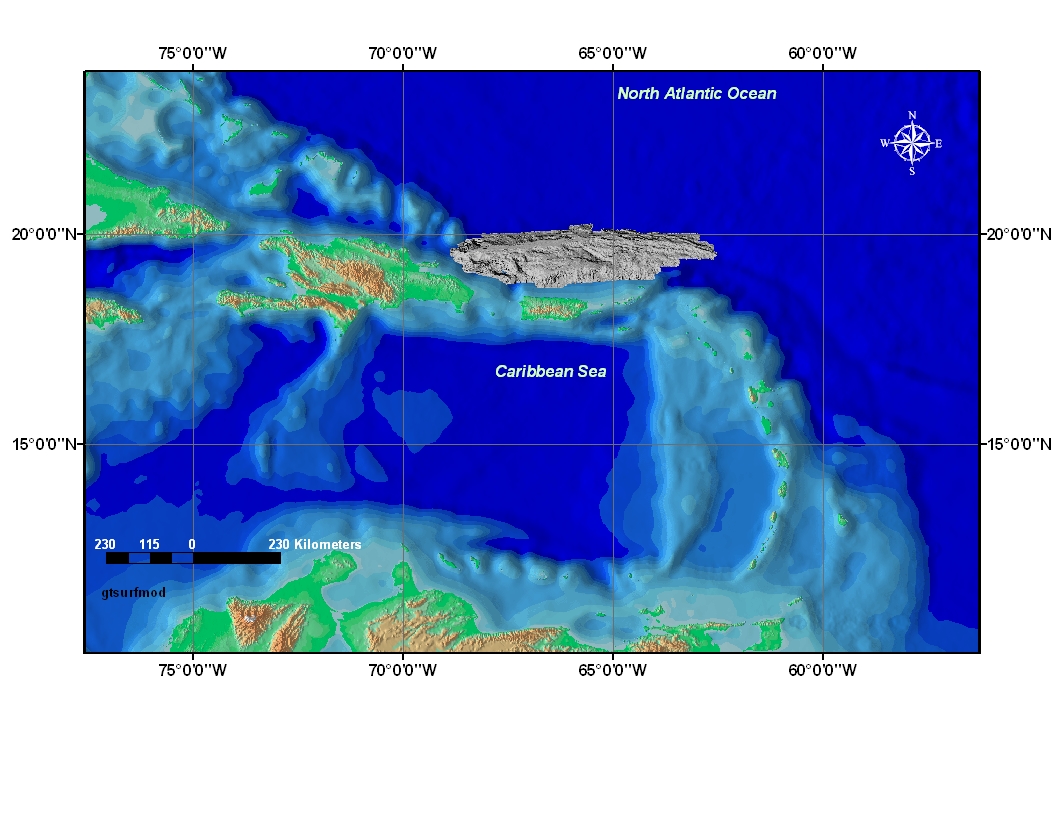
  1. Who distributes the data set? (Distributor 1 of 1)
    Uri ten Brink
    U.S. Geological Survey
    Research Geologist
    384 Woods Hole Road
    Woods Hole, MA
    USA

    (508) 548-8700 x2396 (voice)
    (508) 457-2310 (FAX)
    utenbrink@usgs.gov
    Hours_of_Service: 8AM to 5 PM; M-F
  2. What's the catalog number I need to order this data set? Downloadable Data
  3. What legal disclaimers am I supposed to read?
    Although this dataset has been used by the National Oceanic and Atmospheric Administration (NOAA) and the U.S. Geological Survey (USGS), no warranty, expressed or implied, is made by NOAA or the USGS as to the accuracy of the data and/or related materials. The act of distribution shall not constitute any such warranty, and no responsibility is assumed by NOAA or the USGS in the use of these data or related materials.
  4. How can I download or order the data?
    • Availability in digital form:
      Data format: The four files (gtsurfmod.tif, gtsurfmod.tfw, gtsurfmod.prj, and gtsurfmod_metadata.txt ) in format TIFF (version 3.2) GeoTIFF Image Size: 2
      Network links: http://pubs.usgs.gov/of/2004/1400/data/multibeam/gtsurfmod/gtsurfmod.zip
      Media you can order: DVD-ROM (Density 4700 Mbyte) (format UDF)
      Note: The user must have a computer system with a DVD-ROM available. To browse the information contained on this DVD-ROM, the user must have a current WWW browser available. The user must also have software installed on their computer to unzip the archived file.
    • Cost to order the data: None

  5. What hardware or software do I need in order to use the data set?
    The user may want a program capable of converting or processing "geotiff" images.

Who wrote the metadata?

Dates:
Last modified: 07-Jul-2022
Metadata author:
Glynn Williams
U.S. Geological Survey
Spatial Data Technician
384 Woods Hole Road
Woods Hole, MA
USA

(508) 548-8700 x2290 (voice)
(508) 457-2310 (FAX)
whsc_data_contact@usgs.gov
Hours_of_Service: 8:00AM to 5:00PM; M- F
Contact_Instructions:
The metadata contact email address is a generic address in the event the metadata contact is no longer with the USGS or the email is otherwise invalid.
Metadata standard:
FGDC Content Standards for Digital Geospatial Metadata (FGDC-STD-001-1998)

This page is <https://cmgds.marine.usgs.gov/catalog/whcmsc/open_file_report/ofr2004-1400/gtsurfmod.tif.faq.html>
Generated by mp version 2.9.51 on Thu Jul 14 11:37:39 2022