Citation:
Citation_Information:
Originator: David C. Twichell
Publication_Date: 2005
Title:
Interpretation of the Surficial Geology in the Pulley Ridge Study Area (PULLEY_INTERP.SHP)
Edition: 1.0
Geospatial_Data_Presentation_Form: vector digital data
Series_Information:
Series_Name: Open-File Report
Issue_Identification: 2005-1089
Publication_Information:
Publication_Place: Woods Hole Coastal and Marine Science Center, Woods Hole, MA
Publisher: U.S. Geological Survey, Coastal and Marine Geology Program
Online_Linkage: https://doi.org/10.3133/ofr20051089
Online_Linkage:
Online_Linkage:
Larger_Work_Citation:
Citation_Information:
Originator: VeeAnn A. Cross
Originator: David C. Twichell
Originator: Robert B. Halley
Originator: Kate T. Ciembronowicz
Originator: Bret D. Jarrett
Originator: Erika S. Hammar-Klose
Originator: Al C. Hine
Originator: Stan D. Locker
Originator: Dave F. Naar
Publication_Date: 2005
Title:
GIS Compilation of Data Collected from the Pulley Ridge Deep Coral Reef Region
Edition: 1.0
Series_Information:
Series_Name: Open-File Report
Issue_Identification: 2005-1089
Publication_Information:
Publication_Place: Reston, VA
Publisher: U.S. Geological Survey
Online_Linkage: http://pubs.usgs.gov/of/2005/1089/
Description:
Abstract:
Pulley Ridge is a series of drowned barrier islands that extends almost 200 km in 60-100 m water depths. This drowned ridge is located on the Florida Platform in the southeastern Gulf of Mexico about 250 km west of Cape Sable, Florida. This barrier island chain formed during the initial stage of the Holocene marine transgression. These islands were then submerged and left abandoned near the outer edge of the Florida Platform. The southern portion of Pulley Ridge hosts zooxanthellate scleractinian corals, green, red and brown macro algae, and a mix of deep and typically shallow-water tropical fishes. This reef community is in unusually deep water, and its extent and the controls on its distribution were unknown. To address these questions scientists from the U.S. Geological Survey Coastal and Marine Geology Program in cooperation with scientists from the University of South Florida Department of Marine Sciences have completed a detailed mapping of the southernmost 35 km of Pulley Ridge. The area was mapped using multibeam bathymetry, sidescan-sonar imagery, and high-resolution seismic-reflection profiling to define the geologic framework on which the reef is established. Submersible dives, remotely operated vehicle (ROV) transects, and transects of bottom photographs and video were collected to identify the corals and to map their distribution. This extensive suite of data has been compiled and preliminary analysis of the data suggests that the reefs are not tied to the ridge system, but instead are more broadly distributed. Whether reef distribution is controlled by oceanographic conditions or by subtle differences in the substrate that overlies the barrier island system is unclear, and are topics of continued research.
Purpose:
Polygon shapefile indicating the interpretation of the sidescan-sonar mosaic.
Time_Period_of_Content:
Time_Period_Information:
Single_Date/Time:
Calendar_Date: 2004
Currentness_Reference: publication date
Status:
Progress: Complete
Maintenance_and_Update_Frequency: None planned
Spatial_Domain:
Bounding_Coordinates:
West_Bounding_Coordinate: -83.768420
East_Bounding_Coordinate: -83.599513
North_Bounding_Coordinate: 24.996035
South_Bounding_Coordinate: 24.665195
Keywords:
Theme:
Theme_Keyword_Thesaurus: USGS Metadata Identifier
Theme_Keyword: USGS:160541cf-9f90-41b2-9747-df89935c98ef
Theme:
Theme_Keyword_Thesaurus: None
Theme_Keyword: CMGP
Theme_Keyword: Coastal and Marine Geology Program
Theme_Keyword: coral
Theme_Keyword: coral reef
Theme_Keyword: geologic map
Theme_Keyword: geology
Theme_Keyword: OF 2005-1089
Theme_Keyword: Open-File Report
Theme_Keyword: polygon
Theme_Keyword: shapefile
Theme_Keyword: U.S. Geological Survey
Theme_Keyword: USGS
Theme_Keyword: Woods Hole Science Center
Theme_Keyword: interpretation
Theme:
Theme_Keyword_Thesaurus: ISO 19115 Topic Category
Theme_Keyword: oceans
Theme_Keyword: geoscientificInformation
Theme:
Theme_Keyword_Thesaurus: USGS Thesaurus
Theme_Keyword: scientific interpretation
Theme_Keyword: sea-floor characteristics
Theme_Keyword: marine geology
Theme_Keyword: geospatial datasets
Place:
Place_Keyword_Thesaurus: None
Place_Keyword: Florida
Place_Keyword: Florida Shelf
Place_Keyword: Gulf of Mexico
Place_Keyword: North America
Place_Keyword: Pulley Ridge
Place_Keyword: United States
Access_Constraints: None.
Use_Constraints:
Public domain data from the U.S. Government are freely redistributable with proper metadata and source attribution. Please recognize the U.S. Geological Survey (USGS) as the source of this information.
Point_of_Contact:
Contact_Information:
Contact_Person_Primary:
Contact_Person: David C. Twichell
Contact_Organization: U.S. Geological Survey
Contact_Position: Oceanographer
Contact_Address:
Address_Type: mailing and physical address
Address: 384 Woods Hole Rd.
City: Woods Hole
State_or_Province: MA
Postal_Code: 02543-1598
Country: USA
Contact_Voice_Telephone: (508) 548-8700 x2266
Contact_Facsimile_Telephone: (508) 457-2310
Contact_Electronic_Mail_Address: dtwichell@usgs.gov
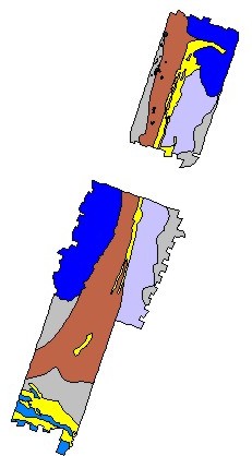
Browse_Graphic:
Browse_Graphic_File_Name:
Browse_Graphic_File_Description: Image showing extent and coverage of data layer.
Browse_Graphic_File_Type: JPEG
Native_Data_Set_Environment:
Microsoft Windows XP Version 5.1 (Build 2600) Service Pack 2; ESRI ArcCatalog 9.1.0.722