Online Links:
Online Links:
| Value | Definition |
|---|---|
| 4015 | USGS Field Activity Number 04015 |
| 5005 | USGS Field Activity Number 05005 |
| Value | Definition |
|---|---|
| 2 | R/V OceanExplorer |
| 3 | R/V Connecticut |
| Value | Definition |
|---|---|
| 1 | SEA SwathPlus Interferometric Sonar |
| 4 | RESON 8101 multibeam sonar |
Online Links:
Online Links:
| Access_Constraints | None |
|---|---|
| Use_Constraints | The intended scale of these data is 1:25,000. Public domain data from the U.S. Government are freely redistributable with proper metadata and source attribution. Please recognize the U.S. Geological Survey (USGS) as the source of this information. |
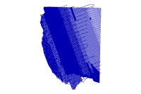
| Data format: | Trackline navigation for SwathPlus and RESON bathymetric sonars in format SHP (version ArcGIS 9.2) ESRI polyline shapefile Size: 41 |
|---|---|
| Network links: |
http://pubs.usgs.gov/of/2007/1373/GIS/shapefile/BathTracklines.zip |
| Media you can order: | DVD-ROM (Density 4.75 Gbytes) (format UDF) |