Citation:
Citation_Information:
Originator: U.S. Geological Survey
Publication_Date: 2008
Title:
SwathPlus and RESON Bathymetric Tracklines collected in the Cape Ann - Salisbury Beach Massachusetts Survey Area (BATHTRACKLINES, Geographic, WGS84)
Edition: 1.0
Geospatial_Data_Presentation_Form: vector digital data
Series_Information:
Series_Name: Open-File Report
Issue_Identification: 2007-1373
Publication_Information:
Publication_Place:
Woods Hole Coastal and Marine Science Center, Woods Hole, Massachusetts
Publisher: U.S. Geological Survey, Coastal and Marine Geology Program
Online_Linkage: https://doi.org/10.3133/ofr20071373
Online_Linkage:
Larger_Work_Citation:
Citation_Information:
Originator: Walter A. Barnhardt
Originator: Brian D. Andrews
Originator: Seth D. Ackerman
Originator: Wayne E. Baldwin
Originator: Christopher J. Hein
Publication_Date: 2008
Title:
High-Resolution Geological Mapping of the Inner Continental Shelf: Cape Ann to Salisbury Beach, Massachusetts.
Edition: 1.0
Series_Information:
Series_Name: Open-File Report
Issue_Identification: 2007-1373
Publication_Information:
Publication_Place: Reston, VA
Publisher: U.S. Geological Survey
Online_Linkage: http://pubs.usgs.gov/of/2007/1373/
Description:
Abstract:
These data were collected under a cooperative agreement with the Massachusetts Office of Coastal Zone Management (CZM) and the U.S. Geological Survey, Coastal and Marine Geology Program, Woods Hole Science Center. Initiated in 2003, the primary objective of this program is to develop regional geologic framework information for the management of coastal and marine resources. Accurate data and maps of sea-floor geology are important first steps toward protecting fish habitat, delineating marine reserves, and assessing environmental changes due to natural or human impacts. The project is focused on the inshore waters (5-30m deep) of Massachusetts between the New Hampshire border and Cape Cod Bay.
Data collected for the mapping cooperative have been released in a series of USGS Open-File Reports (
http://woodshole.er.usgs.gov/project-pages/coastal_mass/html/current_map.html). This spatial dataset is from the Cape Ann and Salisbury Beach Massachusetts project area. They were collected in two separate surveys in 2004 and 2005 and cover approximately 325 square kilometers of the inner continental shelf. High resolution bathymetry and backscatter intensity were collected in 2004 and 2005.
The purpose of these data is to manage the locations and filenames of the 3,870 kms of raw bathymetric files collected using the SwathPlus bathymetric sonar and RESON Multibeam sonar in the Cape Ann to Salisbury Beach survey area.
Time_Period_of_Content:
Time_Period_Information:
Range_of_Dates/Times:
Beginning_Date: 20040223
Ending_Date: 20050916
Currentness_Reference:
ground condition of two date ranges: 20040223 to 20040316 and 20050908 to 20050916
Status:
Progress: Complete
Maintenance_and_Update_Frequency: None planned
Spatial_Domain:
Bounding_Coordinates:
West_Bounding_Coordinate: -70.806655
East_Bounding_Coordinate: -70.594634
North_Bounding_Coordinate: 42.882733
South_Bounding_Coordinate: 42.666790
Keywords:
Theme:
Theme_Keyword_Thesaurus: USGS Metadata Identifier
Theme_Keyword: USGS:8cb21aa1-4add-427f-a62b-6c2f485093b8
Theme:
Theme_Keyword_Thesaurus: None
Theme_Keyword: U.S. Geological Survey
Theme_Keyword: USGS
Theme_Keyword: Coastal and Marine Geology Program
Theme_Keyword: CMGP
Theme_Keyword: Woods Hole Science Center
Theme_Keyword: WHSC
Theme_Keyword: Bathymetry
Theme_Keyword: Seafloor
Theme_Keyword: Marine Geology
Theme_Keyword: Swath Bathymetry
Theme_Keyword: Interferometric Sonar
Theme_Keyword: polyline shapefile
Theme_Keyword: field activity serial number 05005
Theme_Keyword: field activity serial number 04015
Theme_Keyword: SwathPlus
Theme_Keyword: RESON 8101
Theme_Keyword: Science Applications International Corporation
Theme_Keyword: R/V OceanExplorer
Theme_Keyword: R/V Connecticut
Theme:
Theme_Keyword_Thesaurus: ISO 19115 Topic Category
Theme_Keyword: oceans
Theme_Keyword: geoscientificInformation
Theme_Keyword: location
Theme:
Theme_Keyword_Thesaurus: USGS Thesaurus
Theme_Keyword: navigational data
Theme_Keyword: marine geophysics
Theme_Keyword: geospatial datasets
Place:
Place_Keyword_Thesaurus: None
Place_Keyword: United States
Place_Keyword: North America
Place_Keyword: Atlantic Ocean
Place_Keyword: Gulf of Maine
Place_Keyword: Bigelow Bight
Place_Keyword: Merrimack River
Place_Keyword: Ipswich Bay
Place_Keyword: Massachusetts
Place_Keyword: Cape Ann
Place_Keyword: Salisbury Beach
Place_Keyword: Plum Island
Stratum:
Stratum_Keyword_Thesaurus: None
Stratum_Keyword: Seafloor
Stratum_Keyword: sea floor
Temporal:
Temporal_Keyword_Thesaurus: General
Temporal_Keyword: 2004
Temporal_Keyword: 2005
Access_Constraints: None
Use_Constraints:
The intended scale of these data is 1:25,000. Public domain data from the U.S. Government are freely redistributable with proper metadata and source attribution. Please recognize the U.S. Geological Survey (USGS) as the source of this information.
Point_of_Contact:
Contact_Information:
Contact_Person_Primary:
Contact_Person: Brian Andrews
Contact_Organization: U.S. Geological Survey
Contact_Position: Geographer
Contact_Address:
Address_Type: mailing and physical address
Address: 384 Woods Hole Rd.
City: Woods Hole
State_or_Province: MA
Postal_Code: 02543-1598
Country: USA
Contact_Voice_Telephone: 508-548-8700 x2348
Contact_Facsimile_Telephone: 508-457-2310
Contact_Electronic_Mail_Address: [email protected]
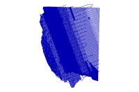
Browse_Graphic:
Browse_Graphic_File_Name:
Browse_Graphic_File_Description: thumbnail image of bathymetric tracklines
Browse_Graphic_File_Type: JPEG
Native_Data_Set_Environment:
Microsoft Windows 2000 Version 5.2 (Build 3790) Service Pack 2; ESRI ArcCatalog 9.2.6.1500
Cross_Reference:
Citation_Information:
Originator: Walter A. Barnhardt
Originator: Brian D. Andrews
Originator: Bradford Butman
Publication_Date: 2006
Title:
High-Resolution Mapping of the Inner Continental Shelf: Nahant to Gloucester, Massachusetts
Series_Information:
Series_Name: Open-File Report
Issue_Identification: 2005-1293
Publication_Information:
Publication_Place: Reston, VA
Publisher: U.S. Geological Survey
Online_Linkage: http://pubs.usgs.gov/of/2005/1293/
Cross_Reference:
Citation_Information:
Originator: Seth D. Ackerman
Originator: Bradford Butman
Originator: Walter A. Barnhardt
Originator: William W. Danforth
Originator: James M. Crocker
Publication_Date: 2006
Title:
High-Resolution Geologic Mapping of the Inner Continental Shelf: Boston Harbor and Approaches, Massachusetts
Series_Information:
Series_Name: Open-File Report
Issue_Identification: 2006-1008
Publication_Information:
Publication_Place: Reston, VA
Publisher: U.S. Geological Survey
Online_Linkage: http://pubs.usgs.gov/of/2006/1008/