Location and JPEG images of photographs of the riverbed collected by the U.S. Geological Survey within the St. Clair River between Michigan and Ontario, Canada, 2008 (ESRI VECTOR SHAPEFILE and JPEG Images, 08016_PHOTO.SHP)

Metadata also available as - [Questions & Answers] - [Parseable text] - [XML]

Metadata:

Identification_Information:
Citation:
Citation_Information:
Originator: U.S. Geological Survey
Publication_Date: 2010
Title:
Location and JPEG images of photographs of the riverbed collected by the U.S. Geological Survey within the St. Clair River between Michigan and Ontario, Canada, 2008 (ESRI VECTOR SHAPEFILE and JPEG Images, 08016_PHOTO.SHP)
Edition: 1.0
Geospatial_Data_Presentation_Form: vector digital data
Series_Information:
Series_Name: Open-File Report
Issue_Identification: 2010-1035
Publication_Information:
Publication_Place: Woods Hole Coastal and Marine Science Center, Woods Hole, MA
Publisher: U.S. Geological Survey, Coastal and Marine Geology Program
Online_Linkage: https://doi.org/10.3133/ofr20101035
Online_Linkage: https://pubs.usgs.gov/of/2010/1035/html/gis.html
Online_Linkage: Larger_Work_Citation:
Citation_Information:
Originator: Jane F. Denny
Originator: David S. Foster
Originator: Charles R. Worley
Originator: Barry J. Irwin
Publication_Date: 2010
Title:
Geophysical data collected from the St. Clair River between Michigan and Ontario, Canada, 2008-016-FA
Edition: 1.0
Geospatial_Data_Presentation_Form: online
Series_Information:
Series_Name: Open-File Report
Issue_Identification: 2010-1035
Publication_Information:
Publication_Place: Reston, VA
Publisher: U.S. Geological Survey
Online_Linkage: https://pubs.usgs.gov/of/2010/1035/
Description:
Abstract:
In 2008, the U.S. Geological Survey (USGS), Woods Hole Coastal and Marine Science Center (WHCMSC), in cooperation with the U.S. Army Corps of Engineers conducted a geophysical and sampling survey of the riverbed of the Upper St. Clair River between Port Huron, MI, and Sarnia, Ontario, Canada. The objectives were to define the Quaternary geologic framework of the St. Clair River to evaluate the relationship between morphologic change of the riverbed and underlying stratigraphy. This report presents the geophysical and sample data collected from the St. Clair River, May 29-June 6, 2008 as part of the International Upper Great Lakes Study, a 5-year project funded by the International Joint Commission of the United States and Canada to examine whether physical changes in the St. Clair River are affecting water levels within the upper Great Lakes, to assess regulation plans for outflows from Lake Superior, and to examine the potential effect of climate change on the Great Lakes water levels ( http://www.iugls.org). This document makes available the data that were used in a separate report, U.S. Geological Survey Open-File Report 2009-1137, which detailed the interpretations of the Quaternary geologic framework of the region. This report includes a description of the suite of high-resolution acoustic and sediment-sampling systems that were used to map the morphology, surficial sediment distribution, and underlying geology of the Upper St. Clair River during USGS field activity 2008-016-FA . Video and photographs of the riverbed were also collected and are included in this data release. Future analyses will be focused on substrate erosion and its effects on river-channel morphology and geometry. Ultimately, the International Upper Great Lakes Study will attempt to determine where physical changes in the St. Clair River affect water flow and, subsequently, water levels in the Upper Great Lakes.
Purpose:
This data set includes the bottom photograph locations and links to the bottom photographs (JPG images) collected within the St. Clair River between Michigan and Ontario, Canada during USGS Cruise 08016. The bottom photographs were collected to ground-truth the geophysical data collected and to characterize the surficial sediment along the riverbed.
Time_Period_of_Content:
Time_Period_Information:
Range_of_Dates/Times:
Beginning_Date: 20080603
Ending_Date: 20080604
Currentness_Reference: ground condition
Status:
Progress: Complete
Maintenance_and_Update_Frequency: None planned
Spatial_Domain:
Bounding_Coordinates:
West_Bounding_Coordinate: -82.427136
East_Bounding_Coordinate: -82.403261
North_Bounding_Coordinate: 43.012497
South_Bounding_Coordinate: 42.963676
Keywords:
Theme:
Theme_Keyword_Thesaurus: USGS Metadata Identifier
Theme_Keyword: USGS:f0090580-9cd2-48d2-8f01-2056df3fb36f
Theme:
Theme_Keyword_Thesaurus: None
Theme_Keyword: U.S. Geological Survey
Theme_Keyword: USGS
Theme_Keyword: Woods Hole Coastal and Marine Science Center
Theme_Keyword: WHCMSC
Theme_Keyword: Coastal and Marine Geology Program
Theme_Keyword: CMGP
Theme_Keyword: bottom photographs
Theme_Keyword: SEABOSS
Theme_Keyword: SEABed Observation and Sampling System
Theme_Keyword: navigation
Theme_Keyword: WHCMSC field activity serial number 08016
Theme_Keyword: ESRI Shapefile
Theme_Keyword: USGS R/V Rafael
Theme_Keyword: JPEG Images
Theme:
Theme_Keyword_Thesaurus: ISO 19115 Topic Category
Theme_Keyword: geoscientificInformation
Theme_Keyword: inlandWaters
Theme_Keyword: location
Theme:
Theme_Keyword_Thesaurus: USGS Thesaurus
Theme_Keyword: image collections
Theme_Keyword: underwater photography
Theme_Keyword: lakebed characteristics
Theme_Keyword: navigational data
Theme_Keyword: geospatial datasets
Place:
Place_Keyword_Thesaurus: None
Place_Keyword: North America
Place_Keyword: United States
Place_Keyword: Michigan
Place_Keyword: Great Lakes
Place_Keyword: Upper Great Lakes
Place_Keyword: Lake Huron
Place_Keyword: St. Clair River
Place_Keyword: Upper St. Clair River
Place_Keyword: Canada
Place_Keyword: Ontario
Access_Constraints: None
Use_Constraints:
Public domain data from the U.S. Government are freely redistributable with proper metadata and source attribution. Please recognize the U.S. Geological Survey as the originator of the dataset.
Point_of_Contact:
Contact_Information:
Contact_Person_Primary:
Contact_Person: Jane Denny
Contact_Organization: U.S. Geological Survey
Contact_Position: Geologist
Contact_Address:
Address_Type: mailing and physical address
Address: 384 Woods Hole Road
City: Woods Hole
State_or_Province: MA
Postal_Code: 02543
Country: USA
Contact_Voice_Telephone: 508-548-8700 x2311
Contact_Facsimile_Telephone: 508-457-2310
Contact_Electronic_Mail_Address: jdenny@usgs.gov
Browse_Graphic:
Browse_Graphic_File_Name: Browse_Graphic_File_Description: Thumbnail image of bottom photographs
Browse_Graphic_File_Type: JPEG
Native_Data_Set_Environment:
Microsoft Windows XP Version 5.1 (Build 2600) Service Pack 3; ESRI ArcCatalog 9.2.6.1500
Cross_Reference:
Citation_Information:
Originator: David S. Foster
Originator: Jane F. Denny
Publication_Date: 2009
Title:
Quaternary Geologic Framework of the St. Clair River between Michigan and Ontario, Canada
Edition: 1.0
Geospatial_Data_Presentation_Form: on-line document
Series_Information:
Series_Name: Open-File Report
Issue_Identification: 2009-1137
Publication_Information:
Publication_Place: Reston, VA
Publisher: U.S. Geological Survey
Online_Linkage: https://pubs.usgs.gov/of/2009/1137/
Cross_Reference:
Citation_Information:
Originator: D.Blackwood
Originator: K. Parolski
Publication_Date: 2001
Title: Seabed observation and sampling system
Geospatial_Data_Presentation_Form: document
Series_Information:
Series_Name: Sea Technology
Issue_Identification: v. 42, no. 2, p. 39-43
Publication_Information:
Publication_Place: Arlington, Virginia
Publisher: Sea Technology
Cross_Reference:
Citation_Information:
Originator: Poppe, L.J.
Originator: Williams, S.J.
Originator: Paskevich, V.F.
Publication_Date: 2005
Title:
USGS East-Coast Sediment Analysis Procedures, Database, and GIS Data
Geospatial_Data_Presentation_Form: online
Series_Information:
Series_Name: Open-File Report
Issue_Identification: 2005-1001
Publication_Information:
Publication_Place: Reston, VA
Publisher: U.S. Geological Survey
Online_Linkage: https://pubs.usgs.gov/of/2005/1001/
Data_Quality_Information:
Logical_Consistency_Report:
All bottom photographs were collected with the mini-SEABOSS (SEABed Observation and Sampling System) by the U.S. Geological Survey within the St. Clair River between Michigan and Ontario, Canada in 2008.
Blackwood and Parolski, 2001
Completeness_Report:
Video and digital photographs were collected at 37 locations using the USGS Mini SEABOSS (Blackwood and Parolski, 2001). A total of 449 photographs were obtained from a digital still camera at user-selected locations along the video drifts.
Sample, photographic and video navigation for locations 1, 2 and (up to time: 13:31 for location 3) used navigation from the video time stamp, as navigation was not recorded in HYPACK. HYPACK navigation was available for bottom sample 3 location and from 13:31 to the end of file for photographs and video at location 3.
Positional_Accuracy:
Horizontal_Positional_Accuracy:
Horizontal_Positional_Accuracy_Report:
Navigation for the mini-SEABOSS: Differential Global Positioning System (DGPS) navigation data were acquired with a Communications Systems International (CSI), Inc. LGBX Pro receiver. The CSI LGBX Pro received positions from a DGPS antenna located on the port, aft roof of the R/V Rafael cabin. DGPS positions were recorded within HYPACK (www.hypack.com) navigation software. Offsets between the DGPS antenna and the mini-SEABOSS were not measured. DGPS accuracy is 1 to 3 meters, depending on the distance from a US Coast Guard coastal repeater station (<http://www.navcen.uscg.gov/>). However, the horizontal position of the mini-SEABOSS during sample collection is assumed to be +/- 10 meters at best, due to a lack of precise positional data at the time of sample recovery.
With the mini-SEABOSS deployed, the research vessel was allowed to drift with occasional power from the vessel to control drift direction. Bottom photographs were acquired at user-selected locations along the drift. Video drift position was derived from the HYPACK navigation files based on start and end times. The drift navigation was merged with the digital photographs based on time of day.
Lineage:
Process_Step:
Process_Description:
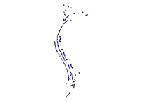
Video and digital photographs were collected at 37 stations using the USGS Mini SEABOSS (Blackwood and Parolski, 2001). Mini SEABOSS stations were selected based on preliminary acoustic-backscatter mosaics, with the objective of characterizing broad areas of different backscatter intensity. With the Mini SEABOSS deployed, the research vessel was allowed to drift with occasional power from the vessel to control drift direction. Continuous video was collected over a total of 11.5 km of lake and riverbed. Video drift position was derived from the HYPACK® navigation files based on the start and end times of the drift. For some portions of the drift, there was no navigation, so the position was derived from the time and position stamp in the video at 30-s intervals. A total of 449 photographs were obtained from a digital still camera at user-selected locations along the video drifts.
Gaps in sequential photo numbers exist. If the camera was triggered accidentally on deck or the photograph was of poor quality or location (e.g. photograph within water column), the photograph was not saved.
Grab samples of the surficial sediment were collected at 15 stations, typically at the end of a drift. The upper 2 cm of sediment was scraped from the surface of the sample for texture analysis. Sediment samples were collected at locations with relatively fine-grained sediment (sand or mud). Samples were not collected in gravel or cobble areas where gravel prevented full closure of the sampler and resulted in a washed-out sample.
A total of 13 bottom samples were submitted for grain-size analysis. Two partially recovered, washed-out samples were not submitted. Grain-size analysis was performed at the USGS Sediment Laboratory at WHCMSC using methods described by Poppe and others (2005).
The mini-SEABOSS is housed with a Minolta CO., LTD, DiMAGE 7Hi camera. The full resolution of the acquired images is 2560 x 1920 pixels.
The EXIF header of the JPEG images contains the time the photo was taken (UTC times) as well as information about the camera used and resolution of the images.
Process_Date: 2008
Process_Step:
Process_Description:
A total of 449 bottom photographs were obtained from a digital camera configured on the mini-SEABOSS. The photographs were taken at user-selected locations along the mini-SEABOSS video drifts.
Sample locations for sample 1 and 2 were read from the video time stamp, as HYPACK navigation was not available. The position information at the end of the video drift was used as position of the sample. (Samples were acquired at the end of video drifts).
Process_Date: 2008
Process_Contact:
Contact_Information:
Contact_Person_Primary:
Contact_Person: Jane F. Denny
Contact_Organization: U.S. Geological Survey
Contact_Position: Geologist
Contact_Address:
Address_Type: mailing and physical address
Address: 384 Woods Hole Road
City: Woods Hole
State_or_Province: MA
Postal_Code: 02543
Country: USA
Contact_Voice_Telephone: 508 548-8700 x 2311
Contact_Facsimile_Telephone: 508-457-2310
Contact_Electronic_Mail_Address: jdenny@usgs.gov
Process_Step:
Process_Description:
Parsed the HYPACK raw navigation for latitude, longitude, time, Julian day, and year, and added Survey ID 08016 by executing a Python script lat_long_fix.py from an xterm (Mac OS X).
Mac OS X (snow leopard 10.6.4)
Process_Date: 2008
Process_Contact:
Contact_Information:
Contact_Person_Primary:
Contact_Person: David Foster
Contact_Organization: U.S. Geological Survey
Contact_Position: Geologist
Contact_Address:
Address_Type: mailing and physical address
Address: 384 Woods Hole Road
City: Woods Hole
State_or_Province: MA
Postal_Code: 02543
Country: USA
Contact_Voice_Telephone: 508 548-8700 x 2271
Contact_Facsimile_Telephone: 508-457-2310
Contact_Electronic_Mail_Address: dfoster@usgs.gov
Process_Step:
Process_Description:
Concatenated the parsed navigation files and edited the file with vi to add missing locations (HYPACK navigation unavailable) for stations 1 and 2, which were read from the video time stamp.
vi, Mac OSX 10.6.4
Process_Date: 2009
Process_Contact:
Contact_Information:
Contact_Person_Primary:
Contact_Person: David Foster
Contact_Organization: U.S. Geological Survey
Contact_Position: Geologist
Contact_Address:
Address_Type: mailing and physical address
Address: 384 Woods Hole Road
City: Woods Hole
State_or_Province: MA
Postal_Code: 02543
Country: USA
Contact_Voice_Telephone: 508 548-8700 x 2271
Contact_Facsimile_Telephone: 508-457-2310
Contact_Electronic_Mail_Address: dfoster@usgs.gov
Process_Step:
Process_Description:
Extracted time from the "Date Picture Taken" in the Exchangeable Image File (EXIF) format header of the quality JPEG bottom photographs using uses the Python script sda_vexiftool_mod12.py (v.Jan18.2007) from an xterm (Mac OS X).
Process_Date: 2009
Process_Contact:
Contact_Information:
Contact_Person_Primary:
Contact_Person: David S. Foster
Contact_Organization: U.S. Geological Survey
Contact_Position: Geologist
Contact_Address:
Address_Type: mailing and physical address
Address: 384 Woods Hole Road
City: Woods Hole
State_or_Province: MA
Postal_Code: 02543
Country: USA
Contact_Voice_Telephone: 508-548-8700 x2271
Contact_Facsimile_Telephone: 508-457-2310
Contact_Electronic_Mail_Address: dfoster@usgs.gov
Process_Step:
Process_Description:
Create ESRI shapefile joining the bottom photo name with the navigation based on matching date and time fields running the Python script sda_hotlink_8.py (v.Feb.23.2005) from PythonWin.
A 'hyperlink' field was added to the attribute table and used to hotlink to the bottom photos.
Process_Date: 2009
Process_Contact:
Contact_Information:
Contact_Person_Primary:
Contact_Person: David S. Foster
Contact_Organization: U.S. Geological Survey
Contact_Position: Geologist
Contact_Address:
Address_Type: mailing and physical address
Address: 384 Woods Hole Road
City: Woods Hole
State_or_Province: MA
Postal_Code: 02543
Country: USA
Contact_Voice_Telephone: 508-548-8700 x2271
Contact_Facsimile_Telephone: 508-457-2310
Contact_Electronic_Mail_Address: dfoster@usgs.gov
Process_Step:
Process_Description:
The digital images were recorded on a compact flash card within the camera. Digital images were downloaded to a local disk and stored within folders with a naming convention based on the Julian Day of data collection. For example, 'bottomphotos155' contains all digital images collected during Julian Day 155.
Full resolution JPEG images were desampled in order to create an image set that would enable faster download.
The following command was used to resize the JPEG images:
convert -file.JPG -resize 25% file_sm.JPG
Mac OSX 10.6.4; convert
Process_Date: 2008
Process_Contact:
Contact_Information:
Contact_Person_Primary:
Contact_Person: David Foster
Contact_Organization: U.S. Geological Survey
Contact_Position: Geologist
Contact_Address:
Address_Type: mailing and physical address
Address: 384 Woods Hole Road
City: Woods Hole
State_or_Province: MA
Postal_Code: 02543
Country: USA
Contact_Voice_Telephone: 508-548-8700 x2271
Contact_Facsimile_Telephone: 508-457-2311
Contact_Electronic_Mail_Address: dfoster@usgs.gov
Process_Step:
Process_Description:
Edits to the metadata were made to fix any errors that MP v 2.9.36 flagged. This is necessary to enable the metadata to be successfully harvested for various data catalogs. In some cases, this meant adding text "Information unavailable" or "Information unavailable from original metadata" for those required fields that were left blank. Other minor edits were probably performed (title, publisher, publication place, etc.). The link to the data in the Distribution_Information section had to be fixed. Attempted to modify http to https where appropriate. Reordered the links in the identification section to have a landing page link as the first link. Moved the minimal source information provided to make it the first process step. The distribution format name was modified in an attempt to be more consistent with other metadata files of the same data format. Added the distribution format JPEG to account for the JPEG images in the zip file. The metadata date (but not the metadata creator) was edited to reflect the date of these changes. The metadata available from a harvester may supersede metadata bundled within a download file. Compare the metadata dates to determine which metadata file is most recent.
Process_Date: 20171018
Process_Contact:
Contact_Information:
Contact_Organization_Primary:
Contact_Organization: U.S. Geological Survey
Contact_Person: VeeAnn A. Cross
Contact_Position: Marine Geologist
Contact_Address:
Address_Type: Mailing and Physical
Address: 384 Woods Hole Road
City: Woods Hole
State_or_Province: MA
Postal_Code: 02543-1598
Contact_Voice_Telephone: 508-548-8700 x2251
Contact_Facsimile_Telephone: 508-457-2310
Contact_Electronic_Mail_Address: vatnipp@usgs.gov
Process_Step:
Process_Description: USGS Thesaurus keywords added to the keyword section.
Process_Date: 20180720
Process_Contact:
Contact_Information:
Contact_Organization_Primary:
Contact_Organization: U.S. Geological Survey
Contact_Person: VeeAnn A. Cross
Contact_Position: Marine Geologist
Contact_Address:
Address_Type: Mailing and Physical
Address: 384 Woods Hole Road
City: Woods Hole
State_or_Province: MA
Postal_Code: 02543-1598
Contact_Voice_Telephone: 508-548-8700 x2251
Contact_Facsimile_Telephone: 508-457-2310
Contact_Electronic_Mail_Address: vatnipp@usgs.gov
Process_Step:
Process_Description: Crossref DOI link was added as the first link in the metadata.
Process_Date: 20191118
Process_Contact:
Contact_Information:
Contact_Organization_Primary:
Contact_Organization: U.S. Geological Survey
Contact_Person: VeeAnn A. Cross
Contact_Position: Marine Geologist
Contact_Address:
Address_Type: Mailing and Physical
Address: 384 Woods Hole Road
City: Woods Hole
State_or_Province: MA
Postal_Code: 02543-1598
Contact_Voice_Telephone: 508-548-8700 x2251
Contact_Facsimile_Telephone: 508-457-2310
Contact_Electronic_Mail_Address: vatnipp@usgs.gov
Process_Step:
Process_Description:
Added keywords section with USGS persistent identifier as theme keyword.
Process_Date: 20200908
Process_Contact:
Contact_Information:
Contact_Organization_Primary:
Contact_Organization: U.S. Geological Survey
Contact_Person: VeeAnn A. Cross
Contact_Position: Marine Geologist
Contact_Address:
Address_Type: Mailing and Physical
Address: 384 Woods Hole Road
City: Woods Hole
State_or_Province: MA
Postal_Code: 02543-1598
Contact_Voice_Telephone: 508-548-8700 x2251
Contact_Facsimile_Telephone: 508-457-2310
Contact_Electronic_Mail_Address: vatnipp@usgs.gov
Spatial_Data_Organization_Information:
Direct_Spatial_Reference_Method: Vector
Point_and_Vector_Object_Information:
SDTS_Terms_Description:
SDTS_Point_and_Vector_Object_Type: Entity point
Point_and_Vector_Object_Count: 449
Spatial_Reference_Information:
Horizontal_Coordinate_System_Definition:
Geographic:
Latitude_Resolution: 0.000001
Longitude_Resolution: 0.000001
Geographic_Coordinate_Units: Decimal degrees
Geodetic_Model:
Horizontal_Datum_Name: D_WGS_1984
Ellipsoid_Name: WGS_1984
Semi-major_Axis: 6378137.000000
Denominator_of_Flattening_Ratio: 298.257224
Entity_and_Attribute_Information:
Detailed_Description:
Entity_Type:
Entity_Type_Label: 08016_photo
Entity_Type_Definition: ESRI vector shapefile
Entity_Type_Definition_Source: ESRI
Attribute:
Attribute_Label: FID
Attribute_Definition: Internal feature number.
Attribute_Definition_Source: ESRI
Attribute_Domain_Values:
Unrepresentable_Domain:
Sequential unique whole numbers that are automatically generated.
Attribute:
Attribute_Label: Shape
Attribute_Definition: Feature geometry.
Attribute_Definition_Source: ESRI
Attribute_Domain_Values:
Unrepresentable_Domain: Coordinates defining the features.
Attribute:
Attribute_Label: Station
Attribute_Definition:
Number of the station, or sample, location (STxx, where ST=station, and xx = station number)
Attribute_Definition_Source: U.S. Geological Survey
Attribute_Domain_Values:
Enumerated_Domain:
Enumerated_Domain_Value: ST1
Enumerated_Domain_Value_Definition:
station, or sample, location. Format STxx, where ST=station, and xx= station number
Enumerated_Domain_Value_Definition_Source: U.S. Geological Survey
Attribute:
Attribute_Label: Hour
Attribute_Definition: Hour of data collection (24-hr clock, UTC) based on EXIF header
Attribute_Definition_Source: U.S. Geological Survey
Attribute_Domain_Values:
Range_Domain:
Range_Domain_Minimum: 11
Range_Domain_Maximum: 19
Attribute_Units_of_Measure: hour
Attribute:
Attribute_Label: Min
Attribute_Definition:
Minute of data collection (24-hour clock, UTC), based on EXIF header
Attribute_Definition_Source: U.S. Geological Survey
Attribute_Domain_Values:
Range_Domain:
Range_Domain_Minimum: 0
Range_Domain_Maximum: 59
Attribute_Units_of_Measure: minute
Attribute:
Attribute_Label: Sec
Attribute_Definition:
Second of data collection (24-hr clock, UTC), based on EXIF header
Attribute_Definition_Source: U.S. Geological Survey
Attribute_Domain_Values:
Range_Domain:
Range_Domain_Minimum: 0
Range_Domain_Maximum: 59
Attribute_Units_of_Measure: second
Attribute:
Attribute_Label: LAT
Attribute_Definition: Latitude position of station (decimal degrees, WGS84)
Attribute_Definition_Source: U.S. Geological Survey
Attribute_Domain_Values:
Range_Domain:
Range_Domain_Minimum: 42.963676
Range_Domain_Maximum: 43.012497
Attribute_Units_of_Measure: decimal degrees
Attribute:
Attribute_Label: Long
Attribute_Definition: Longitude of station location (decimal degrees, WGS84)
Attribute_Definition_Source: U.S. Geological Survey
Attribute_Domain_Values:
Range_Domain:
Range_Domain_Minimum: -82.427136
Range_Domain_Maximum: -82.403261
Attribute_Units_of_Measure: decimal degrees
Attribute:
Attribute_Label: JD
Attribute_Definition:
Julian Day of data collection (year 2008), where julian day is the numeric day of the year with January 1 equal to day 1
Attribute_Definition_Source: U.S. Geological Survey
Attribute_Domain_Values:
Range_Domain:
Range_Domain_Minimum: 155
Range_Domain_Maximum: 156
Attribute_Units_of_Measure: Julian Day (Year 2008)
Attribute:
Attribute_Label: PICNAME
Attribute_Definition: Name of the digital image.
Attribute_Definition_Source: U.S. Geological Survey
Attribute_Domain_Values:
Enumerated_Domain:
Enumerated_Domain_Value: PICTXXXX.JPG
Enumerated_Domain_Value_Definition:
Filename for digital photographs format 'PICTXXXX.JPG', where PICT is picture, XXXX is file number starting with 0030, and JPEG is the image format.
Enumerated_Domain_Value_Definition_Source: U.S. Geological Survey
Attribute:
Attribute_Label: GPSHour
Attribute_Definition: Hour of day extracted from the HYPACK navigation (24-hr clock)
Attribute_Definition_Source: U.S. Geological Survey
Attribute_Domain_Values:
Range_Domain:
Range_Domain_Minimum: 11
Range_Domain_Maximum: 19
Attribute_Units_of_Measure: hour of day (24-hr clock)
Attribute:
Attribute_Label: GPSMin
Attribute_Definition: Minute of data collection extracted from the HYPACK navigation
Attribute_Definition_Source: U.S. Geological Survey
Attribute_Domain_Values:
Range_Domain:
Range_Domain_Minimum: 0
Range_Domain_Maximum: 59
Attribute_Units_of_Measure: minute of the day
Attribute:
Attribute_Label: GPSSec
Attribute_Definition: Second of data collection
Attribute_Definition_Source: U.S. Geological Survey
Attribute_Domain_Values:
Range_Domain:
Range_Domain_Minimum: 0
Range_Domain_Maximum: 59
Attribute_Units_of_Measure: second of the day
Attribute:
Attribute_Label: Hyperlink
Attribute_Definition: Path to the digital photograph
Attribute_Definition_Source: U.S. Geological Survey
Attribute_Domain_Values:
Unrepresentable_Domain:
Text field listing the path to the digital photograph that corresponds to a specific location
Distribution_Information:
Distributor:
Contact_Information:
Contact_Person_Primary:
Contact_Person: Jane Denny
Contact_Organization: U.S. Geological Survey
Contact_Position: Geologist
Contact_Address:
Address_Type: mailing and physical address
Address: 384 Woods Hole Road
City: Woods Hole
State_or_Province: MA
Postal_Code: 02543
Country: USA
Contact_Voice_Telephone: 508-548-8700 x2311
Contact_Facsimile_Telephone: 508-457-2310
Contact_Electronic_Mail_Address: jdenny@usgs.gov
Resource_Description: Downloadable Data
Distribution_Liability:
Neither the U.S. Government, the Department of the Interior, nor the USGS, nor any of their employees, contractors, or subcontractors, make any warranty, express or implied, nor assume any legal liability or responsibility for the accuracy, completeness, or usefulness of any information, apparatus, product, or process disclosed, nor represent that its use would not infringe on privately owned rights. The act of distribution shall not constitute any such warranty, and no responsibility is assumed by the USGS in the use of these data or related materials.
Any use of trade, product, or firm names is for descriptive purposes only and does not imply endorsement by the U.S. Government.
Standard_Order_Process:
Digital_Form:
Digital_Transfer_Information:
Format_Name: Shapefile
Format_Version_Number: ArcGIS 9.2
Format_Information_Content:
WinZip (version 9.0) file containing bottom photograph locations and JPEG images of bottom photographs collected by the U.S. Geological Survey within the St. Clair River between Michigan and Ontario, Canada, 2008
File_Decompression_Technique: Use WinZip or pkUnzip
Transfer_Size: 58
Digital_Transfer_Option:
Online_Option:
Computer_Contact_Information: Access_Instructions: Data can be downloaded via the World Wide Web (WWW)
Digital_Form:
Digital_Transfer_Information:
Format_Name: JPEG
Format_Information_Content:
WinZip (version 9.0) file containing bottom photograph locations and JPEG images of bottom photographs collected by the U.S. Geological Survey within the St. Clair River between Michigan and Ontario, Canada, 2008
File_Decompression_Technique: Use WinZip or pkUnzip
Transfer_Size: 58
Digital_Transfer_Option:
Online_Option:
Computer_Contact_Information: Access_Instructions: Data can be downloaded via the World Wide Web (WWW)
Fees: none
Technical_Prerequisites:
This zip file contains data available in Environmental Systems Research Institute (ESRI) shapefile format. The user must have ArcGIS or ArcView 3.0 or greater software to read and process the data file. In lieu of ArcView or ArcGIS, the user may utilize another GIS application package capable of importing the data. A free data viewer, ArcExplorer, capable of displaying the data is available from ESRI at www.esri.com.
This zip file also contains desampled JPG images of the bottom samples. Full resolution bottom photographs are available upon request, or can be downloaded individually (https://pubs.usgs.gov/of/2010/1035/gis_catalog/seaboss/photos/).
Metadata_Reference_Information:
Metadata_Date: 20240318
Metadata_Contact:
Contact_Information:
Contact_Organization_Primary:
Contact_Organization: U.S. Geological Survey
Contact_Person: Jane Denny
Contact_Position: Geologist
Contact_Address:
Address_Type: mailing and physical address
Address: 384 Woods Hole Road
City: Woods Hole
State_or_Province: MA
Postal_Code: 02543
Country: USA
Contact_Voice_Telephone: 508-548-8700 x 2311
Contact_Facsimile_Telephone: 508-457-2310
Contact_Electronic_Mail_Address: whsc_data_contact@usgs.gov
Contact_Instructions:
The metadata contact email address is a generic address in the event the person is no longer with USGS. (updated on 20240318)
Metadata_Standard_Name: FGDC Content Standards for Digital Geospatial Metadata
Metadata_Standard_Version: FGDC-STD-001-1998
Metadata_Time_Convention: local time
Metadata_Access_Constraints: none
Metadata_Use_Constraints: none

This page is <https://cmgds.marine.usgs.gov/catalog/whcmsc/open_file_report/ofr2010-1035/08016_photo.html>
Generated by mp version 2.9.51 on Mon Mar 25 16:05:30 2024