Online Links:
Online Links:
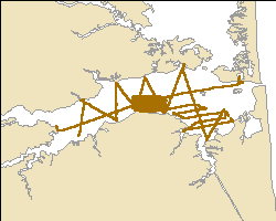
| Range of values | |
|---|---|
| Minimum: | -75.181767 |
| Maximum: | -75.072817 |
| Units: | decimal degrees |
| Range of values | |
|---|---|
| Minimum: | 38.576183 |
| Maximum: | 38.6202 |
| Units: | decimal degrees |
| Range of values | |
|---|---|
| Minimum: | 0.2 |
| Maximum: | 16.7 |
| Units: | meters |
| Range of values | |
|---|---|
| Minimum: | 105 |
| Maximum: | 105 |
| Units: | days |
donav:
files=`ls *.RAW | cut -d. -f1`
for file in $files
do
	awk -f awkit $file.RAW > $file.navdep
done
The AWK script "awkit" simply extracts any line of information in the HYPACK file that contains either the string "GPGGA" or "SDDBT" and writes this information to a new file with the extension navdep.
awkit:
{
if ($0 ~ /GPGGA|SDDBT/) {
	print $0
	}
}
This process step and all subsequent process steps were performed by the same person - VeeAnn A. Cross.
Person who carried out this activity:
files=`ls *.navdep | cut -d. -f1`
for file in $files
do
	awk -f awkholdhypack $file.navdep > $file.holdhypack
done
awkholdhypack:
BEGIN {
FS = ","
}
{
FS = ","
depth = -9999
if ($1 ~ /GPGGA/)
	{
	utctime = $2
	latdeg = substr($3,1,2)
	latmin = substr($3,3,6)
	declat = latdeg + (latmin/60)
	londeg = substr($5,1,3)
	lonmin = substr($5,4,6)
	declon = -1 * (londeg + (lonmin/60))
	if (NR==1) {
		holddepth = -9999
		}
	else {
		printf("%s, %9.6f, %9.6f, %5.1f\n", holdutctime, holddeclon, holddeclat, holddepth)
	}
	holdutctime = utctime
	holdutcdate = utcdate
	holddeclon = declon
	holddeclat = declat
	holddepth = -9999
	}
if ($1 ~ /SDDBT/)
	{
	if ($4 != "")
		{
		depthreal = $4
		holddepth = depthreal
		}
	else
		{
		depthreal = -9999
		holddepth = -9999
		}
	}
}
END {
printf("%s, %9.6f, %9.6f, %5.1f\n", holdutctime, holddeclon, holddeclat, holddepth)
}
Data sources used in this process:
catit:
cat 008_1213.holdhypack \
043_1404.holdhypack \
043_1422.holdhypack \
044_1423.holdhypack \
045_1423.holdhypack \
043_1424.holdhypack \
044_1424.holdhypack \
044A1424.holdhypack \
043_1425.holdhypack \
043_1426.holdhypack \
044_1427.holdhypack \
045_1441.holdhypack \
045_1500.holdhypack \
046_1500.holdhypack \
047_1545.holdhypack \
048_1606.holdhypack \
049_1625.holdhypack \
050_1647.holdhypack \
118_1723.holdhypack \
112_1737.holdhypack \
001_1744.holdhypack \
023_1744.holdhypack \
021_1811.holdhypack \
019_1827.holdhypack \
017_1857.holdhypack \
015_1912.holdhypack \
515_2015.holdhypack \
518_2024.holdhypack \
521_2035.holdhypack \
524_2049.holdhypack \
527_2101.holdhypack \
530_2113.holdhypack \
533_2125.holdhypack \
536_2138.holdhypack \
539_2151.holdhypack \
542_2202.holdhypack \
545_2211.holdhypack > jd105hypack.csv
Data sources used in this process:
| Access_Constraints | None. |
|---|---|
| Use_Constraints | The public domain data from the U.S. Government are freely redistributable with proper metadata and source attribution. Please recognize the U.S. Geological Survey as the originator of the dataset. |
| Data format: | This WinZip (v. 14) file contains the point shapefile as well as the associated metadata files. in format Shapefile (version ArcGIS 9.2) Size: 0.67 |
|---|---|
| Network links: |
https://pubs.usgs.gov/of/2011/1039/data/navigation/hypack/processed/jd105hypack.zip https://pubs.usgs.gov/of/2011/1039/html/ofr2011-1039-catalog.html https://doi.org/10.3133/ofr20111039 |