Trackline navigation for Knudsen 3202 seismic-reflection data collected by the U.S. Geological Survey surrounding the eastern Elizabeth Islands and northern Martha's Vineyard, MA, 2011 (Esri polyline shapefile, GCS WGS 84, 2011-013-FA_Knudsen_tracklines.shp)

Metadata also available as - [Questions & Answers] - [Parseable text] - [XML]

Metadata:

Identification_Information:
Citation:
Citation_Information:
Originator: U.S. Geological Survey
Publication_Date: 2014
Title:
Trackline navigation for Knudsen 3202 seismic-reflection data collected by the U.S. Geological Survey surrounding the eastern Elizabeth Islands and northern Martha's Vineyard, MA, 2011 (Esri polyline shapefile, GCS WGS 84, 2011-013-FA_Knudsen_tracklines.shp)
Edition: 1.0
Geospatial_Data_Presentation_Form: vector digital data
Series_Information:
Series_Name: Open-File Report
Issue_Identification: 2013-1020
Publication_Information:
Publication_Place:
Woods Hole Coastal and Marine Science Center, Woods Hole, Massachusetts
Publisher: U.S. Geological Survey, Coastal and Marine Geology Program
Online_Linkage: https://doi.org/10.3133/ofr20131020
Online_Linkage: Larger_Work_Citation:
Citation_Information:
Originator: Elizabeth A. Pendleton
Originator: Brian D. Andrews
Originator: William W. Danforth
Originator: David S. Foster
Publication_Date: 2014
Title:
High-resolution geophysical data collected aboard the U.S. Geological Survey research vessel Rafael to supplement existing datasets from Buzzards Bay and Vineyard Sound, Massachusetts
Edition: 1.0
Series_Information:
Series_Name: Open-File Report
Issue_Identification: 2013-1020
Publication_Information:
Publication_Place: Reston, VA
Publisher: U.S. Geological Survey
Online_Linkage: https://doi.org/10.3133/ofr20131020
Online_Linkage: https://pubs.usgs.gov/of/2013/1020/
Description:
Abstract:
These data were collected under a cooperative agreement between the Massachusetts Office of Coastal Zone Management (CZM) and the U.S. Geological Survey (USGS), Coastal and Marine Geology Program, Woods Hole Coastal and Marine Science Center (WHCMSC). Initiated in 2003, the primary objective of this program is to develop regional geologic framework information for the management of coastal and marine resources. Accurate data and maps of seafloor geology are important first steps toward protecting fish habitat, delineating marine resources, and assessing environmental changes due to natural or human impacts. The project is focused on the inshore waters of coastal Massachusetts, primarily in water depths of 2-30 meters. Data collected for the mapping cooperative have been released in a series of USGS Open-File Reports (https://woodshole.er.usgs.gov/project-pages/coastal_mass/). The data collected in this study area are located in both Buzzards Bay and Vineyard Sound and are primarily in the shallow water areas around the eastern Elizabeth Islands and Martha's Vineyard, Massachusetts. The data include high resolution bathymetry, acoustic-backscatter intensity, sound velocity in water, seismic-reflection profiles, and navigation data. These data were collected during several cruises between 2007 and 2011 onboard the R/V Rafael using the following equipment: an SEA Ltd SwathPlus interferometric sonar (234 kHz), Klein 3000 dual frequency sidescan sonar, a boomer source and Geometrics 8-channel GeoEel streamer, a Knudsen 3200 subbottom profiling system, and 4 GPS antennae. More information about the cruises conducted as part of the project: Geologic Mapping of the Seafloor Offshore of Massachusetts can be found on the Woods Hole Coastal and Marine Science Center Field Activity webpages: https://cmgds.marine.usgs.gov/fan_info.php?fan=2011-013-FA, https://cmgds.marine.usgs.gov/fan_info.php?fan=2009-068-FA, https://cmgds.marine.usgs.gov/fan_info.php?fan=2007-039-FA, https://cmgds.marine.usgs.gov/fan_info.php?fan=2010-100-FA, and https://cmgds.marine.usgs.gov/fan_info.php?fan=2010-047-FA.
Purpose:
This dataset contains trackline navigation for approximately 940 km of Knudsen 3202 chirp seismic-reflection data collected by the U.S. Geological Survey during Woods Hole Science Center cruise 2011-013-FA offshore of the Elizabeth Islands and Martha's Vineyard. This information can help spatially correlate the seismic-reflection profiles with other data in the GIS.
Time_Period_of_Content:
Time_Period_Information:
Range_of_Dates/Times:
Beginning_Date: 20110802
Ending_Date: 20110831
Currentness_Reference:
Survey 2011-013-FA was conducted 20110802 to 20110831. Data were not collected on 20110807, 20110812-20110815, 20110821, and 20110825-20110829 due to weather.
Status:
Progress: Complete
Maintenance_and_Update_Frequency: None planned
Spatial_Domain:
Bounding_Coordinates:
West_Bounding_Coordinate: -70.826385
East_Bounding_Coordinate: -70.447288
North_Bounding_Coordinate: 41.551037
South_Bounding_Coordinate: 41.434208
Keywords:
Theme:
Theme_Keyword_Thesaurus: USGS Metadata Identifier
Theme_Keyword: USGS:937a13f7-337c-448f-967a-107679d7ea85
Theme:
Theme_Keyword_Thesaurus: None
Theme_Keyword: U.S. Geological Survey
Theme_Keyword: USGS
Theme_Keyword: Coastal and Marine Geology Program
Theme_Keyword: CMGP
Theme_Keyword: Woods Hole Coastal and Marine Science Center
Theme_Keyword: WHCMSC
Theme_Keyword: Seafloor
Theme_Keyword: Marine Geology
Theme_Keyword: WHCMSC field activity serial number 2011-013-FA
Theme_Keyword: seismic profile
Theme_Keyword: trackline navigation
Theme_Keyword: seismic navigation
Theme_Keyword: seismic reflection
Theme_Keyword: chirp
Theme_Keyword: Knudsen
Theme_Keyword: 3202
Theme_Keyword: R/V Rafael
Theme_Keyword: Esri shapefile
Theme:
Theme_Keyword_Thesaurus: ISO 19115 Topic Category
Theme_Keyword: oceans
Theme_Keyword: location
Theme:
Theme_Keyword_Thesaurus: USGS Thesaurus
Theme_Keyword: navigational data
Theme_Keyword: marine geophysics
Theme_Keyword: geospatial datasets
Place:
Place_Keyword_Thesaurus: None
Place_Keyword: North America
Place_Keyword: Atlantic Ocean
Place_Keyword: Massachusetts
Place_Keyword: United States
Place_Keyword: Naushon Island
Place_Keyword: Elizabeth Islands
Place_Keyword: Buzzards Bay
Place_Keyword: Vineyard Sound
Place_Keyword: Quicks Hole
Place_Keyword: Robinsons Hole
Place_Keyword: Martha's Vineyard
Place_Keyword: Pasque Island
Place_Keyword: Weepecket Islands
Place_Keyword: Nonamesset Island
Place_Keyword: Uncatena Island
Place_Keyword: Nantucket Sound
Place_Keyword: Tarpaulin Cove
Place_Keyword: East Chop
Place_Keyword: West Chop
Place_Keyword: Middle Ground
Place_Keyword: Woods Hole
Place_Keyword: Hedge Fence
Place_Keyword: L' Hommedieu Shoal
Place_Keyword: Vineyard Haven Harbor
Place_Keyword: North Channel
Place_Keyword: Penzance
Access_Constraints: None
Use_Constraints:
Public domain data from the U.S. Government are freely redistributable with proper metadata and source attribution. Please recognize the U.S. Geological Survey as the source of this information
Point_of_Contact:
Contact_Information:
Contact_Person_Primary:
Contact_Person: Elizabeth A. Pendleton
Contact_Organization: U.S. Geological Survey
Contact_Position: Geologist
Contact_Address:
Address_Type: mailing and physical address
Address: 384 Woods Hole Road
City: Woods Hole
State_or_Province: MA
Postal_Code: 02543-1598
Country: USA
Contact_Voice_Telephone: 508-548-8700 x2259
Contact_Facsimile_Telephone: 508-457-2310
Contact_Electronic_Mail_Address: ependleton@usgs.gov
Browse_Graphic:
Browse_Graphic_File_Name: Browse_Graphic_File_Description:
Trackline navigation at even 500 shot intervals for Knudsen 3202 seismic-reflection data collected within Vineyard Sound and Buzzards Bay, MA, 2009
Browse_Graphic_File_Type: PNG
Native_Data_Set_Environment:
Microsoft Windows Vista Version 6.1 (Build 7601) Service Pack 1; ESRI ArcCatalog 9.3.1.1850
Cross_Reference:
Citation_Information:
Originator: Andrews, B.D.
Originator: Ackerman, S.D.
Originator: Baldwin, W.E.
Originator: Foster, D.S.
Originator: Schwab, W.C.
Publication_Date: 2013
Title:
High-Resolution Geophysical Data From the Inner Continental Shelf at Vineyard Sound, Massachusetts
Edition: 1.0
Geospatial_Data_Presentation_Form: vector and raster digital data
Series_Information:
Series_Name: Open-File Report
Issue_Identification: 2012-1006
Publication_Information:
Publication_Place: Reston, VA
Publisher: U.S. Geological Survey
Online_Linkage: https://pubs.usgs.gov/of/2012/1006/
Cross_Reference:
Citation_Information:
Originator: Ackerman, S.D.
Originator: Andrews, B.D.
Originator: Foster, D.S.
Originator: Baldwin, W.E.
Originator: Schwab, W.C.
Publication_Date: 2013
Title:
High-Resolution Geophysical Data from the Inner Continental Shelf: Buzzards Bay, Massachusetts
Edition: 1.0
Geospatial_Data_Presentation_Form: vector and raster digital data
Series_Information:
Series_Name: Open-File Report
Issue_Identification: 2012-1002
Publication_Information:
Publication_Place: Reston, VA
Publisher: U.S. Geological Survey
Online_Linkage: https://pubs.usgs.gov/of/2012/1002/
Cross_Reference:
Citation_Information:
Originator: Pendleton, E.A.
Originator: Twichell, D.C.
Originator: Foster, D.S.
Originator: Worley, C.R.
Originator: Irwin, B.J.
Originator: Danforth, W.W.
Publication_Date: 2012
Title:
High-Resolution Geophysical Data From the Sea Floor Surrounding the Western Elizabeth Islands, Massachusetts
Edition: 1.0
Geospatial_Data_Presentation_Form: vector and raster digital data
Series_Information:
Series_Name: Open-File Report
Issue_Identification: 2011-1184
Publication_Information:
Publication_Place: Reston, VA
Publisher: U.S. Geological Survey
Online_Linkage: https://pubs.usgs.gov/of/2011/1184/
Cross_Reference:
Citation_Information:
Originator: Turecek, A.M.
Originator: Danforth, W.W.
Originator: Baldwin, W.E.
Originator: Barnhardt, W.A.
Publication_Date: 2012
Title:
High-Resolution Geophysical Data Collected Within Red Brook Harbor, Buzzards Bay, Massachusetts, in 2009
Edition: 1.0
Geospatial_Data_Presentation_Form: vector and raster digital data
Series_Information:
Series_Name: Open-File Report
Issue_Identification: 2010-1091
Publication_Information:
Publication_Place: Reston, VA
Publisher: U.S. Geological Survey
Online_Linkage: https://pubs.usgs.gov/of/2010/1091/
Cross_Reference:
Citation_Information:
Originator: John Stockwell
Publication_Date: 2008
Title: CWP/SU: Seismic Uni*x
Edition: 1.0
Geospatial_Data_Presentation_Form: document
Publication_Information:
Publication_Place: Golden, CO
Publisher: Center for Wave Phenomena - Colorado School of Mines
Other_Citation_Details: version 43R3
Online_Linkage: http://www.cwp.mines.edu/cwpcodes/index.html
Cross_Reference:
Citation_Information:
Originator: Paul Henkart
Publication_Date: 2007
Title: SIOSEIS
Edition: 1.0
Geospatial_Data_Presentation_Form: document
Publication_Information:
Publication_Place: LaJolla, CA
Publisher:
Scripps Institution of Oceanography, University of California - San Diego
Online_Linkage: http://sioseis.ucsd.edu/index.html
Cross_Reference:
Citation_Information:
Originator: Michael W. Norris
Originator: Alan K. Faichney
Publication_Date: 2002
Title: SEGY Rev.1 Data Exchange Format1
Edition: 1.0
Geospatial_Data_Presentation_Form: document
Publication_Information:
Publication_Place: Tulsa, OK
Publisher: Society of Exploration Geophysicists
Online_Linkage: http://www.seg.org/documents/10161/77915/seg_y_rev1.pdf
Data_Quality_Information:
Attribute_Accuracy:
Attribute_Accuracy_Report: All attributes were checked in a consistent manner.
Logical_Consistency_Report:
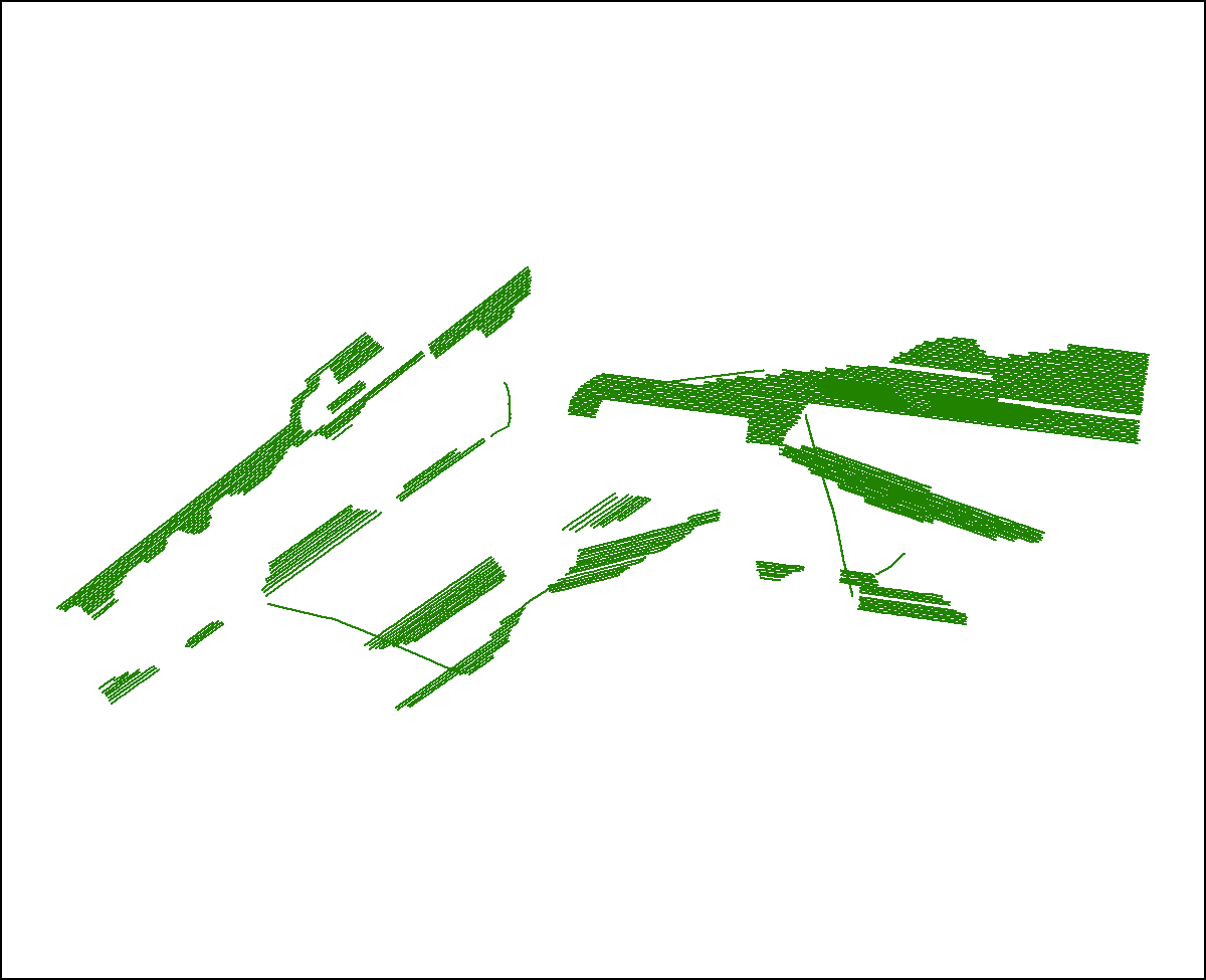
Any spurious data points were removed during processing. For each seismic trackline there is one seismic-profile image that is hyperlinked by the field 'image'. No duplicates exist.
Completeness_Report:
Sections of tracklines where navigation was recorded but no seismic data were logged are not included.
Positional_Accuracy:
Horizontal_Positional_Accuracy:
Horizontal_Positional_Accuracy_Report:
Differential Global Positioning System (DGPS) navigation data were acquired with a Communications Systems International (CSI), Inc. LGBX Pro receiver. Navigation data were sent to the Knudsen SounderSuite acquisition application, which logged the coordinates to individual trace headers in the Society of Exploration Geophysicists Y (SEG-Y) Revision 1 format (Norris and Faichney, 2002). A 2 m horizontal offset between the seismic transducers and the DGPS receiver was not accounted for during data acquisition, and resulting positional accuracy is assumed to be better than 10 m.
Lineage:
Source_Information:
Source_Citation:
Citation_Information:
Originator: Information unavailable from original metadata - assumed USGS
Publication_Date: unknown
Title: Information unavailable from original metadata
Type_of_Source_Media: disc
Source_Time_Period_of_Content:
Time_Period_Information:
Range_of_Dates/Times:
Beginning_Date: 20110802
Ending_Date: 20110831
Source_Currentness_Reference:
Survey 2011-013-FA was conducted 20110802 to 20110831. Data were not collected on 20110807, 20110812-20110815, 20110821, and 20110825-20110829 due to weather.
Source_Citation_Abbreviation: USGS
Source_Contribution:
Chirp seismic data were collected using a dual frequency (3.5 and 200 kHz) Knudsen Engineering Limited (KEL) Chirp 3202 system (Knudsen Engineering Limited, 2009) with transducers mounted on a rigid pole on the starboard side of the R/V Rafael of Woods Hole, MA. Knudsen SounderSuite seismic acquisition software was used to control the Chirp 3202 system, digitally log trace data in the Society of Exploration Geophysicists Y (SEG-Y) Revision 1 format (Norris and Faichney), and record DGPS navigation coordinates to the SEG-Y trace headers in arc seconds. The transducer draft was 0.5 m below the water surface, and the draft offset was accounted for during data acquisition. Navigation coordinates and water depths from the 200-kHz channel were logged together in ASCII formatted files for each survey line. Data were acquired at a peak frequency of 3.5 - 5.0 kiloHertz, a 0.25 or 0.2 second fire rate (4 or 5 shots per second), a 36-38 microsecond sample interval, and record lengths between 26 and 130 milliseconds. Unique shot point locations are provided in the zip-compressed package for the Knudsen trackline shapefile.
Process_Step:
Process_Description:
A C-shell script was executed that called on Seismic Unix (version 4.1) to read the SEG-Y files, write a Seismic Unix file, and extract SEG-Y trace header information, including shot number, longitude, latitude, year, Julian day, and time of day (UTC) to ASCII text files for each survey line. Files were filtered using AWK (no version) to save records for the first and last shots, and shots at unique longitude/latitude positions in between. The VIM (version 7.2.108) text editor was then used to create a new field in each navigation and trace header text file that combined Julian day and UTC time. Finally, using the newly created field as the 'join' field, the Unix JOIN (no version) command was used to merge coordinates from the navigation text file with corresponding shot records in each trace header file based on this Julian day time field. Geographic coordinates (WGS84) were converted to UTM zone 19 coordinates (WGS84) using Proj (version 4.6.0), and added to the text files in two new columns.
Process_Date: 2011
Process_Contact:
Contact_Information:
Contact_Person_Primary:
Contact_Person: David S. Foster
Contact_Organization: U.S. Geological Survey
Contact_Position: Geologist
Contact_Address:
Address_Type: mailing and physical address
Address: 384 Woods Hole Road
City: Woods Hole
State_or_Province: MA
Postal_Code: 02543-1598
Country: USA
Contact_Voice_Telephone: 508-548-8700 x2271
Contact_Facsimile_Telephone: 508-457-2271
Contact_Electronic_Mail_Address: dfoster@usgs.gov
Process_Step:
Process_Description:
Text files containing trace header records for the first and last shots, and shots with unique longitude/latitude positions for each seismic line were concatenated into a comma-delimited text file (CSV) , which is provided in the zip-compressed package of this trackline shapefile, then imported into ArcMap (version 9.3.1) using 'Add XY data' and saved as points (Geographic, WGS84) in the Esri shapefile format.
Process_Date: 2011
Process_Contact:
Contact_Information:
Contact_Person_Primary:
Contact_Person: David S. Foster
Contact_Organization: U.S. Geological Survey
Contact_Position: Geologist
Contact_Address:
Address_Type: mailing and physical address
Address: 384 Woods Hole Road
City: Woods Hole
State_or_Province: MA
Postal_Code: 02543-1598
Country: USA
Contact_Voice_Telephone: 508-548-8700 x2271
Contact_Facsimile_Telephone: 508-457-2310
Contact_Electronic_Mail_Address: dfoster@usgs.gov
Process_Step:
Process_Description:
The shapefile containing unique shot point positions, created in the previous step, was used as an input for VACExtras (version 1.97), a VB collection of tools developed by VeeAnn Cross (USGS-WHCMSC), which converts point data to a new polyline shapefile, based on record order. The 'line' field was used to define which points were used to generate each polyline feature. Also populated during VACExtras polyline creation were fields 'shot', 'year', 'JD', and 'shot_end'. Using XTools Pro (version 5.2.0) for ArcGIS desktop, the length of each polyline segment was calculated and included in the attribute field 'LENGTH', specifying UTM, Zone 19 N, WGS84, and meters.
Process_Date: 2011
Process_Contact:
Contact_Information:
Contact_Person_Primary:
Contact_Person: David S. Foster
Contact_Organization: U.S. Geological Survey
Contact_Position: Geologist
Contact_Address:
Address_Type: mailing and physical address
Address: 384 Woods Hole Road
City: Woods Hole
State_or_Province: MA
Postal_Code: 02543-1598
Country: USA
Contact_Voice_Telephone: 508-548-8700 x2271
Contact_Facsimile_Telephone: 508-457-2310
Contact_Electronic_Mail_Address: dfoster@usgs.gov
Process_Step:
Process_Description:
Edits to the metadata were made to fix any errors that MP v 2.9.36 flagged. This is necessary to enable the metadata to be successfully harvested for various data catalogs. In some cases, this meant adding text "Information unavailable" or "Information unavailable from original metadata" for those required fields that were left blank. Other minor edits were probably performed (title, publisher, publication place, etc.). Removed link to another publication in the Identification section. Added the DOI link in the Identification section - both as the first link and as part of the Larger Work citation. Fixed the publication date and also the Larger Work citation title to match what is available online. Updated the link to the project page in the abstract as well as the field activity links. The source information was incomplete and had to be modified to meet the standard. Fixed a link in the distribution section. The metadata date (but not the metadata creator) was edited to reflect the date of these changes. The metadata available from a harvester may supersede metadata bundled within a download file. Compare the metadata dates to determine which metadata file is most recent.
Process_Date: 20171005
Process_Contact:
Contact_Information:
Contact_Organization_Primary:
Contact_Organization: U.S. Geological Survey
Contact_Person: VeeAnn A. Cross
Contact_Position: Marine Geologist
Contact_Address:
Address_Type: Mailing and Physical
Address: 384 Woods Hole Road
City: Woods Hole
State_or_Province: MA
Postal_Code: 02543-1598
Contact_Voice_Telephone: 508-548-8700 x2251
Contact_Facsimile_Telephone: 508-457-2310
Contact_Electronic_Mail_Address: vatnipp@usgs.gov
Process_Step:
Process_Description: USGS Thesaurus keywords added to the keyword section.
Process_Date: 20180720
Process_Contact:
Contact_Information:
Contact_Organization_Primary:
Contact_Organization: U.S. Geological Survey
Contact_Person: VeeAnn A. Cross
Contact_Position: Marine Geologist
Contact_Address:
Address_Type: Mailing and Physical
Address: 384 Woods Hole Road
City: Woods Hole
State_or_Province: MA
Postal_Code: 02543-1598
Contact_Voice_Telephone: 508-548-8700 x2251
Contact_Facsimile_Telephone: 508-457-2310
Contact_Electronic_Mail_Address: vatnipp@usgs.gov
Process_Step:
Process_Description:
Added keywords section with USGS persistent identifier as theme keyword.
Process_Date: 20200908
Process_Contact:
Contact_Information:
Contact_Organization_Primary:
Contact_Organization: U.S. Geological Survey
Contact_Person: VeeAnn A. Cross
Contact_Position: Marine Geologist
Contact_Address:
Address_Type: Mailing and Physical
Address: 384 Woods Hole Road
City: Woods Hole
State_or_Province: MA
Postal_Code: 02543-1598
Contact_Voice_Telephone: 508-548-8700 x2251
Contact_Facsimile_Telephone: 508-457-2310
Contact_Electronic_Mail_Address: vatnipp@usgs.gov
Spatial_Data_Organization_Information:
Direct_Spatial_Reference_Method: Vector
Point_and_Vector_Object_Information:
SDTS_Terms_Description:
SDTS_Point_and_Vector_Object_Type: String
Point_and_Vector_Object_Count: 325
Spatial_Reference_Information:
Horizontal_Coordinate_System_Definition:
Geographic:
Latitude_Resolution: 0.000001
Longitude_Resolution: 0.000001
Geographic_Coordinate_Units: Decimal degrees
Geodetic_Model:
Horizontal_Datum_Name: D_WGS_1984
Ellipsoid_Name: WGS_1984
Semi-major_Axis: 6378137.000000
Denominator_of_Flattening_Ratio: 298.257224
Entity_and_Attribute_Information:
Detailed_Description:
Entity_Type:
Entity_Type_Label: 2011-013-FA_Knudsen_tracklines
Entity_Type_Definition: Shot point navigation for seismic profiles (500 shot interval)
Entity_Type_Definition_Source: USGS
Attribute:
Attribute_Label: FID
Attribute_Definition: Internal feature number.
Attribute_Definition_Source: Esri
Attribute_Domain_Values:
Unrepresentable_Domain:
Sequential unique whole numbers that are automatically generated.
Attribute:
Attribute_Label: Shape
Attribute_Definition: Feature geometry.
Attribute_Definition_Source: Esri
Attribute_Domain_Values:
Unrepresentable_Domain: Coordinates defining the features.
Attribute:
Attribute_Label: line
Attribute_Definition: Name of seismic data file
Attribute_Definition_Source: U.S. Geological Survey
Attribute_Domain_Values:
Unrepresentable_Domain: character string
Attribute:
Attribute_Label: image
Attribute_Definition: Name of seismic profile PNG image
Attribute_Definition_Source: U.S. Geological Survey
Attribute_Domain_Values:
Unrepresentable_Domain: character string
Attribute:
Attribute_Label: SHOT
Attribute_Definition: Shot number (first)
Attribute_Definition_Source: U.S. Geological Survey
Attribute_Domain_Values:
Range_Domain:
Range_Domain_Minimum: 1
Range_Domain_Maximum: 1
Attribute_Units_of_Measure: shot number
Attribute_Measurement_Resolution: 1
Attribute:
Attribute_Label: YEAR
Attribute_Definition: Calendar year data were collected
Attribute_Definition_Source: U.S. Geological Survey
Attribute_Domain_Values:
Range_Domain:
Range_Domain_Minimum: 2011
Range_Domain_Maximum: 2011
Attribute_Units_of_Measure: year
Attribute_Measurement_Resolution: 1
Attribute:
Attribute_Label: JD
Attribute_Definition:
Julian day data were collected where Julian day is the integer number representing the interval of time in days since January 1 of the year
Attribute_Definition_Source: U.S. Geological Survey
Attribute_Domain_Values:
Range_Domain:
Range_Domain_Minimum: 214
Range_Domain_Maximum: 243
Attribute_Units_of_Measure: year
Attribute_Measurement_Resolution: 1
Attribute:
Attribute_Label: shot_end
Attribute_Definition: Shot number (last)
Attribute_Definition_Source: U.S. Geological Survey
Attribute_Domain_Values:
Range_Domain:
Range_Domain_Minimum: 480
Range_Domain_Maximum: 13743
Attribute_Units_of_Measure: shot
Attribute_Measurement_Resolution: 1
Attribute:
Attribute_Label: length
Attribute_Definition: Length of profile in meters (UTM Zone 19N, WGS84)
Attribute_Definition_Source: U.S. Geological Survey
Attribute_Domain_Values:
Range_Domain:
Range_Domain_Minimum: 343.35
Range_Domain_Maximum: 8999.87
Attribute_Units_of_Measure: meters
Attribute_Measurement_Resolution: 0.01
Overview_Description:
Entity_and_Attribute_Overview:
The unique shot CSV file contains 9 columns of data with one row for each shot point. The column descriptions for the nine data columns are as follows: Northing (UTM, Zone 19N WGS 84), Easting (UTM, Zone 19N WGS 84), Latitude (WGS 84), Longitude (WGS 84), line number, line image name, shot number, year of data collection, and date and time of data collection in Julian Day, Hour,Minute and second in the format JD:HH:MM:SS
Entity_and_Attribute_Detail_Citation: U.S. Geological Survey
Distribution_Information:
Distributor:
Contact_Information:
Contact_Person_Primary:
Contact_Person: Elizabeth A. Pendleton
Contact_Organization: U.S. Geological Survey
Contact_Position: Geologist
Contact_Address:
Address_Type: mailing and physical address
Address: 384 Woods Hole Rd.
City: Woods Hole
State_or_Province: MA
Postal_Code: 02543-1598
Contact_Voice_Telephone: (508) 548-8700x2259
Contact_Facsimile_Telephone: (508) 457-2310
Contact_Electronic_Mail_Address: ependleton@usgs.gov
Resource_Description: Downloadable Data
Distribution_Liability:
Neither the U.S. Government, the Department of the Interior, nor the USGS, nor any of their employees, contractors, or subcontractors, make any warranty, express or implied, nor assume any legal liability or responsibility for the accuracy, completeness, or usefulness of any information, apparatus, product, or process disclosed, nor represent that its use would not infringe on privately owned rights. The act of distribution shall not constitute any such warranty, and no responsibility is assumed by the USGS in the use of these data or related materials. Any use of trade, product, or firm names is for descriptive purposes only and does not imply endorsement by the U.S. Government.
Standard_Order_Process:
Digital_Form:
Digital_Transfer_Information:
Format_Name: Shapefile
Format_Version_Number: ArcGIS 9.3.1
Format_Information_Content:
This WinZip (v 14.5) file contains a shapefile of knudsen tracklines surrounding the Elizabeth Islands and Martha's Vineyard, MA, and the associated metadata.
File_Decompression_Technique: Use WinZip or pkUnzip
Transfer_Size: 5
Digital_Transfer_Option:
Online_Option:
Computer_Contact_Information: Access_Instructions: Data can be downloaded via the World Wide Web (WWW)
Digital_Form:
Digital_Transfer_Information:
Format_Name: Comma Separated Values (CSV)
Transfer_Size: 5
Digital_Transfer_Option:
Online_Option:
Computer_Contact_Information: Access_Instructions: Data can be downloaded via the World Wide Web (WWW)
Fees: None
Technical_Prerequisites:
This zip file contains data available in Environmental Systems Research Institute (Esri) polyline shapefile format. The user must have ArcGIS or ArcView 3.0 or greater software to read and process the shapefile. In lieu of ArcView or ArcGIS, the user may utilize another GIS application package capable of importing the data. A free data viewer, ArcExplorer, capable of displaying the data is available from Esri at www.esri.com.
Metadata_Reference_Information:
Metadata_Date: 20211116
Metadata_Contact:
Contact_Information:
Contact_Person_Primary:
Contact_Person: Aaron Turecek
Contact_Organization: U.S. Geological Survey
Contact_Position: Geographer
Contact_Address:
Address_Type: mailing and physical address
Address: 384 Woods Hole Rd.
City: Woods Hole
State_or_Province: MA
Postal_Code: 02543-1598
Country: USA
Contact_Voice_Telephone: 508-548-8700 x2230
Contact_Facsimile_Telephone: 508-457-2310
Contact_Electronic_Mail_Address: whsc_data_contact@usgs.gov
Contact_Instructions:
The metadata contact email address is a generic address in the event the metadata contact is no longer with the USGS or the email is otherwise invalid.
Metadata_Standard_Name: FGDC Content Standards for Digital Geospatial Metadata
Metadata_Standard_Version: FGDC-STD-001-1998
Metadata_Time_Convention: local time

This page is <https://cmgds.marine.usgs.gov/catalog/whcmsc/open_file_report/ofr2013-1020/2011-013-FA_Knudsen_tracklines.html>
Generated by mp version 2.9.50 on Tue Nov 16 10:06:51 2021