2-meter backscatter images produced from 20 multibeam hydrographic surveys collected off the Delmarva Peninsula by the National Oceanic and Atmospheric Administration's National Ocean Service between 2006 and 2011 (TIFF, UTM Zone 18N, WGS 84)

Metadata also available as - [Outline] - [Parseable text] - [XML]

Frequently anticipated questions:


What does this data set describe?

Title:
2-meter backscatter images produced from 20 multibeam hydrographic surveys collected off the Delmarva Peninsula by the National Oceanic and Atmospheric Administration's National Ocean Service between 2006 and 2011 (TIFF, UTM Zone 18N, WGS 84)
Abstract:
Between 2006 and 2011 Science Applications International Corporation (SAIC), under contract by the National Oceanic and Atmospheric Administration's (NOAA) National Ocean Service (NOS), collected twenty-three hydrographic surveys totaling over 4100 square-kilometers of Reson multibeam bathymetric and Klein sidescan-sonar data for the purposes of updating nautical charts. Data extended from the entrance of Delaware Bay south to Parramore Island in water depths from about 3 to 35 meters below mean lower low water. Data were collected at a fixed 40-meter line spacing which provided 40-100 percent seafloor coverage for multibeam bathymetry. NOS releases processed bathymetry via an interactive map interface in bathymetry attributed grid (BAG) format. All twenty-three survey datasets were downloaded, merged, resampled, and interpolated to fill data gaps. Sidescan data products are limited within the Delmarva survey area and there are no multibeam backscatter data products available. The U.S. Geological Survey obtained the raw RESON multibeam data files from SAIC and NOAA for twenty of the hydrographic surveys and extracted the backscatter data using Quality Positioning Service's (QPS) Fledermaus FMGeocoder Toolbox (FMGT) to produce backscatter mosaics for the inner-continental shelf of the Delmarva Peninsula. Backscatter mosaics and regional seamless bathymetric datasets created from NOAA data are a valuable tool for characterizing seafloor geology, sediment transport pathways, and marine resources. Additionally, obtaining this near full seafloor coverage backscatter and bathymetry dataset from an existing source greatly increased project deliverables, geophysical survey efficiency, collaboration among government agencies, and the area over which geologic data interpretations can be conducted by the USGS.
  1. How might this data set be cited?
    National Oceanic and Atmospheric Administration's National Ocean Service, and U.S. Geological Survey, 2015, 2-meter backscatter images produced from 20 multibeam hydrographic surveys collected off the Delmarva Peninsula by the National Oceanic and Atmospheric Administration's National Ocean Service between 2006 and 2011 (TIFF, UTM Zone 18N, WGS 84): Open-File Report 2014-1262, U.S. Geological Survey, Coastal and Marine Geology Program, Woods Hole Coastal and Marine Science Center, Woods Hole, MA.

    Online Links:

    This is part of the following larger work.

    Pendleton, E.A., Brothers, L.L., Theiler, E.R., Danforth, W.W., and Parker, C.E., 2015, National Oceanic and Atmospheric Administration Hydrographic Survey Data Collected Offshore of the Delmarva Peninsula Reprocessed and Repurposed for a U.S. Geological Survey Regional Geologic Framework Study: Open-File Report 2014-1262, U.S. Geological Survey, Reston, VA.

    Online Links:

  2. What geographic area does the data set cover?
    West_Bounding_Coordinate: -75.633
    East_Bounding_Coordinate: -74.569
    North_Bounding_Coordinate: 38.816
    South_Bounding_Coordinate: 37.490
  3. What does it look like?
    http://pubs.usgs.gov/of/2014/1262/downloads/data/backscatter/BS_all.png (png)
    thumbnail image of regional backscatter mosaics for Delmarva Peninsula
  4. Does the data set describe conditions during a particular time period?
    Beginning_Date: 01-Jun-2006
    Ending_Date: 30-Sep-2011
    Currentness_Reference:
    ground condition
  5. What is the general form of this data set?
    Geospatial_Data_Presentation_Form: raster digital data
  6. How does the data set represent geographic features?
    1. How are geographic features stored in the data set?
      This is a Raster data set. It contains the following raster data types:
      • Dimensions, type Pixel
    2. What coordinate system is used to represent geographic features?
      Grid_Coordinate_System_Name: Universal Transverse Mercator
      Universal_Transverse_Mercator:
      UTM_Zone_Number: 18
      Transverse_Mercator:
      Scale_Factor_at_Central_Meridian: 0.9996
      Longitude_of_Central_Meridian: -75
      Latitude_of_Projection_Origin: 0
      False_Easting: 500000
      False_Northing: 0
      Planar coordinates are encoded using row and column
      Abscissae (x-coordinates) are specified to the nearest 2.0
      Ordinates (y-coordinates) are specified to the nearest 2.0
      Planar coordinates are specified in meters
      The horizontal datum used is D_WGS_1984.
      The ellipsoid used is WGS_1984.
      The semi-major axis of the ellipsoid used is 6378137.000000.
      The flattening of the ellipsoid used is 1/298.257224.
  7. How does the data set describe geographic features?
    Entity_and_Attribute_Overview:
    There are no attributes associated with a GeoTIFF image. Image pixel values contain acoustic reflectivity values normalized to an 8-bit data range. Low-backscatter is represented by dark tones (low values) and high-backscatter is represented by bright tones (high values). The background color is set to 2 and can be turned off without removing data values.
    Entity_and_Attribute_Detail_Citation: U.S. Geological Survey

Who produced the data set?

  1. Who are the originators of the data set? (may include formal authors, digital compilers, and editors)
    • National Oceanic and Atmospheric Administration's National Ocean Service
    • U.S. Geological Survey
  2. Who also contributed to the data set?
    National Oceanic and Atmospheric Administration, National Ocean Service, National Geophysical Data Center, U.S. Geological Survey
  3. To whom should users address questions about the data?
    Elizabeth Pendleton
    U.S. Geological Survey
    Geologist
    U.S. Geological Survey
    Woods Hole, MA

    (508) 548-8700x2259 (voice)
    (508)-457-2310 (FAX)
    ependleton@usgs.gov

Why was the data set created?

These 20 2-m interpolated backscatter surfaces were created from NOAA-NOS hydrographic survey datasets. Backscatter mosaic images are useful geophysical datasets for geologic framework studies. USGS extracted these backscatter data from NOAA surveys and created seamless mosaics to use in a geologic framework investigation.

How was the data set created?

  1. From what previous works were the data drawn?
    Reson 8101 (source 1 of 2)
    NOAA-NOS, 2011, NOAA Hydrographic Surveys using Reson 8101 MBES along the Delmarva Peninsula: Descriptive Reports H11647, H11648, H11649, H11872, H11873, H11874, H11992, and H12161., Leidos (formerly SAIC), Newport, RI.

    Online Links:

    Other_Citation_Details:
    8 Reson 8101 surveys were used to construct this regional backscatter dataset. The descriptive reports are listed in the Source Information and an inclusive citation is shown here. Bathymetry data and accompanying reports can be accessed through NGDC via the online linkage URL. The publication date of these surveys actually range from 2009 to 2011.
    Type_of_Source_Media: online
    Source_Contribution:
    These hydrographic reports and data provided valuable information on the source RESON 8101 MBES backscatter data that went into these backscatter mosaics. The data were acquired between 2006 and 2011 by SAIC for NOAA aboard M/V Atlantic Surveyor. A hull-mounted RESON SeaBat 8101(240 kHz) was used to acquire the multibeam echosounder data. Below is a list of references for the individual H-survey descriptive reports that used the Reson 8101 Seabat sonar. Survey bathymetry data and descriptive reports can be downloaded through the NGDC's Interactive Map Interface to NOS Data and Products (http://maps.ngdc.noaa.gov/viewers/bathymetry/?layers=nos_hydro&minx=-200&maxx=-50&miny=10&maxy=70). Semi-raw .gsf format data can be obtained by request through NGDC. Data accessed on September 12, 2014. National Oceanic and Atmospheric Administration, 2007, Descriptive report for survey H11647, Project No. OPR-D302-KR-07: National Ocean Service, National Oceanic and Atmospheric Administration, SAIC Doc 07-TR-008, accessed September 12, 2014 at http://surveys.ngdc.noaa.gov/mgg/NOS/coast/H10001-H12000/H11647/DR/H11647.pdf National Oceanic and Atmospheric Administration, 2007, Descriptive report for survey H11648, Project No. OPR-D302-KR-07: National Ocean Service, National Oceanic and Atmospheric Administration, SAIC Doc 07-TR-009, accessed September 12, 2014 at http://surveys.ngdc.noaa.gov/mgg/NOS/coast/H10001-H12000/H11648/DR/H11648.pdf National Oceanic and Atmospheric Administration, 2007, Descriptive report for survey H11649, Project No. OPR-D302-KR-07: National Ocean Service, National Oceanic and Atmospheric Administration, SAIC Doc 07-TR-010, accessed September 12, 2014 at http://surveys.ngdc.noaa.gov/mgg/NOS/coast/H10001-H12000/H11649/DR/H11649.pdf National Oceanic and Atmospheric Administration, 2008, Descriptive report for survey H11872, Project No. OPR-D302-SA-08: National Ocean Service, National Oceanic and Atmospheric Administration, SAIC Doc 09-TR-035, accessed September 12, 2014 at http://surveys.ngdc.noaa.gov/mgg/NOS/coast/H10001-H12000/H11872/DR/H11872.pdf National Oceanic and Atmospheric Administration, 2008, Descriptive report for survey H11873, Project No. OPR-D302-SA-08: National Ocean Service, National Oceanic and Atmospheric Administration, SAIC Doc 09-TR-043, accessed September 12, 2014 at http://surveys.ngdc.noaa.gov/mgg/NOS/coast/H10001-H12000/H11873/DR/H11873.pdf National Oceanic and Atmospheric Administration, 2008, Descriptive report for survey H11874, Project No. OPR-D302-SA-08: National Ocean Service, National Oceanic and Atmospheric Administration, SAIC Doc 09-TR-044, accessed September 12, 2014 at http://surveys.ngdc.noaa.gov/mgg/NOS/coast/H10001-H12000/H11874/DR/H11874.pdf National Oceanic and Atmospheric Administration, 2008, Descriptive report for survey H11992, Project No. OPR-D302-SA-08: National Ocean Service, National Oceanic and Atmospheric Administration, SAIC Doc 09-TR-045, accessed September 12, 2014 at http://surveys.ngdc.noaa.gov/mgg/NOS/coast/H10001-H12000/H11992/DR/H11992.pdf Oceanic and Atmospheric Administration, SAIC Doc 11-TR-003, accessed September 12, 2014 at http://surveys.ngdc.noaa.gov/mgg/NOS/coast/H12001-H14000/H12161/DR/H12161.pdf
    Reson 7125 (source 2 of 2)
    NOAA-NOS, 2010, NOAA Hydrographic Surveys using Reson 7125 MBES along the Delmarva Peninsula: Descriptive Reports H12001, H12002, H12003, H12091, H12092, H12093, H12094, H12160, H12336, H12337, H12338, and H12339, Leidos (formerly SAIC), Newport, RI.

    Online Links:

    Other_Citation_Details:
    12 Reson 7125 surveys were used to construct this regional backscatter dataset. The descriptive reports are listed in the Source Information and an inclusive citation is shown here. Bathymetry data and accompanying reports can be accessed through NGDC via the online linkage URL. The publication dates for these surveys actually range from 2006 to 2010.
    Type_of_Source_Media: online
    Source_Contribution:
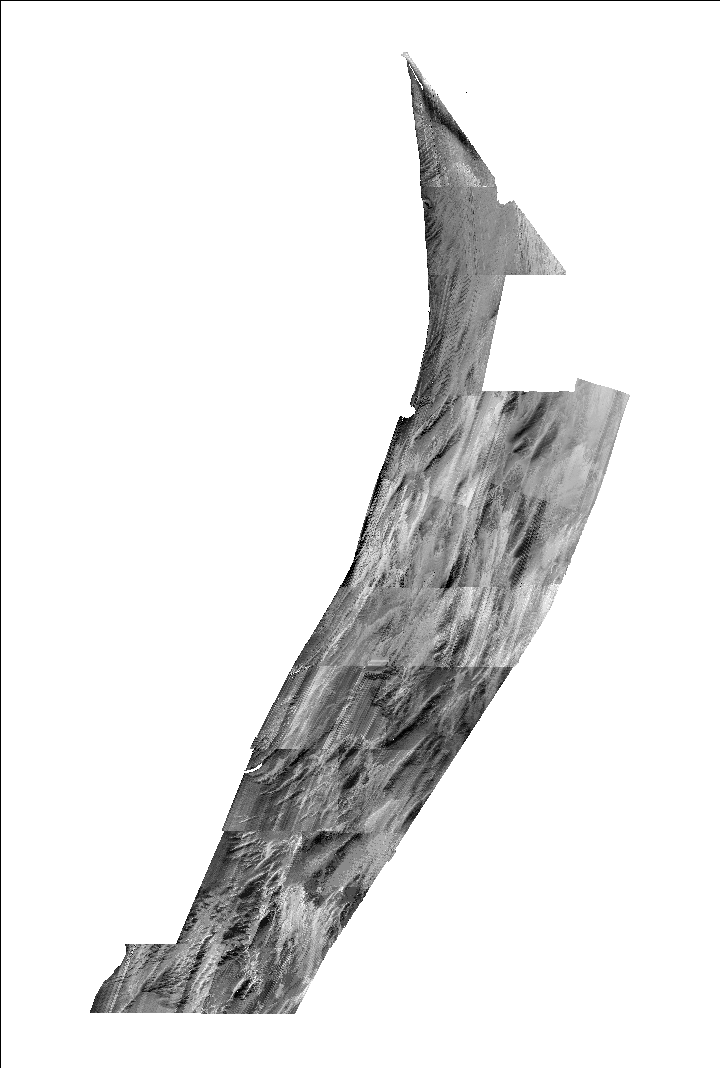
    These hydrographic reports and data provided valuable information on the source RESON 7125 MBES backscatter data that went into these backscatter mosaics. The data were acquired between 2006 and 2011 by SAIC for NOAA aboard M/V Atlantic Surveyor. A hull-mounted RESON SeaBat 7125(200 and 400 kHz) was used to acquire the multibeam echosounder data. Below is a list of references for the individual H-survey descriptive reports that used the Reson 7125 Seabat sonar. Survey bathymetry data and descriptive reports can be downloaded through the NGDC's Interactive Map Interface to NOS Data and Products (http://maps.ngdc.noaa.gov/viewers/bathymetry/?layers=nos_hydro&minx=-200&maxx=-50&miny=10&maxy=70). National Oceanic and Atmospheric Administration, 2009, Descriptive report for survey H12001, Project No. OPR-D302-SA-09: National Ocean Service, National Oceanic and Atmospheric Administration, SAIC Doc 10-TR-001, accessed September 12, 2014 at http://surveys.ngdc.noaa.gov/mgg/NOS/coast/H12001-H14000/H12001/DR/H12001.pdf National Oceanic and Atmospheric Administration, 2010, Descriptive report for survey H12002, Project No. OPR-D302-SA-09: National Ocean Service, National Oceanic and Atmospheric Administration, SAIC Doc 10-TR-002, accessed September 12, 2014 at http://surveys.ngdc.noaa.gov/mgg/NOS/coast/H12001-H14000/H12002/DR/H12002.pdf National Oceanic and Atmospheric Administration, 2010, Descriptive report for survey H12003, Project No. OPR-D302-SA-09: National Ocean Service, National Oceanic and Atmospheric Administration, SAIC Doc 10-TR-003, accessed September 12, 2014 at http://surveys.ngdc.noaa.gov/mgg/NOS/coast/H12001-H14000/H12003/DR/H12003.pdf National Oceanic and Atmospheric Administration, 2010, Descriptive report for survey H12091, Project No. OPR-D302-SA-09: National Ocean Service, National Oceanic and Atmospheric Administration, SAIC Doc 10-TR-004, accessed September 12, 2014 at http://surveys.ngdc.noaa.gov/mgg/NOS/coast/H12001-H14000/H12091/DR/H12091.pdf National Oceanic and Atmospheric Administration, 2010, Descriptive report for survey H12092, Project No. OPR-D302-SA-09: National Ocean Service, National Oceanic and Atmospheric Administration, SAIC Doc 10-TR-030, accessed September 12, 2014 at http://surveys.ngdc.noaa.gov/mgg/NOS/coast/H12001-H14000/H12092/DR/H12092.pdf National Oceanic and Atmospheric Administration, 2010, Descriptive report for survey H12093, Project No. OPR-D302-SA-09: National Ocean Service, National Oceanic and Atmospheric Administration, SAIC Doc 11-TR-001, accessed September 12, 2014 at http://surveys.ngdc.noaa.gov/mgg/NOS/coast/H12001-H14000/H12093/DR/H12093.pdf National Oceanic and Atmospheric Administration, 2010, Descriptive report for survey H12094, Project No. OPR-D302-SA-09: National Ocean Service, National Oceanic and Atmospheric Administration, SAIC Doc 10-TR-040, accessed September 12, 2014 at http://surveys.ngdc.noaa.gov/mgg/NOS/coast/H12001-H14000/H12094/DR/H12094.pdf National Oceanic and Atmospheric Administration, 2011, Descriptive report for survey H12160, Project No. OPR-D302-KR-10: National Ocean Service, National Oceanic and Atmospheric Administration, SAIC Doc 11-TR-005, accessed September 12, 2014 at http://surveys.ngdc.noaa.gov/mgg/NOS/coast/H12001-H14000/H12160/DR/H12160.pdf National Oceanic and Atmospheric Administration, 2011, Descriptive report for survey H12336, Project No. OPR-D302-KR-11: National Ocean Service, National Oceanic and Atmospheric Administration, SAIC Doc 11-TR-030, accessed September 12, 2014 at http://surveys.ngdc.noaa.gov/mgg/NOS/coast/H12001-H14000/H12336/DR/H12336.pdf National Oceanic and Atmospheric Administration, 2011, Descriptive report for survey H12337, Project No. OPR-D302-KR-11: National Ocean Service, National Oceanic and Atmospheric Administration, SAIC Doc 12-TR-003, accessed September 12, 2014 at http://surveys.ngdc.noaa.gov/mgg/NOS/coast/H12001-H14000/H12337/DR/H12337.pdf National Oceanic and Atmospheric Administration, 2011, Descriptive report for survey H12338, Project No. OPR-D302-KR-11: National Ocean Service, National Oceanic and Atmospheric Administration, SAIC Doc 12-TR-004, accessed September 12, 2014 at http://surveys.ngdc.noaa.gov/mgg/NOS/coast/H12001-H14000/H12338/DR/H12338.pdf National Oceanic and Atmospheric Administration, 2011, Descriptive report for survey H12339, Project No. OPR-D302-KR-11: National Ocean Service, National Oceanic and Atmospheric Administration, SAIC Doc 12-TR-005, accessed September 12, 2014 at http://surveys.ngdc.noaa.gov/mgg/NOS/coast/H12001-H14000/H12339/DR/H12339.pdf
  2. How were the data generated, processed, and modified?
    Date: 25-Aug-2014 (process 1 of 9)
    Semi-raw MBES data were obtained from NGDC by request through the NOS Hydrographic data manager, (LTJG David Rodziewicz, NOAA Corps) and through Rebecca T. Quintal of Leidos (formerly SAIC). Semi-raw means that the data have some offsets and corrections applied (i.e. tides, atitude, and positioning), but the data are still in the native Reson acquisition format. NOAA and SAIC were able to supply .gsf format files for 20 of the 23 H-surveys requested. Quality Positioning Services (QPS) Fledermaus FMGeocoder Toolbox (FMGT) software (version 7.4.1) was used to import the semi-raw MBES data and extract the backscatter. This process step and all of the following process steps were completed by the following Process Contact: Person who carried out this activity:
    Elizabeth Pendleton
    U.S. Geological Survey
    Geologist
    U.S. Geological Survey
    Woods Hole, MA

    (508) 548-8700x2259 (voice)
    (508)-457-2310 (FAX)
    ependleton@usgs.gov
    Date: 26-Aug-2014 (process 2 of 9)
    The 20 hydrographic surveys were processed individually in FMGT to allow modification of processing parameters among surveys (i.e. modification of ocean absorption coefficients). All the MBES backscatter data were processed as uncalibrated, beam-averaged, logarithmic space (dB) data in either Reson 8101 or 7125 MBES data. Ocean absorption coefficients were not modified for the Reson 8101 data, but the Reson 7125 data were processed with ocean absorption coefficients between 70 and 120, based on information in a technical note published by QPS Fledermaus FMGT developers (https://confluence.qps.nl/display/KBE/Technical+Note+3%3A+Absorption+coefficient). The best ocean absorption coefficient was arrived at by testing a few lines at a time and estimating water temperature, salinity, and sonar frequency.
    Date: 31-Aug-2014 (process 3 of 9)
    After data were imported to FMGT, the backscatter was processed based on the user defined inputs described in the previous step and a mosaic was made for the entire survey by defining a mosaic resolution (2-m for all 20 surveys) and bounding extents (based on the survey tracklines). The processing steps of FMGT are not complex and user-input is limited, but the computational time for processing a single survey from import to processing to mosaic can take up to 24 hours to complete on a 64-bit computer with 4 processers and 12.0 GB of RAM.
    Date: 31-Aug-2014 (process 4 of 9)
    After satisfactory mosaic images for each survey were produced with FMGT, survey mosaics were exported as 2-m per pixel GeoTIFF images. The native horizontal coordinate system was GCS, NAD83, so the GeoTIFFs were reprojected in ArcMap (version 10.2) using the NAD83_to_WGS84_5 transformation from GCS to UTM Zone 18N. A .tfw was also created for each GeoTIFF in ArcMAP
    Date: 31-Aug-2014 (process 5 of 9)
    Because the data were collected at a set-line spacing of 40-m, some gaps between adjacent lines existed in areas shallower than ~ 10-meters. Matlab (R2014a) was used to fill null values (gaps between adjacent lines and small data drop outs in backscatter) in the GeoTIFFS by interpolating backscatter values from surrounding pixels (f(x) inpaintNaNs). Surveys with an average depth greater than 10-m did not require much interpolation. The background of each image was given a value of 253, so that the background would not be interpolated. The edges of the backscatter mosaic were trimmed in Photoshop (version CS6) to remove interpolation artifacts and trackline dangles.
    Date: 02-Mar-2016 (process 6 of 9)
    Edits to the metadata were made to fix any errors that MP v 2.9.30 flagged. This is necessary to enable the metadata to be successfully harvested for various data catalogs. In some cases, this meant adding text "Information unavailable" or "Information unavailable from original metadata" for those required fields that were left blank. Fix publication dates that were ranges and removed empty elements that were unnecesary for the dataset. The links to download the data had to be fixed. The metadata date (but not the metadata creator) was edited to reflect the date of these changes. The metadata available from a harvester may supersede metadata bundled within a download file. Compare the metadata dates to determine which metadata file is most recent. Person who carried out this activity:
    U.S. Geological Survey
    Attn: VeeAnn A. Cross
    Marine Geologist
    384 Woods Hole Rd.
    Woods Hole, MA

    508-548-8700 x2251 (voice)
    508-457-2310 (FAX)
    vatnipp@usgs.gov
    Date: 20-Jul-2018 (process 7 of 9)
    USGS Thesaurus keywords added to the keyword section. Person who carried out this activity:
    U.S. Geological Survey
    Attn: VeeAnn A. Cross
    Marine Geologist
    384 Woods Hole Road
    Woods Hole, MA

    508-548-8700 x2251 (voice)
    508-457-2310 (FAX)
    vatnipp@usgs.gov
    Date: 18-Nov-2019 (process 8 of 9)
    Crossref DOI link was added as the first link in the metadata. Person who carried out this activity:
    U.S. Geological Survey
    Attn: VeeAnn A. Cross
    Marine Geologist
    384 Woods Hole Road
    Woods Hole, MA

    508-548-8700 x2251 (voice)
    508-457-2310 (FAX)
    vatnipp@usgs.gov
    Date: 08-Sep-2020 (process 9 of 9)
    Added keywords section with USGS persistent identifier as theme keyword. Person who carried out this activity:
    U.S. Geological Survey
    Attn: VeeAnn A. Cross
    Marine Geologist
    384 Woods Hole Road
    Woods Hole, MA

    508-548-8700 x2251 (voice)
    508-457-2310 (FAX)
    vatnipp@usgs.gov
  3. What similar or related data should the user be aware of?
    Organization, International Hydrographic, 2008, IHO Standards for Hydrographic Surveys: Special Publication 44, International Hydrographic Bureau, Monaco.

    Online Links:


How reliable are the data; what problems remain in the data set?

  1. How well have the observations been checked?
  2. How accurate are the geographic locations?
    Data collected under contract with NOAA for Nautical Charting must conform to IHO (International Hydrographic Organization) S-44 standards, which is 5-meters + 5% of water depth, horizontally in areas where under-keel clearance is of concern. This ensures that any sounding that falls outside of the maximum allowable horizontal position offset will not be used in depth calculations. Positioning confidence checks are performed daily during hydrographic surveys for NOAA and these checks can be viewed for the individual descriptive reports (see the source data for links to reports). Because MBES backscatter is co-located with the MBES bathymetry, the horizontal accuracies are the same.
  3. How accurate are the heights or depths?
  4. Where are the gaps in the data? What is missing?
    These images include Reson 8101 and 7125 MBES backscatter collected during 20 M/V Atlantic Surveyor cruises conducted by SAIC for the purposes of updating NOAA nautical charts. The individual hydrographic survey grids can be downloaded by visiting NGDC's Interactive Map Interface to NOS Data and Products: <http://www.ngdc.noaa.gov/mgg/bathymetry/hydro.html> There are 23 H-surveys in the bathymetric grid, but only 20 H-surveys could be obtained in .gsf format for backscatter extraction. NOAA was not able to provide .gsf format MBES data for H-surveys H11554, H11555, and H11650.
  5. How consistent are the relationships among the observations, including topology?
    These backscatter mosaic images were created from 20 NOAA-NOS multibeam echosounder (MBES) datasets. NOAA/NOS publishes the bathymetry data in .bag format through NGDC Interactive Map Interface to NOS Data and Products <http://www.ngdc.noaa.gov/mgg/bathymetry/hydro.html>. However, MBES backscatter data are not published and even sidescan sonar datasets are limited within this area (only 9 of 23 sidescan H-survey datasets are published through NGDC). In order to create a seamless backscatter mosaic, 20 of the 23 MBES surveys were obtained in their semi-raw form (.gsf format) and were processed to extract backscatter using Quality Positioning Services (QPS) Fledermaus FMGeocoder Toolbox (FMGT) software . All individual mosaics follow the same color convention: Low-backscatter is represented by dark tones (low values) and high-backscatter is represented by bright tones (high values). A DN value of 200 is not necessarily equal among surveys. The file naming convention of the TIFF images follows the Hydrograpic Survey number assigned by NOAA and SAIC.

How can someone get a copy of the data set?

Are there legal restrictions on access or use of the data?
Access_Constraints None
Use_Constraints Public domain data from the U.S. Government are freely redistributable with proper metadata and source attribution. Please recognize the U.S. Geological Survey (USGS) as the source of this information.
  1. Who distributes the data set? (Distributor 1 of 1)
    Elizabeth A. Pendleton
    U.S. Geological Survey
    Geologist
    384 Woods Hole Rd.
    Woods Hole, MA

    (508) 548-8700x2259 (voice)
    (508) 457-2310 (FAX)
    ependleton@usgs.gov
  2. What's the catalog number I need to order this data set? USGS Open-File Report 2014-1262 backscatter images from the Delmarva Peninsula area (NOS_2m_backscatter_TIFFs.zip). The zip file contains the following TIFF images: H11647_2m.tif, H11648_2m.tif, H11649_2m.tif, H11872_2m.tif, H11873_2m.tif, H11874_2m.tif, H11992_2m.tif, H12001_2m.tif, H12002_2m.tif, H12003_2m.tif, H12091_2m.tif, H12092_2m.tif, H12093_2m.tif, H12094_2m.tif, H12160_2m.tif, H12161_2m.tif, H12336_2m.tif, H12337_2m.tif, H12338_2m.tif, and H12339_2m.tif. Each image has a TIFF world file, with the same image prefix name, with the extension tfw. The browse graphic PNG file (BS_all.png) and the FGDC CSDGM metadata files (Hsurvey_backscatter.xml.html, Hsurvey_backscatter.xml.txt, Hsurvey_backscatter.xml.xml, Hsurvey_backscatter.xml_faq.html)are also in the zip file.
  3. What legal disclaimers am I supposed to read?
    Neither the U.S. Government, the Department of the Interior, the U.S. Geological Survey (USGS), National Oceanic and Atmospheric Administration (NOAA), nor any of their employees, contractors, or subcontractors, make any warranty, express or implied, nor assume any legal liability or responsibility for the accuracy, completeness, or usefulness of any information, apparatus, product, or process disclosed, nor represent that its use would not infringe on privately owned rights. The act of distribution shall not constitute any such warranty, and no responsibility is assumed by the USGS or NOAA in the use of these data or related materials. Any use of trade, product, or firm names is for descriptive purposes only and does not imply endorsement by the U.S. Government.
  4. How can I download or order the data?
  5. Is there some other way to get the data?
    none
  6. What hardware or software do I need in order to use the data set?
    The images contained in the ZIP file are available as GeoTIFF images with world files. To utilize these data, the user must have an image viewer, or an image processing or GIS software package capable of importing a TIFF image.

Who wrote the metadata?

Dates:
Last modified: 18-Mar-2024
Metadata author:
Elizabeth A. Pendleton
U.S. Geological Survey
Geologist
U.S. Geological Survey
Woods Hole, MA
USA

508-548-8700 x2259 (voice)
508-457-2310 (FAX)
whsc_data_contact@usgs.gov
Contact_Instructions:
The metadata contact email address is a generic address in the event the person is no longer with USGS. (updated on 20240318)
Metadata standard:
FGDC Content Standards for Digital Geospatial Metadata (FGDC-STD-001-1998)

This page is <https://cmgds.marine.usgs.gov/catalog/whcmsc/open_file_report/ofr2014-1262/Hsurvey_backscatter.xml.faq.html>
Generated by mp version 2.9.51 on Mon Mar 25 16:05:45 2024