Location of Sea-Floor Photographs Acquired During U.S. Geological Survey (USGS) Cruise 2014-046-FA in Narragansett Bay (Geographic, WGS 84)

Metadata also available as - [Questions & Answers] - [Parseable text] - [XML]

Metadata:

Identification_Information:
Citation:
Citation_Information:
Originator: U.S. Geological Survey
Publication_Date: 2015
Title:
Location of Sea-Floor Photographs Acquired During U.S. Geological Survey (USGS) Cruise 2014-046-FA in Narragansett Bay (Geographic, WGS 84)
Edition: 1.0
Geospatial_Data_Presentation_Form: vector digital data
Series_Information:
Series_Name: Open-File Report
Issue_Identification: 2015-1149
Publication_Information:
Publication_Place: Woods Hole Coastal and Marine Science Center, Woods Hole, MA
Publisher: U.S. Geological Survey, Coastal and Marine Geology Program
Online_Linkage: https://doi.org/10.3133/ofr20151149
Online_Linkage: Online_Linkage: Online_Linkage: Online_Linkage: Larger_Work_Citation:
Citation_Information:
Originator: K.Y. McMullen
Originator: L.J. Poppe
Originator: D.S. Blackwood
Originator: M.J. Nardi
Originator: M.A. Andring
Publication_Date: 2015
Title:
Sea-floor morphology and sedimentary environments in southern Narragansett Bay, Rhode Island
Edition: 1.0
Series_Information:
Series_Name: Open-File Report
Issue_Identification: 2015-1149
Publication_Information:
Publication_Place: Reston, VA
Publisher: U.S. Geological Survey
Other_Citation_Details: DVD-ROM
Online_Linkage: https://doi.org/10.3133/ofr20151149
Online_Linkage: https://pubs.usgs.gov/of/2015/1149/
Description:
Abstract:
The U.S. Geological Survey (USGS), in cooperation with the National Oceanic and Atmospheric Administration (NOAA), is producing detailed geologic maps of the coastal sea floor. Bathymetric data, originally collected by NOAA for charting purposes, provide a framework for research and management activities along southern Narragansett Bay, show the composition and terrain of the seabed, and provide information on sediment transport and benthic habitat. During September 2014, bottom photographs and surficial sediment data were acquired as part of a ground-truth reconnaissance survey of this area. Interpretations were derived from the multibeam-echosounder, sedimentary, and photographic data collected in Narragansett Bay. For more information on the ground-truth survey see https://cmgds.marine.usgs.gov/fan_info.php?fan=2014-046-FA.
Purpose:
The purpose of this dataset is to release the locations and identifiers of 103 bottom photographs collected at 21 stations based on topographic data of the sea floor in Narragansett Bay. The photos were collected with a Van Veen grab sampler modified to carry still and video camera systems (small SEABOSS) during USGS survey 2014-046-FA, in September 2014.
Time_Period_of_Content:
Time_Period_Information:
Range_of_Dates/Times:
Beginning_Date: 20140915
Ending_Date: 20140916
Currentness_Reference: ground condition
Status:
Progress: Complete
Maintenance_and_Update_Frequency: None planned
Spatial_Domain:
Bounding_Coordinates:
West_Bounding_Coordinate: -71.431541
East_Bounding_Coordinate: -71.316731
North_Bounding_Coordinate: 41.467492
South_Bounding_Coordinate: 41.423971
Keywords:
Theme:
Theme_Keyword_Thesaurus: USGS Metadata Identifier
Theme_Keyword: USGS:ec1ffd93-d7f7-43ab-ac52-e6c84ed4bc78
Theme:
Theme_Keyword_Thesaurus: None
Theme_Keyword: U.S. Geological Survey
Theme_Keyword: USGS
Theme_Keyword: Coastal and Marine Geology Program
Theme_Keyword: CMGP
Theme_Keyword: Woods Hole Coastal and Marine Science Center
Theme_Keyword: WHCMSC
Theme_Keyword: R/V Rafael
Theme_Keyword: Esri Shapefile
Theme_Keyword: bottom photograph locations
Theme_Keyword: photo locations
Theme_Keyword: stations
Theme_Keyword: sea floor
Theme_Keyword: Field Activity Number 2014-046-FA
Theme_Keyword: ground-truth
Theme_Keyword: point shapefile
Theme_Keyword: SEABOSS
Theme:
Theme_Keyword_Thesaurus: ISO 19115 Topic Category
Theme_Keyword: location
Theme_Keyword: oceans
Theme_Keyword: geoscientificInformation
Theme:
Theme_Keyword_Thesaurus: USGS Thesaurus
Theme_Keyword: navigational data
Theme_Keyword: underwater photography
Theme_Keyword: geospatial datasets
Place:
Place_Keyword_Thesaurus: None
Place_Keyword: Narragansett Bay
Place_Keyword: North America
Place_Keyword: United States
Place_Keyword: Atlantic Ocean
Place_Keyword: U.S. East Coast
Place_Keyword: Rhode Island
Access_Constraints: None
Use_Constraints:
Public domain data from the U.S. Government are freely redistributable with proper metadata and source attribution. Please recognize the U.S. Geological Survey (USGS) as the source of this information.
Point_of_Contact:
Contact_Information:
Contact_Person_Primary:
Contact_Person: Katherine McMullen
Contact_Organization: U.S. Geological Survey
Contact_Position: Field and Laboratory Technician
Contact_Address:
Address_Type: mailing and physical address
Address: 384 Woods Hole Road
City: Woods Hole
State_or_Province: MA
Postal_Code: 02543-1598
Country: USA
Contact_Voice_Telephone: (508) 548-8700 x2277
Contact_Facsimile_Telephone: (508) 457-2310
Contact_Electronic_Mail_Address: kmcmullen@usgs.gov
Browse_Graphic:
Browse_Graphic_File_Name: Browse_Graphic_File_Description:
Thumbnail image showing location and extent of bottom photo locations in Narragansett Bay
Browse_Graphic_File_Type: GIF
Native_Data_Set_Environment:
Microsoft Windows Vista Version 6.1 (Build 7601) Service Pack 1; ESRI ArcCatalog 9.3.1.4095
Cross_Reference:
Citation_Information:
Originator: D.S. Blackwood
Originator: K.F. Parolski
Publication_Date: 2001
Title: Seabed observation and sampling system
Edition: 1.0
Series_Information:
Series_Name: Sea Technology
Issue_Identification: v. 42, no. 2, p. 39-43
Cross_Reference:
Citation_Information:
Originator: K.Y. McMullen
Originator: L.J. Poppe
Originator: R.P. Signell
Originator: J.F. Denny
Originator: J.M. Crocker
Originator: A.L. Beaver
Originator: P.T. Schattgen
Publication_Date: 2007
Title:
Surficial geology in central Narragansett Bay, Rhode Island: Interpretations of sidescan sonar and multibeam bathymetry
Edition: 1.0
Series_Information:
Series_Name: Open-File Report
Issue_Identification: 2006-1199
Publication_Information:
Publication_Place: Reston, VA
Publisher: U.S. Geological Survey
Online_Linkage: https://pubs.usgs.gov/of/2006/1199/
Data_Quality_Information:
Attribute_Accuracy:
Attribute_Accuracy_Report: All attributes were checked in a consistent manner.
Logical_Consistency_Report:
No additional checks for topological consistency were performed on this data.
Completeness_Report:
Locations of all still photographs of the sea floor in the Narragansett Bay H12324 study area collected during the R/V RAFAEL cruise 2014-046 were included in this dataset. Other photographs were collected during cruise 2014-046 that lie outside the study area. Navigation was not saved in Hypack files during the time two pictures were taken (324-21a and 324-21b), however the navigation was recorded on video and was obtained from video for these two locations.
Positional_Accuracy:
Horizontal_Positional_Accuracy:
Horizontal_Positional_Accuracy_Report:
Navigation was by differential GPS. Although GPS gave the ship's position rather than that of the SEABOSS, water depths were generally shallow and scope of the cable minimal. Therefore, SEABOSS offset from the antenna was less than 10 m. The time on the camera was synchronized with GPS and verified by comparing the time in the Exif header with a photograph of the written GPS time. A one-second offset was found between the camera and GPS time, however this is well within the navigation error and was not corrected.
Lineage:
Source_Information:
Source_Citation:
Citation_Information:
Originator: U.S. Geological Survey
Publication_Date: 2015
Title: SEABOSS photographs
Type_of_Source_Media: photographs
Source_Time_Period_of_Content:
Time_Period_Information:
Range_of_Dates/Times:
Beginning_Date: 20140915
Ending_Date: 20140916
Source_Currentness_Reference: ground condition
Source_Citation_Abbreviation: SEABOSS
Source_Contribution: Photographs of the sea floor
Process_Step:
Process_Description:
Time recorded in Exif headers of the photographs was matched with navigation data and manually entered into an Excel spreadsheet (2010 version, but saved as an Excel 97-2003 Worksheet) and other fields were added and populated. Navigation was not saved in Hypack files during the time two pictures were taken (324-21a and 324-21b), however the navigation was recorded on video and was obtained from video for these two locations.
Process_Date: 2014
Source_Produced_Citation_Abbreviation: 2014-046_324botphotos.xls
Process_Contact:
Contact_Information:
Contact_Person_Primary:
Contact_Person: Katherine McMullen
Contact_Organization: U.S. Geological Survey
Contact_Position: Field and Labratory Technician
Contact_Address:
Address_Type: mailing and physical address
Address: 384 Woods Hole Road
City: Woods Hole
State_or_Province: MA
Postal_Code: 02543-1598
Country: USA
Contact_Voice_Telephone: (508) 548-8700 x2277
Contact_Facsimile_Telephone: (508) 457-2310
Contact_Electronic_Mail_Address: kmcmullen@usgs.gov
Process_Step:
Process_Description:
ArcMap 9.3.1 was used to create a shapefile from the Excel file using Tools-Add XY Data to import the excel file with Longitude in the x field and Latitude in the y field. This file was changed to a shapefile by right clicking on the name, selecting Data-Export Data, exporting all features using the layer's source data coordinate system.
Source_Used_Citation_Abbreviation: 2014-046_324botphotos.xls
Process_Date: 2014
Source_Produced_Citation_Abbreviation: 2014-046_324botphotos.shp
Process_Contact:
Contact_Information:
Contact_Person_Primary:
Contact_Person: Katherine McMullen
Contact_Organization: U.S. Geological Survey
Contact_Position: Field and Laboratory Technician
Contact_Address:
Address_Type: mailing and physical address
Address: 384 Woods Hole Road
City: Woods Hole
State_or_Province: MA
Postal_Code: 02543
Country: USA
Contact_Voice_Telephone: 508-548-8700 x2277
Contact_Facsimile_Telephone: 508-457-2310
Contact_Electronic_Mail_Address: kmcmullen@usgs.gov
Process_Step:
Process_Description:
Edits to the metadata were made to fix any errors that MP v 2.9.36 flagged. This is necessary to enable the metadata to be successfully harvested for various data catalogs. In some cases, this meant adding text "Information unavailable" or "Information unavailable from original metadata" for those required fields that were left blank. Other minor edits were probably performed (title, publisher, publication place, etc.). Attempted to modify http to https where appropriate. The metadata date (but not the metadata creator) was edited to reflect the date of these changes. The metadata available from a harvester may supersede metadata bundled within a download file. Compare the metadata dates to determine which metadata file is most recent.
Process_Date: 20170509
Process_Contact:
Contact_Information:
Contact_Organization_Primary:
Contact_Organization: U.S. Geological Survey
Contact_Person: VeeAnn A. Cross
Contact_Position: Marine Geologist
Contact_Address:
Address_Type: Mailing and Physical
Address: 384 Woods Hole Road
City: Woods Hole
State_or_Province: MA
Postal_Code: 02543-1598
Contact_Voice_Telephone: 508-548-8700 x2251
Contact_Facsimile_Telephone: 508-457-2310
Contact_Electronic_Mail_Address: vatnipp@usgs.gov
Process_Step:
Process_Description: USGS Thesaurus keywords added to the keyword section.
Process_Date: 20180720
Process_Contact:
Contact_Information:
Contact_Organization_Primary:
Contact_Organization: U.S. Geological Survey
Contact_Person: VeeAnn A. Cross
Contact_Position: Marine Geologist
Contact_Address:
Address_Type: Mailing and Physical
Address: 384 Woods Hole Road
City: Woods Hole
State_or_Province: MA
Postal_Code: 02543-1598
Contact_Voice_Telephone: 508-548-8700 x2251
Contact_Facsimile_Telephone: 508-457-2310
Contact_Electronic_Mail_Address: vatnipp@usgs.gov
Process_Step:
Process_Description: Crossref DOI link was added as the first link in the metadata.
Process_Date: 20191118
Process_Contact:
Contact_Information:
Contact_Organization_Primary:
Contact_Organization: U.S. Geological Survey
Contact_Person: VeeAnn A. Cross
Contact_Position: Marine Geologist
Contact_Address:
Address_Type: Mailing and Physical
Address: 384 Woods Hole Road
City: Woods Hole
State_or_Province: MA
Postal_Code: 02543-1598
Contact_Voice_Telephone: 508-548-8700 x2251
Contact_Facsimile_Telephone: 508-457-2310
Contact_Electronic_Mail_Address: vatnipp@usgs.gov
Process_Step:
Process_Description:
Added keywords section with USGS persistent identifier as theme keyword.
Process_Date: 20200908
Process_Contact:
Contact_Information:
Contact_Organization_Primary:
Contact_Organization: U.S. Geological Survey
Contact_Person: VeeAnn A. Cross
Contact_Position: Marine Geologist
Contact_Address:
Address_Type: Mailing and Physical
Address: 384 Woods Hole Road
City: Woods Hole
State_or_Province: MA
Postal_Code: 02543-1598
Contact_Voice_Telephone: 508-548-8700 x2251
Contact_Facsimile_Telephone: 508-457-2310
Contact_Electronic_Mail_Address: vatnipp@usgs.gov
Spatial_Data_Organization_Information:
Direct_Spatial_Reference_Method: Vector
Point_and_Vector_Object_Information:
SDTS_Terms_Description:
SDTS_Point_and_Vector_Object_Type: Entity point
Point_and_Vector_Object_Count: 103
Spatial_Reference_Information:
Horizontal_Coordinate_System_Definition:
Geographic:
Latitude_Resolution: 0.000001
Longitude_Resolution: 0.000001
Geographic_Coordinate_Units: Decimal degrees
Geodetic_Model:
Horizontal_Datum_Name: D_WGS_1984
Ellipsoid_Name: WGS_1984
Semi-major_Axis: 6378137.000000
Denominator_of_Flattening_Ratio: 298.257224
Entity_and_Attribute_Information:
Detailed_Description:
Entity_Type:
Entity_Type_Label: 2014-046_324botphotos
Entity_Type_Definition: Shapefile Attribute Table
Entity_Type_Definition_Source: ESRI
Attribute:
Attribute_Label: FID
Attribute_Definition: Internal feature number.
Attribute_Definition_Source: ESRI
Attribute_Domain_Values:
Unrepresentable_Domain:
Sequential unique whole numbers that are automatically generated.
Attribute:
Attribute_Label: Shape
Attribute_Definition: Feature geometry.
Attribute_Definition_Source: ESRI
Attribute_Domain_Values:
Unrepresentable_Domain: Coordinates defining the features.
Attribute:
Attribute_Label: STATION
Attribute_Definition: Sequential identifier assigned to each sample site
Attribute_Definition_Source: USGS
Attribute_Domain_Values:
Unrepresentable_Domain: Characters and numerics identifying sampling sites
Attribute:
Attribute_Label: PHOTO
Attribute_Definition:
Unique sequential identifier assigned to each photograph based on the station of collection.
Attribute_Definition_Source: USGS
Attribute_Domain_Values:
Unrepresentable_Domain: Characters and numerics identifying photos
Attribute:
Attribute_Label: DATE_
Attribute_Definition: Month, day, and year when the photograph was taken
Attribute_Definition_Source: USGS
Attribute_Domain_Values:
Unrepresentable_Domain: Character String: Months, days, and year as mm/dd/yyyy
Attribute:
Attribute_Label: LATITUDE
Attribute_Definition: Latitude coordinate of photo location, WGS 84
Attribute_Definition_Source: USGS
Attribute_Domain_Values:
Range_Domain:
Range_Domain_Minimum: 41.423971
Range_Domain_Maximum: 41.467492
Attribute_Units_of_Measure: Decimal degrees
Attribute_Measurement_Resolution: 0.000001
Attribute:
Attribute_Label: LONGITUDE
Attribute_Definition: Longitude coordinate of photo location, WGS 84
Attribute_Definition_Source: USGS
Attribute_Domain_Values:
Range_Domain:
Range_Domain_Minimum: -71.431542
Range_Domain_Maximum: -71.316731
Attribute_Units_of_Measure: Decimal degrees
Attribute_Measurement_Resolution: 0.000001
Attribute:
Attribute_Label: DEVICE
Attribute_Definition: Equipment used to collect the photograph
Attribute_Definition_Source: USGS
Attribute_Domain_Values:
Enumerated_Domain:
Enumerated_Domain_Value: SMALL SEABOSS GRAB
Enumerated_Domain_Value_Definition: USGS Small Seabed Observation and Sampling System (SEABOSS)
Enumerated_Domain_Value_Definition_Source: USGS
Attribute:
Attribute_Label: CRUISEID
Attribute_Definition: Cruise identifier
Attribute_Definition_Source: USGS
Attribute_Domain_Values:
Enumerated_Domain:
Enumerated_Domain_Value: 2014-046-FA
Enumerated_Domain_Value_Definition:
Field activity serial number assigned by Woods Hole Coastal and Marine Science Center data archives. In the format yyyy-xxx-FA where yyyy is the year, xxx is the cruise number of that year. FA indicates field activity.
Enumerated_Domain_Value_Definition_Source: USGS
Attribute:
Attribute_Label: PROJECTID
Attribute_Definition: Name of project for which the photographs were taken.
Attribute_Definition_Source: USGS
Attribute_Domain_Values:
Enumerated_Domain:
Enumerated_Domain_Value: SURVEY H12324
Enumerated_Domain_Value_Definition: Project name assigned by scientist
Enumerated_Domain_Value_Definition_Source: USGS
Attribute:
Attribute_Label: PRINCIPAL
Attribute_Definition: Name of Chief scientist during the cruise
Attribute_Definition_Source: USGS
Attribute_Domain_Values:
Enumerated_Domain:
Enumerated_Domain_Value: KMCMULLEN
Enumerated_Domain_Value_Definition: Katherine McMullen
Enumerated_Domain_Value_Definition_Source: USGS
Attribute:
Attribute_Label: PHOTO_MR
Attribute_Definition: Relative disk location of medium-resolution photograph
Attribute_Definition_Source: USGS
Attribute_Domain_Values:
Unrepresentable_Domain: Location of image file
Attribute:
Attribute_Label: JDTIME
Attribute_Definition:
Date and time, as recorded in the EXIF header, when photo was taken in the format JJJ:HH:MM:SS where JJJ is the Julian day, HH is the hour, MM is the minute, and SS is the second. Time is in GMT and Julian day is the integer number representing the interval of time in days since January 1 of the year of collection.
Attribute_Definition_Source: Scientist
Attribute_Domain_Values:
Unrepresentable_Domain: Numerics separated by colons
Overview_Description:
Entity_and_Attribute_Overview:
Data layer attributes include date and position photograph was acquired; station and photograph identifiers. The naming convention for photographs is a 3-number location identification (324, referring to NOAA Survey H12324 in Narragansett Bay), dash, the station number, and a letter of the photograph at that station (multiple photos are often taken at a single location), an underscore, and the resolution of the photograph if it is not full resolution (mr for medium resolution, and tn for thumbnail). For instance, 324-14a_mr.jpg is a photograph from Survey H12324, station 14, photo a, medium resolution and is in JPEG format.
Medium resolution photographs can be hyperlinked in this shapefile. In order to effectively utilize this attribute in ArcGIS, the user must follow a couple of steps. First, the user must open the Layer Properties of the bottom photograph shapefile within ArcMap - select the Display tab - and click on the check box next to "Support Hyperlinks using field:" and the field selected from the dropdown menu needs to be "PHOTO_MR". The hyperlink is set to a document. Additionally, a hyperlink base must be supplied in the ArcMap document (mxd) to complete the full path to the images. This is accomplished from File - Document Properties. On the Summary tab there is a section for "Hyperlink base". The text supplied here needs to be the disk information preceding "data" in the full path to the image. If the data are being read from a DVD, this would be the drive letter such as F:\.
The Excel, shapefile, and comma-delimited text files have the same fields of information with the same headers as the shapefile attribute table.
Entity_and_Attribute_Detail_Citation: U.S. Geological Survey
Distribution_Information:
Distributor:
Contact_Information:
Contact_Person_Primary:
Contact_Person: Katherine McMullen
Contact_Organization: U.S. Geological Survey
Contact_Position: Field and Laboratory Technician
Contact_Address:
Address_Type: mailing and physical address
Address: 384 Woods Hole Road
City: Woods Hole
State_or_Province: MA
Postal_Code: 02543-1598
Country: USA
Contact_Voice_Telephone: (508) 548-8700 x2277
Contact_Facsimile_Telephone: (508) 457-2310
Contact_Electronic_Mail_Address: kmcmullen@usgs.gov
Resource_Description:
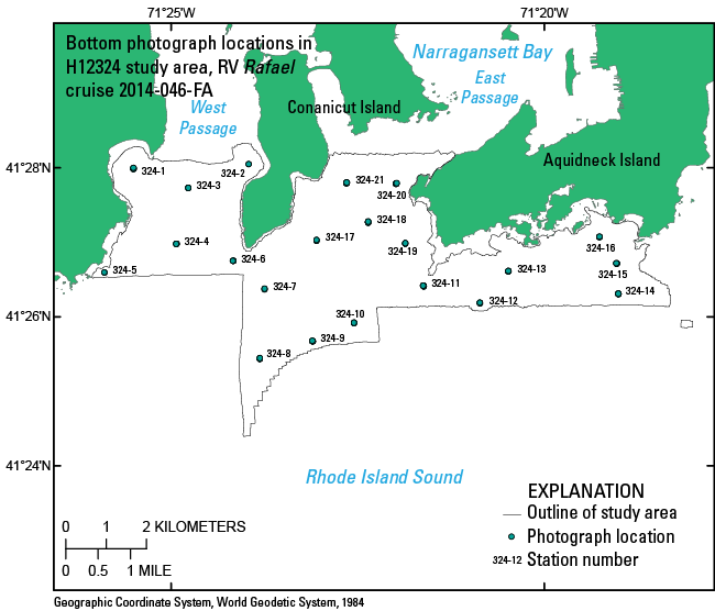
Downloadable Data - 2014-046_324botphotos.zip includes an Excel, text, and shape file of the bottom photograph locations along with a browse graphic and metadata.
Distribution_Liability:
Neither the U.S. Government, the Department of the Interior, nor the USGS, nor the National Oceanic and Atmospheric Administration (NOAA), nor any of their employees, contractors, or subcontractors, make any warranty, express or implied, nor assume any legal liability or responsibility for the accuracy, completeness, or usefulness of any information, apparatus, product, or process disclosed, nor represent that its use would not infringe on privately owned rights. The act of distribution shall not constitute any such warranty, and no responsibility is assumed by the USGS, or NOAA, in the use of these data or related materials. Any use of trade, product, or firm names is for descriptive purposes only and does not imply endorsement by the U.S. Government.
Standard_Order_Process:
Digital_Form:
Digital_Transfer_Information:
Format_Name: Shapefile
Format_Version_Number: ArcGIS 9.3.1
Format_Specification: Esri point shapefile
Format_Information_Content:
A zip file containing the geospatial data, metadata describing the data set, the comma-delimited text file and Excel 2003 (.xls) file of the photograph data, and a browse graphic showing the data layer coverage and extent.
File_Decompression_Technique: zip archive
Transfer_Size: 0.09
Digital_Transfer_Option:
Online_Option:
Computer_Contact_Information: Access_Instructions: Data are downloadable via the Internet
Offline_Option:
Offline_Media: DVD-ROM
Recording_Capacity:
Recording_Density: 4.75
Recording_Density_Units: Gbytes
Recording_Format: UDF
Digital_Form:
Digital_Transfer_Information:
Format_Name: XLS
Format_Version_Number: 2003
Format_Specification: MS Excel Format
Format_Information_Content:
Microsoft Excel file where the first record contains field headings contained in a zip file.
File_Decompression_Technique: no compression applied
Transfer_Size: 0.09
Digital_Transfer_Option:
Online_Option:
Computer_Contact_Information: Access_Instructions: Data are downloadable via the Internet
Offline_Option:
Offline_Media: DVD-ROM
Recording_Capacity:
Recording_Density: 4.75
Recording_Density_Units: Gbytes
Recording_Format: UDF
Digital_Form:
Digital_Transfer_Information:
Format_Name: CSV
Format_Version_Number: text file
Format_Specification: Comma Separated Value
Format_Information_Content:
Comma-delimited text file where the first record contains field headings. Data fields are comma separated. File contained in a zip file.
File_Decompression_Technique: no compression applied
Transfer_Size: 0.09
Digital_Transfer_Option:
Online_Option:
Computer_Contact_Information: Access_Instructions: Data are downloadable via the Internet
Offline_Option:
Offline_Media: DVD-ROM
Recording_Capacity:
Recording_Density: 4.75
Recording_Density_Units: Gbytes
Recording_Format: UDF
Fees: None
Technical_Prerequisites:
These data are available in Environmental Systems Research Institute (Esri) shapefile format. The user must have a program capable of reading a shapefile. A free data viewer, ArcGIS Explorer, capable of displaying the data is available from Esri at www.esri.com. The user must have software capable of uncompressing archived zip files, such as Winzip or Pkware. These data are also available as an Excel formatted (.xls) file. The user must have a software program capable of reading Excel files. These data are also available as a generic ASCII formatted text file. The user must have a software program capable of reading the comma-delimited data file.
Metadata_Reference_Information:
Metadata_Date: 20211116
Metadata_Contact:
Contact_Information:
Contact_Person_Primary:
Contact_Person: Katherine McMullen
Contact_Organization: U.S. Geological Survey
Contact_Position: Field and Laboratory Technician
Contact_Address:
Address_Type: mailing and physical address
Address: 384 Woods Hole Road
City: Woods Hole
State_or_Province: MA
Postal_Code: 02543-1598
Country: USA
Contact_Voice_Telephone: (508) 548-8700 x2277
Contact_Facsimile_Telephone: (508) 457-2310
Contact_Electronic_Mail_Address: whsc_data_contact@usgs.gov
Contact_Instructions:
The metadata contact email address is a generic address in the event the metadata contact is no longer with the USGS or the email is otherwise invalid.
Metadata_Standard_Name: FGDC Content Standards for Digital Geospatial Metadata
Metadata_Standard_Version: FGDC-STD-001-1998
Metadata_Time_Convention: local time
Metadata_Access_Constraints: None
Metadata_Use_Constraints: None

This page is <https://cmgds.marine.usgs.gov/catalog/whcmsc/open_file_report/ofr2015-1149/2014-046_324botphotosmeta.html>
Generated by mp version 2.9.50 on Tue Nov 16 10:06:52 2021