Polygon shapefile of the interpretation of the seabed geologic substrates in quadrangle 6 of the Stellwagen Bank National Marine Sanctuary region offshore of Boston, Massachusetts based on data collected by the U.S. Geological Survey from 1993-2004 (Geographic, NAD 83)

Metadata also available as - [Questions & Answers] - [Parseable text] - [XML]

Metadata:

Identification_Information:
Citation:
Citation_Information:
Originator: Page C. Valentine
Publication_Date: 2015
Title:
Polygon shapefile of the interpretation of the seabed geologic substrates in quadrangle 6 of the Stellwagen Bank National Marine Sanctuary region offshore of Boston, Massachusetts based on data collected by the U.S. Geological Survey from 1993-2004 (Geographic, NAD 83)
Edition: 1.0
Geospatial_Data_Presentation_Form: vector digital data
Series_Information:
Series_Name: Scientific Investigations Map
Issue_Identification: 3341
Publication_Information:
Publication_Place: Woods Hole Coastal and Marine Science Center, Woods Hole, MA
Publisher: U.S. Geological Survey, Coastal and Marine Geology Program
Online_Linkage: https://doi.org/10.3133/sim3341
Online_Linkage: https://pubs.er.usgs.gov/publication/sim3341
Larger_Work_Citation:
Citation_Information:
Originator: Page C. Valentine
Originator: Leslie B. Gallea
Publication_Date: 2015
Title:
Seabed maps showing topography, ruggedness, backscatter intensity, sediment mobility, and the distribution of geologic substrates in quadrangle 6 of the Stellwagen Bank National Marine Sanctuary region offshore of Boston, Massachusetts
Edition: 1.0
Series_Information:
Series_Name: Scientific Investigations Map
Issue_Identification: 3341
Publication_Information:
Publication_Place: Reston, VA
Publisher: U.S. Geological Survey
Online_Linkage: https://doi.org/10.3133/sim3341
Online_Linkage: https://pubs.er.usgs.gov/publication/sim3341
Description:
Abstract:
The U.S. Geological Survey (USGS), in cooperation with the National Oceanic and Atmospheric Administration's National Marine Sanctuary Program, has conducted seabed mapping and related research in the Stellwagen Bank National Marine Sanctuary region since 1993. The area is approximately 3,700 square kilometers (km2) and is subdivided into 18 quadrangles. Seven maps, at a scale of 1:25,000, of quadrangle 6 (211 km2) depict seabed topography, backscatter, ruggedness, geology, substrate mobility, mud content, and areas dominated by fine-grained or coarse-grained sand. Interpretations of bathymetric and seabed backscatter imagery, photographs, video, and grain-size analyses were used to create the geology-based maps. In all, data from 420 stations were analyzed, including sediment samples from 325 locations. The seabed geology map shows the distribution of 10 substrate types ranging from boulder ridges to immobile, muddy sand to mobile, rippled sand. Substrate types are defined on the basis of sediment grain-size composition, surficial morphology, sediment layering, and the mobility or immobility of substrate surfaces. This map series is intended to portray the major geological elements (substrates, features, processes) of environments within quadrangle 6. Additionally, these maps will be the basis for the study of the ecological requirements of invertebrate and vertebrate species that utilize these substrates and guide seabed management in the region.
Purpose:
This shapefile contains attribute fields that can be used to symbolically illustrate geologic substrate interpretation of the seabed in quadrangle 6 of the Stellwagen Bank National Marine Sanctuary (SBNMS) region. This interpretation is based on multibeam sonar bathymetry, multibeam backscatter imagery, video, photos, and grain-size analyses of samples collected from the seabed in the time period 1993-2004.
Time_Period_of_Content:
Time_Period_Information:
Range_of_Dates/Times:
Beginning_Date: 1993
Ending_Date: 2004
Currentness_Reference:
ground condition of original data upon which the interpretation is based.
Status:
Progress: Complete
Maintenance_and_Update_Frequency: As needed
Spatial_Domain:
Bounding_Coordinates:
West_Bounding_Coordinate: -70.222221
East_Bounding_Coordinate: -70.033333
North_Bounding_Coordinate: 42.322224
South_Bounding_Coordinate: 42.202778
Keywords:
Theme:
Theme_Keyword_Thesaurus: USGS Metadata Identifier
Theme_Keyword: USGS:4d6109c1-0bf5-4e3a-83ca-488e4418c1f5
Theme:
Theme_Keyword_Thesaurus: none
Theme_Keyword: U.S. Geological Survey
Theme_Keyword: USGS
Theme_Keyword: Coastal and Marine Geology Program
Theme_Keyword: CMGP
Theme_Keyword: Woods Hole Coastal and Marine Science Center
Theme_Keyword: WHCMSC
Theme_Keyword: Esri Shapefile
Theme_Keyword: interpretation
Theme_Keyword: seabed geology
Theme_Keyword: substrate distribution
Theme_Keyword: Scientific Investigations Map 3341
Theme_Keyword: polygon
Theme_Keyword: quadrangle 6
Theme_Keyword: geology
Theme_Keyword: geologic substrates
Theme_Keyword: sediment mobility
Theme_Keyword: substrate
Theme_Keyword: substrate mobility
Theme_Keyword: substrate grain size
Theme_Keyword: substrate mud content
Theme:
Theme_Keyword_Thesaurus: ISO 19115 Topic Category
Theme_Keyword: oceans
Theme_Keyword: geoscientificInformation
Theme_Keyword: environment
Theme:
Theme_Keyword_Thesaurus: USGS Thesaurus
Theme_Keyword: scientific interpretation
Theme_Keyword: sea-floor characteristics
Theme_Keyword: marine geology
Theme_Keyword: geospatial datasets
Place:
Place_Keyword_Thesaurus: none
Place_Keyword: Massachusetts
Place_Keyword: Boston, Massachusetts
Place_Keyword: Massachusetts Bay
Place_Keyword: Stellwagen Bank
Place_Keyword: Stellwagen Bank National Marine Sanctuary
Place_Keyword: U.S. east coast
Place_Keyword: United States
Place_Keyword: North America
Place_Keyword: Atlantic Ocean
Access_Constraints: None
Use_Constraints: The interpretation was completed at a map scale of 1:25,000.
Point_of_Contact:
Contact_Information:
Contact_Person_Primary:
Contact_Person: Page C. Valentine
Contact_Organization: U.S. Geological Survey
Contact_Position: Research Geologist
Contact_Address:
Address_Type: mailing and physical address
Address: 384 Woods Hole Rd.
City: Woods Hole
State_or_Province: MA
Postal_Code: 02543-1598
Country: USA
Contact_Voice_Telephone: (508) 548-8700 x2339
Contact_Facsimile_Telephone: (508) 457-2310
Contact_Electronic_Mail_Address: pvalentine@usgs.gov
Browse_Graphic:
Browse_Graphic_File_Name: http://pubs.usgs.gov/sim/3341/data/SIM3341_geol_interp.jpg
Browse_Graphic_File_Description:
Thumbnail image showing the interpreted bottom features within quadrangle 6 of the SBNMS region.
Browse_Graphic_File_Type: JPEG
Data_Set_Credit:
Public domain data from the U.S. Government are freely redistributable with proper metadata and source attribution. Please recognize the U.S. Geological Survey as the source of this information.
Native_Data_Set_Environment:
Microsoft Windows Vista Version 6.1 (Build 7601) Service Pack 1; ESRI ArcCatalog 9.3.1.4095
Cross_Reference:
Citation_Information:
Originator: Page C. Valentine
Originator: Leslie B. Gallea
Originator: Dann S. Blackwood
Originator: Erin R. Twomey
Publication_Date: 2010
Title:
Seabed photographs, sediment texture analyses, and sun-illuminated sea floor topography in the Stellwagen Bank National Marine Sanctuary region off Boston, Massachusetts
Edition: 1.0
Series_Information:
Series_Name: Data Series
Issue_Identification: 469
Publication_Information:
Publication_Place: Reston, VA
Publisher: U.S. Geological Survey
Online_Linkage: http://pubs.usgs.gov/ds/469/
Cross_Reference:
Citation_Information:
Originator: Page C. Valentine, editor
Publication_Date: 2005
Title:
Sea floor image maps showing topography, sun-illuminated topography, backscatter intensity, ruggedness, slope, and the distribution of boulder ridges and bedrock outcrops in the Stellwagen Bank National Marine Sanctuary region off Boston, Massachusetts
Edition: 1.0
Series_Information:
Series_Name: Scientific Investigations Map
Issue_Identification: 2840
Publication_Information:
Publication_Place: Reston, VA
Publisher: U.S. Geological Survey
Other_Citation_Details: DVD-ROM
Online_Linkage: http://pubs.usgs.gov/sim/2005/2840/
Data_Quality_Information:
Logical_Consistency_Report:
The interpretation was carried out by a single person and is consistent throughout the study area, quadrangle 6 of the SBNMS region. There should not be slivers between interpreted polygons, nor should the polygons have overlap.
Completeness_Report:
This interpretation reflects complete coverage of the study area, quadrangle 6 of the SBNMS region.
Positional_Accuracy:
Horizontal_Positional_Accuracy:
Horizontal_Positional_Accuracy_Report:
Navigation for all data upon which the interpretation was based used either differential GPS or GPS. These systems are assumed to have an accuracy better than 10 meters. Some of the data used in the interpretation relied on a towed system. Drift of the towed system was not accounted for. Additional inaccuracies are associated with how the interpretation was drawn in a freehand method. Based on this information, the interpretation is assumed to be accurate to within about 40 meters.
Lineage:
Source_Information:
Source_Citation:
Citation_Information:
Originator: Page C. Valentine
Originator: Leslie B. Gallea
Originator: Dann S. Blackwood
Originator: Erin R. Twomey
Publication_Date: 2010
Title:
Seabed photographs, sediment texture analyses, and sun-illuminated sea floor topography in the Stellwagen Bank National Marine Sanctuary region off Boston, Massachusetts
Edition: 1.0
Series_Information:
Series_Name: Data Series
Issue_Identification: 469
Publication_Information:
Publication_Place: Reston, VA
Publisher: U.S. Geological Survey
Online_Linkage: http://pubs.usgs.gov/ds/469/
Type_of_Source_Media: online
Source_Time_Period_of_Content:
Time_Period_Information:
Range_of_Dates/Times:
Beginning_Date: 1994
Ending_Date: 2004
Source_Currentness_Reference: ground condition of the originally collected data.
Source_Citation_Abbreviation: DS469
Source_Contribution:
Original photographic imagery and sediment grain size analyses were used to interpret the seabed geology of the study area.
Source_Information:
Source_Citation:
Citation_Information:
Originator: Page C. Valentine, editor
Publication_Date: 2005
Title:
Sea floor image maps showing topography, sun-illuminated topography, backscatter intensity, ruggedness, slope, and the distribution of boulder ridges and bedrock outcrops in the Stellwagen Bank National Marine Sanctuary region off Boston, Massachusetts
Edition: 1.0
Series_Information:
Series_Name: Scientific Investigations Map
Issue_Identification: 2840
Publication_Information:
Publication_Place: Reston, VA
Publisher: U.S. Geological Survey
Other_Citation_Details: DVD-ROM
Online_Linkage: http://pubs.usgs.gov/sim/2005/2840/
Type_of_Source_Media: DVD-ROM
Source_Time_Period_of_Content:
Time_Period_Information:
Range_of_Dates/Times:
Beginning_Date: 1994
Ending_Date: 1996
Source_Currentness_Reference: Ground condition of originally collected data.
Source_Citation_Abbreviation: SIM2840
Source_Contribution:
Original multibeam sonar bathymetric and backscatter imagery were used to interpret the seabed geology of the study area.
Source_Information:
Source_Citation:
Citation_Information:
Originator: U.S. Geological Survey
Publication_Date: Unpublished Material
Title: Bottom Video
Type_of_Source_Media: Hi-8 video tape
Source_Time_Period_of_Content:
Time_Period_Information:
Range_of_Dates/Times:
Beginning_Date: 1993
Ending_Date: 2004
Source_Currentness_Reference: Ground condition of the originally collected data.
Source_Citation_Abbreviation: Video
Source_Contribution:
Original video imagery of the seabed was used to interpret the seabed geology of the study area.
Process_Step:
Process_Description:
A polygon shapefile was created in ArcCatalog (version 9.0) with a custom Mercator projection using the following parameters: central longitude -70 degrees 19 minutes; latitude of true scale 41 degrees 39 minutes; false easting and false northing, both 0; datum, NAD 83.
Process_Date: 2005
Process_Contact:
Contact_Information:
Contact_Person_Primary:
Contact_Person: Page C. Valentine
Contact_Organization: U.S. Geological Survey
Contact_Position: Research Geologist
Contact_Address:
Address_Type: mailing and physical address
Address: 384 Woods Hole Rd.
City: Woods Hole
State_or_Province: MA
Postal_Code: 02543-1598
Country: USA
Contact_Voice_Telephone: (508)457-2239
Contact_Facsimile_Telephone: (508) 457-2310
Contact_Electronic_Mail_Address: pvalentine@usgs.gov
Process_Step:
Process_Description:
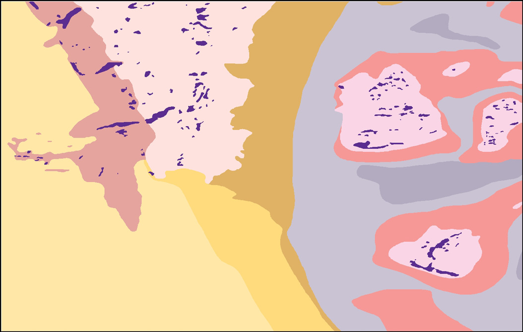
Interpretations were drawn on paper maps, which displayed the sun-illuminated topography with the locations of sediment grain size, with textural analysis, and video/photo stations. These paper maps were printed at a scale of 1:25000 on a large format HP plotter. The interpretation was based on seabed samples to determine sediment grain size distribution, photo and video imagery to identify small seabed features, multibeam sonar data to identify large seabed features and relative reflectivity (hardness and softness) of seabed sediments. The paper interpretations were transferred to ArcGIS visually based on background data layers in the GIS. The process was an iterative one, with the interpretation then printed on the paper maps with underlying bathymetry or backscatter, and interpretation lines adjusted based on the other data printed on the maps.

The following information was used as guidelines to derive individual units.

Individual sediment samples were aggregated into substrate types by comparing their textural composition, with special emphasis placed on:

(1) mean grain size in phi units;
(2) standard deviation from the mean of grain size distribution (degree of sorting) in phi units;
(3) significant grain size(s) in phi units;
(4) mud, sand and gravel contents in weight percents of the sample;
(5) sand fraction subdivided into fine grained sand (3 and 4 phi) and coarse grained sand (0, 1, and 2 phi) in weight percents of the sample;
(6) gravel fraction subdivided into G1 (-1 and -2 phi) and G2 (-3, -4, and -5 phi) in weight percents of the sample.

Gravel pebbles larger than -5 phi (6.4 cm) were not collected in this study, although larger pebbles, cobbles, and boulders were observed in seabed imagery.

Mobility of sediments was determined by the presence or absence of sand ripples, as viewed in video and photographic imagery.

Substrate layering was determined by the presence of a layer of finer sediment overlying (but not completely covering) coarser sediment, as viewed in video and photographic imagery.

This process took place over a number of years, 2005-2010.
Source_Used_Citation_Abbreviation: DS469
Source_Used_Citation_Abbreviation: SIM2840
Source_Used_Citation_Abbreviation: video
Process_Date: 2010
Process_Step:
Process_Description:
In ArcGIS 9.3.1, slivers between polygons were identified and removed. Much of this work was accomplished using ArcToolbox - Data Management Tools - Feature Class - Integrate. Overlap between polygons was also taken care of often using the clip option from the editor menu discarding the overlapping portion. Further tweaking of the polygons was necessary. To maintain integrity between adjacent polygons, the remaining edits were done using map topology. Shapefiles don't have topology, but by using the map topology capabilities of ArcGIS, editing of shared nodes was possible.
Process_Date: 2012
Process_Contact:
Contact_Information:
Contact_Person_Primary:
Contact_Person: VeeAnn A. Cross
Contact_Organization: U.S. Geological Survey
Contact_Position: Marine Geologist
Contact_Address:
Address_Type: mailing and physical address
Address: Woods Hole Coastal and Marine Science Center
Address: 384 Woods Hole Rd.
City: Woods Hole
State_or_Province: MA
Postal_Code: 02543-1598
Contact_Voice_Telephone: (508) 548-8700 x2251
Contact_Facsimile_Telephone: (508) 457-2310
Contact_Electronic_Mail_Address: vatnipp@usgs.gov
Process_Step:
Process_Description:
The final piece of the geology interpretation was the already published boulder ridge data. The previously published ridge polygons (SIM 2840) were published as shapefiles in two separate data layers. One data layer consisted of boulder ridges < 1 meter in height, with the other data layer having boulder ridges greater than or equal to 1 meter in height. In edit mode in ArcGIS 9.3.1, the ridge shapefiles were copied and added (pasted) to the geology interpretation shapefile. With the ridges selected, the clip option was chosen from the edit menu to clip the underlying polygons and discard the overlap. Additionally, any ridges falling outside quadrangle 6 were deleted.
Process_Date: 2012
Process_Step:
Process_Description:
The geology interpretation polygons serve multiple functions. With this in mind, the attribute table was constructed such that any of the geologic interpretations associated with quadrangle 6 could be symbolized from the single shapefile. For instance, the geologic substrate unit A1 is equivalent to the mobile sediment unit of the substrate mobility map. Additionally, geologic substrate unit A1, combined with several other geologic substrate units, comprises the single coarse-grained substrate. In this manner, the geologic substrate units can be used in various combinations of units to derive all subsequent geologic maps in quadrangle 6.
Process_Date: 2012
Process_Step:
Process_Description:
The interpretation shapefile was projected from the custom Mercator projection to a geographic coordinate system using ArcToolbox - Data Management Tools - Projections and Transformations - Feature - Project. The output coordinate system was geographic, NAD83. No datum transformation was necessary.
Process_Date: 2012
Process_Step:
Process_Description: USGS Thesaurus keywords added to the keyword section.
Process_Date: 20180720
Process_Contact:
Contact_Information:
Contact_Organization_Primary:
Contact_Organization: U.S. Geological Survey
Contact_Person: VeeAnn A. Cross
Contact_Position: Marine Geologist
Contact_Address:
Address_Type: Mailing and Physical
Address: 384 Woods Hole Road
City: Woods Hole
State_or_Province: MA
Postal_Code: 02543-1598
Contact_Voice_Telephone: 508-548-8700 x2251
Contact_Facsimile_Telephone: 508-457-2310
Contact_Electronic_Mail_Address: vatnipp@usgs.gov
Process_Step:
Process_Description:
Added keywords section with USGS persistent identifier as theme keyword.
Process_Date: 20200908
Process_Contact:
Contact_Information:
Contact_Organization_Primary:
Contact_Organization: U.S. Geological Survey
Contact_Person: VeeAnn A. Cross
Contact_Position: Marine Geologist
Contact_Address:
Address_Type: Mailing and Physical
Address: 384 Woods Hole Road
City: Woods Hole
State_or_Province: MA
Postal_Code: 02543-1598
Contact_Voice_Telephone: 508-548-8700 x2251
Contact_Facsimile_Telephone: 508-457-2310
Contact_Electronic_Mail_Address: vatnipp@usgs.gov
Spatial_Data_Organization_Information:
Direct_Spatial_Reference_Method: Vector
Point_and_Vector_Object_Information:
SDTS_Terms_Description:
SDTS_Point_and_Vector_Object_Type: G-polygon
Point_and_Vector_Object_Count: 187
Spatial_Reference_Information:
Horizontal_Coordinate_System_Definition:
Geographic:
Latitude_Resolution: 0.000001
Longitude_Resolution: 0.000001
Geographic_Coordinate_Units: Decimal degrees
Geodetic_Model:
Horizontal_Datum_Name: North American Datum of 1983
Ellipsoid_Name: Geodetic Reference System 80
Semi-major_Axis: 6378137.000000
Denominator_of_Flattening_Ratio: 298.257222
Entity_and_Attribute_Information:
Detailed_Description:
Entity_Type:
Entity_Type_Label: SIM3341_geologic_interp
Entity_Type_Definition:
Interpreted substrate polygons of quadrangle 6 located in the Stellwagen Bank National Marine Sanctuary region.
Entity_Type_Definition_Source: U.S. Geological Survey
Attribute:
Attribute_Label: FID
Attribute_Definition: Internal feature number
Attribute_Definition_Source: Esri
Attribute_Domain_Values:
Unrepresentable_Domain:
Sequential unique whole numbers that are automatically generated.
Attribute:
Attribute_Label: Shape
Attribute_Definition: Feature geometry.
Attribute_Definition_Source: Esri
Attribute_Domain_Values:
Unrepresentable_Domain: Coordinates defining the features.
Attribute:
Attribute_Label: Sub_Unit_S
Attribute_Definition:
Substrate Unit Symbol abbreviation corresponding to the geologic substrate ("geo_substr") name.
Attribute_Definition_Source: U.S. Geolgocial Survey
Attribute_Domain_Values:
Enumerated_Domain:
Enumerated_Domain_Value: A1
Enumerated_Domain_Value_Definition: Abbreviated symbol for A1 r_cgS
Enumerated_Domain_Value_Definition_Source: Page Valentine, U.S. Geological Survey
Attribute_Domain_Values:
Enumerated_Domain:
Enumerated_Domain_Value: A2
Enumerated_Domain_Value_Definition: Abbreviated symbol for A2 i_cgS
Enumerated_Domain_Value_Definition_Source: Page Valentine, U.S. Geological Survey
Attribute_Domain_Values:
Enumerated_Domain:
Enumerated_Domain_Value: B
Enumerated_Domain_Value_Definition: Abbreviated symbol for B r_cgS / i_cbG
Enumerated_Domain_Value_Definition_Source: Page Valentine, U.S. Geological Survey
Attribute_Domain_Values:
Enumerated_Domain:
Enumerated_Domain_Value: C
Enumerated_Domain_Value_Definition: Abbreviated symbol for C i_cbG
Enumerated_Domain_Value_Definition_Source: Page Valentine, U.S. Geological Survey
Attribute_Domain_Values:
Enumerated_Domain:
Enumerated_Domain_Value: D1
Enumerated_Domain_Value_Definition: Abbreviated symbol for D1 i_cgS / pbcG
Enumerated_Domain_Value_Definition_Source: Page Valentine, U.S. Geological Survey
Attribute_Domain_Values:
Enumerated_Domain:
Enumerated_Domain_Value: D2
Enumerated_Domain_Value_Definition: Abbreviated symbol for D2 i_mcgS / pcbG
Enumerated_Domain_Value_Definition_Source: Page Valentine, U.S. Geological Survey
Attribute_Domain_Values:
Enumerated_Domain:
Enumerated_Domain_Value: E
Enumerated_Domain_Value_Definition: Abbreviated symbol for E i_cgS
Enumerated_Domain_Value_Definition_Source: Page Valentine, U.S. Geological Survey
Attribute_Domain_Values:
Enumerated_Domain:
Enumerated_Domain_Value: F
Enumerated_Domain_Value_Definition: Abbreviated symbol for F i_cgS / pbcG
Enumerated_Domain_Value_Definition_Source: Page Valentine, U.S. Geological Survey
Attribute_Domain_Values:
Enumerated_Domain:
Enumerated_Domain_Value: G1
Enumerated_Domain_Value_Definition: Abbreviated symbol for G1 i_mfgS
Enumerated_Domain_Value_Definition_Source: Page Valentine, U.S. Geological Survey
Attribute_Domain_Values:
Enumerated_Domain:
Enumerated_Domain_Value: G2
Enumerated_Domain_Value_Definition: Abbreviated symbol for G2 i_mfgS
Enumerated_Domain_Value_Definition_Source: Page Valentine, U.S. Geological Survey
Attribute:
Attribute_Label: geo_substr
Attribute_Definition:
Geologic substrate unit name that designates a unique substrate area on the seabed of quadrangle 6.
Attribute_Definition_Source: U.S. Geological Survey
Attribute_Domain_Values:
Enumerated_Domain:
Enumerated_Domain_Value: A1 r_cgS
Enumerated_Domain_Value_Definition:
Rippled, coarse-grained sand. Substrate A1 is a mobile sand deposit on the upper flank of Stellwagen Bank. Depth range is 30 to 56 m. Mean weight percents per grain-size category: mud <1; sand 90 (fgS, 3; cgS, 88); gravel 9 (G1, 8; G2, 1). Substrate A1 is equivalent to the mobile portion of adjacent substrate B; and it is similar to adjacent immobile substrate A2 which lies at deeper depths (53 to 77 m) on the lower flank of Stellwagen Bank and contains more fine-grained sand (11 weight percent).
Enumerated_Domain_Value_Definition_Source: Page Valentine, U.S. Geological Survey
Attribute_Domain_Values:
Enumerated_Domain:
Enumerated_Domain_Value: A2 i_cgS
Enumerated_Domain_Value_Definition:
Immobile, coarse-grained sand. Substrate A2 is an immobile sand deposit on the lower flank of Stellwagen Bank. Depth range is 53 to 77 m. Mean weight percents per grain-size category: mud 1; sand 83 (fgS, 11; cgS, 72); gravel, 16 (G1, 11; G2, 5). Substrate A2 is similar to adjacent mobile substrate A1 which lies at shallower depths (30 to 56 m) and contains less fine-grained sand (3 weight percent). It contains less mud and fine-grained sand than substrate E.
Enumerated_Domain_Value_Definition_Source: Page Valentine, U.S. Geological Survey
Attribute_Domain_Values:
Enumerated_Domain:
Enumerated_Domain_Value: B r_cgS / i_cbG
Enumerated_Domain_Value_Definition:
Rippled, coarse-grained sand; partial veneer on immobile, cobble, boulder gravel. Substrate B is a layered substrate of mobile sand overlying immobile gravel on the shallow flank of Stellwagen Bank. Depth range is 36 to 58 m. Mean weight percents per grain-size category: mud, <1; sand, 92 (fgS, 5; cgS, 86); gravel, 8 (G1, 7; G2, 1). Cobbles and boulders are identified on the basis of video and photographic imagery. Boulder ridges (substrate C) are present. The mobile sand layer of substrate B is equivalent to adjacent mobile substrate A1.
Enumerated_Domain_Value_Definition_Source: Page Valentine, U.S. Geological Survey
Attribute_Domain_Values:
Enumerated_Domain:
Enumerated_Domain_Value: C i_cbG
Enumerated_Domain_Value_Definition:
Immobile, cobble, boulder gravel. Substrate C is immobile gravel that forms topographic ridges where cobbles and boulders are piled upon one another and are separated by voids. It is identified on the basis of video and photographic images of mapped topographic ridges. It is present on the flank of Stellwagen Bank where it is associated with substrate B (36 to 58 m) and substrate D1 (50 to 83 m), and on the tops of North, East, and Middle Ninety Banks where it is associated with substrate D2 (87 to 105 m). It is equivalent to boulder ridges <1 m and >=1m on Maps A, E, F, and G.
Enumerated_Domain_Value_Definition_Source: Page Valentine, U.S. Geological Survey
Attribute_Domain_Values:
Enumerated_Domain:
Enumerated_Domain_Value: D1 i_cgS / pcbG
Enumerated_Domain_Value_Definition:
Immobile, coarse-grained sand; partial veneer on pebble, cobble, boulder gravel. Substrate D1 is a layered substrate of immobile sand overlying immobile gravel on the flank of Stellwagen Bank. Depth range is 50 to 83 m. Mean weight percents per grain-size category: mud, 4; sand, 50 (fgS, 16; cgS, 34); gravel, 45 (G1, 11; G2, 34). Pebbles, cobbles, and boulders are identified on the basis of video and photographic imagery. Boulder ridges (substrate C) are present. Substrate D1 is similar to substrate D2 which lies at deeper depths (87 to 105 m) on the tops of North, East, and Middle Ninety Banks and has higher mud content (12 weight percent).
Enumerated_Domain_Value_Definition_Source: Page Valentine, U.S. Geological Survey
Attribute_Domain_Values:
Enumerated_Domain:
Enumerated_Domain_Value: D2 i_mcgS / pcbG
Enumerated_Domain_Value_Definition:
Immobile, muddy, coarse-grained sand; partial veneer on pebble, cobble, boulder gravel. Substrate D2 is a layered substrate of immobile sand overlying immobile gravel on the tops of North, East, and Middle Ninety Banks. Depth range is 87 to 105 m. Mean weight percents per grain-size category: mud, 12; sand, 76 (fgS, 22; cgS, 55); gravel, 12 (G1, 8; G2, 4). Pebbles, cobbles, and boulders are identified on the basis of video and photographic imagery. Boulder ridges (substrate C) are present. Substrate D2 is similar to substrate D1 which lies at shallower depths (50 to 83 m) on the flank of Stellwagen Bank and has lower mud content (4 weight percent).
Enumerated_Domain_Value_Definition_Source: Page Valentine, U.S. Geological Survey
Attribute_Domain_Values:
Enumerated_Domain:
Enumerated_Domain_Value: E i_cgS
Enumerated_Domain_Value_Definition:
Immobile, coarse-grained sand. Substrate E is an immobile sand deposit on the lower flank of Stellwagen Bank. Depth range is 66 to 122 m. Mean weight percents per grain-size category: mud 4; sand, 82 (fgS, 18; cgS, 64); gravel, 14(G1, 9; G2, 5). Boulder ridges are absent. Substrate E is similar in mud content to substrate D1 and contains more mud and fine-grained sand than substrate A2.
Enumerated_Domain_Value_Definition_Source: Page Valentine, U.S. Geological Survey
Attribute_Domain_Values:
Enumerated_Domain:
Enumerated_Domain_Value: F i_cgS / pcbG
Enumerated_Domain_Value_Definition:
Immobile, coarse-grained sand; partial veneer on pebble, cobble, boulder gravel. Substrate F is a layered substrate of immobile sand overlying immobile gravel on the flanks of the Ninety Meter Banks. Depth range is 90 to 148 m. Mean weight percents per grain-size category: mud, 9; sand, 69 (fgS, 25; cgS, 44); gravel, 22 (G1, 13; G2, 9). Pebbles, cobbles, and boulders are identified on the basis of video and photographic imagery. Boulder ridges are absent. Substrate F is similar to substrates D1 and D2, except that F lies at deeper depths, and the partial veneer of coarse grained sand on the gravel is more extensive.
Enumerated_Domain_Value_Definition_Source: Page Valentine, U.S. Geological Survey
Attribute_Domain_Values:
Enumerated_Domain:
Enumerated_Domain_Value: G1 i_mfgS
Enumerated_Domain_Value_Definition:
Immobile, muddy, fine-grained sand. Substrate G1 is an immobile muddy sand deposit in valleys between Stellwagen Bank and the Ninety Meter Banks. Depth range is 85 to 171 m. Mean weight percents per grain-size category: mud, 10; sand, 88 (fgS, 78; cgS, 10); gravel, 1 (G1, 1; G2, 1). Substrate G1 is similar to substrate G2 which lies at deeper depths (125 to 185 m) and has higher 4 phi sand (58 weight percent) and higher mud content (23 weight percent).
Enumerated_Domain_Value_Definition_Source: Page Valentine, U.S. Geological Survey
Attribute_Domain_Values:
Enumerated_Domain:
Enumerated_Domain_Value: G2 i_mfgS
Enumerated_Domain_Value_Definition:
Immobile, muddy, fine-grained sand. Substrate G2 is an immobile muddy sand deposit in deep parts of valleys lying between the Ninety Meter Banks. Depth range is 125 to 185 m. Mean weight percents per grain-size category: mud, 23; sand, 77 (fgs, 77; cgS, 1); gravel, 0. Substrate G2 has the highest mud content of all substrates in quadrangle 6.
Enumerated_Domain_Value_Definition_Source: Page Valentine, U.S. Geological Survey
Attribute:
Attribute_Label: geo_descr
Attribute_Definition:
Text description corresponding to the geologic substrate attribute "geo_substr".
Attribute_Definition_Source: U.S. Geological Survey
Attribute_Domain_Values:
Unrepresentable_Domain: Character set (text).
Attribute:
Attribute_Label: Substr_Mob
Attribute_Definition:
Substrate mobility interpreted unit based on the presence of sand ripples observed in video and photographic imagery.
Attribute_Definition_Source: U.S. Geological Survey
Attribute_Domain_Values:
Enumerated_Domain:
Enumerated_Domain_Value: mobile sediment
Enumerated_Domain_Value_Definition: Rippled sand; equivalent to substrate A1.
Enumerated_Domain_Value_Definition_Source: Page Valentine, U.S. Geological Survey
Attribute_Domain_Values:
Enumerated_Domain:
Enumerated_Domain_Value: mobile and immobile sediment
Enumerated_Domain_Value_Definition:
Rippled sand overlying immobile cobble and boulder gravel; equivalent to substrate B.
Enumerated_Domain_Value_Definition_Source: Page Valentine, U.S. Geological Survey
Attribute_Domain_Values:
Enumerated_Domain:
Enumerated_Domain_Value: immobile sediment
Enumerated_Domain_Value_Definition:
Sand, sand partial veneer on gravel, and muddy sand; equivalent to substrates A2, D1, D2, E, F, G1, and G2.
Enumerated_Domain_Value_Definition_Source: Page Valentine, U.S. Geological Survey
Attribute_Domain_Values:
Enumerated_Domain:
Enumerated_Domain_Value: boulder ridges <1 meter in height
Enumerated_Domain_Value_Definition: Ridges <1 meter in height equivalent to substrate C.
Enumerated_Domain_Value_Definition_Source: Page Valentine, U.S. Geological Survey
Attribute_Domain_Values:
Enumerated_Domain:
Enumerated_Domain_Value: boulder ridges >=1 meter in height
Enumerated_Domain_Value_Definition: Ridges >=1 meter in height equivalent to substrate C.
Enumerated_Domain_Value_Definition_Source: Page Valentine, U.S. Geological Survey
Attribute:
Attribute_Label: mob_descr
Attribute_Definition:
Text description corresponding to the substrate mobility attribute "Substr_Mob".
Attribute_Definition_Source: U.S. Geological Survey
Attribute_Domain_Values:
Unrepresentable_Domain: Character set (text).
Attribute:
Attribute_Label: sub_grain
Attribute_Definition:
Substrate grain size interpreted unit based on the mean weight percent of the sand fraction.
Attribute_Definition_Source: U.S. Geological Survey
Attribute_Domain_Values:
Enumerated_Domain:
Enumerated_Domain_Value: fine-grained substrate
Enumerated_Domain_Value_Definition:
Muddy sand in which fine-grained sand (3 and 4 phi combined) constitutes > 50 mean weight percent of the sand fraction; equivalent to substrates G1 and G2.
Enumerated_Domain_Value_Definition_Source: Page Valentine, U.S. Geological Survey
Attribute_Domain_Values:
Enumerated_Domain:
Enumerated_Domain_Value: coarse-grained substrate
Enumerated_Domain_Value_Definition:
Sand and sand partial veneer on gravel in which coarse-grained sand (2, 1, and 0 phi combined) constitutes > 50 mean weight percent of the sand fraction; equivalent to substrates A1, A2, B, D1, D2, E, and F.
Enumerated_Domain_Value_Definition_Source: Page Valentine, U.S. Geological Survey
Attribute_Domain_Values:
Enumerated_Domain:
Enumerated_Domain_Value: boulder ridges <1 meter in height
Enumerated_Domain_Value_Definition: Ridges <1 meter in height equivalent to substrate C.
Enumerated_Domain_Value_Definition_Source: Page Valentine, U.S. Geological Survey
Attribute_Domain_Values:
Enumerated_Domain:
Enumerated_Domain_Value: boulder ridges >=1 meter in height
Enumerated_Domain_Value_Definition: Ridges >=1 meter in height equivalent to substrate C.
Enumerated_Domain_Value_Definition_Source: Page Valentine, U.S. Geological Survey
Attribute:
Attribute_Label: grain_desc
Attribute_Definition:
Text description corresponding to the substrate grain size "sub_grain".
Attribute_Definition_Source: U.S. Geological Survey
Attribute_Domain_Values:
Unrepresentable_Domain: Character set (text).
Attribute:
Attribute_Label: substr_mud
Attribute_Definition:
Substrate mud content interpreted unit based on the mean weight percent of mud content.
Attribute_Definition_Source: U.S. Geological Survey
Attribute_Domain_Values:
Enumerated_Domain:
Enumerated_Domain_Value: <= 1
Enumerated_Domain_Value_Definition:
mud content <= 1 mean weight percent, equivalent to substrates A1, A2, and B.
Enumerated_Domain_Value_Definition_Source: Page Valentine, U.S. Geological Survey
Attribute_Domain_Values:
Enumerated_Domain:
Enumerated_Domain_Value: >1 to 5
Enumerated_Domain_Value_Definition:
mud content >1 to 5 mean weight percent, equivalent to substrates D1 and E.
Enumerated_Domain_Value_Definition_Source: Page Valentine, U.S. Geological Survey
Attribute_Domain_Values:
Enumerated_Domain:
Enumerated_Domain_Value: >5 to 10
Enumerated_Domain_Value_Definition:
mud content >5 to 10 mean weight percent, equivalent to substrates F and G1.
Enumerated_Domain_Value_Definition_Source: Page Valentine, U.S. Geological Survey
Attribute_Domain_Values:
Enumerated_Domain:
Enumerated_Domain_Value: >10 to 20
Enumerated_Domain_Value_Definition:
mud content >10 to 20 mean weight percent, equivalent to substrate D2.
Enumerated_Domain_Value_Definition_Source: Page Valentine, U.S. Geological Survey
Attribute_Domain_Values:
Enumerated_Domain:
Enumerated_Domain_Value: >20 to 50
Enumerated_Domain_Value_Definition:
mud content >20 to 50 mean weight percent, equivalent to substrate G2.
Enumerated_Domain_Value_Definition_Source: Page Valentine, U.S. Geological Survey
Attribute_Domain_Values:
Enumerated_Domain:
Enumerated_Domain_Value: boulder ridges <1 meter in height
Enumerated_Domain_Value_Definition: Ridges <1 meter in height equivalent to substrate C.
Enumerated_Domain_Value_Definition_Source: Page Valentine, U.S. Geological Survey
Attribute_Domain_Values:
Enumerated_Domain:
Enumerated_Domain_Value: boulder ridges >=1 meter in height
Enumerated_Domain_Value_Definition: Ridges >=1 meter in height equivalent to substrate C.
Enumerated_Domain_Value_Definition_Source: Page Valentine, U.S. Geological Survey
Attribute:
Attribute_Label: mud_descr
Attribute_Definition:
Text description corresponding to the substrate mud content "substr_mud".
Attribute_Definition_Source: U.S. Geologic Survey
Attribute_Domain_Values:
Unrepresentable_Domain: Character set (text).
Overview_Description:
Entity_and_Attribute_Overview:
In the geo_substr attribute, weight percents described in the domain value definitions may not add to 100 due to rounding of values. Also in the geo_substr attributes, the mean weight percents for the units, sand is divided into two composite grades: fine-grained sand (fgS; 0.062 to <0.25 mm) and coarse-grained sand (cgS; 0.25 to <2mm). Gravel is also divided into two composite grades: Gravel1 (G1; w to <8 mm) and Grave2(Gs; 8 to <64 mm). This G1 and G2 are not to be confused with the geologic substrate units G1 i_mfgS and G2 i_mfgS.
Entity_and_Attribute_Detail_Citation: Page Valentine, U.S. Geological Survey
Distribution_Information:
Distributor:
Contact_Information:
Contact_Person_Primary:
Contact_Person: Page C. Valentine
Contact_Organization: U.S. Geological Survey
Contact_Position: Research Geologist
Contact_Address:
Address_Type: mailing and physical address
Address: 384 Woods Hole Rd.
City: Woods Hole
State_or_Province: MA
Postal_Code: 02543-1598
Country: USA
Contact_Voice_Telephone: (508) 548-8700 x2239
Contact_Facsimile_Telephone: (508) 457-2310
Contact_Electronic_Mail_Address: pvalentine@usgs.gov
Resource_Description:
SIM3341_geologic_interp.zip containing SIM3341_geologic_interp.shp and the shapefile components as well as FGDC metadata and the browse graphic SIM3341_geol_interp.jpg. Additionally, the following ArcGIS 9.3.1 layer files are included: SIM3341_geologic_interp.lry, SIM334_geologic_sediment_mobility.lyr, SIM3341_geologic_substrate_coarseness.lyr, and SIM3341_geologic_substrate_mud_content.lyr.
Distribution_Liability:
Neither the U.S. Government, the Department of the Interior, nor the U.S. Geological Survey (USGS), nor any of their employees, contractors, or subcontractors, make any warranty, express or implied, nor assume any legal liability or responsibility for the accuracy, completeness, or usefulness of any information, apparatus, product, or process disclosed, nor represent that its use would not infringe on privately owned rights. The act of distribution shall not constitute any such warranty, and no responsibility is assumed by the USGS in the use of these data or related materials. Any use of trade, product, or firm names is for descriptive purposes only and does not imply endorsement by the U.S. Government.
Standard_Order_Process:
Digital_Form:
Digital_Transfer_Information:
Format_Name: Shapefile
Format_Version_Number: ArcGIS 9.3.1
Format_Information_Content:
This WinZip (version 14.0) contains the shapefile, browse graphic, and associated metadata. Additionally, ArcGIS 9.3.1 layer files are included for each variation of the mapping units.
Transfer_Size: 0.62
Digital_Transfer_Option:
Online_Option:
Computer_Contact_Information:
Network_Address:
Fees: None.
Technical_Prerequisites:
These data are available in Environmental Systems Research Institute (Esri) shapefile format. The user must software capable of reading this format. The data are available for download in WinZip format.
Metadata_Reference_Information:
Metadata_Date: 20240318
Metadata_Contact:
Contact_Information:
Contact_Person_Primary:
Contact_Person: VeeAnn A. Cross
Contact_Organization: U.S. Geological Survey
Contact_Position: Marine Geologist
Contact_Address:
Address_Type: mailing and physical address
Address: 384 Woods Hole Rd.
City: Woods Hole
State_or_Province: MA
Postal_Code: 02543-1598
Contact_Voice_Telephone: (508) 548-8700 x2251
Contact_Facsimile_Telephone: (508) 457-2310
Contact_Electronic_Mail_Address: whsc_data_contact@usgs.gov
Contact_Instructions:
The metadata contact email address is a generic address in the event the person is no longer with USGS. (updated on 20240318)
Metadata_Standard_Name: FGDC Content Standards for Digital Geospatial Metadata
Metadata_Standard_Version: FGDC-STD-001-1998
Metadata_Time_Convention: local time

This page is <https://cmgds.marine.usgs.gov/catalog/whcmsc/sim/sim3341/SIM3341_geologic_interpmeta.html>
Generated by mp version 2.9.51 on Mon Mar 25 16:05:46 2024