Underwater imagery and classifications of the substrate and coral reef habitat on the Kona coast of the Island of Hawaiʻi, from 2003, 2004, and 2022
By Joshua Logan, Meredith Leigh McPherson, Kristen Alkins, Gerry A. Hatcher, Ann E. Gibbs, Curt D. Storlazzi, and Sarah Groff
https://doi.org/10.5066/P13ZPWNS
Dates
Published: Sept. 24, 2025
Summary
Images of the seafloor off the Kona coast of the Island of Hawaiʻi were collected by the United States Geological Survey in 2003, 2004, and 2022, during field activities A803HW, A204HW, A604HW, and 2022-615-FA. The images were acquired in cooperation with the National Park Service, primarily in the waters off Kaloko-Honokōhau National Historical Park, Puʻukoholā Heiau National Historic Site, and Puʻuhonua o Hōnaunau National Historical Park. The images were classified for live coral cover and dominant bottom type, and were used to assess the long-term impacts of repeated coral bleaching events in the region. This data release presents the classified images and a spreadsheet with the image classifications.
Imagery Data
-
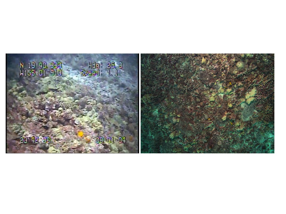
Underwater imagery of the substrate and coral reef habitat on the Kona coast of the Island of Hawaiʻi, from 2003, 2004, and 2022
Images of the seafloor off the Kona coast of the Island of Hawaiʻi were collected by the United States Geological Survey in 2003, 2004, and 2022, during field activities A803HW, A204HW, A604HW, and 2022-615-FA. The images were collected in cooperation with the National Park Service, primarily in the waters off Kaloko-Honokōhau National Historical Park, Puʻukoholā Heiau National Historic Site, and Puʻuhonua o Hōnaunau National Historical Park. The 2003 and 2004 images were acquired using a SeaViewer underwater video camera, either towed behind a research vessel or lowered over the side while drifting. GPS positions from a boat-mounted receiver were encoded into the video. Still frames were extracted from the video and geotagged by writing the geographic positions into each image’s EXIF metadata. The 2022 images were acquired using a Teledyne FLIR camera in an underwater housing. The camera was lowered over the side of the vessel and set to capture one image every two seconds while drifting. GPS positions were recorded using a boat-mounted, differentially processed GPS receiver. The images were geotagged by writing the geographic positions into each image’s EXIF metadata. The time stamps for all images in this data release are in Coordinated Universal Time (UTC). The images provided in this data release were used to evaluate coral cover and were manually classified by a specialist. Only the images used in this project are included in the release.
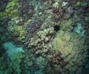 Example image of coral on seafloor near Kaloko-Honokōhau National Historical Park.

Other Data
-
Classifications of underwater imagery of the substrate and coral reef habitat on the Kona coast of the Island of Hawaiʻi, from 2003, 2004, and 2022
This portion of the data release presents a comma-delimited text file with classifications of images of the seafloor off the Kona coast of the Island of Hawaiʻi. The images were collected by the United States Geological Survey in 2003, 2004, and 2022, during field activities A803HW, A204HW, A604HW, and 2022-615-FA, in cooperation with the National Park Service, primarily in the waters off Kaloko-Honokōhau National Historical Park, Puʻukoholā Heiau National Historic Site, and Puʻuhonua o Hōnaunau National Historical Park. The images were classified for live coral cover and dominant type (four coral types, rubble, macroalgae, and two bottom substrate types) manually by a single specialist with a background in ecological studies. The resulting classifications were tabulated in a comma-delimited text file for further analysis.
Data Files
KonaHawaiiUnderwaterImageClassifications.csv - 389.2 KB
Metadata Files
KonaHawaiiUnderwaterImageClassifications_metadata.xml - 22.6 KB
KonaHawaiiUnderwaterImageClassifications_metadata.txt - 22.5 KB
Suggested Citation
Logan, J.B., McPherson, M.L., Alkins, K.A., Hatcher, G.A., Gibbs, A.E., Storlazzi, C.D., and Groff, S., 2025, Underwater imagery and classifications of the substrate and coral reef habitat on the Kona coast of the Island of Hawaiʻi, from 2003, 2004, and 2022: U.S. Geological Survey data release, https://doi.org/10.5066/P13ZPWNS.
Overview Image