Vertical land motion rates for the years 2015 to 2023 - Coastal Alaska
By Manoochehr Shirzaei, Oluwaseyi Dasho, Ashutosh Tiwari, and Li H. Erikson
https://doi.org/10.5066/P1RTIKBK
Dates
Published: Sept. 26, 2025
Summary
Datasets contain vertical land motion (VLM) rates (land uplift and subsidence) derived from Sentinel-1 A/B satellites between 2015 and 2023 for the Alaska coastline. Files are available as csv files.
Imagery Data
-
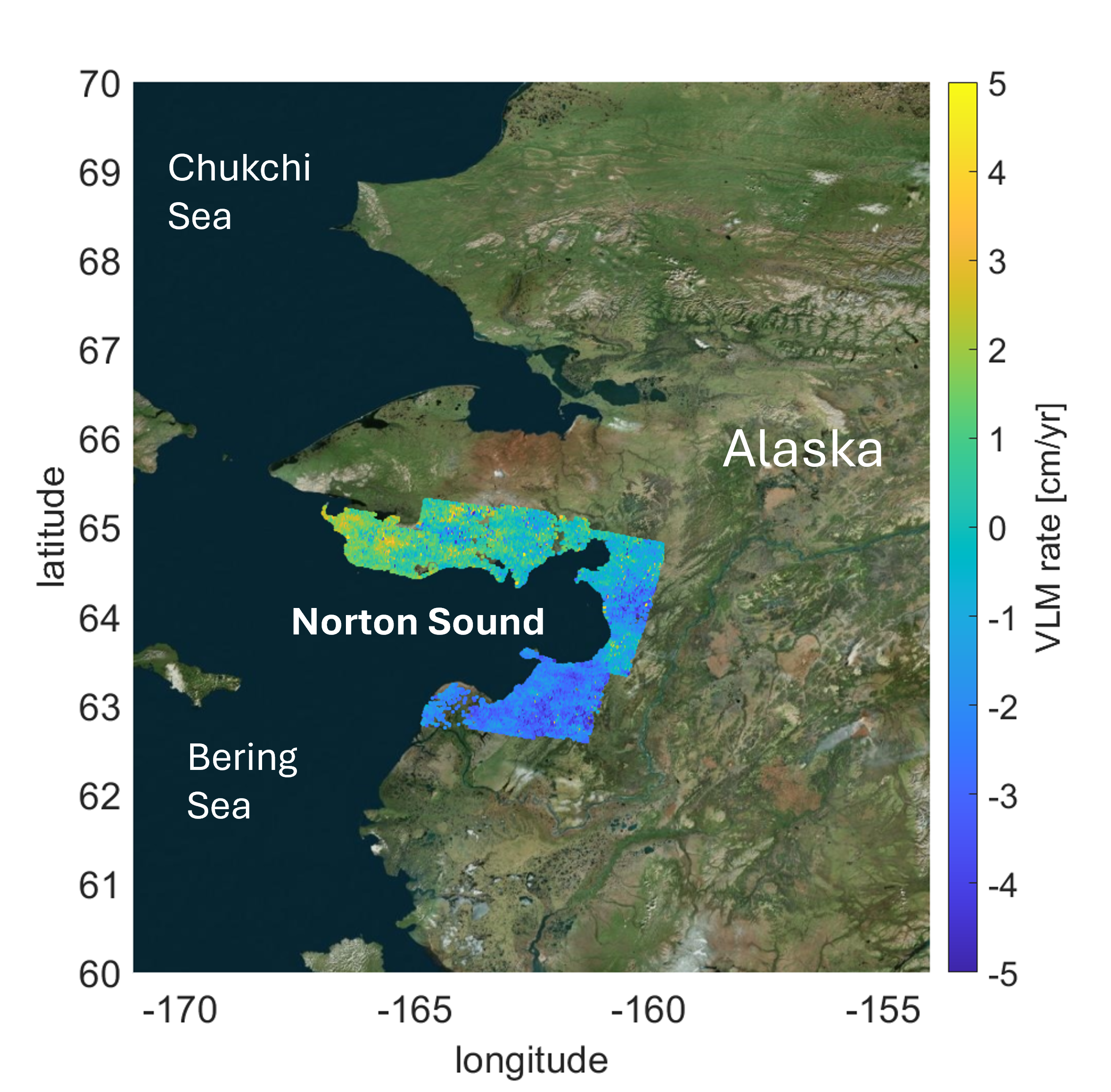
Vertical land motion rates for the years 2015 to 2023 - Norton Sound, Alaska
This dataset contains rates of land subsidence and uplift derived from Sentinel-1A/B (2015-2023) synthetic aperture radar (SAR) satellites for the Alaska coastline along Norton Sound. The data consist of vertical land motion (VLM) rates and the 1-sigma error in land motion rates and are available as a csv file.
Data Files
Vertical_Land_Motion_NortonSound_CoastalAlaska.zip - 5.7 MB - MD5:ba2c670e590e77841cc4a1894832e7e9
Metadata Files
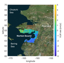 Map showing the area for which vertical land motion (VLM) data are available.
Suggested Citation
Shirzaei, M., Dasho, O., Tiwari, A., and Erikson, L., 2025, Vertical land motion rates for the years 2015 to 2023 - Coastal Alaska: U.S. Geological Survey data release, https://doi.org/10.5066/P1RTIKBK.