Composite multibeam bathymetry surface and data sources of the southern Cascadia Margin offshore Oregon and northern California (version 2.0, April 2026)
By Peter Dartnell, Jane Anne Rudebusch, James E. Conrad, Janet T. Watt, and Jenna C. Hill
https://doi.org/10.5066/P9C5DBMR
Dates
Published: Aug. 23, 2021
Last Revised: April 2, 2026 (ver. 2.0)
Data Collected: July 31, 2018 – June 9, 2022
Summary
Bathymetry data from various sources, including USGS-funded multibeam data collected between 2018-2022 by the National Oceanic and Atmospheric Administration (NOAA) and the U.S. Geological Survey (USGS), were combined to create a composite 30-m resolution multibeam bathymetry surface of the southern Cascadia Margin offshore of Oregon and northern California. The bathymetry data are available as a 30-m resolution GeoTIFF file, accompanied by a polygon shapefile describing the data sources used to create the composite bathymetry surface. This bathymetric surface was created as part of a cooperative project between the U.S. Geological Survey, Pacific Coastal and Marine Science Center, NOAA, and the Bureau of Ocean Energy Management. The surface was generated to assist research projects studying offshore geohazards including mapping faults, submarine landslides, sediment transport pathways, and seafloor cold seeps. These data are not intended to be used for navigation.
Sonar Data
-
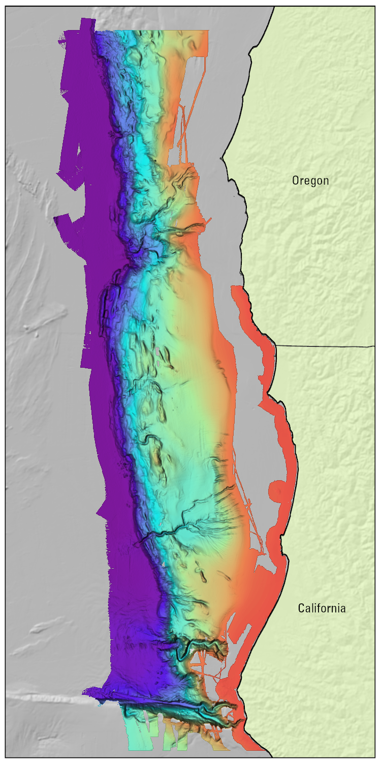
Composite multibeam bathymetry surface of the southern Cascadia Margin offshore Oregon and northern California (ver. 2.0, April 2026)
Data from various sources, including 2018-2022 multibeam bathymetry data collected by the National Oceanic and Atmospheric Administration (NOAA) and the U.S. Geological Survey (USGS), were combined to create a composite 30-m resolution multibeam bathymetry surface of southern Cascadia Margin offshore Oregon and northern California. The data are available as a GeoTIFF file.
Data Files
SouthernCascadia_30m_bathy_UTM10N_NAD83_v2.zip - 100.6 MB - MD5:2fff330223bb1d47295235e4520f8997
Metadata Files
SouthernCascadia_30m_bathy_UTM10N_NAD83_metadatav2.xml - 23.6 KB
SouthernCascadia_30m_bathy_UTM10N_NAD83_metadatav2.txt - 23.1 KB
 Quick view image of the southern Cascadia Margin composite multibeam bathymetry surface.
 -
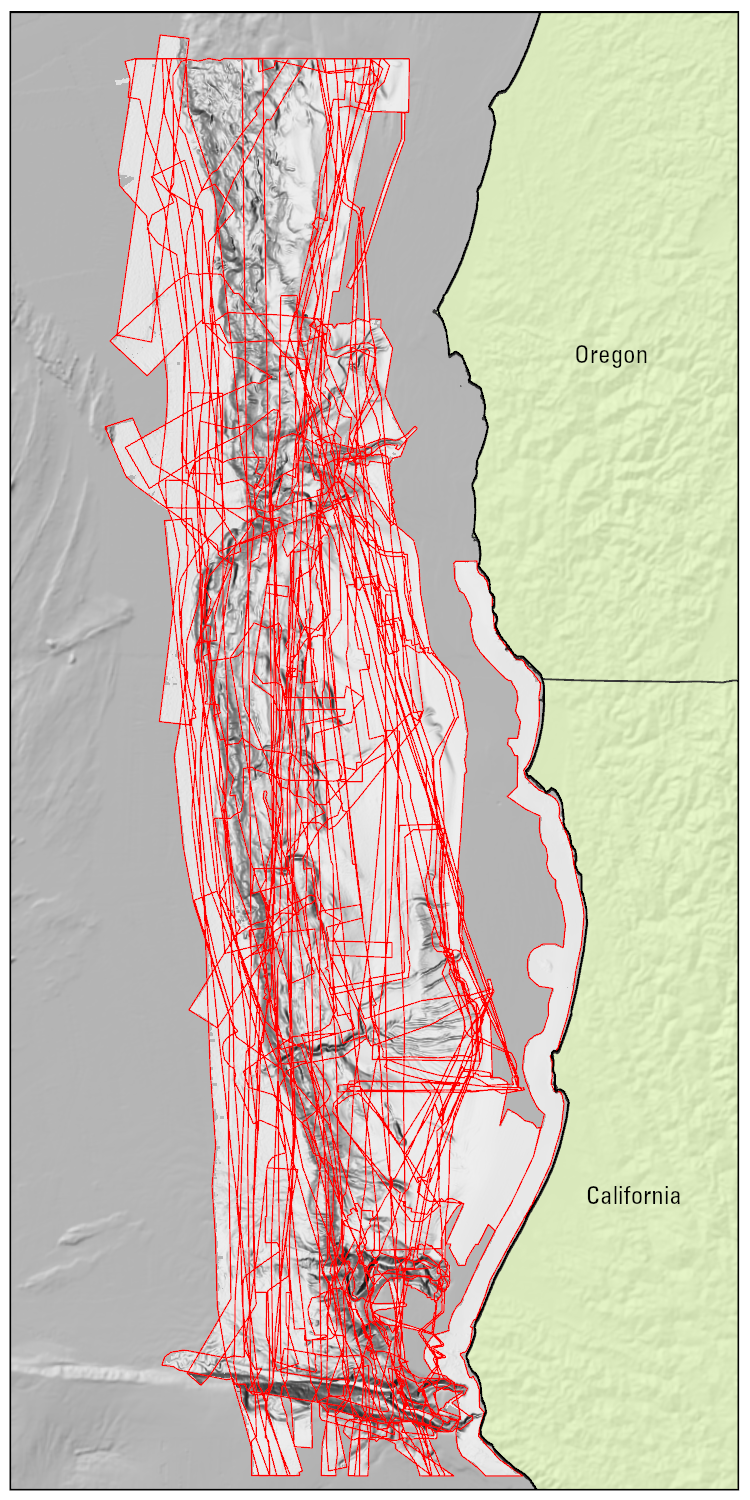
Polygon shapefile of data sources used to create a composite multibeam bathymetry surface of the southern Cascadia Margin offshore Oregon and northern California (ver. 2.0, April 2026)
This polygon shapefile describes the data sources used to create a composite 30-m resolution multibeam bathymetry surface of southern Cascadia Margin offshore Oregon and northern California.
Data Files
SouthernCascadia_bathy_sources_v2.zip - 62.5 KB - MD5:9242e0565321e190b2814dec25aab180
Metadata Files
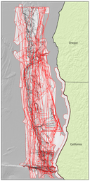 Quick view image of the data source polygon shapefile used to create a southern Cascadia Margin composite multibeam bathymetry surface
Supplemental Files
- VersionHistory_P9C5DBMR.txt - 1.4 KB
- 2018-642-FA - View Details
- 2019-636-FA - View Details
- 2021-643-FA - View Details
Related Field Activities
Suggested Citation
Dartnell, P., Rudebusch, J.A., Conrad, J.E., Watt, J.T., and Hill, J.C., Composite multibeam bathymetry surface and data sources of the southern Cascadia Margin offshore Oregon and northern California (version 2.0, April 2026): U.S. Geological Survey data release, https://doi.org/10.5066/P9C5DBMR
Revision History
First release: 2021
Revised: April 2026 (ver. 2.0)
Changes in Version 2.0
Multibeam composite DEM will be updated with additional datasets collected after it was originally published.
Overview Image
