High-resolution geophysical and geological data collected from outer Cape Cod, Massachusetts during USGS Field Activity 2021-004-FA
By Seth D. Ackerman, David S. Foster, Charles R. Worley, and Alexander R. Nichols
https://doi.org/10.5066/P9GO90TI
Dates
Published: Nov. 14, 2023
Data Collected: June 9, 2021 – June 24, 2021
Summary
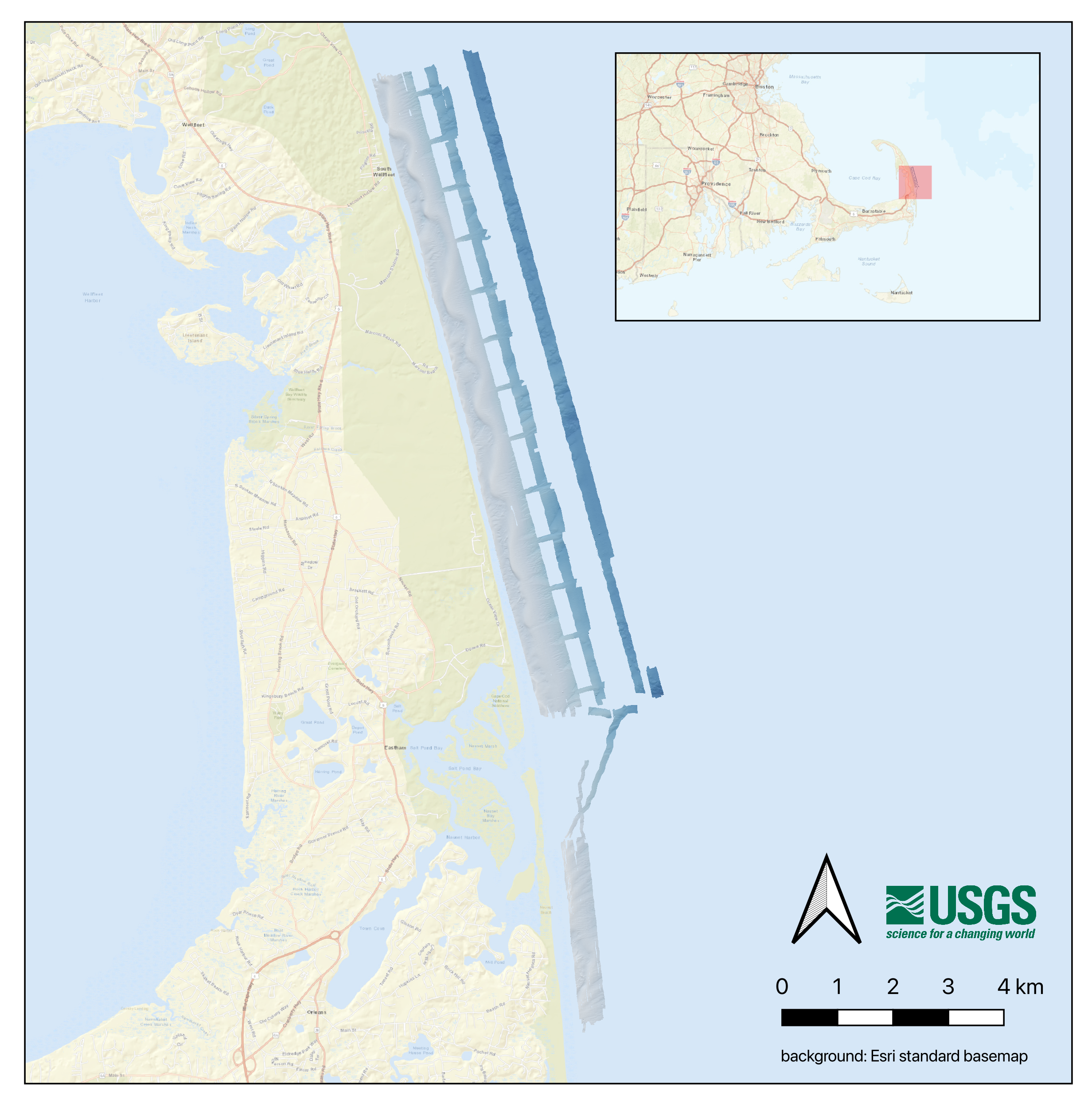
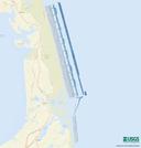
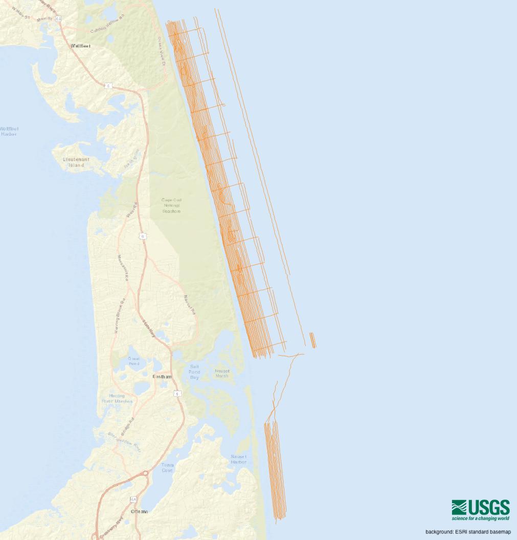
The U.S. Geological Survey (USGS) Woods Hole Coastal and Marine Science Center (WHCMSC) completed a bathymetric and shallow seismic-reflection survey during the period of June 9, 2021 to June 24, 2021 in water depths from 2 m to 30 m for a portion of the outer Cape Cod nearshore environment between Marconi and Nauset Beaches. The products from this survey will help to support white shark research on their shallow-water behavior in the dynamic nearshore environment at Cape Cod National Seashore (CACO). CACO visitors’ safety is threatened by interactions between the public and white sharks. This project provides CACO with baseline data and information on nearshore white shark habitat, specifically in the nearshore shoreface, bathymetric trough, and longshore bar. This data release provides the geophysical data collected from outer Cape Cod during USGS Field Activities 2021-002-FA in 2021.
Seismic Data
-
Chirp seismic reflection - shotpoints, tracklines, profile images, and SEG-Y traces for EdgeTech SB-424 chirp data collected during USGS field activity 2021-004-FA (point and polyline shapefiles, CSV text, PNG Images, and SEGY data, GCS WGS 84)
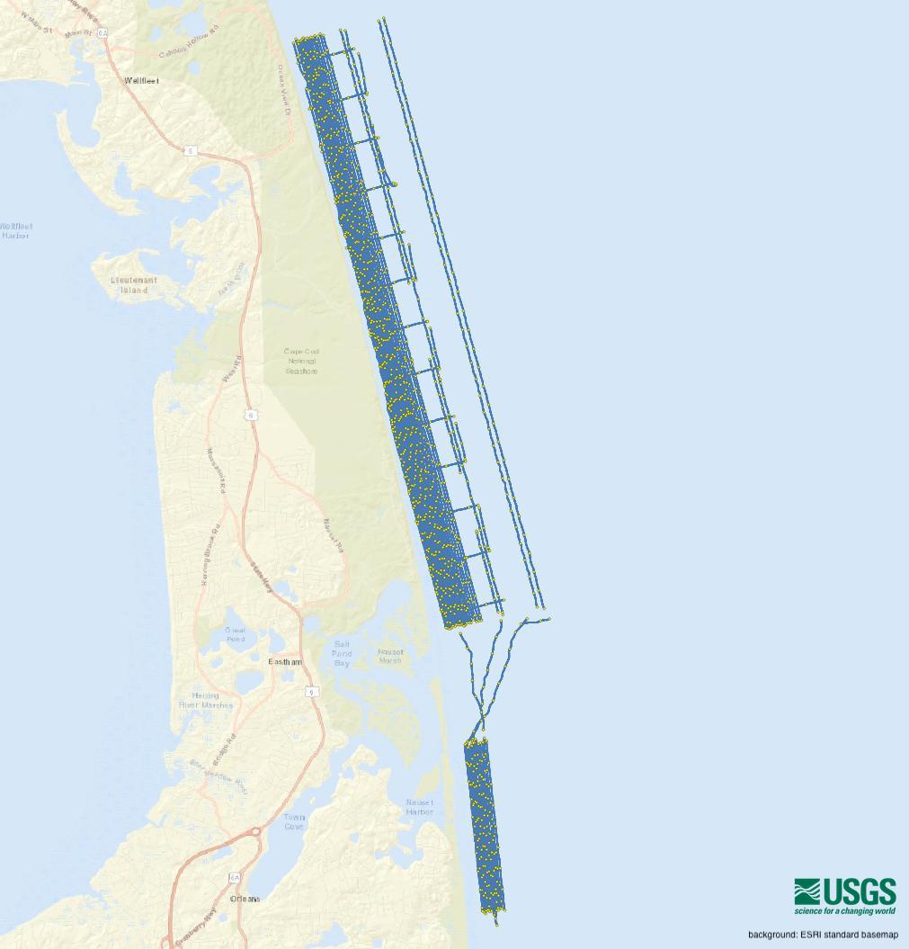
This dataset contains shotpoint and trackline navigation, profile images, and raw SEG-Y trace data for approximately 358 km of EdgeTech SB424 chirp seismic-reflection data collected by the U.S. Geological Survey during USGS field activity 2021-004-FA from outer Cape Cod. Images of each seismic profile were generated in order to provide portable and easily viewable alternatives to the SEG-Y versions of the data. Each profile image can be hyperlinked to its corresponding trackline navigation contained within the Esri polyline shapefile '2021-002-FA_SB424Tracklines.shp'. Shotpoint index and tick marks along the top of the PNG images correlate to the positions of 500 shot intervals within the Esri point shapefile '2021-004-FA_SB424sht500.shp'. This information allows for spatial correlation of chirp seismic-reflection profiles images with other geophysical data for investigating sea-floor morphology and stratigraphy in the area.
Data Files
2021-004-FA_SB424_Images.zip - 698.9 MB - MD5:040b3104450c785c7c60590adc2d2ffc
2021-004-FA_SB424_SegyData.zip - 6.3 GB - MD5:d54e50f2df8e26adc15dbfff1e071803
2021-004-FA_SB424_Shapefiles.zip - 3.8 MB - MD5:f3e3e5f18654e0501c1cd8eede72797a
2021-004-FA_SB424_shtnav.zip - 6.7 MB - MD5:dab42efc795901adcc21fac8fe58da67
Metadata Files
2021-004-FA_SB424_meta.xml - 40.6 KB
2021-004-FA_SB424_meta.txt - 39.9 KB
Sonar Data
-
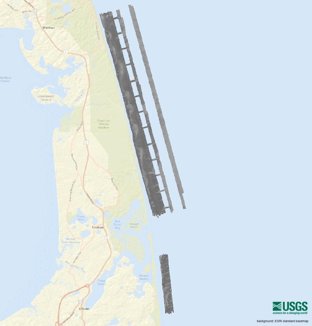
Multibeam backscatter data collected during USGS Field Activity 2021-004-FA, using a dual-head Teledyne SeaBat T20-P multibeam echo sounder (8-bit GeoTIFF, UTM Zone 19N, WGS84, 1-m resolution)
This dataset provides a high-resolution multibeam backscatter mosaic of the seabed created from sonar data collected by the U.S. Geological Survey during survey 2021-004-FA from outer Cape Cod, Massachusetts. The multibeam backscatter mosaic will be used in conjunction with other geophysical and sample data to investigate the morphology and geologic framework of the sea floor and coastal environment of Massachusetts.
Data Files
2021-004-FA_T20P_Backscatter_1m.zip - 15.2 MB - MD5:6f64dbd81b80c1dac9a282796de00121
Metadata Files
2021-004-FA_T20P_Backscatter_1m_meta.xml - 23.6 KB
2021-004-FA_T20P_Backscatter_1m_meta.txt - 23.1 KB
-
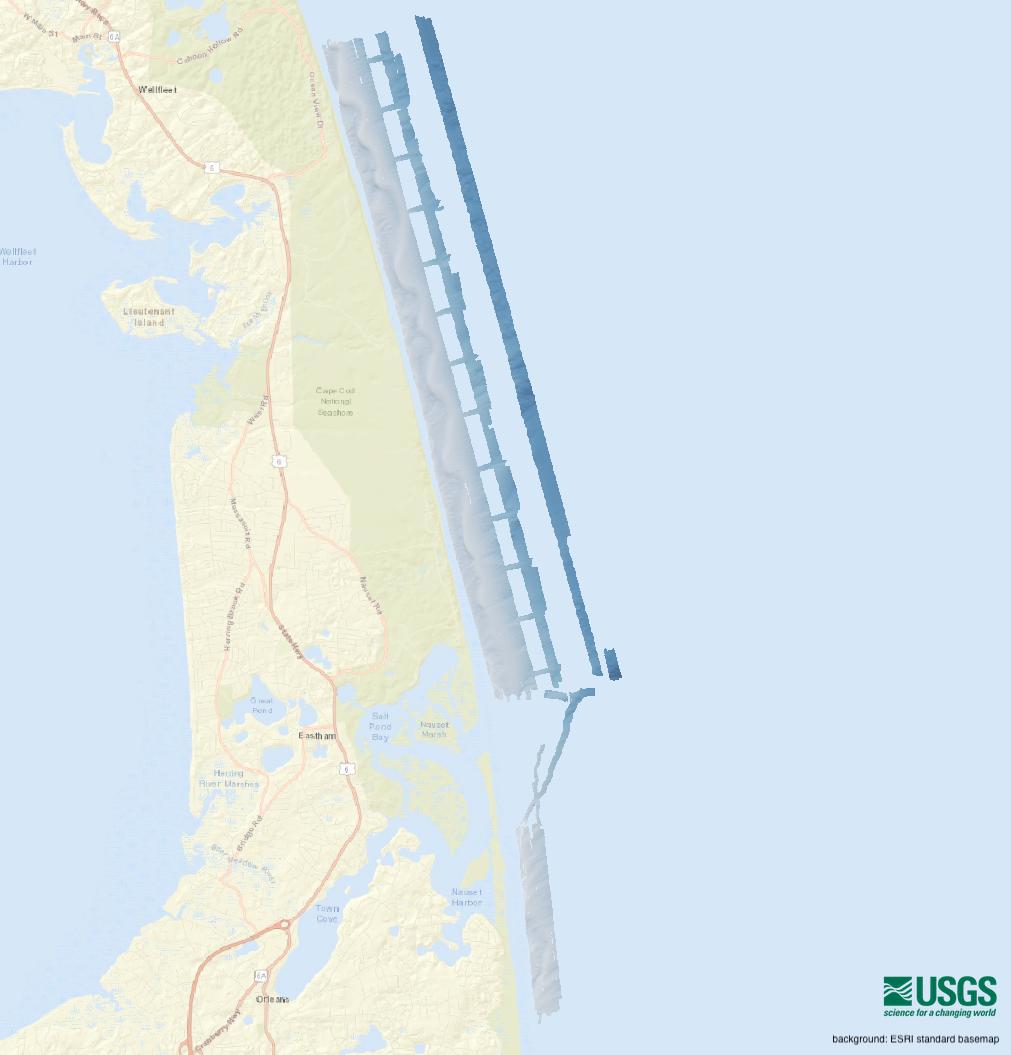
Multibeam bathymetric data collected during USGS field activity 2021-004-FA, using a dual-head Teledyne SeaBat T20-P multibeam echo sounder (32-bit GeoTIFF, UTM Zone 19N, NAD 83, NAVD88 Vertical Datum, 2-m resolution)
This dataset provides a high-resolution digital elevation model (DEM) of the seabed created from bathymetric sonar data collected by the U.S. Geological Survey during survey 2021-004-FA from outer Cape Cod, Massachusetts. The final dataset is referenced to the North American Vertical Datum of 1988 (NAVD 88). In conjunction with other geophysical and sample data, this bathymetry dataset will be used to investigate the morphology and geologic framework of the sea floor and coastal environment of Massachusetts.
Data Files
2021-004-FA_T20P_Bathymetry_2m_NAVD88.zip - 14.6 MB - MD5:66683408e8c9aafea56254f627d68edd
Metadata Files
-
Multibeam sonar tracklines collected during USGS field activity 2021-004-FA, using a dual-head Teledyne SeaBat T20-P multibeam echo sounder (Esri polyline shapefile, GCS WGS 84)
This dataset contains a polyline shapefile representing the trackline navigation for approximately 358 kilometers of multibeam echo sounder bathymetry and backscatter data collected by the U.S. Geological Survey during survey 2021-004-FA from outer Cape Cod, Massachusetts. This information can help spatially correlate the bathymetry and backscatter data with other geophysical data.
Data Files
2021-004-FA_T20P_Tracklines.zip - 280.3 KB - MD5:4f9f8a6e169eff181d08cab1c9e8ef3d
Metadata Files
2021-004-FA_T20P_Tracklines_meta.xml - 26.2 KB
2021-004-FA_T20P_Tracklines_meta.txt - 25.6 KB

-
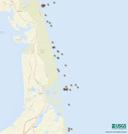
RAW sound velocity profile data from a Minos X collected from outer Cape Cod, Massachusetts during USGS Field Activity 2021-004-FA (PNG images, SVP text, and point shapefile, GCS WGS 84)
This dataset is used to display the locations of sound velocity profiles collected with AML Minos X SVP (sound velocity profiler) during survey 2021-004-FA from outer Cape Cod, Massachusetts. The information contained within the sound velocity profiles is needed to account for refraction artifacts that may be present within raw swath bathymetric data. This dataset contains graphs of the raw sound velocity profile at each station location, as well as location in Geographic Coordinate System (GCS) WGS 84 latitude and longitude, time of day and date of collection.
Data Files
2021-004-FA_SVP_data.zip - 2.0 MB - MD5:5e8738ec7883286f82b4bc938285d654
Metadata Files
2021-004-FA_SVP_data_meta.xml - 26.4 KB
2021-004-FA_SVP_data_meta.txt - 25.6 KB

Related Field Activities
- 2021-004-FA - View Details
Suggested Citation
Ackerman, S.D., Foster, D.S., Worley, C.R., and Nichols, A.R., 2023, High-resolution geophysical and geological data collected from outer Cape Cod, Massachusetts during USGS Field Activity 2021-004-FA: U.S. Geological Survey data release, https://doi.org/10.5066/P9GO90TI
Overview Image