Seismic sub-bottom, sediment core and radiocarbon data collected in Ozette Lake, Washington from 2019-2021
By George R. Snyder, Alicia F. Balster-Gee, Daniel S. Brothers, Drake M. Singleton, Jason S. Padgett, Jenna C. Hill, Andrew C. Ritchie, SeanPaul M. La Selle, Jared W. Kluesner, Brian Sherrod, Daniel C. Powers, Peter Dal Ferro, and Jackson E. Currie
https://doi.org/10.5066/P9W5RAL4
Dates
Published: June 15, 2024
Summary
Seismic-reflection data and cores were collected in Ozette Lake, Washington, from 2019 to 2021. These data were used to investigate submarine landslide deposits triggered by large Cascadia Subduction Zone earthquakes. Identification of fault-related submarine hazards is a primary mission of the USGS Coastal and Marine Geology Program. In the US Pacific Northwest region, the greatest earthquake and tsunami threat is posed by the Cascadia Subduction Zone. From 2019-2021 the USGS carried out a detailed field investigation of earthquake-triggered landslide deposits in Ozette Lake, WA, to reconstruct the timing and severity of large subduction zone earthquakes in northern Cascadia. Field data collected as part of this investigation include boomer single-channel seismic, chirp seismic, and sediment cores. These data are intended to further our understanding of geologic hazards relating to the Cascadia Subduction Zone, improve risk assessments for local communities and critical infrastructure, and to provide data for future research on regional tectonic and sedimentary history of northern Cascadia.
Location-Elevation Data
-
Coordinates of sediment cores collected in Ozette Lake Washington, from 2019 to 2021.
Sediment cores and sub-bottom profiles were collected in Ozette Lake, Washington, from 2019 to 2021. These data were used to investigate submarine landslide deposits triggered by large Cascadia Subduction Zone earthquakes.
Data Files
OzetteLake.core.location.information.csv - 22.7 KB - MD5:f9df5038a8e1a642b192fdd7ea2025ec
Metadata Files
Imagery Data
-
Photoscans of cores collected in Ozette Lake, Washington, between 2019 and 2021
Seismic-reflection data and cores were collected in Ozette Lake, Washington, from 2019 to 2021. These data were used to investigate submarine landslide deposits triggered by large Cascadia Subduction Zone earthquakes.
Data Files
2019-622-FA.gravitycore.photoscan.zip - 14.6 MB - MD5:942bcd5c57c9acb664a33b070b27edfc
2019-622-FA.vibracore.photoscan.zip - 258.8 MB - MD5:b275288d0f8a875b5194665e02fd33b0
2021-641-FA.bobcore.photoscan.zip - 332.8 MB - MD5:21d901b58f95b3e30c0ebe82a2fde6e6
Metadata Files
OzetteLake.core.photoscan.metadata.xml - 17.0 KB
OzetteLake.core.photoscan.metadata.txt - 16.3 KB
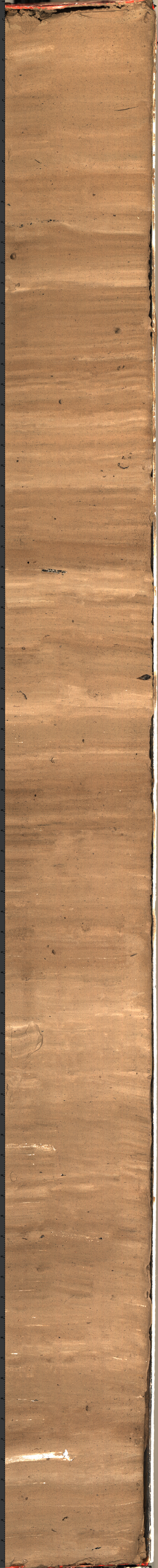
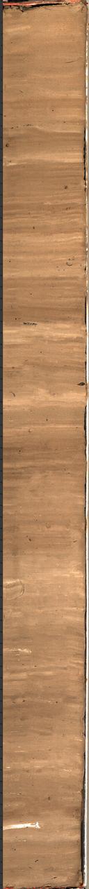 Example photoscan of vibracore VC-04 collected during field activity 2019-622-FA from Ozette Lake, Washington.
 -
Computed tomography (CT) scans of cored collected in Ozette Lake, Washington, between 2019 and 2021
Sediment cores were collected in Ozette Lake, Washington, from 2019 to 2021. Cores were scanned using Computed Tomography (CT). These data were used to investigate submarine landslide deposits triggered by large Cascadia Subduction Zone earthquakes.
Data Files
2019-622-FA.vibracore.CT.zip - 45.8 MB - MD5:929a24b731cbc8e08aee5a13fd9af7d0
2021-641-FA.BobCore.CT.zip - 31.3 MB - MD5:b5ab3c5e9bfb5b4ae2f8e9a2a39d46cf
Metadata Files
OzetteLake.core.CT.metadata.xml - 16.6 KB
OzetteLake.core.CT.metadata.txt - 16.0 KB
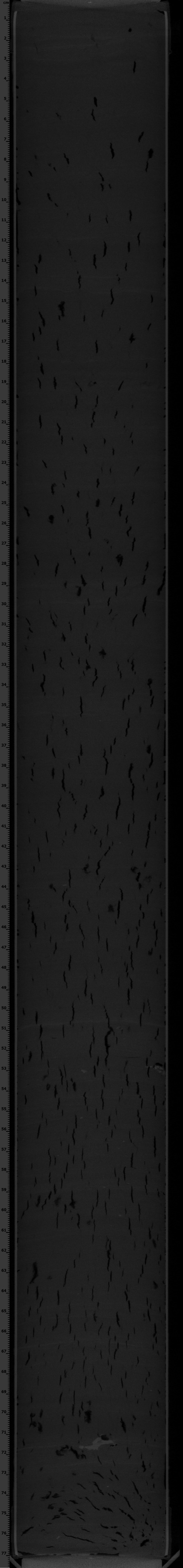
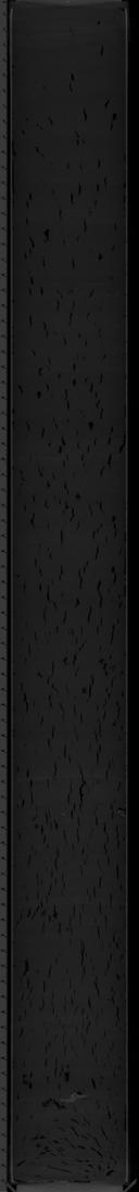 Example CT scan of vibracore VC-04 collected during field activity 2019-622-FA from Ozette Lake, Washington.
Sampling Data
-
Multi-sensor core logger (MSCL) data of vibracores and bob-cores collected in Lake Ozette, from 2019 to 2021
This dataset includes multi-sensor core logger (MSCL) data from sediment cores collected in Lake Ozette, Washington. The sediment cores were collected during USGS field activities 2019-622-FA and 2021-641-FA for investigating submarine landslide deposits triggered by large Cascadia Subduction Zone earthquakes.
Data Files
OzetteLake.core.MSCL.csv - 768.9 KB - MD5:f9ca86026e19b642efe267c737d90348
Metadata Files
OzetteLake.core.MSCL.metadata.xml - 17.8 KB
OzetteLake.core.MSCL.metadata.txt - 17.2 KB
-
Grainsize data from vibracores collected in Ozette Lake, Washington, in 2019
Grainsize data were collected from select sediment cores from Ozette Lake, Washington, in 2019. These data were used to investigate submarine landslide deposits triggered by large Cascadia Subduction Zone earthquakes.
Data Files
OzetteLake.core.grainsize.csv - 47.9 KB - MD5:4409b4a9c19e4ca0a5436a44ced031be
Metadata Files
OzetteLake.core.grainsize.metadata.xml - 75.0 KB
OzetteLake.core.grainsize.metadata.txt - 72.9 KB
Environmental Data
-
X-ray Fluorescence (XRF) scans of vibracores collected in Ozette Lake, Washington, in 2019.
Sediment cores were collected in Ozette Lake, Washington, in 2019, and cores were scanned using X-ray fluorescence (XRF). These data were used to investigate submarine landslide deposits triggered by large Cascadia Subduction Zone earthquakes.
Data Files
OzetteLake.core.XRFdata.csv - 383.4 KB - MD5:617c121b5631f7b4dd693290b0da5c5a
Metadata Files
OzetteLake.core.XRF.metadata.xml - 50.3 KB
OzetteLake.core.XRF.metadata.txt - 50.2 KB
-
Radiocarbon age data from vibracores collected in Ozette Lake, Washington, in 2019
Seismic reflection data and cores were collected in Ozette Lake, Washington, in 2019. Radiocarbon samples were taken from cores in select locations. These data were used to investigate submarine landslide deposits triggered by large Cascadia Subduction Zone earthquakes.
Data Files
OzetteLake.Radiocarbon.data.csv - 9.2 KB - MD5:6215a1f01a957e53be3fa2f67e51db77
Raidocarbon.sample.photos.zip - 378.1 MB - MD5:ea0c1bfb4b495545ff4578e3a4f7ba0c
Metadata Files
OzetteLake.core.radiocarbon.metadata.xml - 22.2 KB
OzetteLake.core.radiocarbon.metadata.txt - 21.5 KB
Seismic Data
-
Boomer seismic-reflection and navigation data collected in Ozette Lake, Washington, in 2019.
Boomer seismic-reflection data and associated navigation files were collected in Ozette Lake, Washington, in 2019 for use in regional earthquake hazard assessments relating the Cascadia Subduction Zone.
Data Files
2019-622_seismic_boomer.zip - 816.3 MB - MD5:b33f1cdd16fcadc8f73d03046335076a
Metadata Files
2019-622-FA_seismic_boomer_metadata.xml - 14.7 KB
2019-622-FA_seismic_boomer_metadata.txt - 14.3 KB
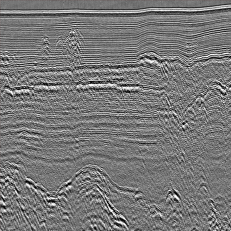
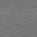 Example image of 2019-622-FA boomer seismic data.
 -
Chirp sub-bottom data collected in Ozette Lake, Washington, in 2019
Chirp seismic reflection data and associated navigation files were collected in Ozette Lake, Washington, in 2019 for use in regional earthquake hazard assessments relating the Cascadia Subduction Zone. Dataset includes both raw and processed chirp data.
Data Files
2019-622-FA_seismic_chirp.zip - 2.4 GB - MD5:fb2d2eedc3a5fd89ab65ce1eb22cf78f
Metadata Files
2019-622-FA_seismic_chirp_metadata.xml - 14.7 KB
2019-622-FA_seismic_chirp_metadata.txt - 14.2 KB
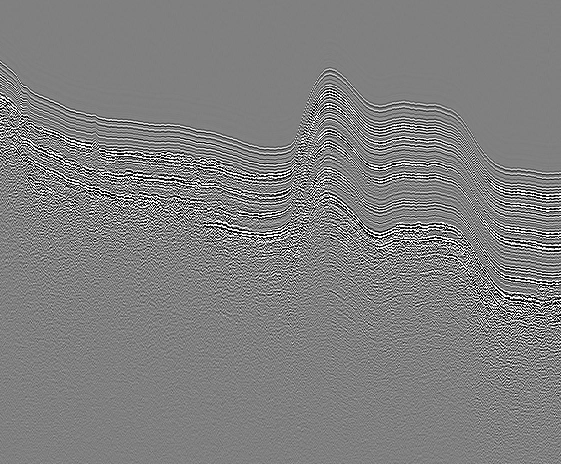
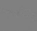 Example image of 2019-622-FA chirp seismic data.
Suggested Citation
Snyder, G.R., Balster-Gee, A.F., Brothers, D.S., Singleton, D.M., Padgett, J.S., Hill, J.C., Ritchie, A.C., La Selle, S.M., Kluesner, J.W., Sherrod, B., Powers, D.C., Dal Ferro, P., and Currie, J.E., 2024, Seismic sub-bottom, sediment core and radiocarbon data collected in Ozette Lake, Washington, from 2019-2021: U.S. Geological Survey data release, https://doi.org/10.5066/P9W5RAL4.