Rain measurements in and near the CZU Lightning Complex Fire area, Santa Cruz Mountains, California, 2020 to 2021
By Amy E. East and Evan T. Dailey
https://doi.org/10.5066/P9Y9HJSN
Dates
Published: Dec. 10, 2021
Data Collected: Nov. 6, 2020 – Oct. 25, 2021
Summary
The CZU Lightning Complex Fire (hereafter, “CZU Fire”) ignited in the Santa Cruz Mountains, California, on August 16, 2020. By the time of full containment on September 22, 2020, the fire had burned 350 km2 (86,510 acres) in Santa Cruz and San Mateo Counties. The U.S. Geological Survey (USGS) installed four rain gages in and near the CZU Fire burn area to measure rainfall during the post-fire wet seasons. Direct measurements of rain amount, duration, and intensity can be used to evaluate causes of post-fire landscape change and to refine post-fire debris-flow thresholds. At each of four measurement locations, rainfall was recorded on an Onset HOBO RG3-M standalone tipping-bucket rain gages, affixed to a 1-m-high stake. These rain gages measure rainfall with a resolution of 0.2 millimeter (mm), and were programmed to record only during rain events. Data were recorded on a self-contained pendant logger housed within the unit and downloaded manually at intervals of weeks to months.
The four rain-gage locations are: Big Basin (Big_Basin, deployed October 29, 2020, within the CZU Fire perimeter at 37.172640, -122.222251); Berry Creek (Berry_Creek, deployed October 23, 2020, within the CZU Fire perimeter at 37.079284, -122.216055); Brookdale Lodge (Brookdale_Lodge, deployed on October 23, 2020, approximately 200 m east of the fire perimeter at 37.106800, -122.109566); and Green Valley Rd. (Green_Valley, deployed January 25, 2021, approximately 6 km east of the fire perimeter at 37.055999, -122.032146). The gages at Berry Creek, Big Basin, and Brookdale Lodge operated beginning in October 2020. The gage at Green Valley Rd. began operating in January 2021, to provide an additional record during a large storm. All four gages then remained operational through the end of the wet season in May 2021.
The USGS gratefully acknowledges the cooperation of Big Basin Redwoods State Park, the Big Creek Lumber Co., the McCrary family, and Brookdale Lodge in the collection of these data.
Environmental Data
-
Rain measurements in and near the CZU Lightning Complex Fire area, Santa Cruz Mountains, California, 2020 to 2021.
Rainfall measurements were collected in and near the CZU Lightning Complex Fire (hereafter, "CZU Fire") burn area, Santa Cruz Mountains, California. The CZU Fire ignited in the Santa Cruz Mountains, California, on August 16, 2020. By the time of full containment on September 22, 2020, the fire had burned 350 km2 (86,510 acres) in Santa Cruz and San Mateo Counties. The U.S. Geological Survey (USGS) installed four rain gages in and near the CZU Fire burn area to measure rainfall during the post-fire wet seasons. The USGS gratefully acknowledges the cooperation of Big Basin Redwoods State Park, the Big Creek Lumber Co., the McCrary family, and Brookdale Lodge in the collection of these data.
Data Files
CZU_RainData_2020-2021.csv - 353.6 KB
Metadata Files
CZU_RainData_2020-2021.xml - 13.1 KB
CZU_RainData_2020-2021.txt - 12.8 KB
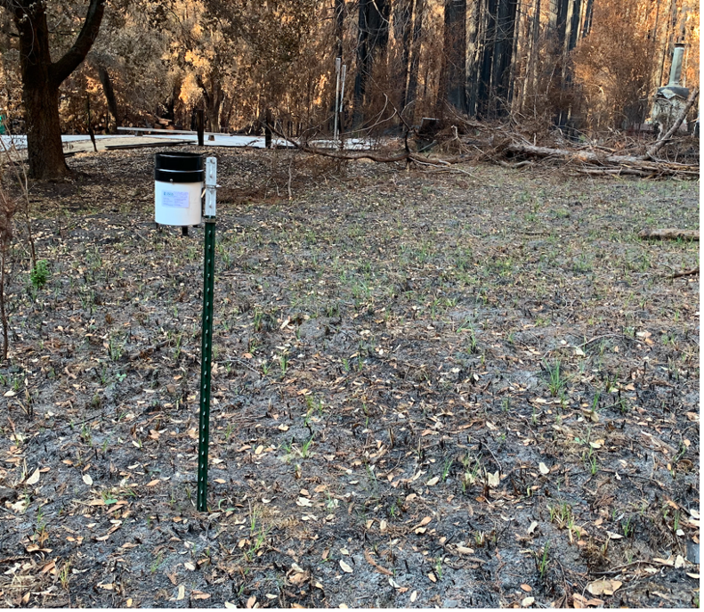
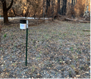 Photograph of USGS rain gage deployed in Big Basin State Park near the former location of the State Park headquarters, which burned in the CZU Lightning Complex Fire.
Related Field Activities
- 2020-638-FA - View Details
Suggested Citation
East, A.E., and Dailey, E.T., 2021, Rain measurements in and near the CZU Lightning Complex Fire area, Santa Cruz Mountains, California, 2020 to 2021: U.S. Geological Survey data release, https://doi.org/10.5066/P9Y9HJSN.
Overview Image
