Topographic and bathymetric data, sediment samples, structure from motion imagery, and reference mark data collected at Marconi Beach, Wellfleet in winter 2021, U.S Geological Survey Field Activity 2021-022-FA (ver. 2, December 2023)
| Field activity number | 2021-022-FA |
|---|---|
| Version | 2.0 |
| Area of operation | Marconi Beach, Cape Cod National Seashore, Massachusetts |
| Dates | January 14, 15; March 10, 17, 2021 |
| Contact | Jin-Si Over |
| Publication Date | November 9, 2021 |
Revised January 11, 2022, ver. 1.1
Revised April 5, 2023, ver. 1.2
Revised December 15, 2023, ver. 2.0
Suggested citation: Over, J.R., Sherwood, C.R., Traykovski, P.A., and Marsjanik, E., 2021, Topographic and bathymetric data, sediment samples, structure from motion imagery, and reference mark data collected at Marconi Beach, Wellfleet in winter 2021, U.S Geological Survey Field Activity 2021-022-FA (ver. 2, December 2023): U.S Geological Survey data release, https://doi.org/10.5066/P9POZ9VH .
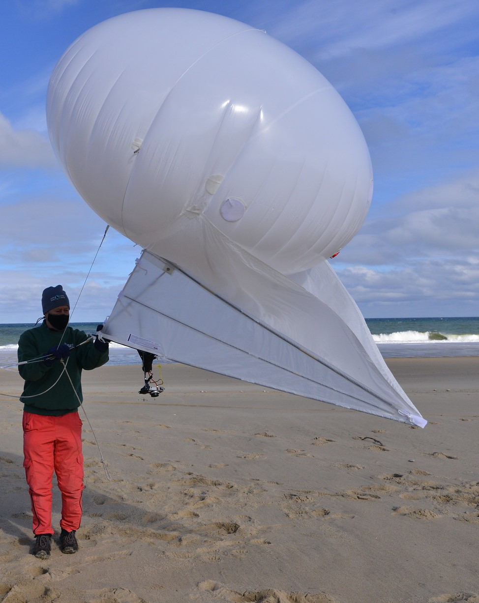
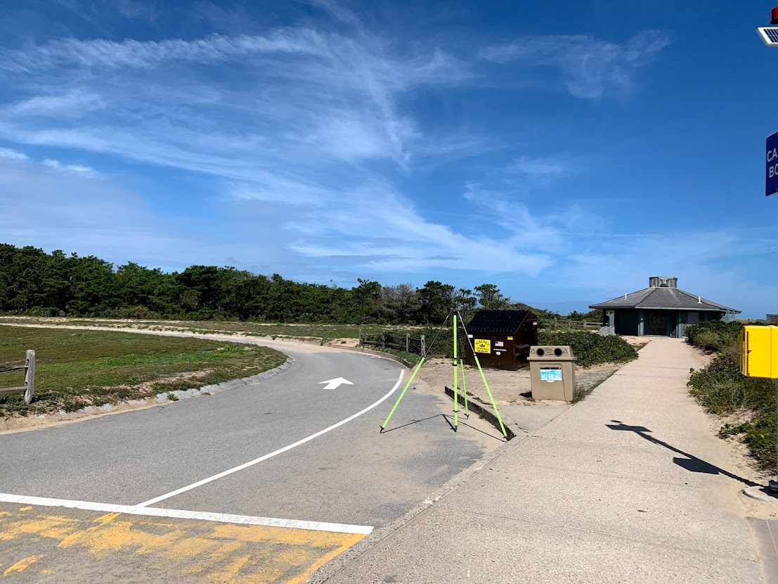
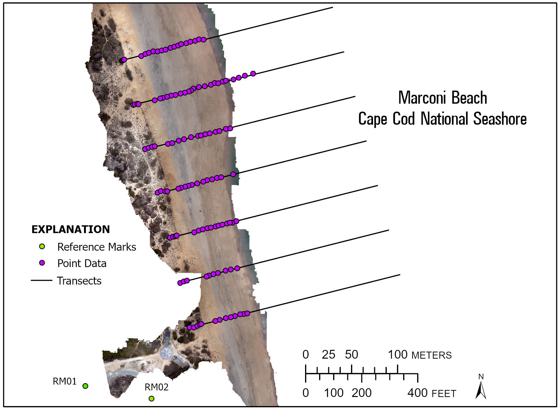
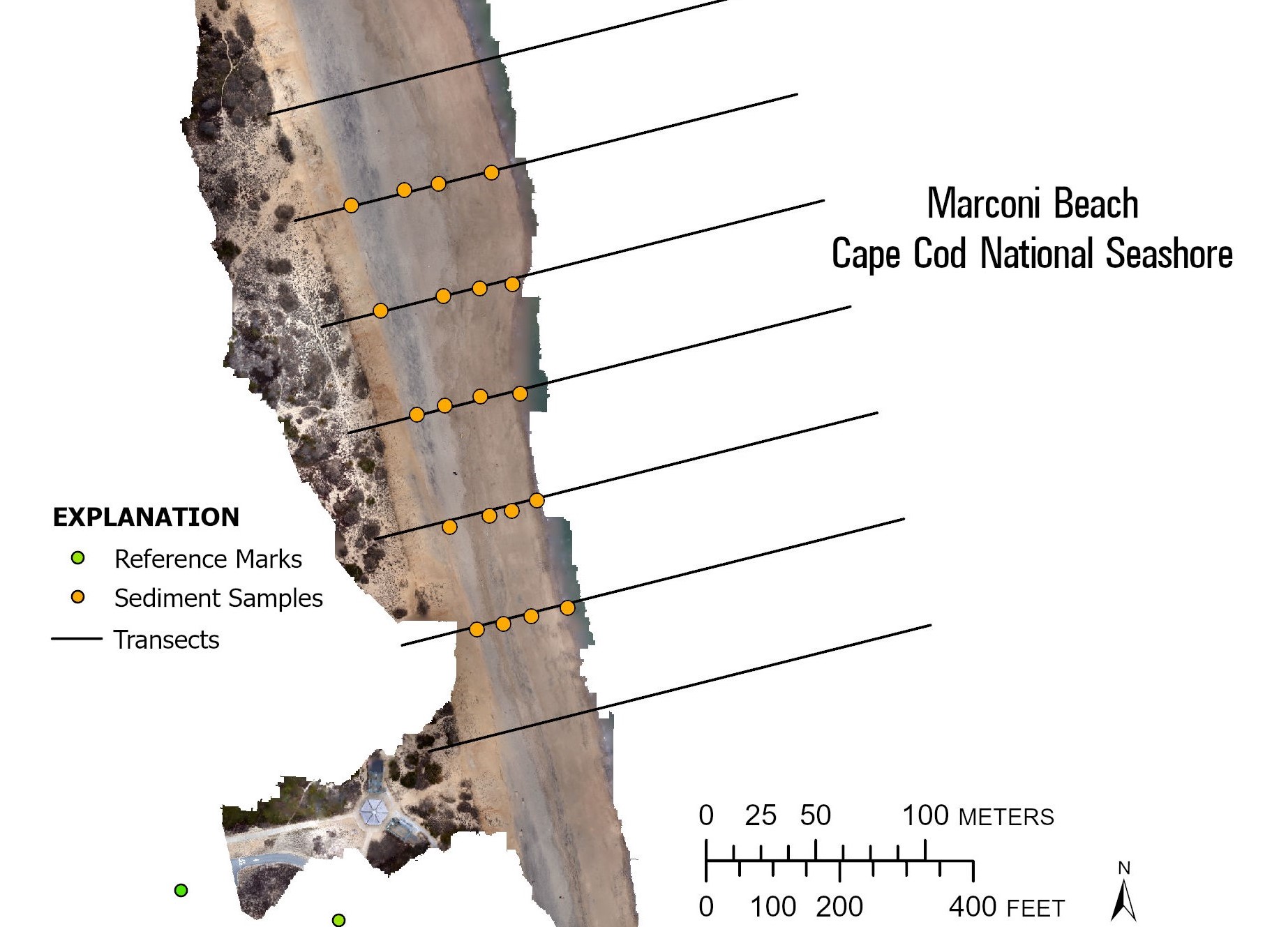
Abstract: The data in this publication map the beach and nearshore environment at Marconi Beach in Wellfleet, MA and provide regional context for the 2021 CoastCam installation that looks out at the coast shared by beachgoers, shorebirds, seals, and sharks. These data were collected as part of field activity 2021-022-FA and a collaboration with the National Park Service at Cape Cod National Seashore to monitor the region that falls within the field of view of CoastCam CACO-02, which are two video cameras aimed at the beach. Starting in February and ending in March 2021, U.S Geological Survey and Woods Hole Oceanographic Institute (WHOI) scientists conducted field surveys to collect position and orientation information for the CoastCam cameras and map the field of view. Two new reference marks were established in the Marconi Beach parking area to establish ground control for future surveys. Elevation data were collected using a real time kinematic – satellite navigation system (RTK-GNSS) receiver attached to a pole and walked on the beach. Point data of the beach face were collected along transects. Grain-size analysis was performed on sediment samples collected with a spade along multiple profiles from the bluff base to the intertidal zone. Aerial images of the beach for use in Structure-from-Motion were taken with a camera (Ricoh GRII) and a post-processed kinematic (PPK) system attached to a helium powered balloon-kite (Helikite) and high-precision GPS targets (AeroPoints) were used as ground control points. Bathymetry was collected in the nearshore using a single-beam echosounder mounted on a surf capable self-righting electric autonomous survey vehicle. Agisoft Metashape (v. 1.7.2) was used to create a digital elevation model with the collected imagery and this was merged with the bathymetry in MATLAB (v. 2020) to create a continuous topobathy product.
Filename and description |
Preview |
Metadata |
Download |
|---|---|---|---|
Topobathy |
|||
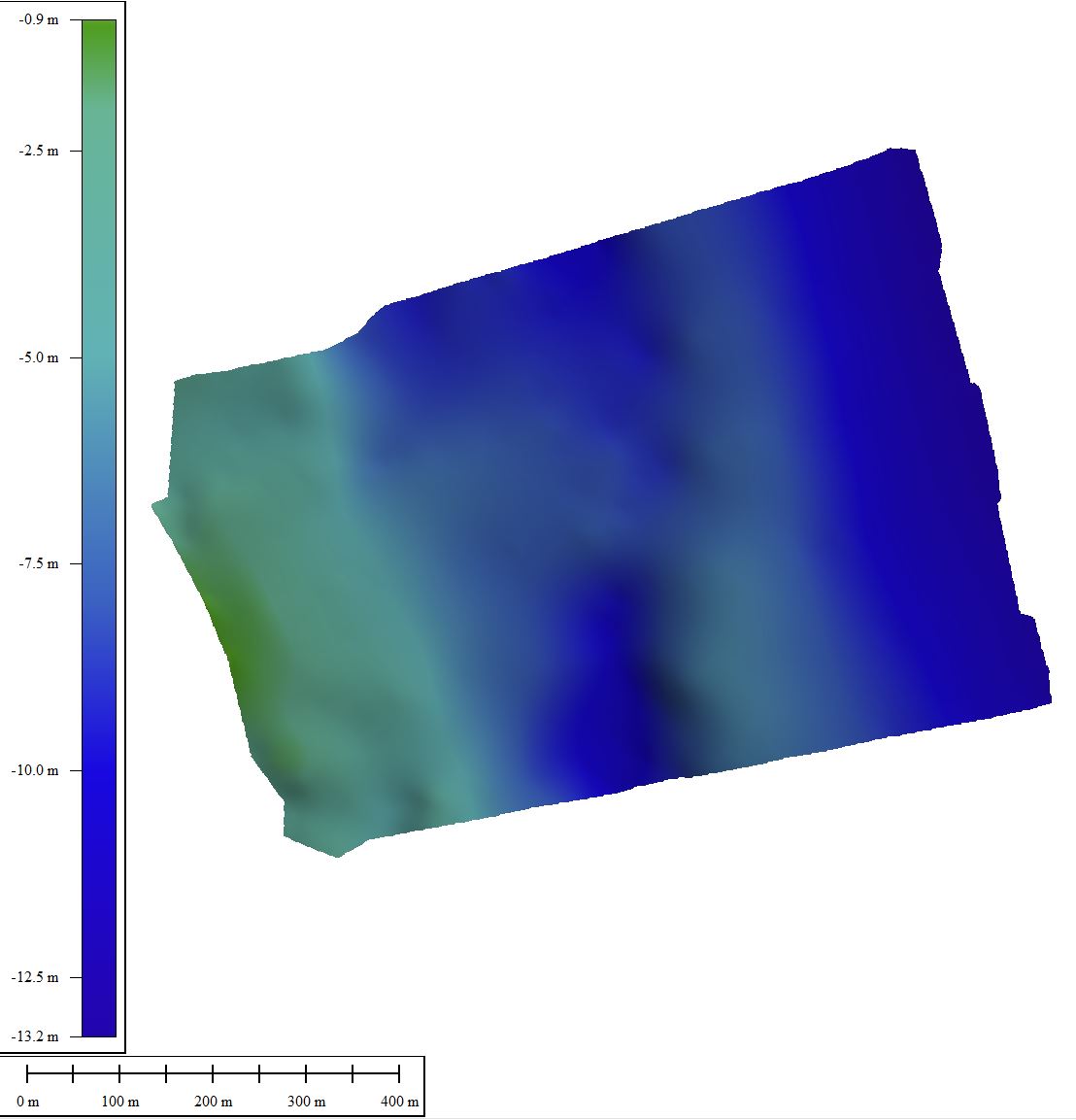
| 2021022FA_Marconi_bathymetry Single-beam bathymetry taken with echosounder mounted on autonomous surface vehicle (1-meter resolution cloud optimized 64-bit float GeoTIFF in UTM Zone 19N and Trackline data in CSV format. File is not cloud optimized). |
 |
TXT XML |
2021022FA_Marconi_bathymetry.zip 3.60 MB |
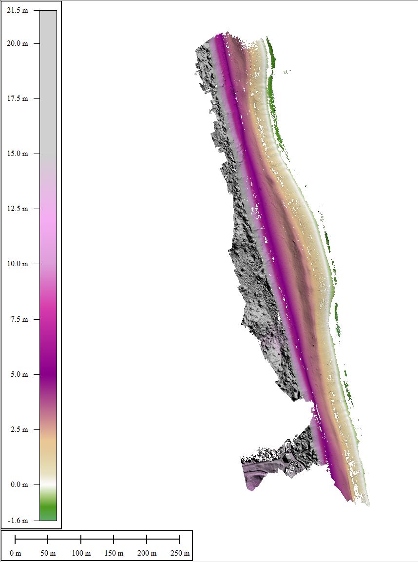
| 2021022FA_Marconi_DSM Digital surface model with 25-centimenter resolution made from the beach imagery using Agisoft Metashape (GeoTIFF, not cloud optimized, UTM Zone 19N 32-bit float). |
 |
TXT XML |
2021022FA_Marconi_DSM_25cm.tif 7.30 MB |
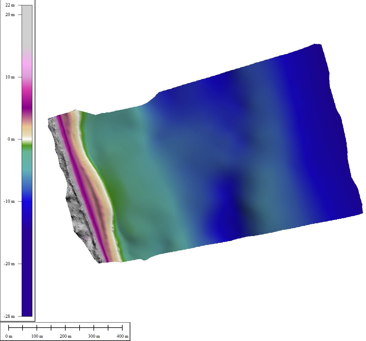
| 2021022FA_Marconi_topobathy Merged 1-meter gridded bathymetry and digital elevation model. (GeoTIFF, not cloud optimized, UTM Zone 19N 32-bit float). |
 |
TXT XML |
2021022FA_Marconi_topobathy_1m.tif 6.40 MB |
Imagery |
|||
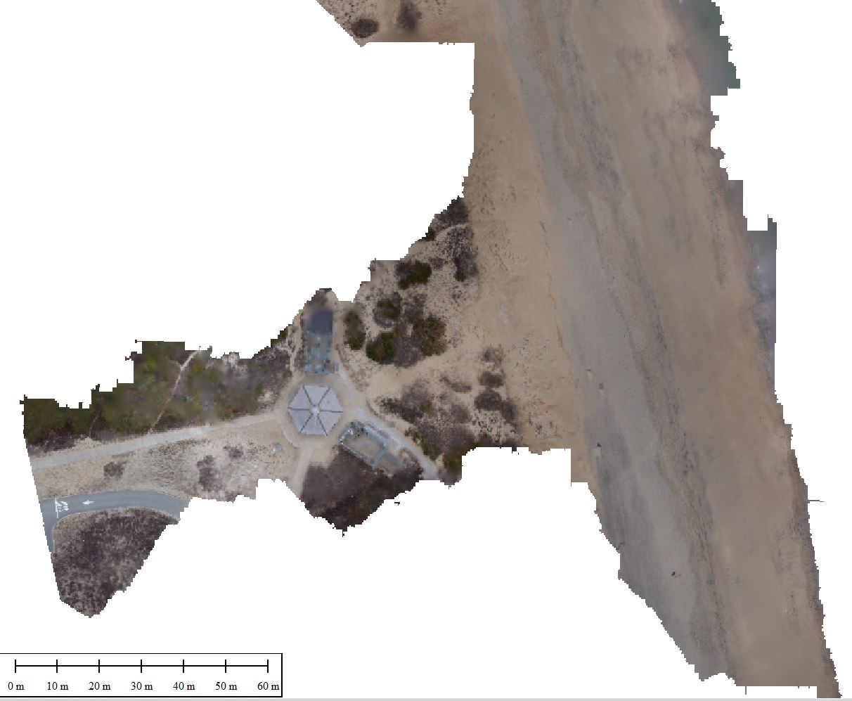
| 2021022FA_Marconi_orthomosaic Orthomosaic with 25 cm resolution made from beach imagery using Agisoft Metashape (GeoTIFF, not cloud optimized, UTM Zone 19N, true-color RGB). |
 |
TXT XML |
2021022FA_Marconi_ortho_25cm.tif 3.70 MB |
| 2021022FA_Marconi_f1 Images collected with camera (Ricoh GRII) attached to a helium powered balloon-kite (Allsopp Helikite LTD) (JPG image format, EXIF headers have been added to include navigation and time tags). |
 |
TXT XML |
2021022FA_Marconi_f1.zip |
| 2021022FA_Marconi_photolocations Post-processed navigation file, including image times and corresponding camera positions. (CSV format). |
 |
||
Navigation |
|||
| 2021022FA_Marconi_nav_transects Real-time kinematic (RTK) elevation data from two Spectra Precision SP80 GNSS receivers during survey 2021-022-FA on Marconi Beach (CSV and shapefile points and line shapefile of the transects.) |
 |
TXT XML |
2021022FA_Marconi_navigation.zip 49 KB |
| 2021022FA_Marconi_reference OPUS data for two Reference marks established at Marconi Beach (ASCII format). |
 |
2021022FA_Marconi_Referencemark01.txt |
|
| 2021022FA_Marconi_ nav_AeroPoints Post-processed kinematic (PPK) location data from deployed ground control targets (AeroPoints) (CSV format). |
 |
2021022FA_Marconi _nav_AeroPoints.csv |
|
Samples |
|||
| 2021022FA_Marconi_sedsamples Location and grain size analysis of sediment samples collected at Head of the Meadow Beach (Point shapefile, CSV, XLSX formats, Geographic, NAD83(2011). |
 |
TXT XML |
2021022FA_Marconi_sedsamples_v2.zip 43 KB |