USGS PCMSC

Imaging The M7.9 Denali Fault Earthquake 2002 Rupture At The Delta River Using SASW, LIDAR, and RADAR

Return to SASW Method and ResultsBack to SASW Method and Results

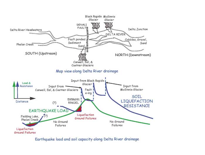
Tectonic uplift, sediment ponding, and their effects on liquefaction potential

Conceptual diagram of the intersection of earthquake load and coil liquefaction resistance capacity.

geotech/denlidarposter/fig6.html
contact: Robert Kayen
last modified 2018