USGS - science for a changing world

Pacific Coastal and Marine Science Center

Seafloor Mapping

Home - Images - Products - Data - Publications - Contact


Backscatter Image of Eastern Santa Barbara Channel

Back to Channel Islands Home Page

acoustic backscatter map of Eastern Santa Barbara Channel survey

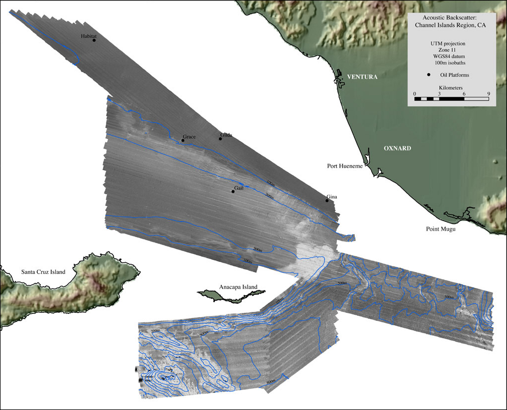
Acoustic backscatter imagery generated from the 2004 multibeam sonar survey of the Northeastern Channel Islands region. Depths within the survey area range from 25 - 1246m. Lighter tones in this image represent higher backscatter while darker tones represent lower backscatter.

Accessibility FOIA Privacy Policies and Notices

U.S. Department of the Interior | U.S. Geological Survey
URL: pacmaps/ci-mos.html
Contact Peter Dartnell
Archived in 2018