Home - Images - Products - Data - Publications - Contact
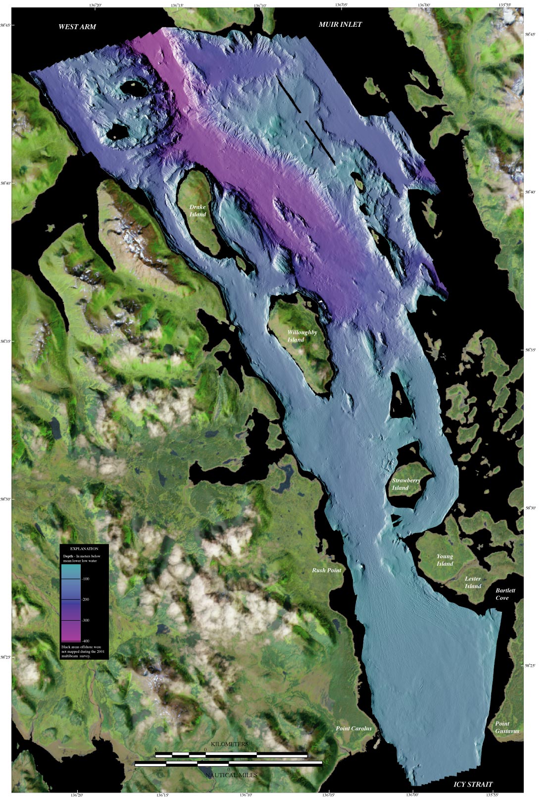
Bathymetry image generated from multibeam-bathymetry data aquired in July, 2001 by the U.S. Geological Survey in cooperation with the National Park Service, Glacier Bay using a Reson 8101 multibeam sonar system. Bathymetry pixel resolution is 5-meters. Depths are in meters below sea level referenced to mean lower low water. Land image generated by combining Landsat-5 imagery (aquired 6/27/1995, bands 7,4,1, 30-m pixel resolution) with shaded-relief imagery generated from USGS 7.5 minute DEM's.
Base from U.S. Geological Survey digital data, 1:24,000 and 1:100,000, 1969-85 Universal Transverse Mercator projection, Zone 8, WGS84 ellipsoid.
