Home - Images - Products - Data - Publications - Contact
Back to Glacier Perspective Views Overview
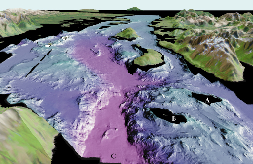
Figure 1. View looking south from the entrance of West Arm of Glacier Bay (arrow 1 on location map). The two prominent bedrock highs in the foreground are Geike Rock (A) and Lone Island (B). The terminus of the Little Ice Age glacier was at the approximate location of (C) in the 1860's. The distance across the bottom of the image is about 10 km (6.2 miles), vertical exaggeration is 2X.
