Home - Images - Products - Data - Publications - Contact
Back to Glacier Perspective Views Overview
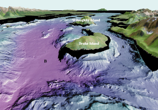
Figure 2. View looking southeast (arrow 2 on location map). Whidbey Passage (A) runs between Drake Island and the mainland and extends south along Willoughby Island. The Main Passage (B) runs east of Drake Island. Whidbey Passage is a glacially carved passage that varies in water depth from 95 m to 170 m (310 ft to 560 ft) along its axis, whereas the main passage varies in water depth from 250 m to 350 m (820 ft to 1150 ft) along its axis in this image. A glacier terminus was located near Willoughby Island in the mid 1800's. The distance across the bottom of the image is about 5 km (3.1 miles), vertical exaggeration is 2X.
