Home - Images - Products - Data - Publications - Contact
Back to Glacier Perspective Views Overview
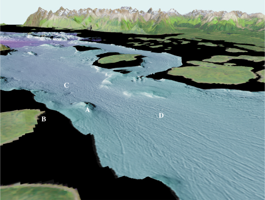
Figure 4. Sitakaday Narrows viewed towards the northeast showing a bedrock knob (A) off Rush Point (B) (arrow 4 on location map). Iceberg wallow pits (C) and gouges (D) show changes in travel paths of icebergs due to tidal current effects. The wallow pits can be as deep as 5 m (16 ft), whereas the gouges can be as deep as 2.5 m (8 ft). The distance across the bottom of the image is about 2.5 km (1.5 miles), vertical exaggeration is 2X.
