Home - Images - Products - Data - Publications - Contact
Back to Glacier Perspective Views Overview
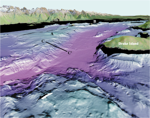
Figure 5. View looking east from the West Arm of Glacier Bay (arrow 5 on location map). A bedrock high (A) extends northwest from the Marble Islands (B). The slope at C to C' drops from about 100 m to 325 m (328 ft to 1070 ft). Drake Island marks the west side of Glacier Bay main passage. The distance across the bottom of the image is about 3.3 km (2.0 miles), vertical exaggeration is 2X.
