Home - Images - Products - Data - Publications - Contact
Back to Glacier Perspective Views Overview
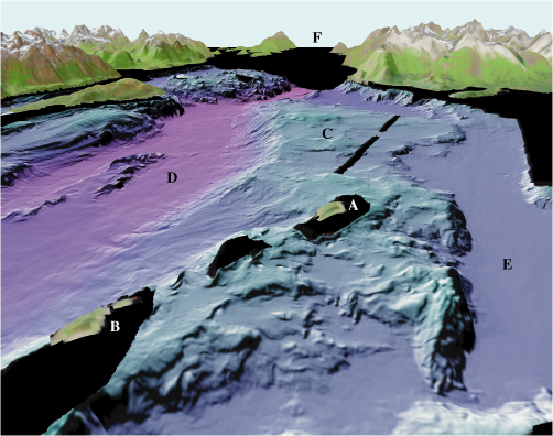
Figure 6. View looking northwest over North (A) and South (B) Marble Islands (arrow 6 on location map). These islands are part of a bedrock high (C) that runs northwest to southeast within Glacier Bay. Glacier Bay main passage (D) is to the west of the bedrock high, whereas Beartrack Cove deep (E) is to the east. The opening to the north (F) is the entrance to the West Arm of Glacier Bay. The distance across the bottom of the image is about 3.5 km (2.2 miles), vertical exaggeration is 2X.
