Home - Images - Products - Data - Publications - Contact
Back to Glacier Perspective Views Overview
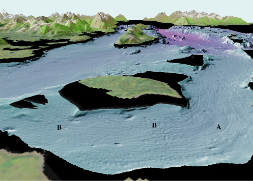
Figure 7. View of Glacier Bay looking northwest over Strawberry Island (arrow 7 on location map). Iceberg gouges (A) turn the corner around Strawberry Island and bend southwest toward the main passage. Depressions at (B) may be wallow pits formed where iceberg keels moved up and down during one or more tidal cycles. The distance across the bottom of the image is about 4.5 km (6.1 miles), vertical exaggeration is 2X.
