Home - Images - Products - Data - Publications - Contact
Back to Glacier Perspective Views Overview
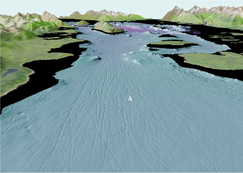
Figure 8. View of the entrance to Glacier Bay looking north (arrow 8 on location map). The terminus of the Little Ice Age glacier was at the bottom of this image in 1794 when Vancouver's exploration discovered the glacier. Linear gouges (A) are likely caused by icebergs grounded on the coarse bottom sediment of Sitakaday Narrows. The bergs were pushed through the Narrows by tidal currents that can reach speeds as fast as 7 knots. The distance across the bottom of the image is about 4.5 km (2.8 miles), vertical exaggeration is 2X.
