Home - Images - Products - Data - Publications - Contact
Return to LA Margin Perspective Views

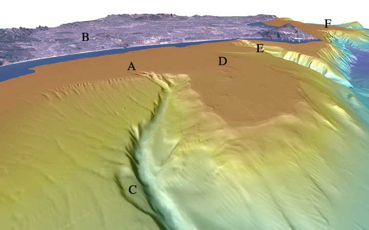
Perspective view looking southeast over Santa Monica Bay. The distance across the bottom of the image is about 9 km with a vertical exaggeration of 6x. Santa Monica submarine canyon begins in about 90 m water depth (A) and meanders down to the Santa Monica Basin. The canyon that has a width ranging from 550 to 900 m and averages 70 m of incision was created when the Los Angeles River flowed out through Ballona Gap (B) and across the shelf that was exposed above sealevel during lower eustatic sea levels. Failures can be seen along the canyon walls. The failure at "C" is 2 km long (3/4 the length of the northern runway of the Los Angeles International Airport (2.7 km)) and up to 53 m deep. Rocky outcrops protrude above the seafloor (D), some by as much as 12 m in central Santa Monica Bay in a region informally called Short Bank. Redondo Canyon (E) and San Pedro Sea Valley (F) are to the south. Download 300dpi TIFF image (16 MB)