Home - Images - Products - Data - Publications - Contact
Return to the Boulder Reef Home Page
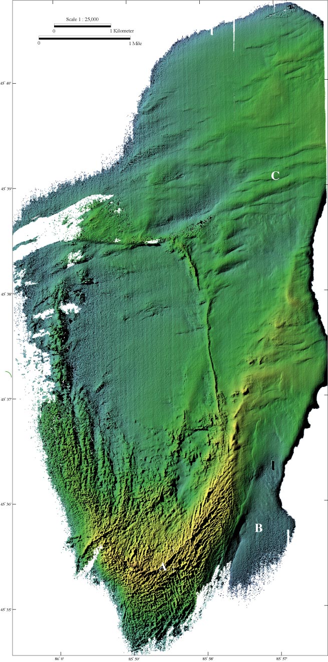
Color-coded shaded relief bathymetry of Boulder Reef. The rough relief in the southern and shallowest portion of the reef (6 to 22 m water depth) is covered with gravel, cobbles, and boulders, with rare patches of sand (Somers, 1968; Edsall and others, 1989; and video data). This coarse bottom material is roughly organized into highs and lows less than a meter high. The arcuate ridge at the south end of the reef (A) is likely a remnant depositional glacial feature from a small lobe of ice originating from the north. The coarse-texture material extends beyond the depths of the survey to the west and south, but transitions to a sand substrate to the east (B) and north (video observations by Greg Kennedy, U.S. Geological Survey, Ann Arbor, Michigan, personal commun., 2002). The strong east-west lineations at depths of 15-20 m in the north half of the image (C) could be related to glacial movement but this is transverse to movement suggested by the ridge to the south or to older glacial events. Sediment samples show that these lineations are drapped with clean sand. Note: The faint N-S lineations seen in the central part of the image are artifacts of the data gathering flight lines.
Image metadata
