Home - Images - Products - Data - Publications - Contact
Return to the Little Traverse Bay Perspective Views
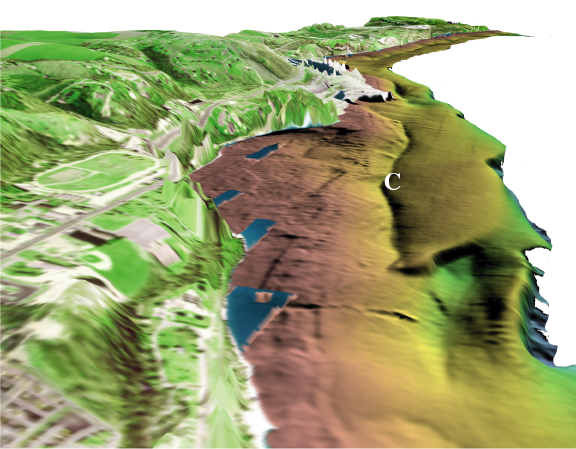
Oblique view of the eastern portion of the Little Traverse Bay data set looking west along the coast. This view illustrates the nearshore, rough relief of outcrops and coarser substrate and the offshore, sediment covered substrate, separated by the shore-parallel trench (C). The blue rectangular areas close to shore are bathymetry data gaps and show the water column from the aerial photographs. The vertical exaggeration is 4x and the distance across the bottom of the image is about 800 meters.
