Home - Images - Products - Data - Publications - Contact
Return to the Trout and High Island home page
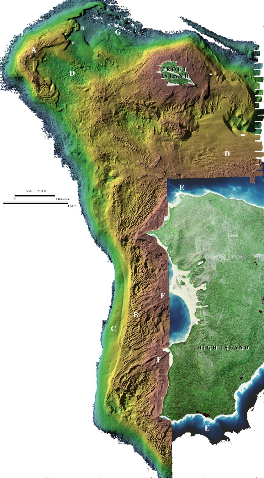
Color-coded shaded-relief bathymetry around Trout Island, and along the west coast of High Island. Similar to the Little Traverse Bay region, the rough nearshore relief west of High Island (B) transitions abruptly offshore to a smooth depositional substrate (C) that is possibly composed of sand. The morphology of Trout Island Shoal (A) suggests a large sand shoal migrating eastward over rough glacial deposits. Two or three gouges (D) of unknown origin, possibly ice or manmade, extend east of Trout Island Shoal for over 1 km. Aerial photography shows the nearshore region to a certain depth and shows sand spits extending offshore (E). Expressions of these sand spits can be seen in the lidar data directly offshore (F).
Image metadata
