Home - Images - Products - Data - Publications - Contact
Return to Lake Tahoe Perspective Views
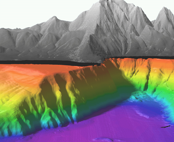
Oblique view of Lake Tahoe shaded-relief bathymetry looking north-northwest towards Stateline Point and Agate Bay (on left) and Crystal Bay (on right). The distance across the bottom of the image is approximately 5 km. The image has a vertical exaggeration of 3 times the horizontal distance. The colored region is the lake floor, while the gray-scale region is the surrounding land. Note the straight, very steep 425-m high cliff trending southwest from Stateline Point. This appears to be an unmapped fault scarp. Also note the abrupt change in slope at the base of the fault scarp. The abruptness of this transition suggests very little sedimentation derived from the north end of the lake.
