Home - Images - Products - Data - Publications - Contact
Return to Lake Tahoe Perspective Views
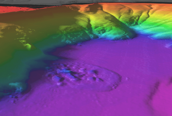
Oblique view of Lake Tahoe shaded-relief bathymetry looking northwest into Carnelian Bay. The distance across the bottom of the image is approximately 2.5 km. The image has a vertical exaggeration of 3 times the horizontal distance. The colored region is the lake floor, while the gray-scale region is the surrounding land. The floor of the lake in this area is at about 1450 m above sea-level and the tops of the bluffs are at about 1760-m. A prominent debris flow can be seen on the floor of the lake. The debris flow is about1500-m long and 1000-m wide. The main debris mass is about 5-m thick, but the individual blocks are as much as 25-m high. The debris flow appears to represent a failure of the bluff directly west of the flow.
