Home - Images - Products - Data - Publications - Contact
Return to Lake Tahoe Perspective Views
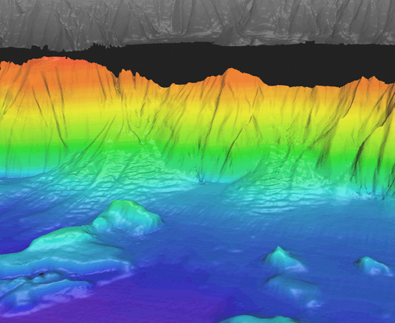
Oblique view of Lake Tahoe shaded-relief bathymetry looking east along the steep eastern margin of the lake. The distance across the bottom of the image is approximately 4.8 km. The image has a vertical exaggeration of 4 times the horizontal distance. The colored region is the lake floor, while the gray-scale region is the surrounding land. The view shows the area just south of Deadman Point on the left to the area of South Point on the right. The foreground shows large blocks on the lake floor derived from a debris avalanche that originated on the west side of the lake (see views 4 and 5). The background shows two well-developed sediment aprons formed at the base of the margin. The apron on the left is about 2 km long with 120 m of relief. The apron on the right is 1.2 km long and also has 120 m of relief. Both aprons are ornamented with large transverse sand waves 5-m high and about100 m between crests.
