Home - Images - Products - Data - Publications - Contact
Back to the Puget Sound Home Page
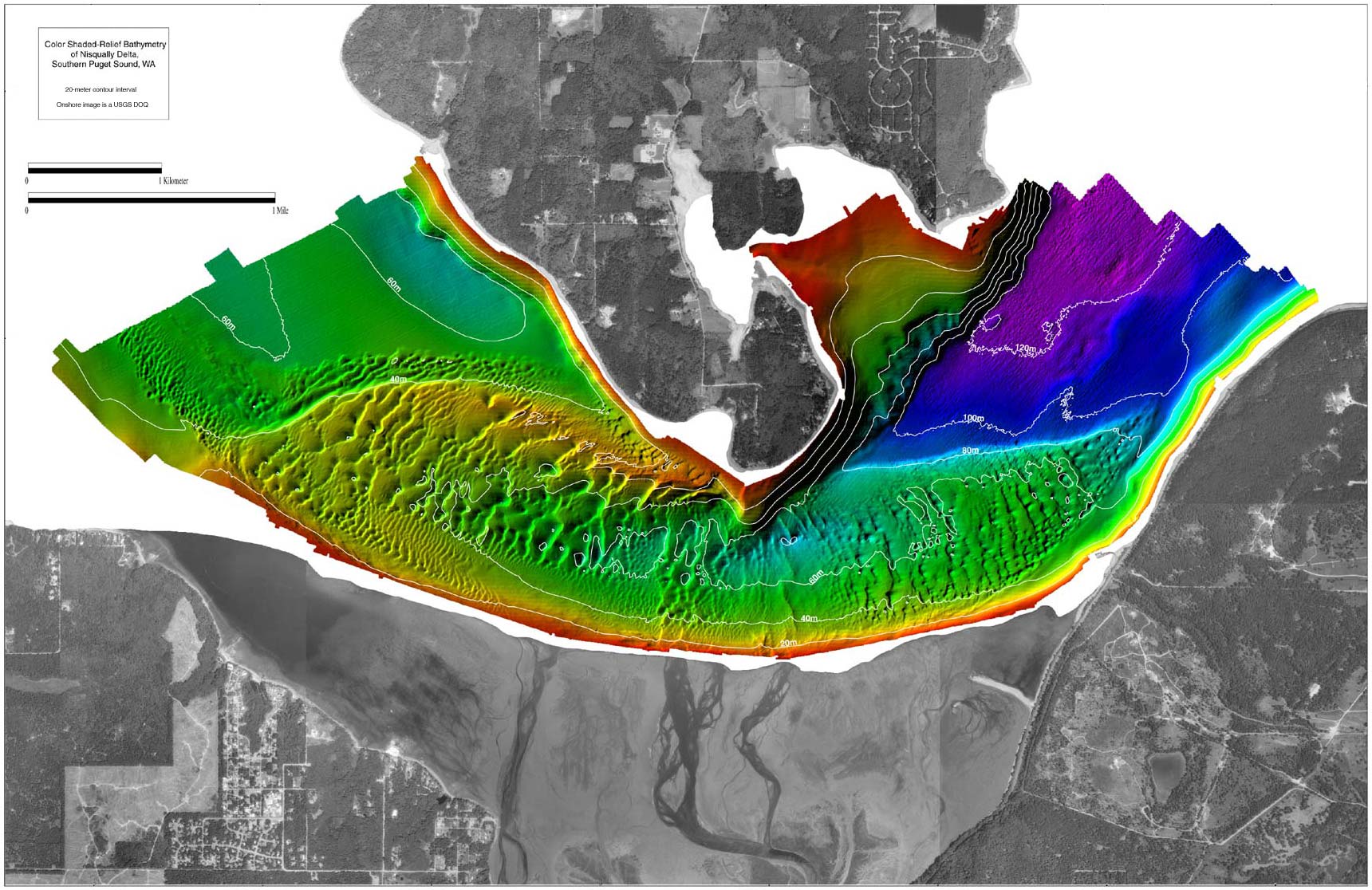
Color shaded-relief bathymetry of the Nisqually Delta, Southern Puget Sound, Washington. This delta is 17.6 km NE of Olympia, WA. The colors show relative depths with reds representing shallow regions and blues representing deeper regions. Depths range from 0m (red) to 130m (purple). The surrounding land image is a USGS DOQ. The epicenter of the February 28, 2001 magnitude 6.8 Nisqually earthquake was located near the center of this map at a depth of 52km. The multibeam bathymetry data was collected 23 days after this earthquake. The distance across the image is approximately 10.5km. Scroll down this page to view a comparison between Nisqually delta legacy data (1994-1999) and the 2001 multibeam data.
For formal metadata please visit metadata
For more information and to download the multibeam bathymetry data in two formats, XYZ ASCII and ArcInfo GRID, please see U.S. Geological Survey Open-File Report OF01-266.
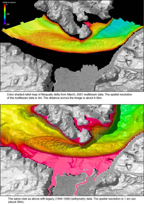
Below is a comparison between the 2001 Nisqually delta multibeam bathymetry data at 3-m spatial resolution and legacy bathymetry data collected between 1994-1999 at 30-m spatial resolution.
Top Image, below: Color shaded-relief map of Nisqually Delta from March, 2001 multibeam data. The spatial resolution of the multibeam data is 3m. The distance across the image is about 9.5km.
Bottom Image, below: The same view as the top image below, with legacy (1994-1999) bathymetry data. The spatial resolution is 1 arc sec (about 30m).