Home - Images - Products - Data - Publications - Contact
Back to the Puget Sound Home Page
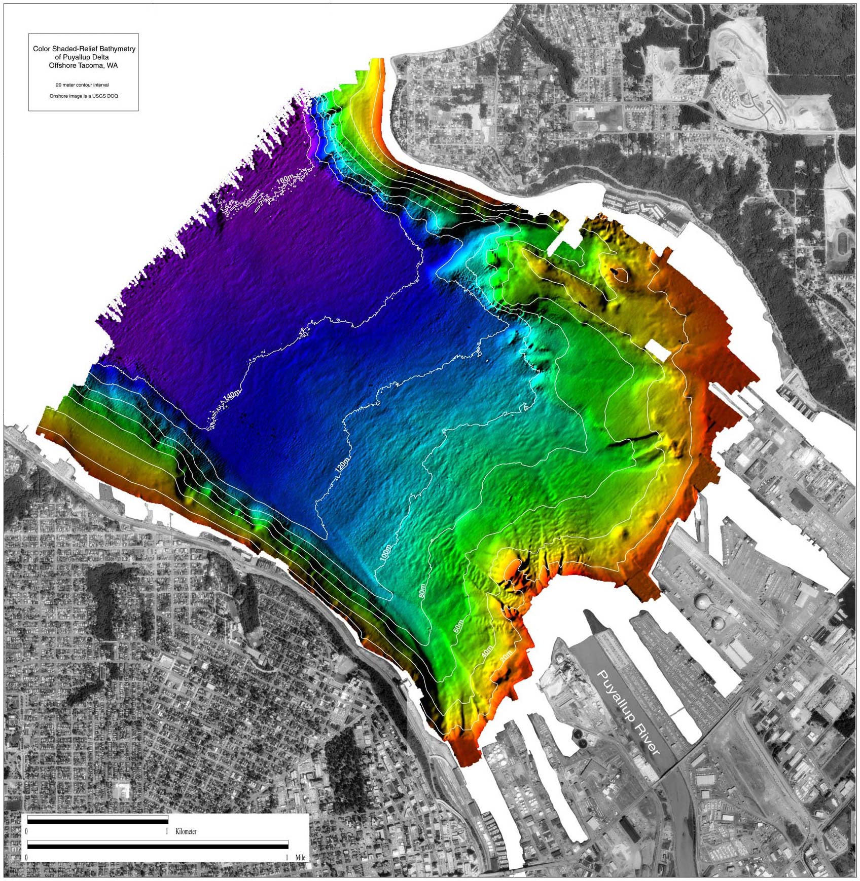
Color shaded-relief bathymetry of Puyallup Delta, offshore Tacoma Washington. The colors show relative depths with reds representing shallow regions and blues representing deeper regions. Depths range from 1m (red) to 170m (purple). The surrounding land image is a USGS DOQ. The Puyallup River flows out through the center of the Tacoma Port region (bottom right). The distance across the image is approximately 6.5km. Scroll down this page to view a comparison between Puyallup delta legacy data (1978-1992) and the 2001 multibeam data.
Field Activity metadata
For more information and to download the multibeam bathymetry data in two formats, XYZ ASCII and ArcInfo GRID, please see U.S. Geological Survey Open-File Report OF01-266.
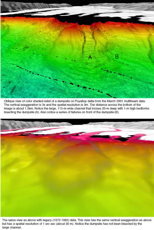
Below is a thumbnail image of a comparison between the 2001 Puyallup delta multibeam bathymetry data (top) at 3-m spatial resolution and legacy bathymetry data (bottom) collected between 1978-1992 at 30-m spatial resolution.
Top Image, below: Oblique view of color shaded-relief of a dumpsite on Puyallup delta from the March 2001 multibeam data. The vertical exaggeration is 3x and the spatial resolution is 3m. The distance across the bottom of the image is about 1.2km. Notice the large, 115-m-wide channel that incises 20m deep with 1-m high bedforms bisecting the dumpsite (A). Also notice a series of failures on front of the dumpsite (B).
Bottom Image, below: The same view as the top image below, with legacy (1972-1982) bathymetry data. This view has the same vertical resolution as top image below, but has a spatial resolution of 1 arc sec (about 30m). Notice the dumpsite has not been bisected by the large channel.