Home - Images - Products - Data - Publications - Contact
Back to San Diego Margin Perspective Views
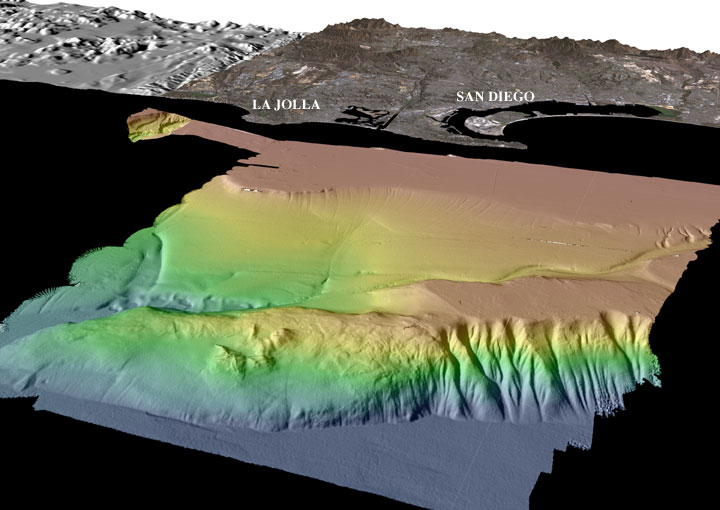
Perspective view of the San Diego multibeam bathymetry looking easterly. Coronado Bank is in the foreground and ranges in water depth from about 135 m (red) to 1180 m (dark blue). Loma Sea Valley is just to the east of Coronado Bank. The land imagery in the background is a combination of Landsat-7 imagery and USGS DEMs. The distance across the bottom of the image is about 25 km. The vertical exaggeration is 2X.
Download 300dpi TIFF image (19 Mb)
