Home - Images - Products - Data - Publications - Contact
Back to San Diego Margin Perspective Views
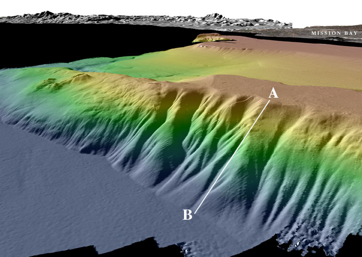
Perspective view of the San Diego multibeam bathymetry looking northeast. Coronado Bank is in the foreground. The vertical drop from A to B is about 1020 m (3347 ft). For comparison, the Empire State Building in New York City is 443 m (1453 ft) to the top of the lighting rod. The land imagery in the background is a combination of Landsat-7 imagery and USGS DEMs. The distance across the bottom of the image is about 5.4 km. The vertical exaggeration is 2X.
Download 300dpi TIFF image (19 Mb)
