Home - Images - Products - Data - Publications - Contact
Back to San Diego Margin Perspective Views

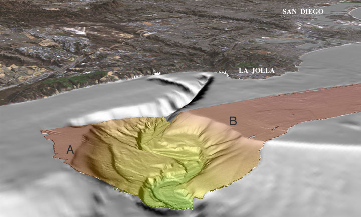
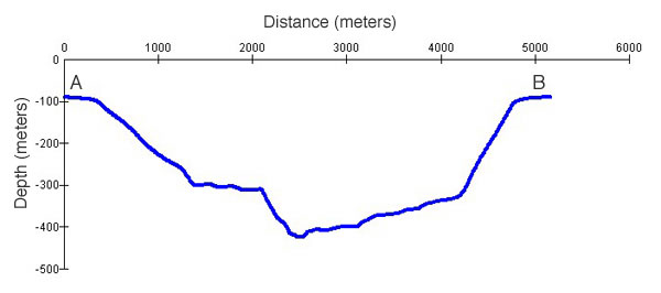
Perspective view of the San Diego multibeam bathymetry (colored) looking southeast at the head of La Jolla Canyon. The profile below shows the cross-section of the canyon from A to B. The lower resolution bathymetry data (gray) is created from NOAA, National Ocean Service, hydrographic survey data. The land imagery in the background is a combination of Landsat-7 imagery and USGS DEMs. The distance across the bottom of the image is about 8.5 km. The vertical exaggeration is 2X.
Download 300dpi TIFF image (16 Mb)
