Home - Images - Products - Data - Publications - Contact
Return to the San Francisco Bay Home Page
The above image is an illustration and should not be used for navigational purposes.
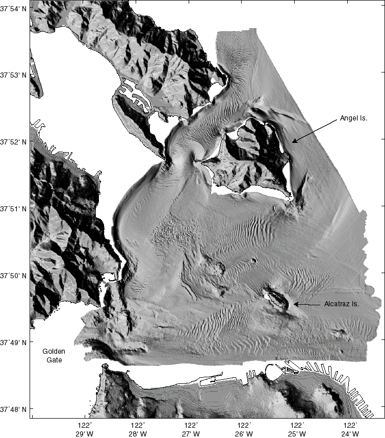
The bathymetry maps of west-central San Francisco Bay were gridded at 4-m pixel resolution.
Prominent features on the bathymetric map include:
Much of the surface of central San Francisco Bay is ornamented with at least three scales of sand waves, the largest class having wavelengths of >40 m and wave heights of >5 m. These bedforms reflect the strong diurnal tidal cycles that occur in the bay. The large bedform field immediately west of Alcatraz Island appears to be a sediment drift, similar to a huge sand dune, with smaller bedforms on its surface. The bedforms around the Tiburon Peninsula show the effects on the sea floor of strong tidal flow around the land.
A large hole has been excavated just off the southwest edge of Alcatraz Island, apparently related to the outgoing ebb tide that flows around the south end of the island.
The rock outcrops to the northwest of Alcatraz Island are clearly shown and their heights have been determined within 30 cm and their volumes have been calculated.
The shaded-relief image of the land surrounding San Francisco Bay was constructed using a DEM (Digital Elevation Model) with 10-meter resolution provided by the USGS National Mapping Division.
