
The December 26, 2004 Indian Ocean Tsunami: Initial Findings on Tsunami Sand Deposits, Damage, and Inundation in Sri Lanka
Survey Site Locations and Photos
HikkaduwaClick photo to see a larger image |
|
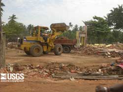 Bulldozers and front-end loaders had redistributed the rubble and cleaned up much of the debris in some areas of Sri Lanka visited by the survey teams. (larger image, 178 kb) |
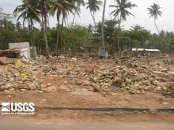 One of many views of the complete destruction of houses and other buildings in Hikkaduwa. (larger image, 189 kb) |
 One of many views of the complete destruction of houses and other buildings in Hikkaduwa. (larger image, 222 kb) |
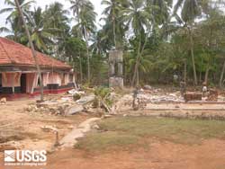
 The gap and curved shape of the rock platform and beach at Hikkaduwa focused the tsunami and increased local damage to buildings. (larger image, 89 kb) |
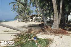 View at Hikkaduwa looking parallel to the beach showing zone of local scour and sand deposition. The trench is located to the right of the trees about 30 m inland from the beach. (larger image, 175 kb) |
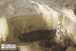 Trench at Hikkaduwa showing the tsunami sand deposit about 23 cm thick. Ground elevation is about 0.5 m and flow depth was about 2.5 m at this site. (larger image, 151 kb) |
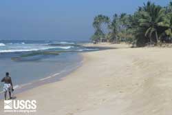
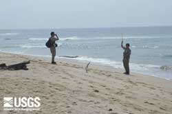 Simple, durable field tools, such as a hand level and tape, are used to survey topographic profiles and to measure heights of water marks above sea level. (larger image, 97 kb) |
|