
The December 26, 2004 Indian Ocean Tsunami: Initial Findings on Tsunami Sand Deposits, Damage, and Inundation in Sri Lanka
Survey Site Locations and Photos
Ibral Nagar NalaveliClick photo to see a larger image |
|
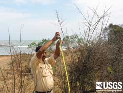 Debris brought onshore by the tsunami and caught in bushes indicate the height of the tsunami. (larger image, 158 kb) |
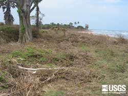 View, looking South, of area inundated by tsunami at Ibral Nagar Nalaveli. Beach in distance. (larger image, 227 kb) |
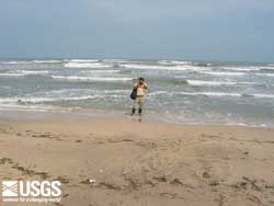 Surveying topography at Ibral Nagar Nalalevi using a hand level. The vertical datum for the surveys was sea level at the time of the survey. This datum was corrected once back in the office to both a tidal datum and sea level at the time the tsunami hit Sri Lanka. (larger image, 91 kb) |
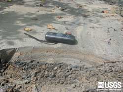 Tsunami deposit at approximately 100 m inland. Multiple layers are visibie... (larger image, 244 kb) |
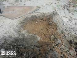 Tsunami deposit at approximately 100 m inland. Multiple layers are visible... (larger image, 217 kb) |
|