
The December 26, 2004 Indian Ocean Tsunami: Initial Findings on Tsunami Sand Deposits, Damage, and Inundation in Sri Lanka
Survey Site Locations and Photos
YalaClick photo to see a larger image |
|
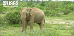 Both domestic and wild animals were seen evacuating to higher ground long before the tsunami arrived on the south coast of Sri Lanka. (larger image, 156 kb) |
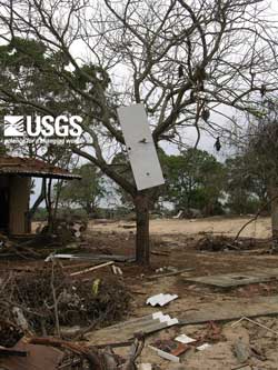 Flow depths were about 4.5 m at Yala Safari Resort where water level were determined by debris in the trees, including a door impaled on a branch. (larger image, 222 kb) |
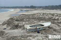
 The tsunami had the ability to transport large particles (a car), but, because primarily sand was available to be transported, almost all tsunami deposits are composed of sand. (larger image, 292 kb) |
|
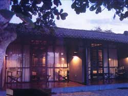 Rooms at the Yala Safari Resort before the tsunami. (larger image, 157 kb) |
 Rooms at the Yala Safari Resort after the tsunami. (larger image, 127 kb) |
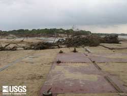
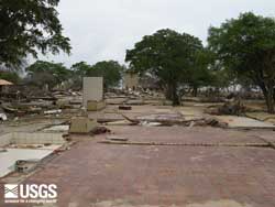 Another photo of the Yala Safari Resort after the tsunami. (larger image, 176 kb) |
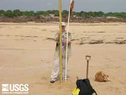 View onshore at Yala showing the broad zone of deposition between the beach and the high ancient duneridge about 450 m landward of the beach. (larger image, 118 kb) |
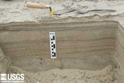 Trench at Yala showing the tsunami sand deposit about 22 cm thick. The trowel sizes and orientation point to the primary, secondary, and tertiary flow directions caused by the topography. Ground elevation is about 0.5 m and flow depth was about 4.5 m at this site. (larger image, 168 kb) |
 View parallel to the beach at Yala from the modern high dunes toward the former site of the Yala Safari Resort. Removal of the dunes for a better view of the ocean greatly increased destruction of the resort caused by the tsunami. (larger image, 141 kb) |